-
-
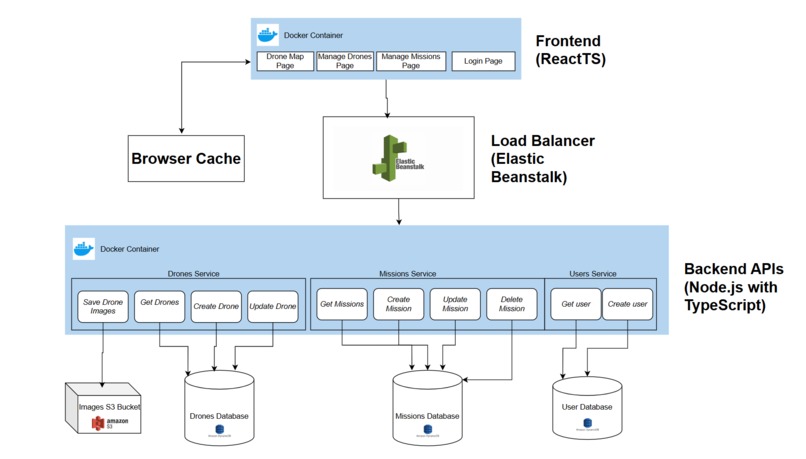
System Architecture diagram
-
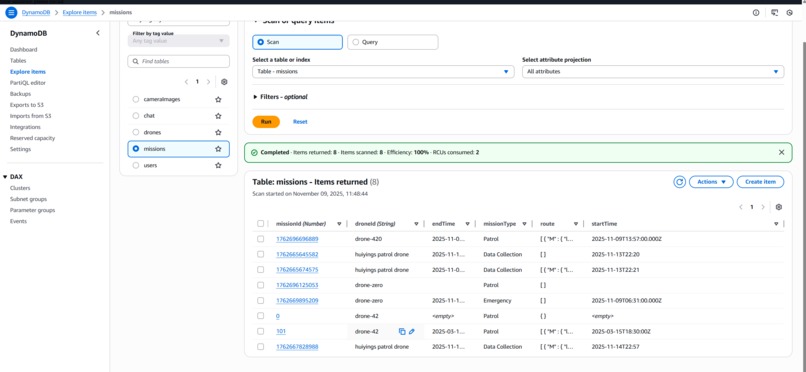
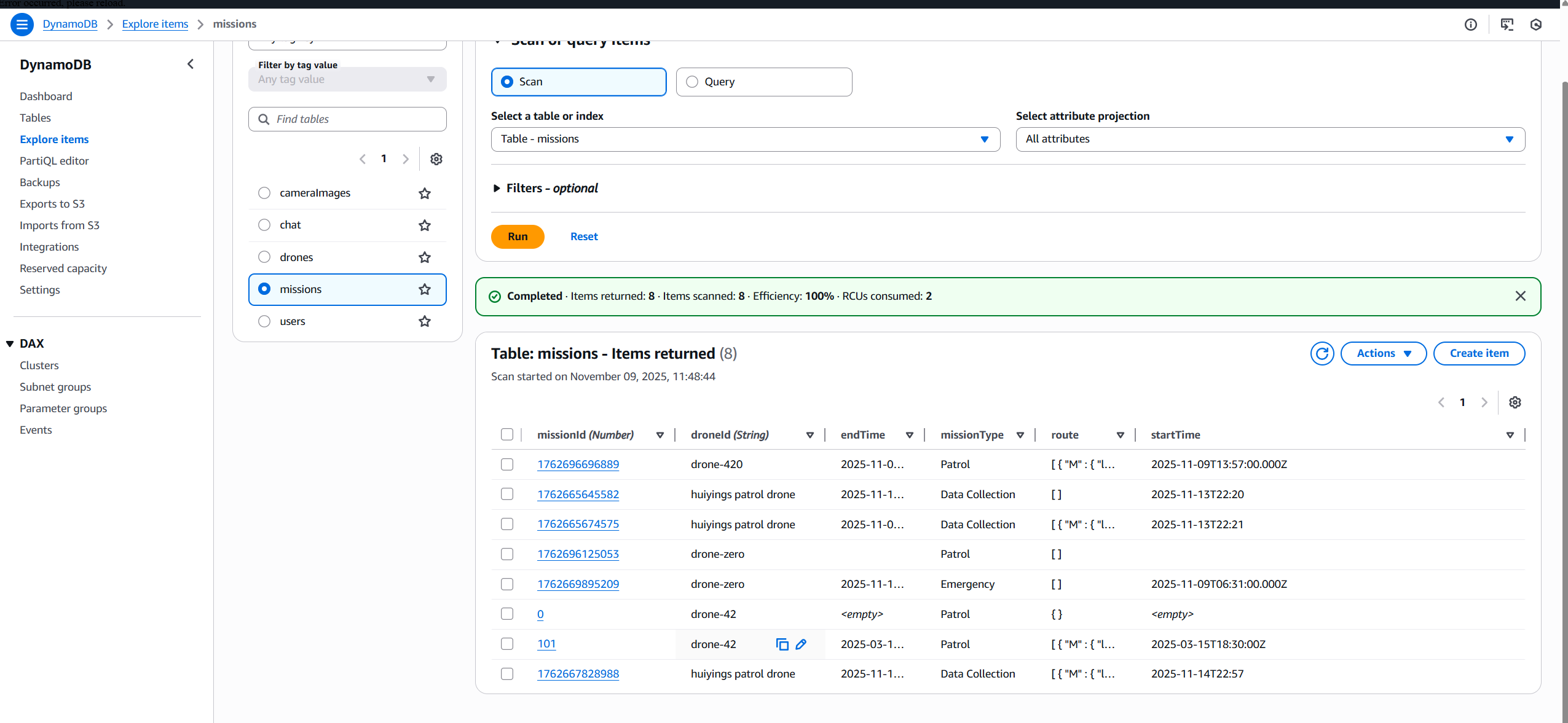
Example of a DynamoDB table
-
-

Inspiration
As cities grow more complex, ensuring public safety and rapid emergency response becomes increasingly difficult. Delays in emergency response can cost lives and monitoring urban areas manually is resource intensive.
Our team was inspired by the potential of drones to transform urban management, not just as tools for surveillance or delivery, but as agents for safety and sustainability. We wanted to “drone the change” by building a system that makes cities smarter and more responsive to incidents. Integrating drones into public safety strategy can reduce the need for physical police presence, and in cities like Kakogawa City, Japan, studies have found that increased surveillance contributed to lower crime rates [1].
What it does
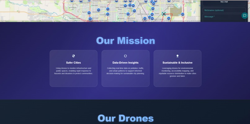
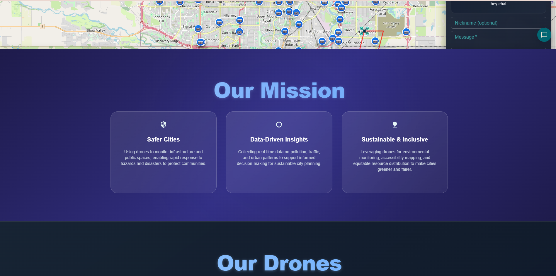
Drone the Change is a smart drone management system that helps cities improve safety and sustainability.
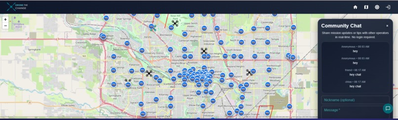
- Admins can add drones, assign patrol or emergency missions, and monitor live status.
- Drones patrol high-risk areas, respond to incidents, and collect environmental data such as air quality.
- The platform enables faster emergency response and supports data-driven urban planning.
How we built it
We built Drone the Change using a full-stack architecture:
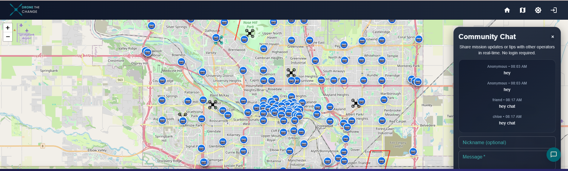
- Frontend: React + TypeScript with Leaflet for real-time drone mapping and mission control.
- Backend: Typescript and Node.js for backend APIs.
- Cloud Infrastructure: We used AWS to ensure scalability, reliability, and secure data handling.
- Database: DynamoDB to manage drones, missions, and user data.
- Image storage: S3 bucket is used to store images taken from drones.
- Load Balancing and Deployment: Elastic Beanstalk for containerized deployment.
- Database: DynamoDB to manage drones, missions, and user data.
We focused on creating a responsive, intuitive interface that allows admins to manage drones and visualize missions in real time.
AI Usage
ChatGPT, Cursor, and CoPilot were used in this project. We used these AI tools as to generate some components, which we reviewed and later modified. We also used these tools to generate base CSS for elements and to debug code.
Challenges we ran into
- Designing a scalable backend capable of handling concurrent missions and drone data.
- Working under time constraints while aligning our solution with all three hackathon focus areas: safety, sustainability, and inclusivity.
Accomplishments that we're proud of
- Developed a fully functional prototype that connects mission management with live drone visualization.
- Successfully implemented an admin panel for adding drones, assigning missions, and tracking activity.
- Created a solution that bridges safety, sustainability, and inclusivity.
What's next for Drone The Change
We plan to:
- Integrate AI for predictive patrol routes and automated emergency response.
- Expand environmental monitoring capabilities for sustainability insights.
References
[1] Sihan Yang, Hiroki Nakajima, Yerim Yang, Yuta Shin, Hideki Koizumi, The impact of surveillance cameras and community safety activities on crime prevention: Evidence from Kakogawa City, Japan, Sustainable Cities and Society, Volume 115, 2024, 105858, ISSN 2210-6707, https://doi.org/10.1016/j.scs.2024.105858.(https://www.sciencedirect.com/science/article/pii/S2210670724006826)
Built With
- amazon-web-services
- docker
- dynamodb
- ec2
- node.js
- reactts
- s3
- yaml

Log in or sign up for Devpost to join the conversation.