![]()

Drone Geo-Tagger
Control Parrot's AR Drone with your phone for any geo-tagging uses, such as Search and Rescue, surveying damage after natural disasters, surveying weather conditions, and other points of interest that you see with your drone.
About our Project
We've prototyped an app that can fly the drone completely through your personal smartphone (or web browser) and tag locations you are interested in. Upon tagging the location, the drone spans a picture and sends location information and pictures back to a server and can be pushed to your phone or a web browser. You can visualize the point of interest on an easy to read map. Each point of interest also shows weather data courtesy of Weather Channel's API.
What we used
Socket.io for realtime communication between Drone and backend.
NodeJS is what we run on our servers for backend processing.
Ionic and [Google Maps API] are used for the mapping app.
Weather Channel's API is used to pull weather data for tagged locations.
AR-drone webflight is used to create an extensive plugin system to control different aspects of drone and is used in our flight app.
Some sweet pictures
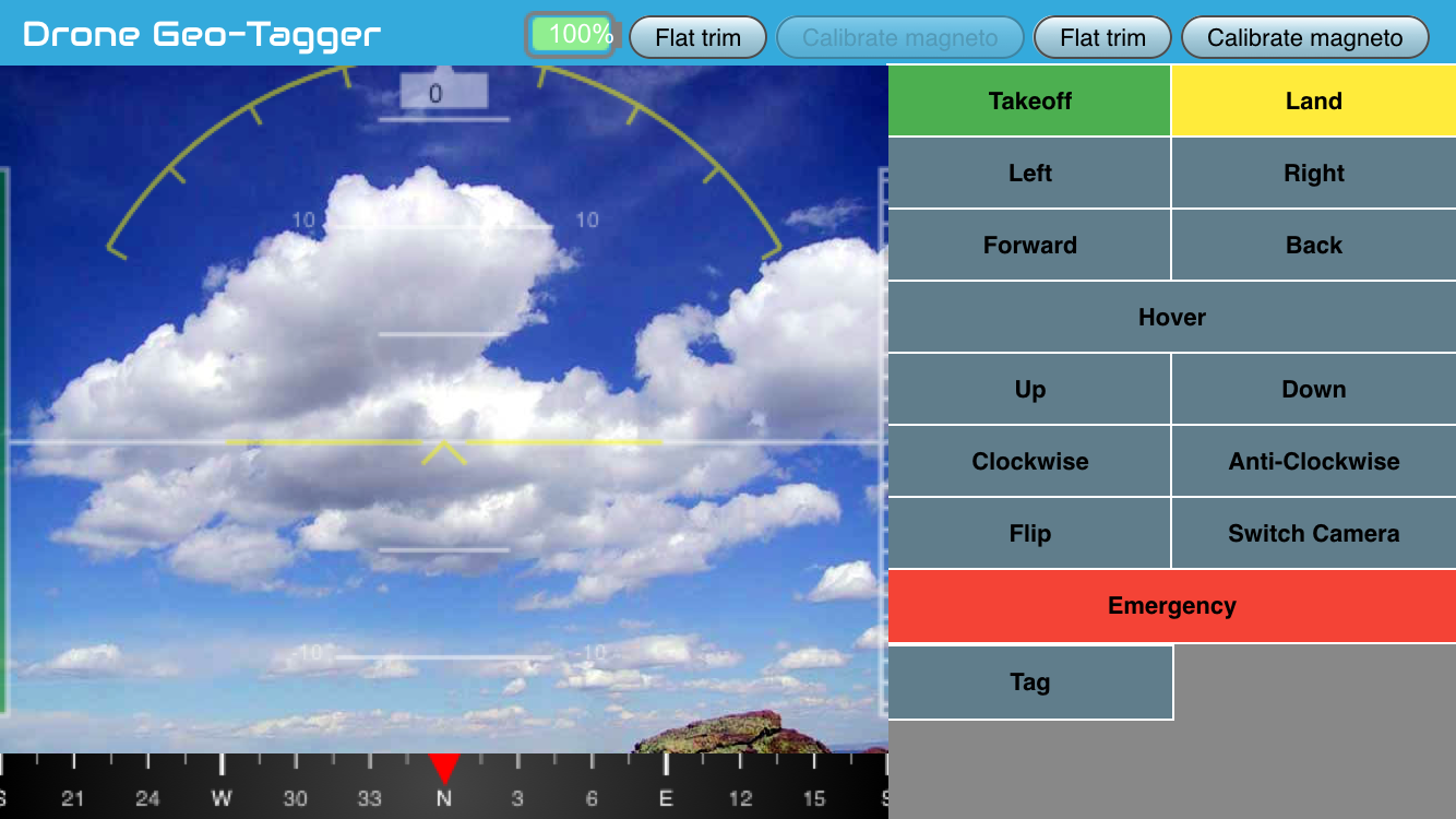
Flight App

This is the initial starting screen if vide feed is turned off. The user can use the navigational controls on the right to control the drone. The Tag button is used to tag a location and optionally snapping a photo to send to the backend servers.

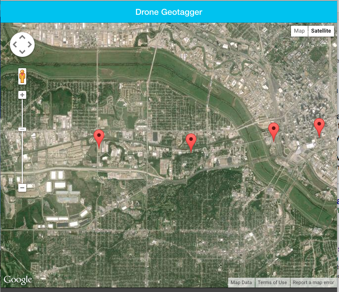
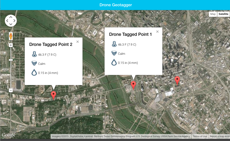
Here we can see a few tagged locations as the drone was flying about the city. In the screenshot, you can see that one of the tags is open and we are looking at weather a few weather conditions at that location. Each tagged location has weather data associated with it and can be pulled up by clicking on the red markers.
See it in action

Copyright
The MIT License (MIT)
Copyright (c) 2015 James Fielder, Joseph Milazzo
Permission is hereby granted, free of charge, to any person obtaining a copy of this software and associated documentation files (the "Software"), to deal in the Software without restriction, including without limitation the rights to use, copy, modify, merge, publish, distribute, sublicense, and/or sell copies of the Software, and to permit persons to whom the Software is furnished to do so, subject to the following conditions:
The above copyright notice and this permission notice shall be included in all copies or substantial portions of the Software.
THE SOFTWARE IS PROVIDED "AS IS", WITHOUT WARRANTY OF ANY KIND, EXPRESS OR IMPLIED, INCLUDING BUT NOT LIMITED TO THE WARRANTIES OF MERCHANTABILITY, FITNESS FOR A PARTICULAR PURPOSE AND NONINFRINGEMENT. IN NO EVENT SHALL THE AUTHORS OR COPYRIGHT HOLDERS BE LIABLE FOR ANY CLAIM, DAMAGES OR OTHER LIABILITY, WHETHER IN AN ACTION OF CONTRACT, TORT OR OTHERWISE, ARISING FROM, OUT OF OR IN CONNECTION WITH THE SOFTWARE OR THE USE OR OTHER DEALINGS IN THE SOFTWARE.


Log in or sign up for Devpost to join the conversation.