-
-
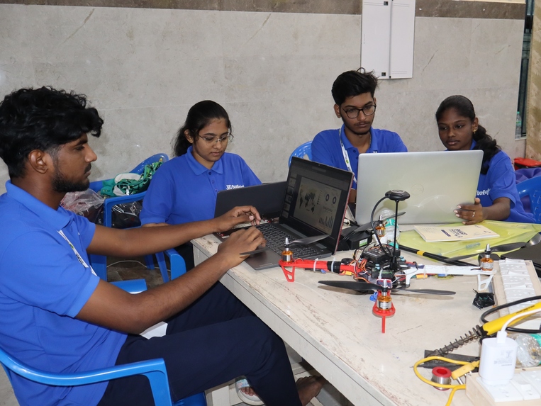
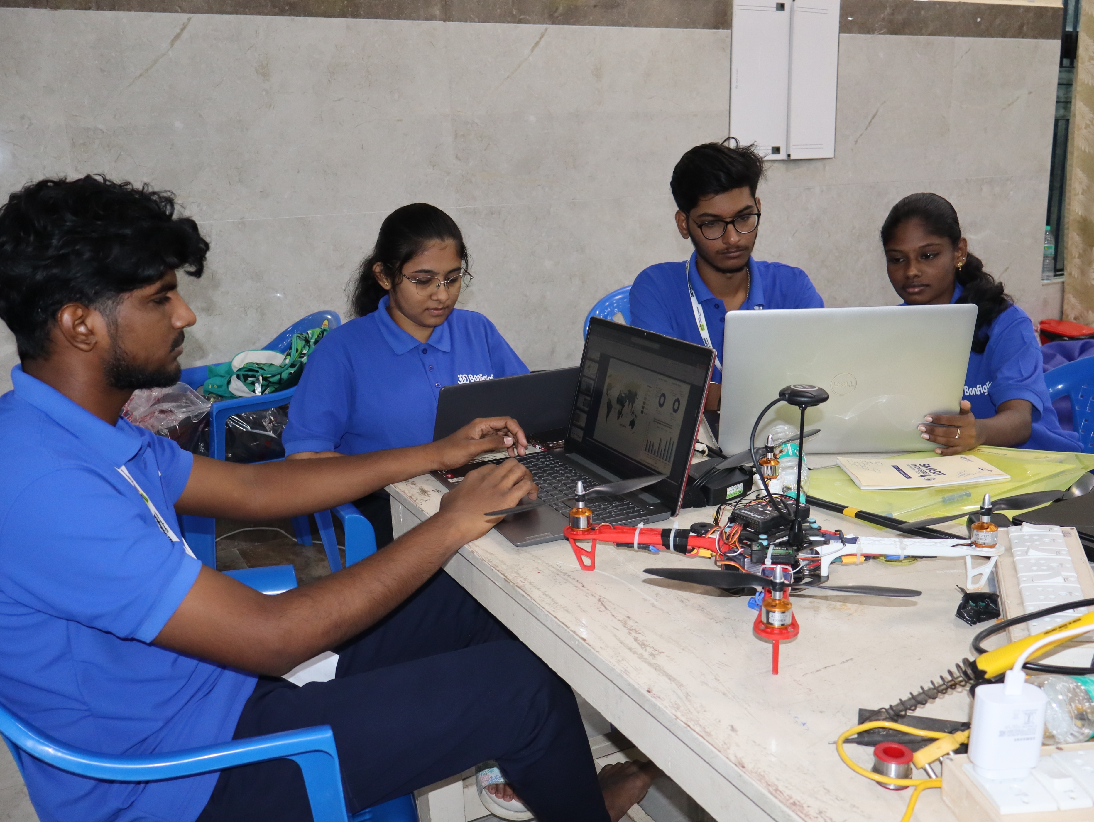
The image we took while working on the project.
The Drone-Based Evapotranspiration Monitoring System by SkyCoders aims to address the challenges of water mismanagement, groundwater depletion, and the limitations of current satellite technologies in monitoring evapotranspiration. India, despite its efforts to monitor water resources, still struggles with inefficiencies in water usage. Our project was inspired by the need to improve water auditing, control, and crop monitoring, particularly in small-scale farms where satellite data lacks the necessary resolution. Evapotranspiration (ET) plays a critical role in determining water use efficiency, total water consumption, and reseeding needs, making accurate real-time ET monitoring essential for optimizing agricultural practices. The limitations of existing solutions such as satellites, rovers, and smart bots presented an opportunity for us to develop a system that could provide high-resolution, real-time data with greater accuracy.
Evapotranspiration is a vital process in agriculture where water from plants and soil is transferred to the atmosphere. Accurate monitoring of this process helps in estimating water usage and the overall health of crops. The existing technologies that are used for ET monitoring, such as satellites and rovers, have significant drawbacks. Satellites suffer from low resolution and cloud cover, making them ineffective for small-scale farms. Rovers, on the other hand, face difficulties in uneven terrain and dense crops, leading to slower data collection. Smart bots, while useful, often lack maneuverability and take more time to process data. Our proposed solution involves using drones equipped with cameras to monitor crop health and water stress, providing timely and accurate insights that help optimize water usage and improve overall farm management. This system provides location mapping through GPS and geofencing, concentrating on specific areas of the farm to enhance care and irrigation efficiency.
One of the critical motivations for developing this system was to bring India’s water usage efficiency closer to that of developed countries. In India, water usage in agriculture ranges between 63% and 79%, while in developed nations, this figure is much lower, around 35%. The inefficiency in water use is primarily due to a lack of real-time, high-resolution data that can help farmers make informed decisions. Our system is designed to address this gap by providing farmers with precise insights into crop water requirements, enabling them to manage their water resources more efficiently and reduce wastage. The solution has the potential to transform water usage practices in Indian agriculture, helping farmers optimize water consumption and improve crop yields.
The development of our system was structured into four key phases, as outlined in our Gantt chart. In Phase 1, we conducted extensive market research to understand the needs of farmers and government agencies. This helped us design a solution that meets the specific challenges faced in agriculture today. Phase 2 involved finalizing the drone design and workflow, ensuring that the technology could deliver the desired accuracy and efficiency. This phase lasted from the first to the third week, during which we made significant progress. In Phase 3, we developed the first prototype and tested it in selected trial areas to validate the system’s performance. Finally, Phase 4 focused on launching the website and initiating market deployment, bringing the system to farmers who can benefit from this advanced technology.
The process flow of our system is straightforward but effective. Drones collect high-resolution data from the field, which is then processed to generate actionable insights. The system uses geo-fencing and geo-referencing to accurately monitor specific areas of the farm, ensuring that water usage is optimized where it is needed the most. The insights generated from the processed data allow farmers to take timely action, whether it’s adjusting irrigation systems or addressing water stress in specific crop sections. These actionable recommendations are what set our system apart from existing solutions, providing a level of precision that has not been achievable with traditional methods.
The drone itself is a quadcopter equipped with a Skydroid C12 camera, capable of covering 4.2 hectares in just 12 minutes of flight. It captures 3,000 images per flight, with a maximum flight time of 12 minutes on a full charge. The drone flies at a speed of 4 meters per second at a height of 10 meters. The system is designed to be efficient and reliable, with a total payload of 1231g and a thrust of 3200g, ensuring stability and accuracy during flight. This technical design allows the drone to gather high-quality data even in challenging conditions, providing farmers with real-time information that can be used to make critical decisions about water usage and crop management.
Accuracy is a significant factor in our system’s success. While satellite-based systems have an accuracy rate of 60-75%, they are limited by resolution and real-time capabilities. Our drone-based system offers over 90% accuracy, benefiting from high spatial resolution and the ability to collect real-time data. By using a trained evapotranspiration model, we’ve been able to achieve even higher accuracy in predicting crop health and water needs. This is a crucial improvement over existing technologies, allowing farmers to rely on the data provided by our system to make more informed decisions about irrigation and water management.
To further support farmers, we developed the CropCare platform, which helps manage crops and optimize water usage. The platform offers a range of features, including a home page for quick sign-in and sign-up, a location page where farmers can pin their location, select their crop type, and set up geofencing. The platform calculates water usage and provides optimized recommendations for free, while a premium subscription offers regional disease alerts and easy access to additional features. CropCare also provides personalized assistance through expert agronomists, who offer tailored advice on water management and disease prevention, making it a comprehensive solution for farmers looking to improve their practices.
From a business perspective, the project operates on a membership model. Farmers can access basic features for free, including crop selection, disease identification, and water and evapotranspiration data. The base price of the drone is INR 70,000, with additional costs for website development (INR 12,000), operating costs (INR 3,400), and marketing (INR 5,000 every six months). The membership fee is INR 199 per month or INR 2,399 annually, with the system needing just 30 users to break even. This pricing model makes the system accessible to a wide range of farmers, ensuring that they can benefit from the technology without a significant financial burden.
In conclusion, the Drone-Based Evapotranspiration Monitoring System is a groundbreaking solution for improving water management in agriculture. By providing real-time, high-resolution data on water usage and crop health, the system empowers farmers to make informed decisions that optimize water use and improve crop yields. This project represents a significant step forward in precision farming, offering a more sustainable approach to agriculture that addresses the critical issue of water scarcity.
Built With
- cloud
- css
- firestore
- google-cloud-platform-(gcp)
- google-firebase
- google-maps
- html
- javascript
- keras
- opencv
- python
- react
- skydroid-c12-camera
- tensorflow
- weather-api

Log in or sign up for Devpost to join the conversation.