-
-

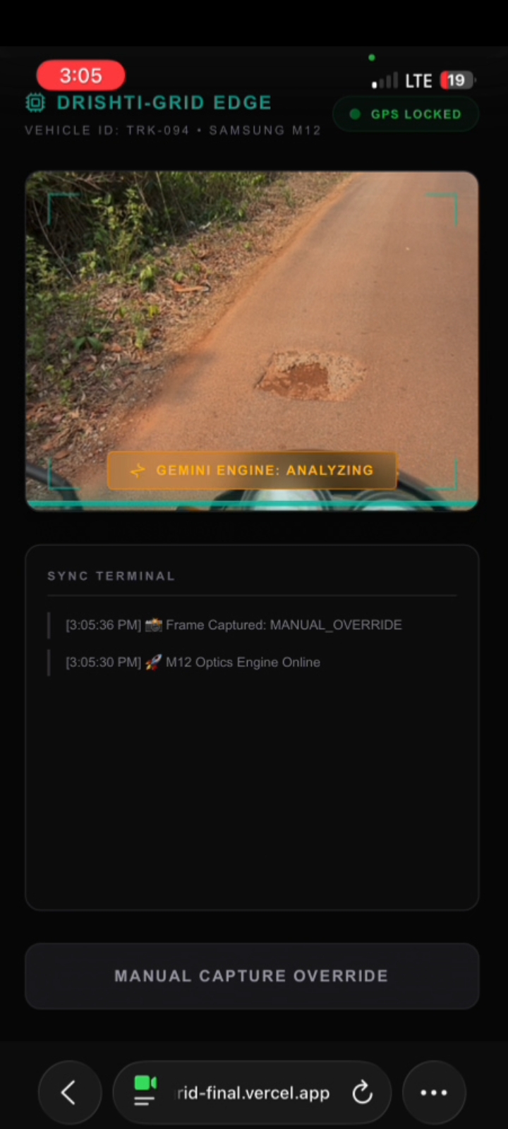
sensor node capturing pothole
-
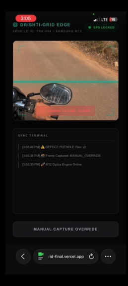
sensor node analysing the severity
-

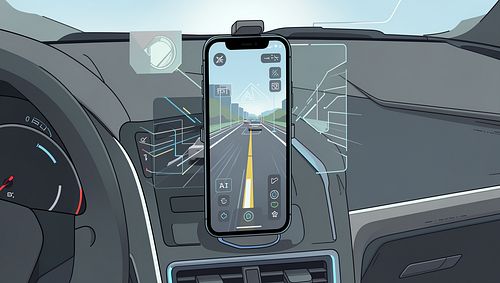
generated img
-
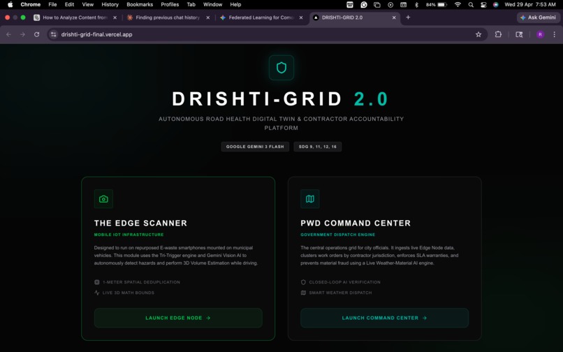
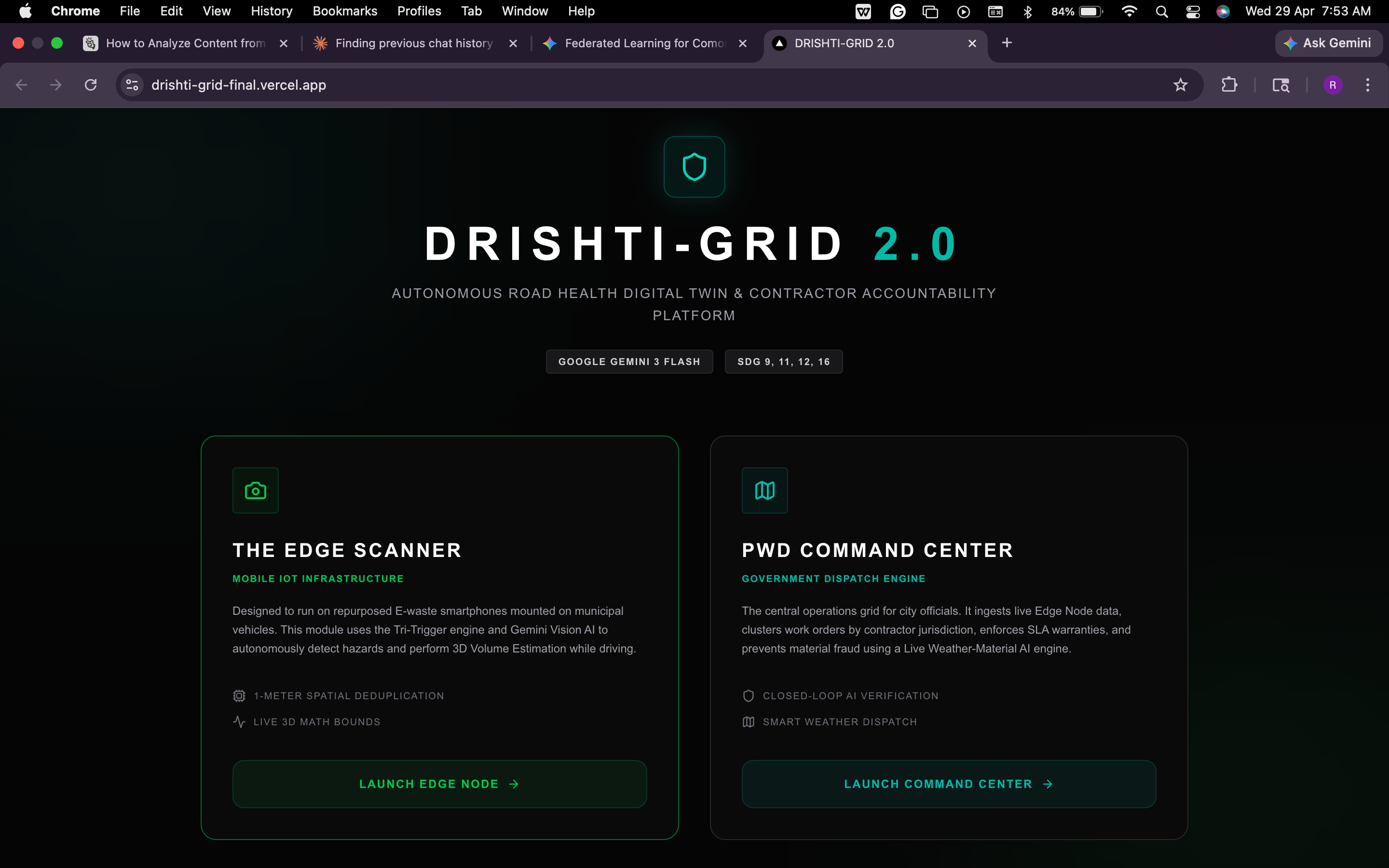
main page
-
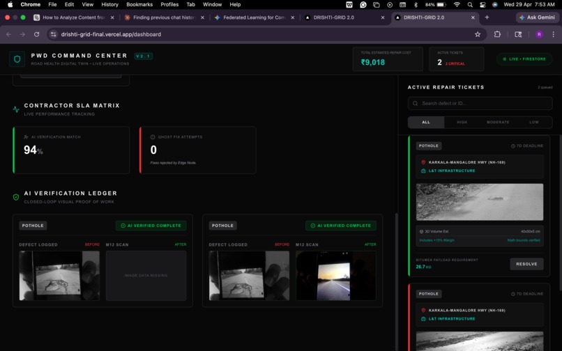
ai verifiacatio, active tickets card
-
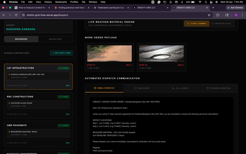
dispatch page for contractors
-
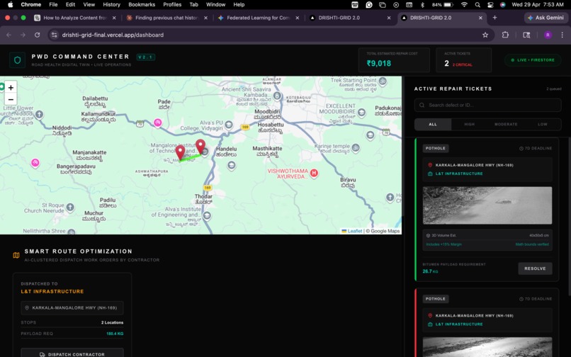
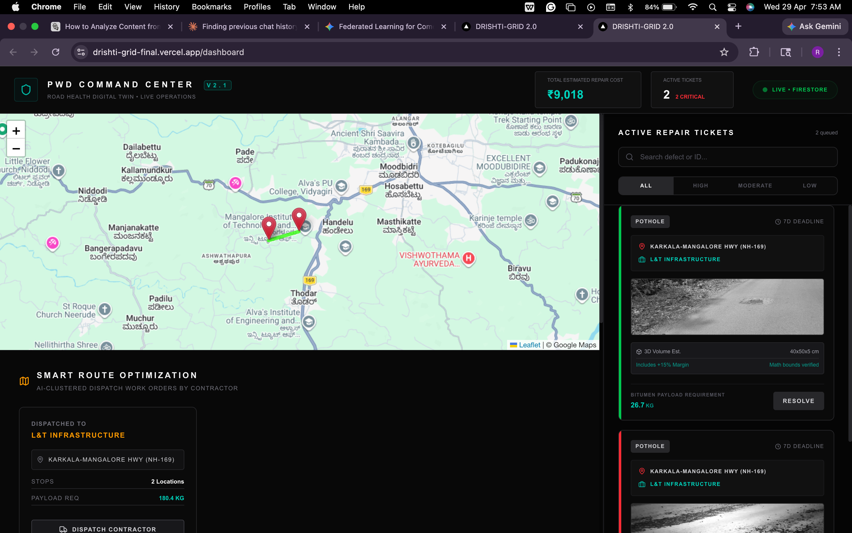
main dashboard


💡 The Real-World Problem
Modern cities face a three-front infrastructure crisis:
- Safety: Reactive road maintenance leads to thousands of lethal accidents, delaying emergency ambulances during the critical "Golden Hour."
- Systemic Fraud: Municipal governments lose millions to "ghost fixes" and contractor material over-billing due to a lack of transparency.
- Sustainability: Millions of functional smartphones are discarded annually, fueling a massive E-waste crisis.
What if we could upcycle this E-waste into a zero-cost, autonomous AI grid that holds infrastructure contractors accountable? That vision became DRISHTI-GRID 2.0.
⚙️ What it does (Innovation & Impact)
DRISHTI-GRID 2.0 is an autonomous GovTech platform that manages the entire lifecycle of road maintenance:
- Zero-Cost Edge Sensors (Mobile PWA): Discarded smartphones (e.g., Samsung M12) are mounted on municipal garbage trucks. Running our Next.js Edge app, they autonomously scan roads using a Tri-Trigger engine (Heartbeat & HTML5 DeviceMotion jerks).
- AI Fraud Prevention (AI/ML): Google Gemini 3 Flash performs Monocular Depth Estimation on 2D images to calculate the exact 3D volume of the hazard. This mathematically caps the raw materials a contractor can bill for.
- Smart Dispatch (Web Platform): The Command Center clusters work orders by contractor jurisdiction. A Live Weather Engine blocks "Hot-Mix" asphalt dispatch during monsoons, forcing temporary gravel fixes to prevent washed-away repairs.
- Closed-Loop AI Verification: Contractors are only paid when our Edge Node re-drives the exact coordinate and the AI visually verifies the road is smooth, committing the proof to an immutable ledger.
📐 UI/UX & Design Philosophy
We engineered a dual-interface system with strict Role-Based Access Control:
- The Edge HUD: Designed for fleet drivers, featuring a cyberpunk-inspired, dark-mode laser scanner HUD that requires zero manual input while driving.
- The PWD Command Center: A military-grade, high-contrast Web UI for city officials, featuring dynamic geospatial plotting (Leaflet Carto-Dark), SLA matrices, and real-time financial tracking.
🛠️ Technical Implementation (How we built it)
- AI Brain:
Google Gemini 3 Flash Previewvia REST API for ultra-low latency multimodal processing and structured JSON schema generation. - Frontend Web:
Next.js 14(React PWA),TypeScript,Tailwind CSS. - Database & Cloud:
Google Firebase Firestorefor real-time NoSQL spatial Web-Socket syncing. - Device APIs: HTML5
Geolocation APIandDeviceMotion API.
🚧 Challenges we ran into
API Spam from Moving Vehicles: If a fleet vehicle gets stuck in traffic over a pothole, it would spam the AI API and database. Solution: We implemented an offline edge-cache utilizing the Haversine Formula. If the active GPS lock is $< 1$ meter from a cached scan, the cloud sync is mathematically suppressed, saving battery and compute costs.
🏆 Accomplishments that we're proud of
- Achieving a $0.00 Hardware Deployment Cost by proving that discarded E-waste can run enterprise-grade IoT edge computing.
- Successfully engineering a multimodal AI prompt capable of reliable 3D Monocular Depth Estimation for financial bounding.
- Achieving a zero-error strict TypeScript build deployed seamlessly on Vercel.
🚀 What's next
- Web3 Integration: Migrating our AI Verification Ledger to decentralized Smart Contracts to enable automated, tamper-proof payouts to contractors.
- OBD2 Telemetry: Integrating real-time vehicle data to dynamically adjust camera capture rates based on truck speed.
Built With
- artificial-intelligence
- firebase
- google-gemini
- leaflet.js
- next.js
- react
- tailwind-css
- typescript

Log in or sign up for Devpost to join the conversation.