Inspiration
As a water resources engineer by trade, I’ve noticed that our industry is traditionally cautious and slow to adopt AI into daily engineering workflows. Yet civil and environmental engineers collect more data than ever: climate variables, pipe networks, pump performance, reservoir releases, streamflow. We rely on those measurements for capital investment, scenario planning and resource allocation.
But measurements in the natural world are rarely static. Environmental and human systems are constantly changing: river channels shift, meters foul, and pumps wear down. The calibrations behind the numbers drift silently, and until an expert re-surveys them, downstream decisions rest on stale values.
The project began with one question. We monitor machine learning models for drift as a matter of course. Why don’t we apply the same discipline to the physical models and sensor networks that run our water systems?
What is it?
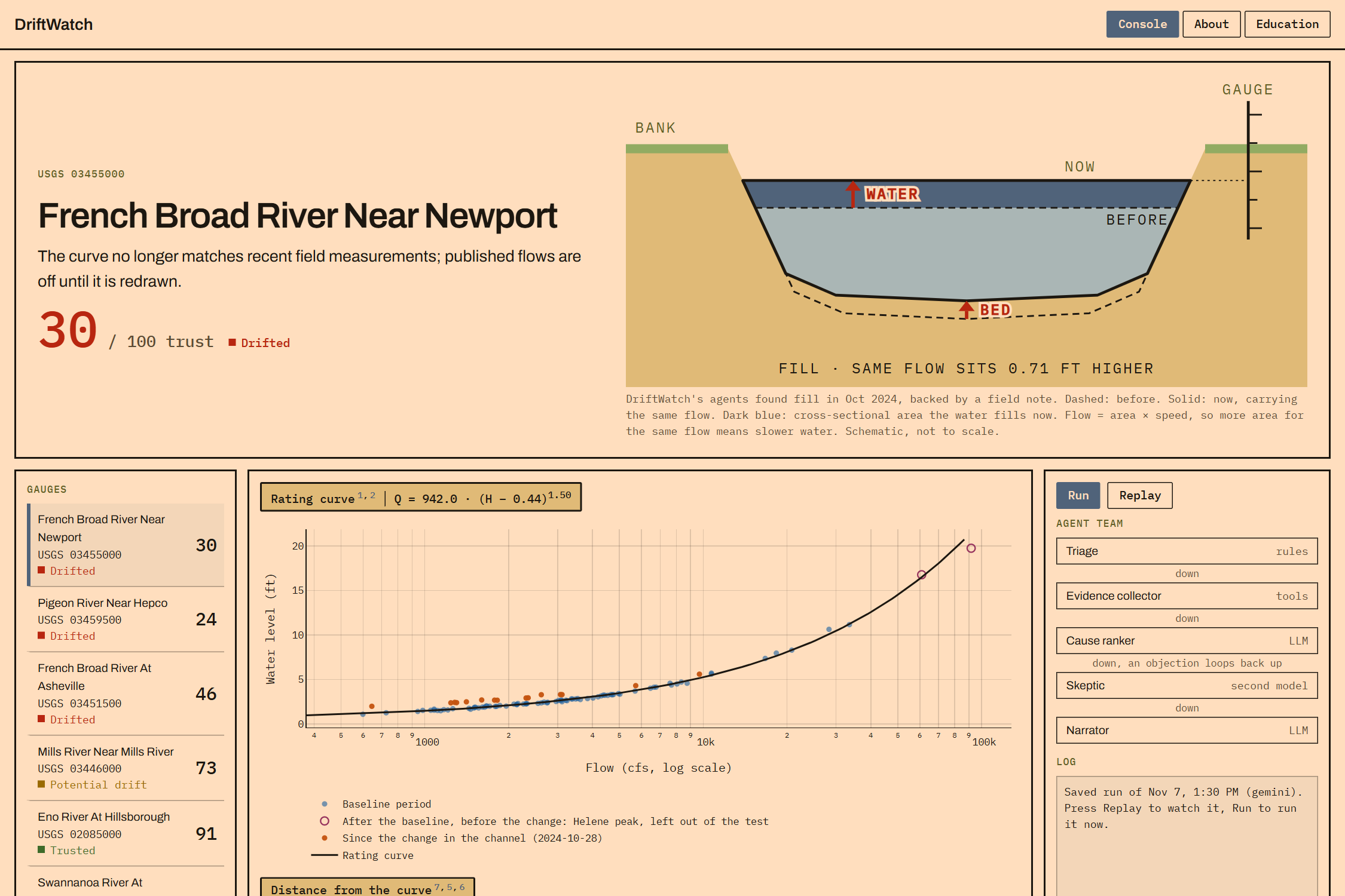
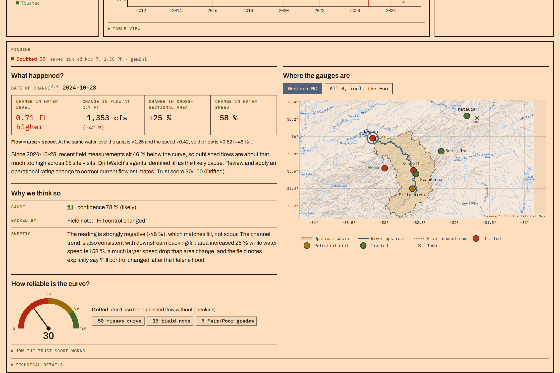
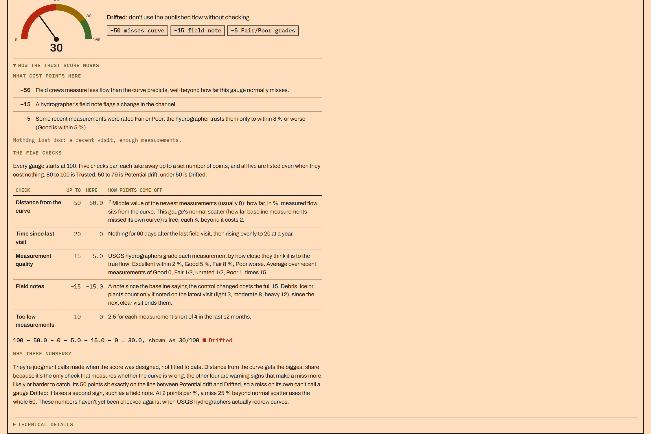
DriftWatch is a general engine for detecting calibration drift in engineered relationships, paired with a LangGraph team of agents that investigates the cause and reports a rating confidence score from 0 to 100
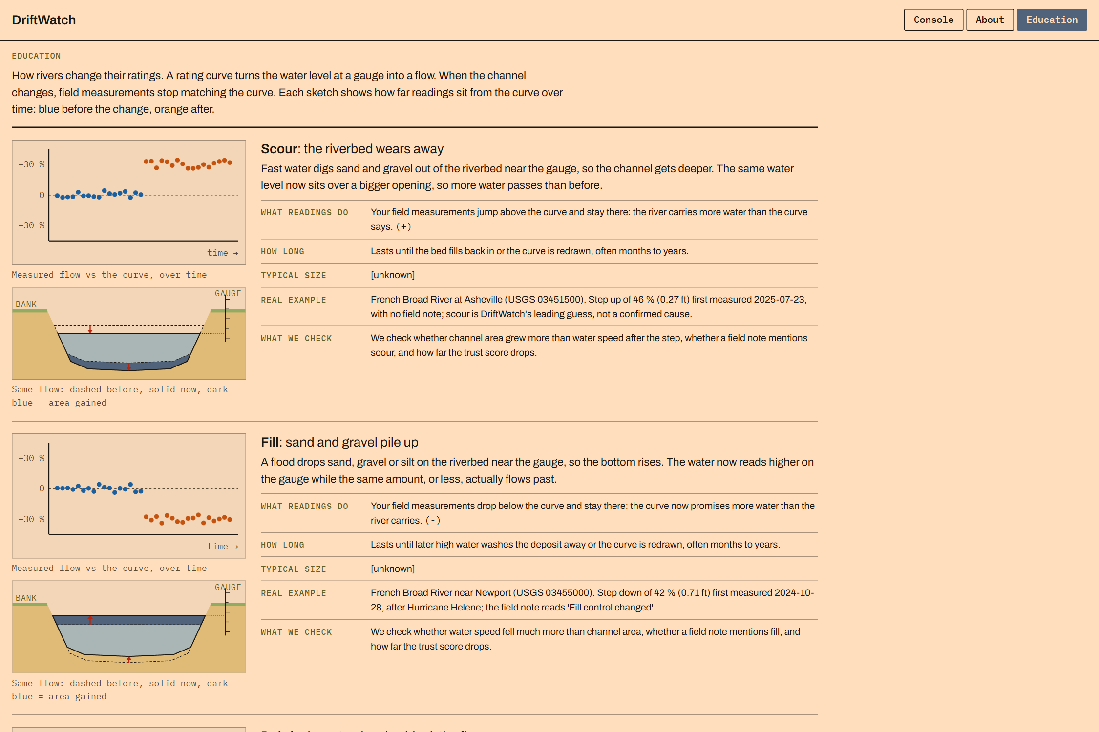
While the engine is architected to be generalized—handling flow meters, pump curves, or rain gauge calibrations—this demonstration focuses on a single hydrologic use case: river rating curve shifts caused by Hurricane Helene.
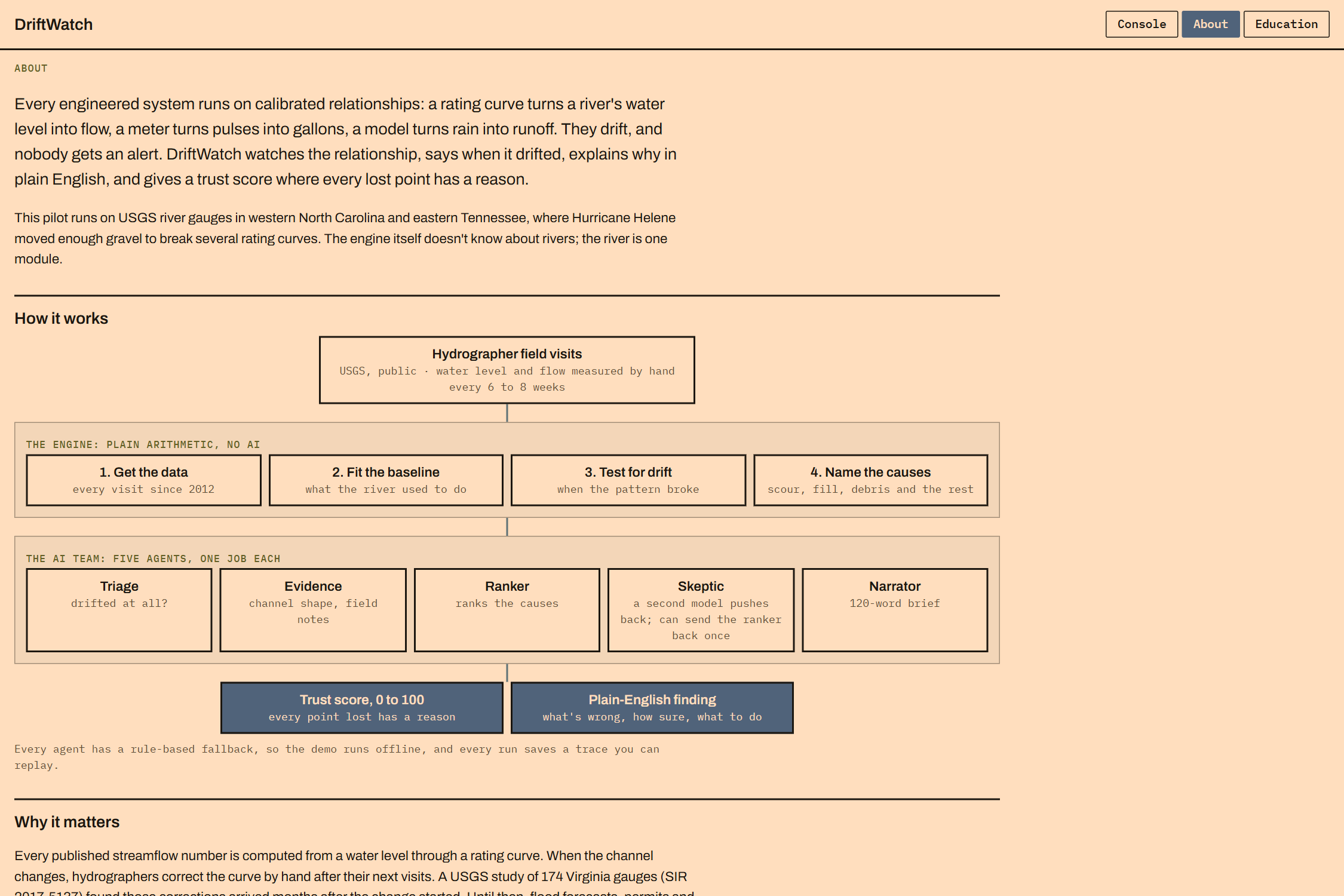
The pipeline:
- Ingests USGS field measurements and field-visit notes.
- Fits the baseline physical relationship (the stage-discharge rating, Q = a(h - e)^b) over a trusted reference period.
- Tests for step shifts and slow slides using residual analysis, field notes, and raw hydraulic metrics.
- Deploys an adversarial team of AI agents to cross-reference statistical anomalies with field notes, meteorological reports, and historical context to explore plausible physical causes (e.g., channel bed scour, vegetation growth, or structural displacement) and score data confidence.
I envision this tool bridging the gap between rating curve maintainers—such as hydrologists at the USGS—and the downstream decision-makers who rely on accurate discharge measurements, including municipal utilities, flood forecasters, urban planners, and hydraulic modelers. Ultimately, it functions as both an early warning system for sensor drift and a real-time data reliability engine for critical water resources workflows.
Built With
- fastapi
- gemini
- google-cloud
- langchain
- langgraph
- numpy
- openai
- openrouter
- pandas
- plotly
- pydantic
- python
- ruptures
- scipy
- usgs-waterservices
- vertex-ai
