-
-
Project card
-
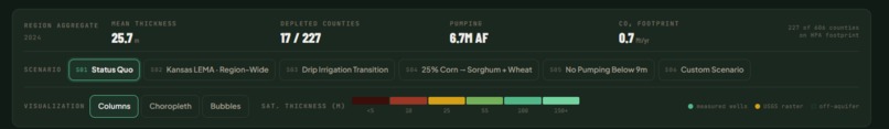
KPIs
-

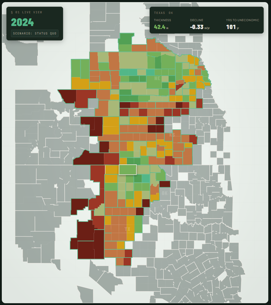
County Map
-
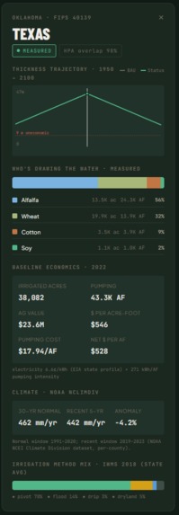
County metrics
-
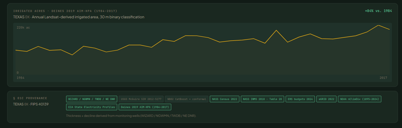
All data together
-
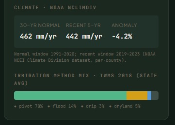
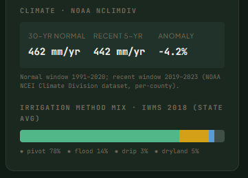
Climate Caveat
-
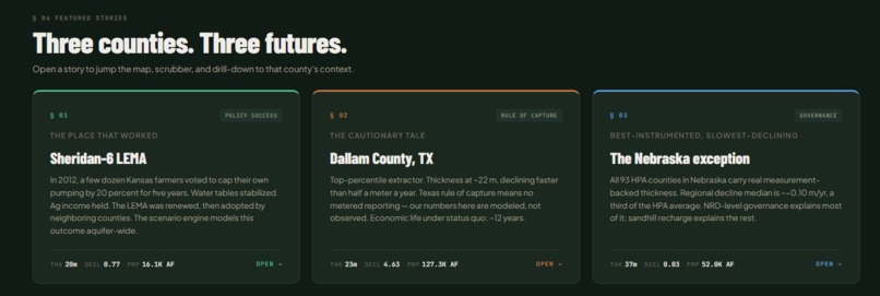
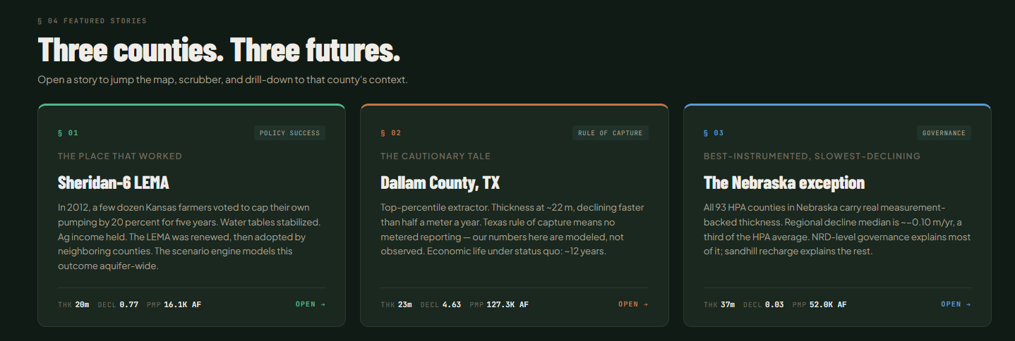
Stories
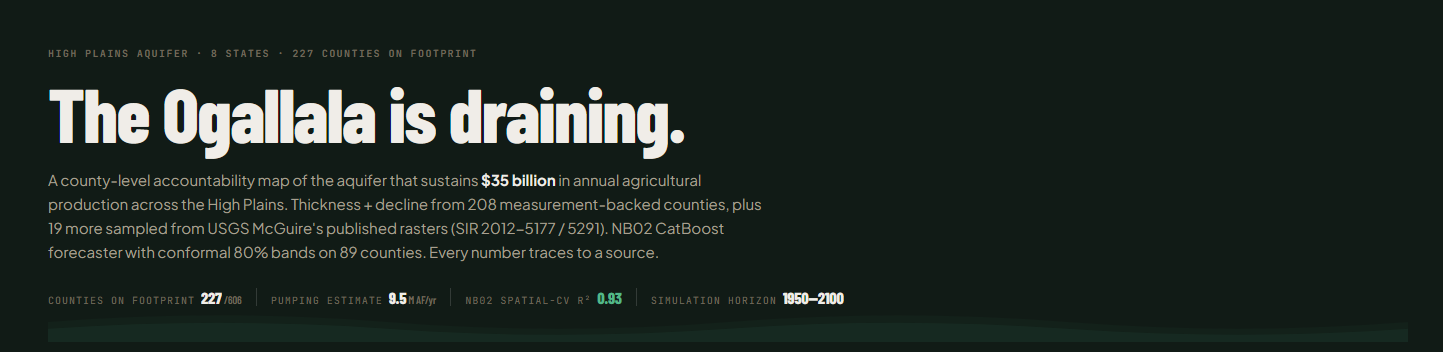

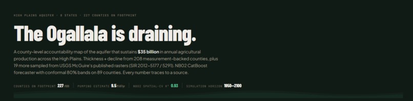
AquiferWatch: Ogallala Aquifer Accountability Platform
Who is draining the High Plains, what it's growing, and how long until it's gone.
Inspiration
The Ogallala Aquifer is the lifeblood of American agriculture, supporting roughly $35 billion in annual production across eight states. However, we are currently withdrawing water 10 times faster than it can naturally recharge.
While state agencies provide data, it is often siloed or presented in dense, aggregate reports. We built AquiferWatch to transform this into a high-stakes, county-level accountability view, moving the conversation from abstract concern to unavoidable math.
What it does
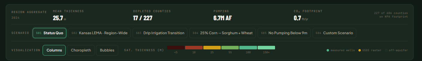
AquiferWatch is an interactive dashboard covering 606 counties. Key features include:
- The "Death Clock": Predicts the specific year each county will hit the "uneconomic" pumping threshold.
- Historical Time Scrubber: A visual journey from 1950 to 2100 showing the "desaturation" of the aquifer in real-time.
- Extraction Attribution: A breakdown of which crops: corn, cotton, soy, or wheat are responsible for the most significant drainage in each county.
- Scenario Engine: A policy-testing tool where users can toggle levers like "20% pumping cuts" or "crop swaps" to see how they extend the aquifer's lifespan.
Methodology & Modeling
We prioritized a "physics-first" approach to ensure our predictions remained grounded in reality rather than just black-box patterns.
1. The Mathematical Core
For the baseline simulation, we utilized a deterministic volumetric balance equation:
$$\text{thickness}(t+1) = \text{thickness}(t) + \frac{\text{recharge} - \text{pumping}}{\text{area} \times \text{specific_yield}}$$
2. Tiered Modeling Strategy
We categorized all 606 counties into three data regimes:
| Regime | Count | Description |
|---|---|---|
| Modeled High | 248 | Used for ground-truth training and validation. |
| Modeled Low | ~358 | Imputed using LightGBM to replace crude bedrock fallback estimates. |
| Metered | Variable | Uses state-specific open records (e.g., Kansas KGS data) for verification. |
Built With
- duckdb
- fastapi
- geopandas
- lightgbm
- next.js
- parquet
- polars
- postgis
- python

Log in or sign up for Devpost to join the conversation.