-
-
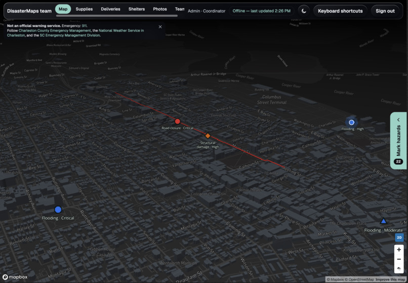
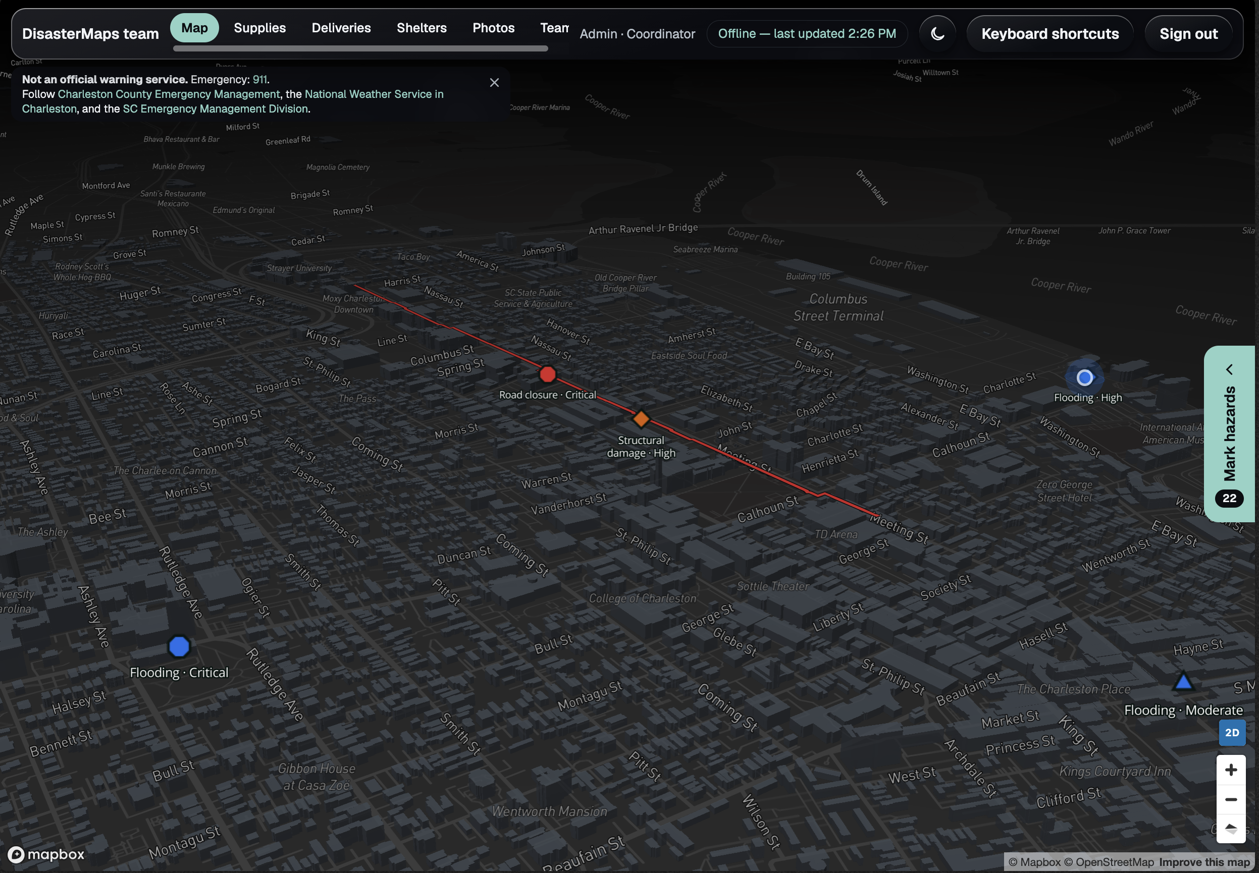
DisasterMaps Web UI
-
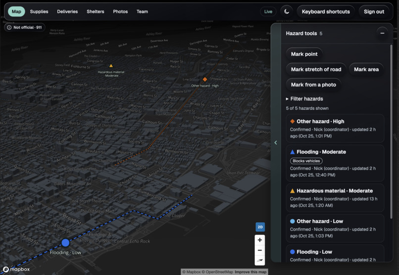
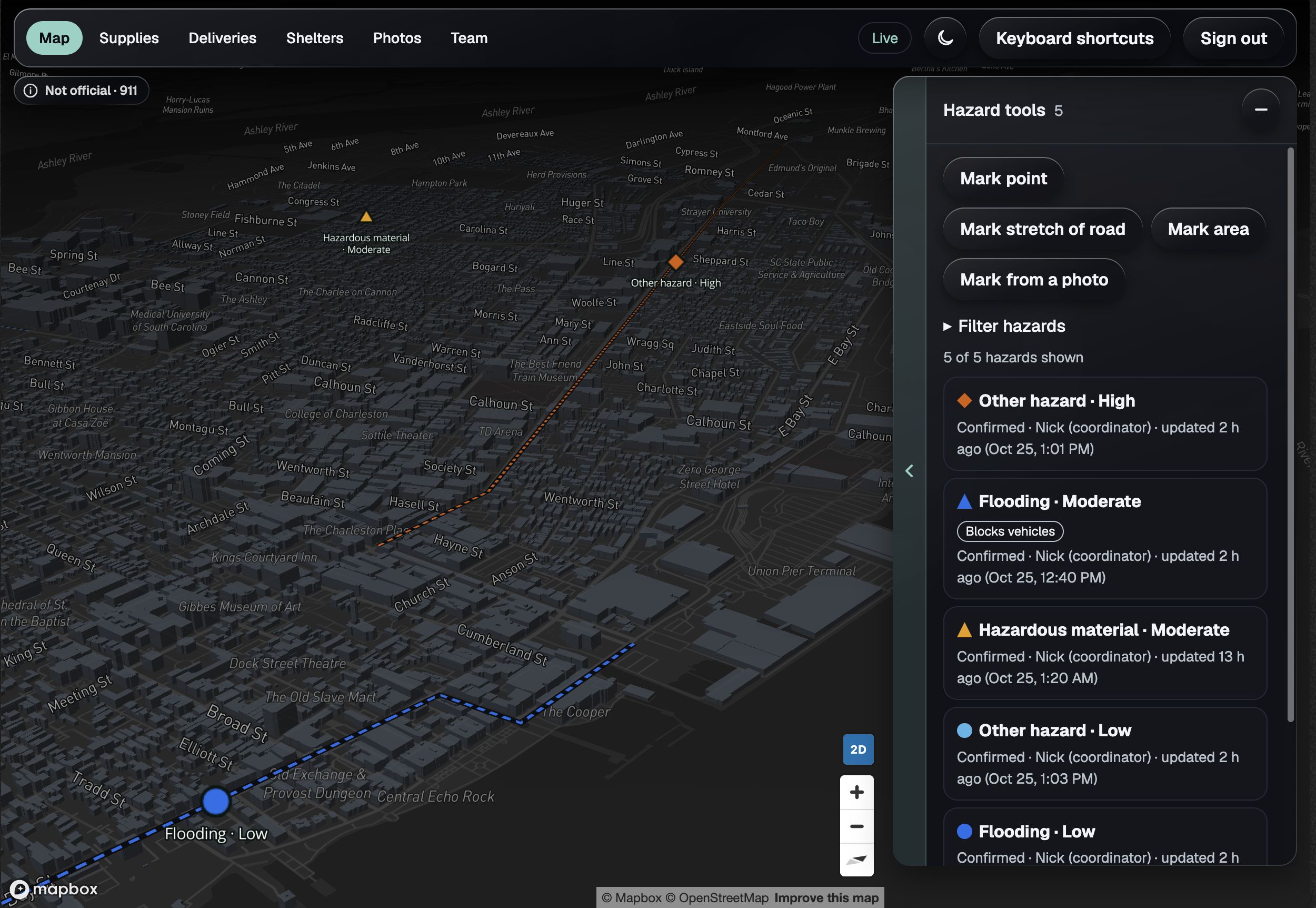
Hazards View
-
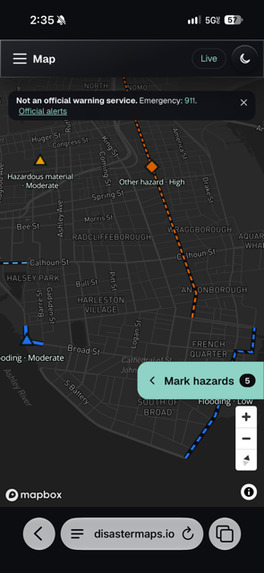
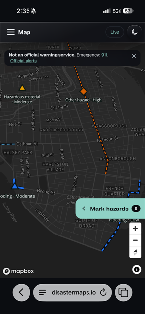
Mobile Hazards View
-
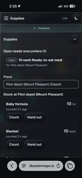
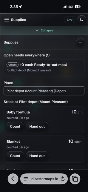
Mobile Supplies Details View
-
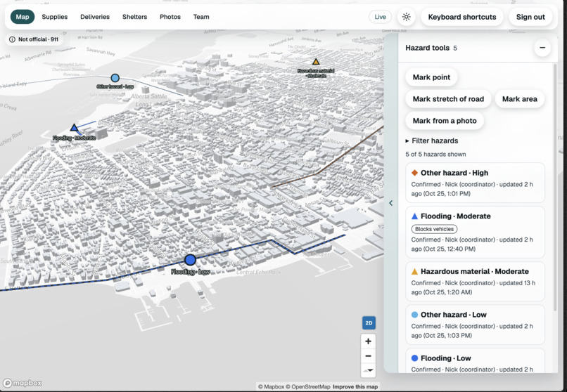
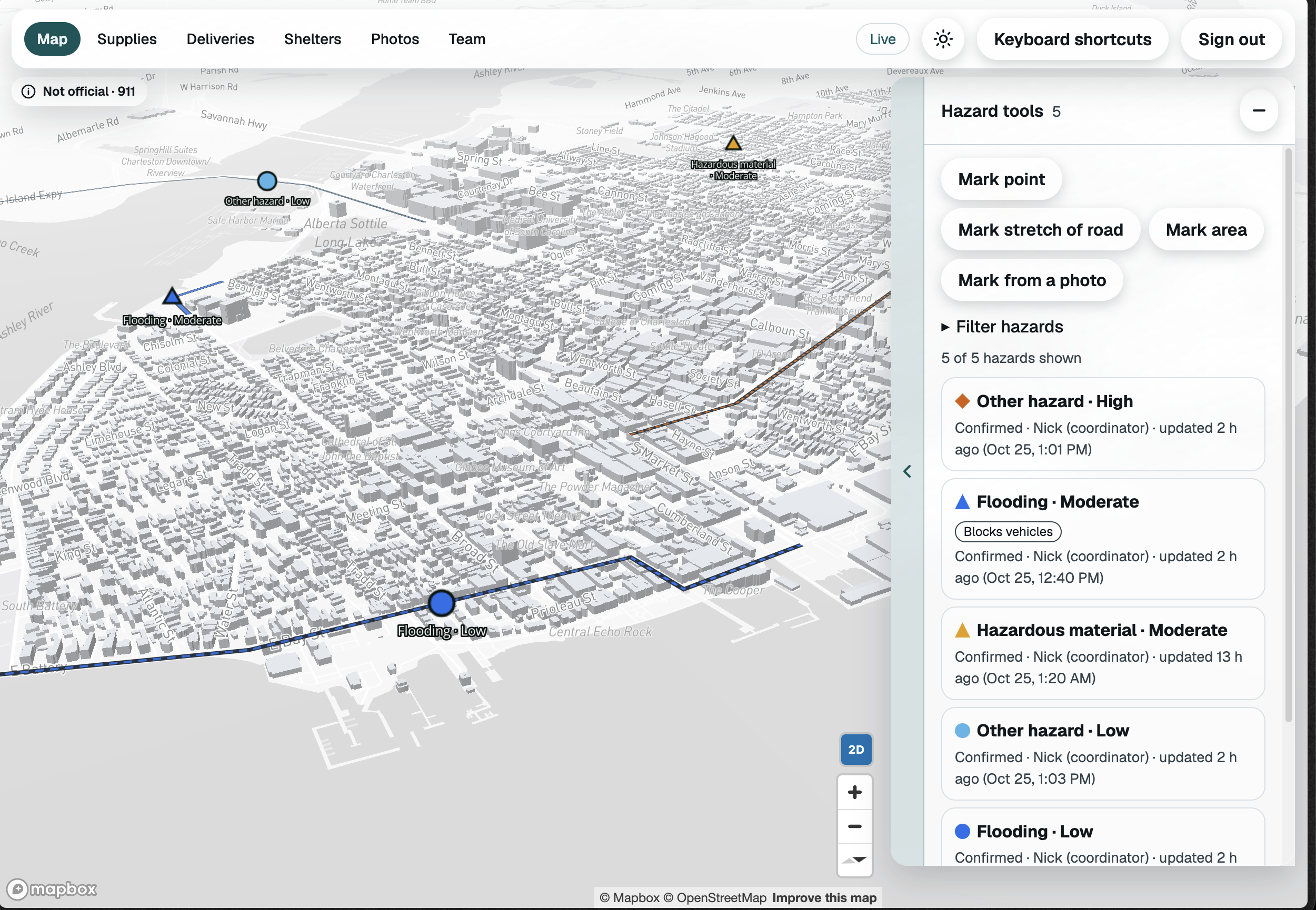
Desktop Light Mode
-
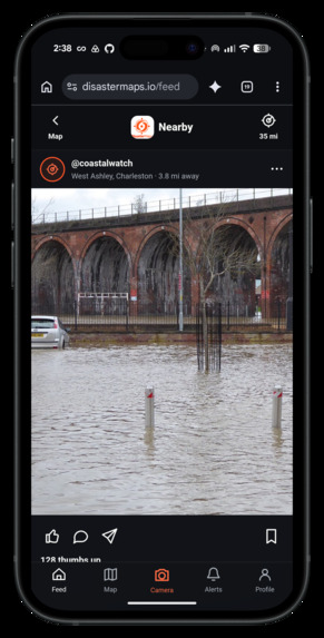
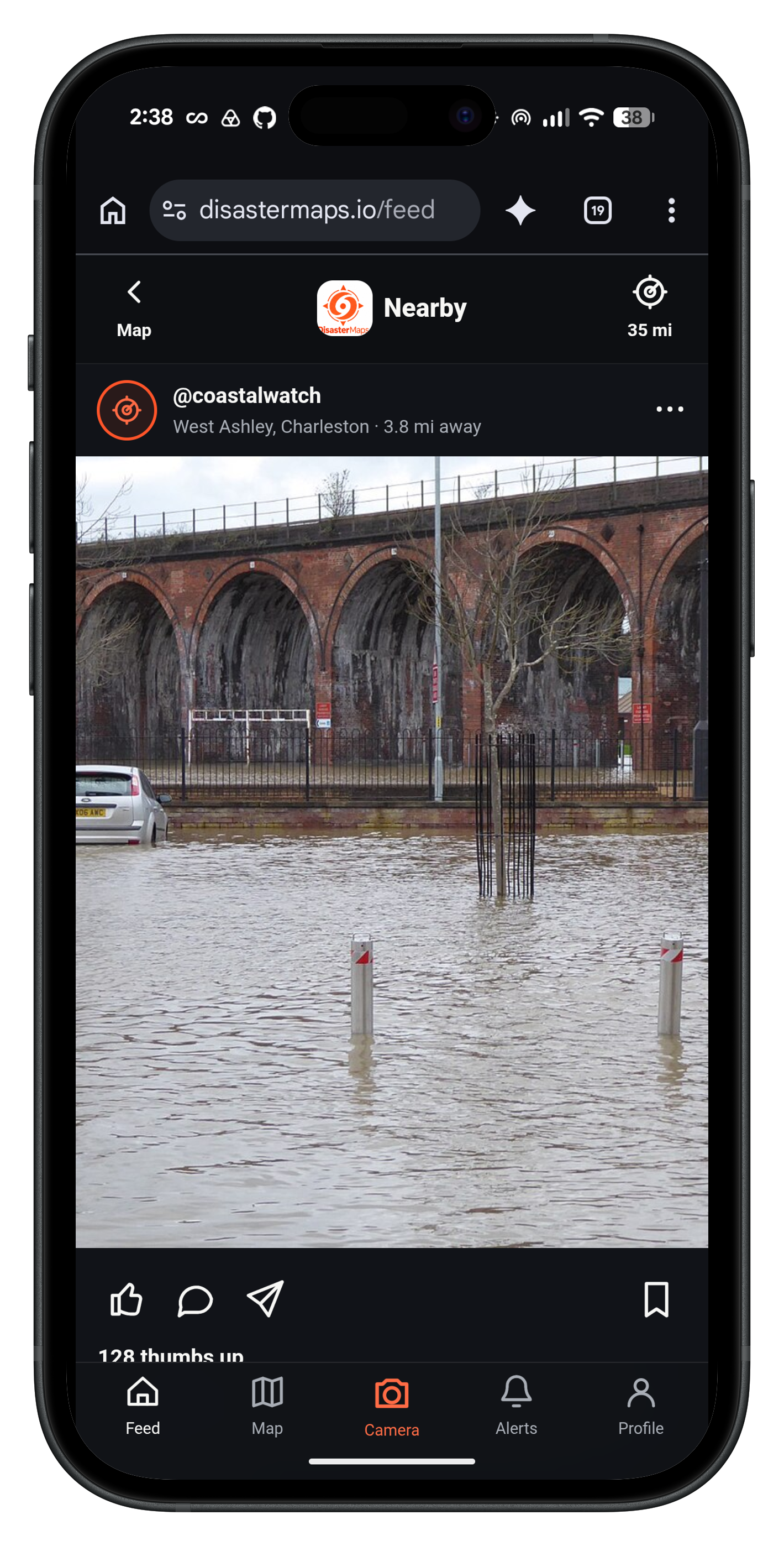
Disaster Feed
-
Logo
Inspiration
The inspiration came from having a conversation with a Hendersonville, NC disaster coordinator at a bar while visiting my parents after Helene. We were talking about how much of a nightmare it was to manage all of those logistics on top of roads being destroyed and everyone displaced. The logistics and huge influx of supplies was just as hard to manage as everything else was. Having an abundance of food in one place but a lack of water was frustrating and even life threatening in some cases.
DisasterMaps helps to make that nightmare stay a memory and not be a lived reality for the disasters of the future.
What it does
DisasterMaps is an AI-powered disaster response platform that connects communities, emergency responders, and relief organizations through a single real-time coordination network. Using agentic AI, DisasterMaps identifies hazards, tracks shelter needs, inventories donated supplies through image recognition, and intelligently coordinates deliveries and evacuation routes. As conditions change, the platform automatically adapts logistics plans and recommends safer routes, keeping human coordinators in control of critical decisions. By turning fragmented information into coordinated action, DisasterMaps helps communities respond faster, distribute resources more efficiently, and save lives when every second counts.
How we built it
Created the project specification from an idea that Chris had been kicking around for a while but had not had the chance to work on. We distilled his ideas into a plan outline, created a git repository and began developing a project constitution and plan using github-spec-kit (https://github.com/github/spec-kit). We split out development tasks into feature slices and each worked simultaneously as 3 separate human+ai dev teams. We used mapbox for the interactive map, Gemini for AI image analysis,
Challenges we ran into
Collaborating over git while using 3 different AI agents (1 codex, 2 claude code). 2/3 of our team was only used to working on solo projects. We used Claude to split up our tasks and the development plan created from spec kit to avoid merge conflicts and merge PRs in the correct order. We had to cut many features (live traffic, live weather & wildfire reporting, call to report a hazard, etc…) due to limited time. But those features will come in the next stage among other features including Meshtastic communication redundancy.
Accomplishments that we're proud of
Map interface, live photo upload with AI photo analyis for hazard detection & reporting, fully responsive mobile-first UI, got alpha version live on disastermaps.io with a real working core feature set,
What we learned
Effective collaboration among a distributed team including both humans and agentic AI. Handling task delegation, merge order, and merge conflict resolution is much easier when working with an AI agent that can analyze both changesets and pull in appropriate changes.
What's next for DisasterMaps
We plan to continue developing it and adding more features that will make it more useful for incident responders.
Built With
- axe-core
- claude
- cloudflare
- codex
- digitalocean
- docker
- flask
- gemini
- gevent
- github
- github-actions
- gunicorn
- jsdom
- jsonschema
- psycopg
- pytest
- python
- react-19
- server-sent-events
- vitest

Log in or sign up for Devpost to join the conversation.