-
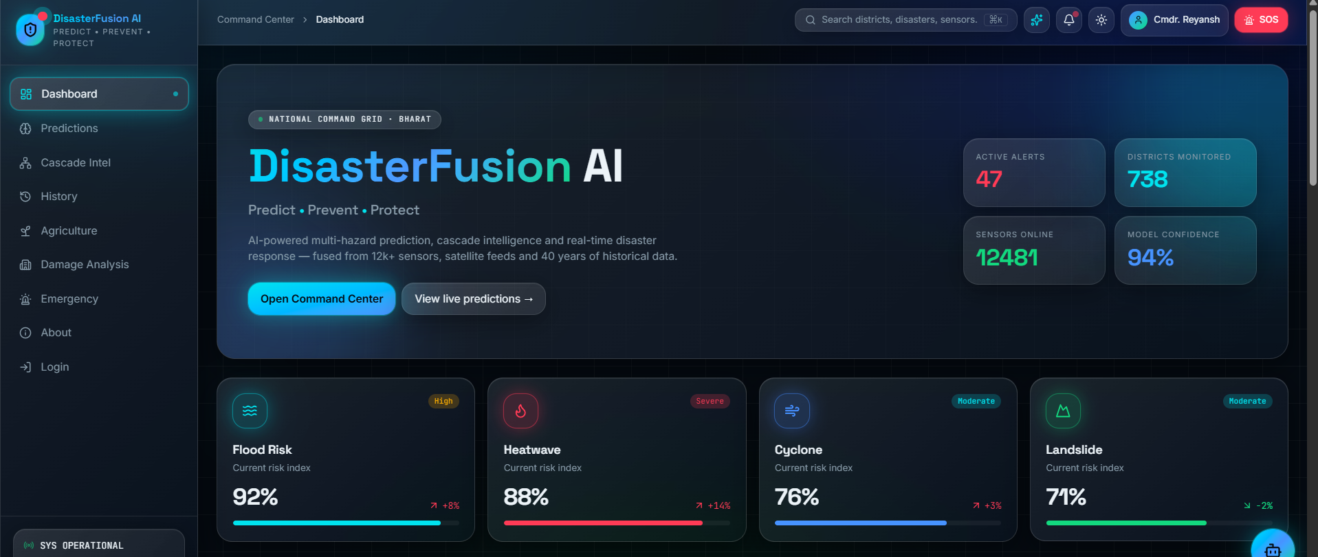
DisasterFusion AI Command Center – A centralized national disaster intelligence dashboard providing real-time monitoring.
-
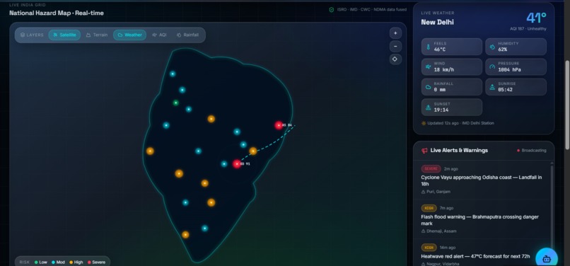
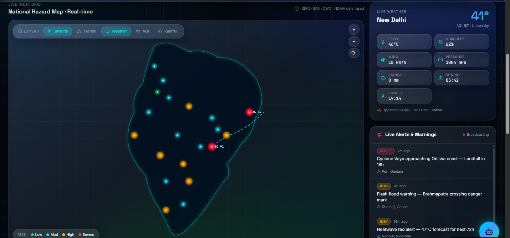
Real-Time National Hazard Map – Interactive GIS map integrating satellite imagery, weather, AQI, rainfall, and live disaster .
-
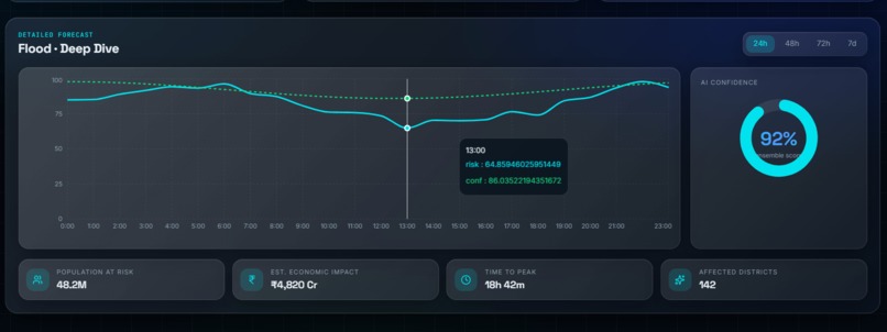
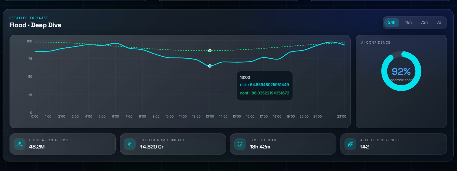
Flood Intelligence Dashboard – Advanced flood forecasting with risk curves, AI confidence, economic impact estimation, and population
-
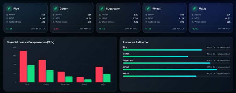
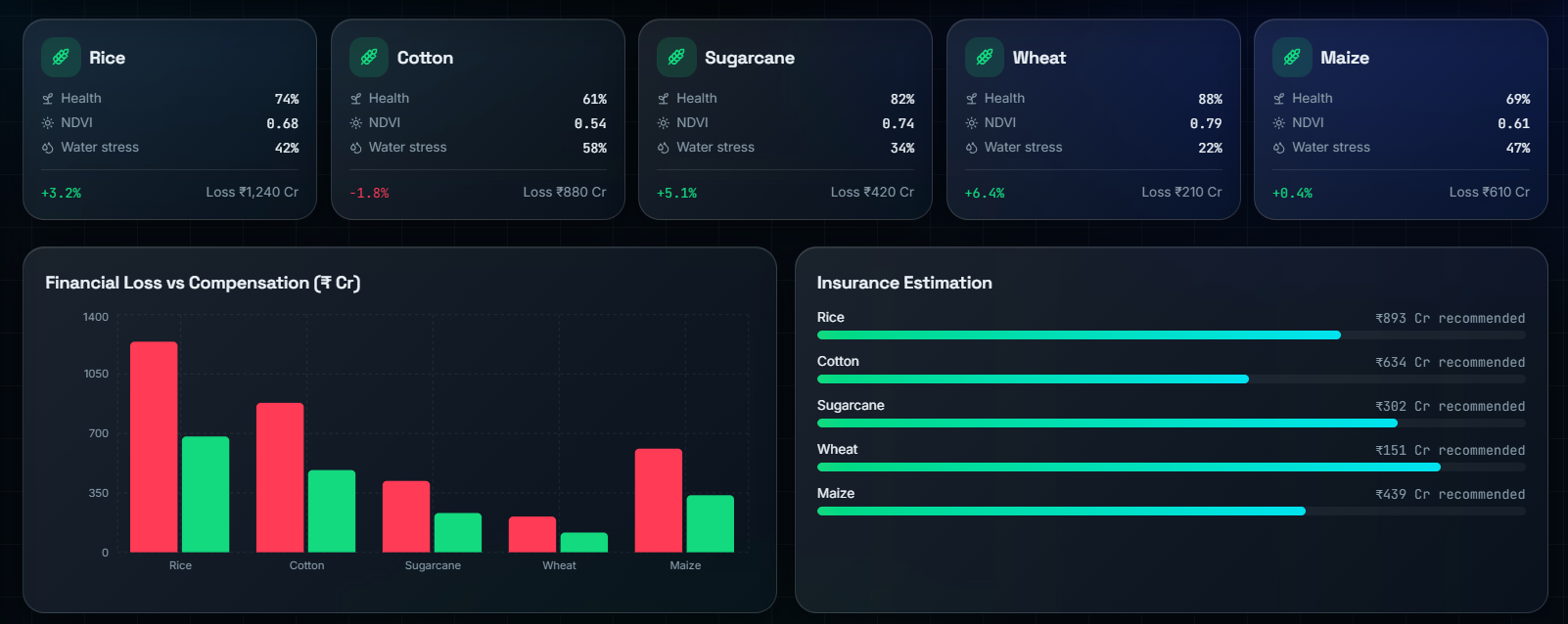
Agricultural Loss Assessment – Intelligent comparison of crop losses, compensation planning, and AI-generated insurance recommendations.
-
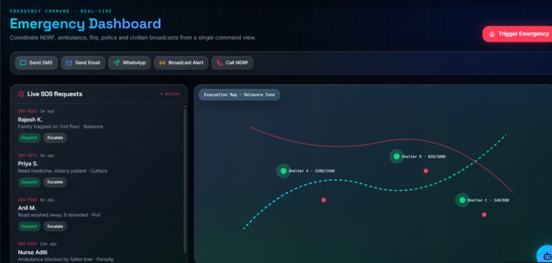
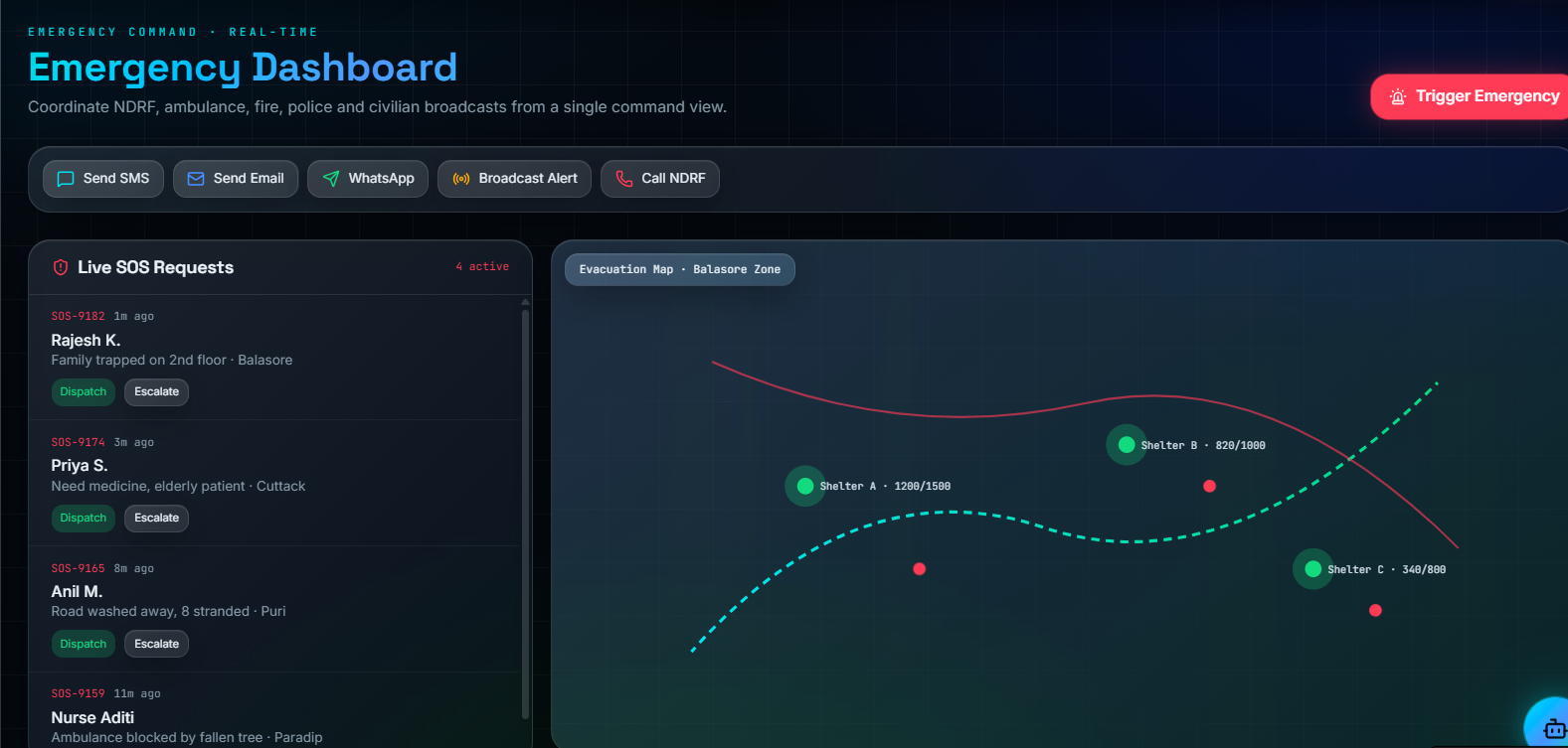
Emergency Operations Center – Unified command dashboard for SOS management, evacuation planning, emergency broadcasting, and rescue
-
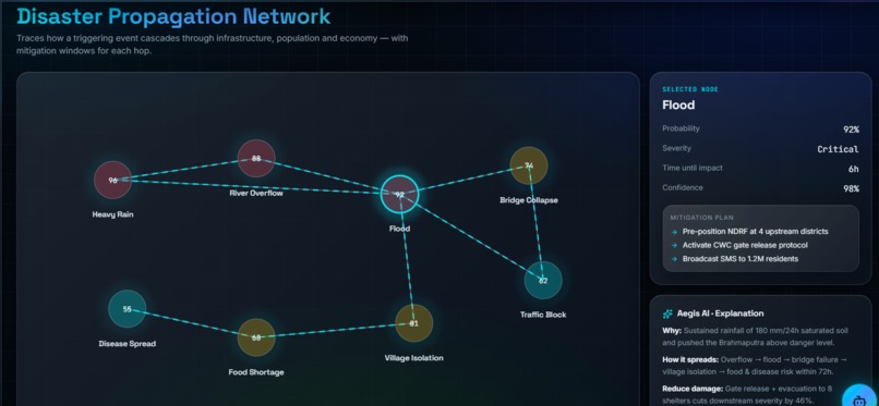
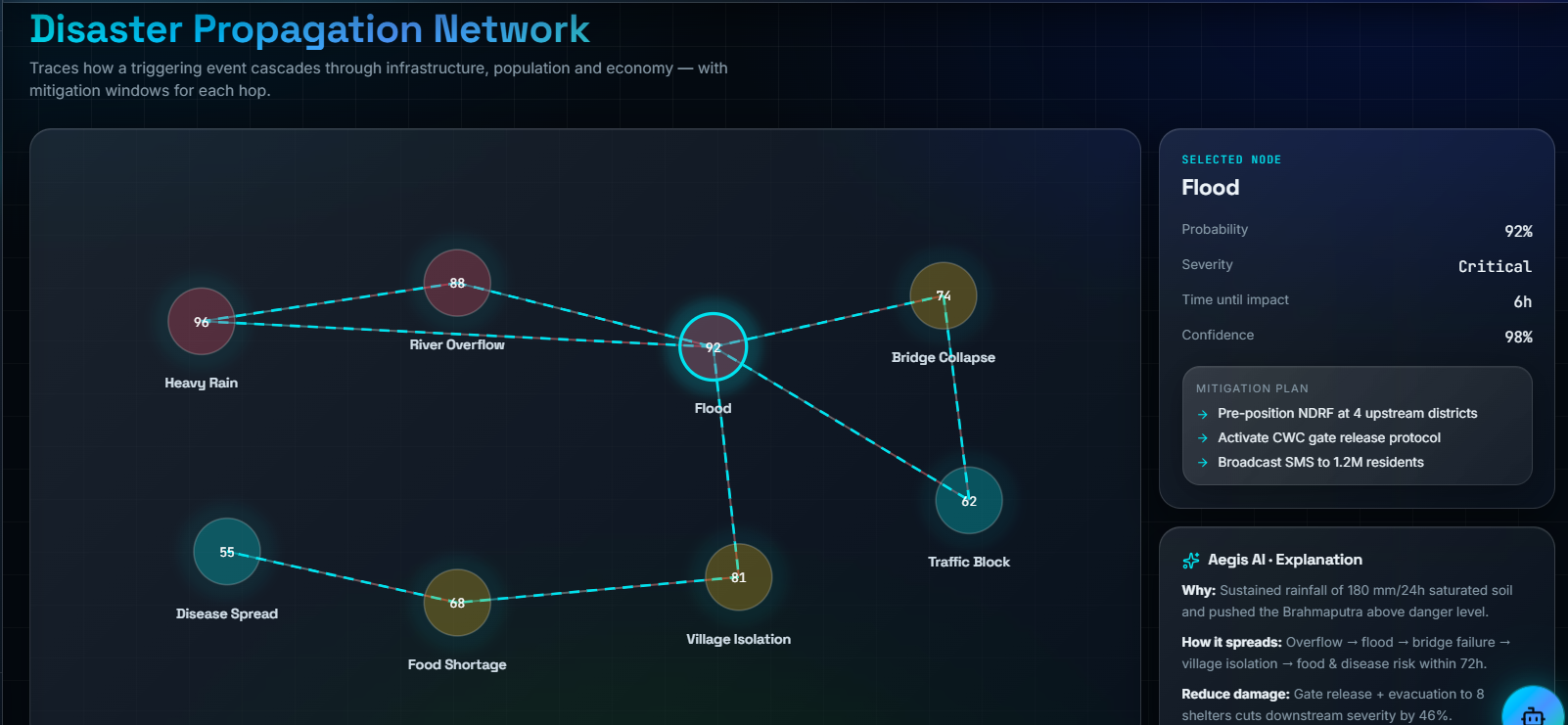
Cascade Impact Intelligence – AI-driven propagation network visualizing how disasters spread across infrastructure, transportation.
-
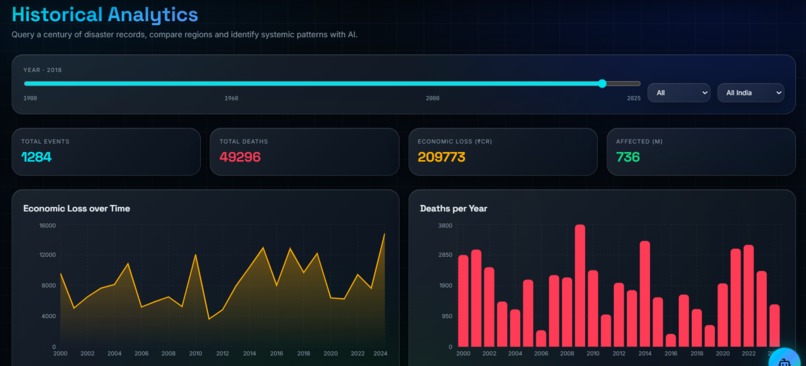
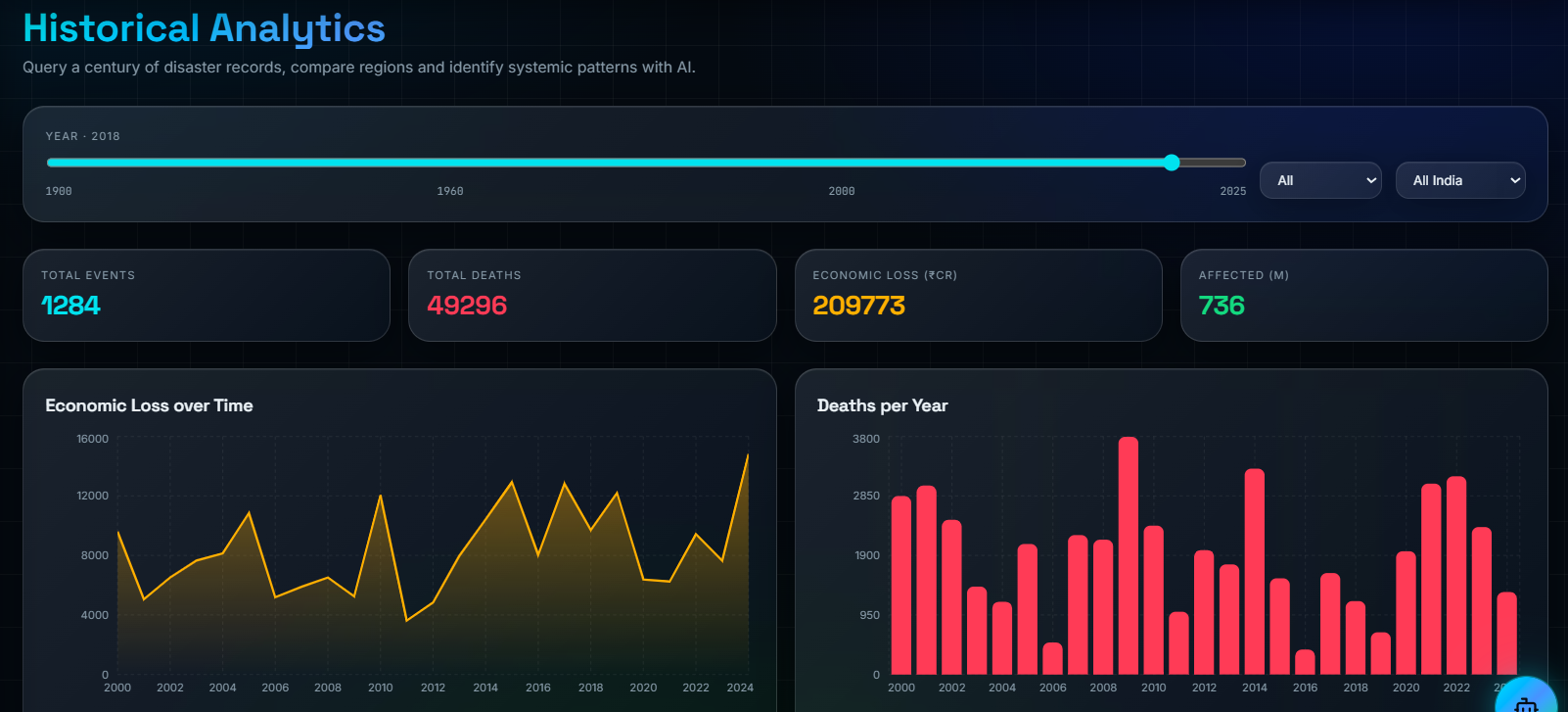
Historical Disaster Analytics – Century-scale disaster records enabling trend analysis, economic loss estimation, and policy-driven .
-
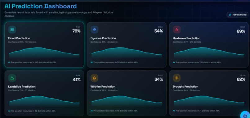
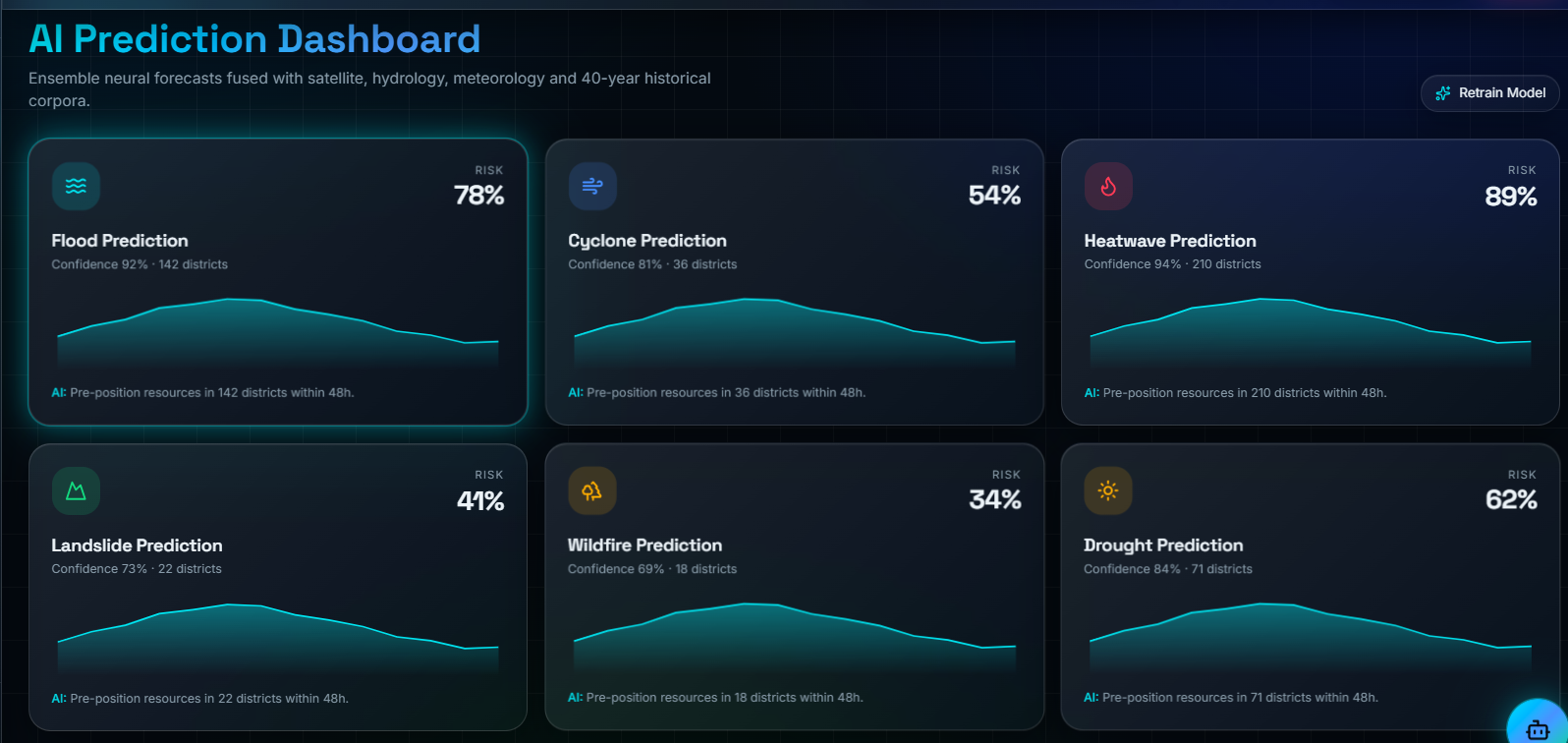
AI Multi-Hazard Prediction Dashboard – Deep learning models forecasting flood, cyclone, heatwave, landslide, wildfire, and drought risks
-
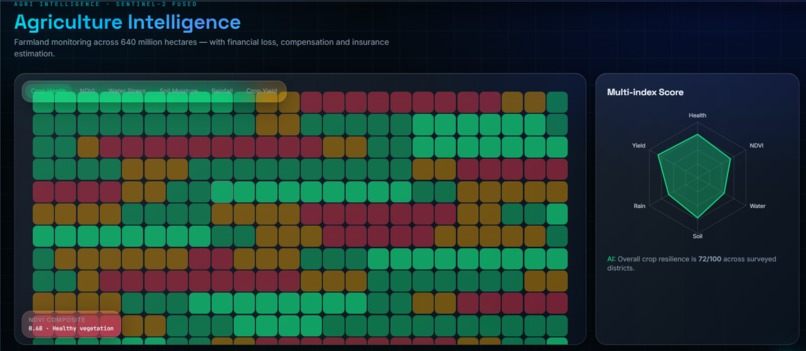
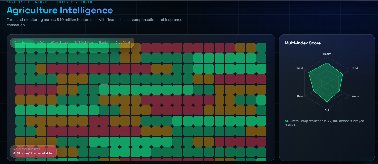
AI Agriculture Intelligence – Satellite-powered crop health monitoring with NDVI analysis, yield prediction, insurance estimation.
-
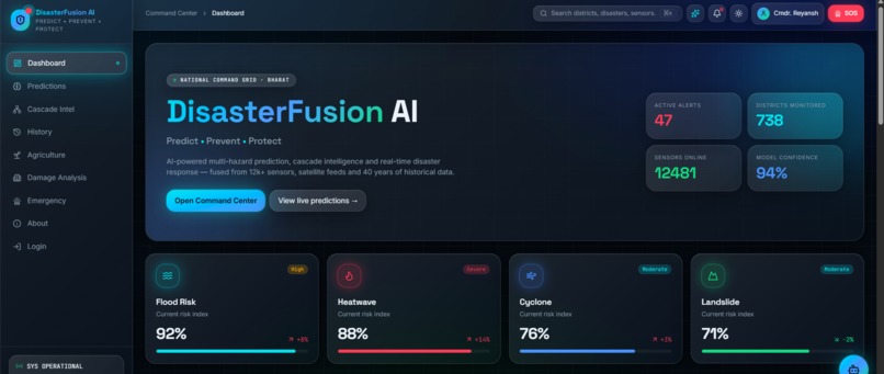
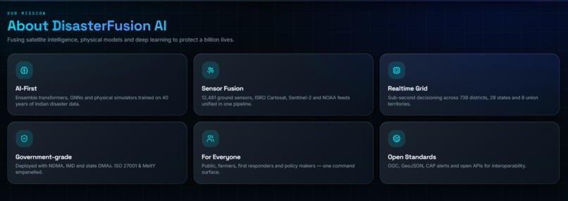
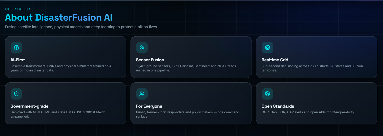
Mission & Technology Overview – Introducing DisasterFusion AI's vision, sensor fusion architecture, AI capabilities.
-
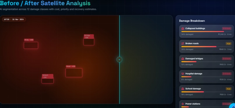
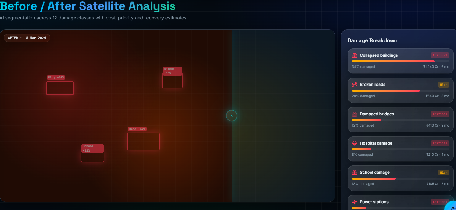
Before & After Satellite Damage Assessment – AI-powered image segmentation detecting damaged infrastructure and estimating recovery costs
-
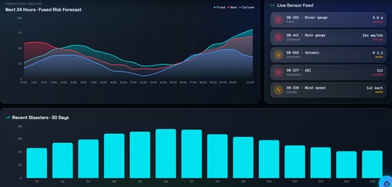
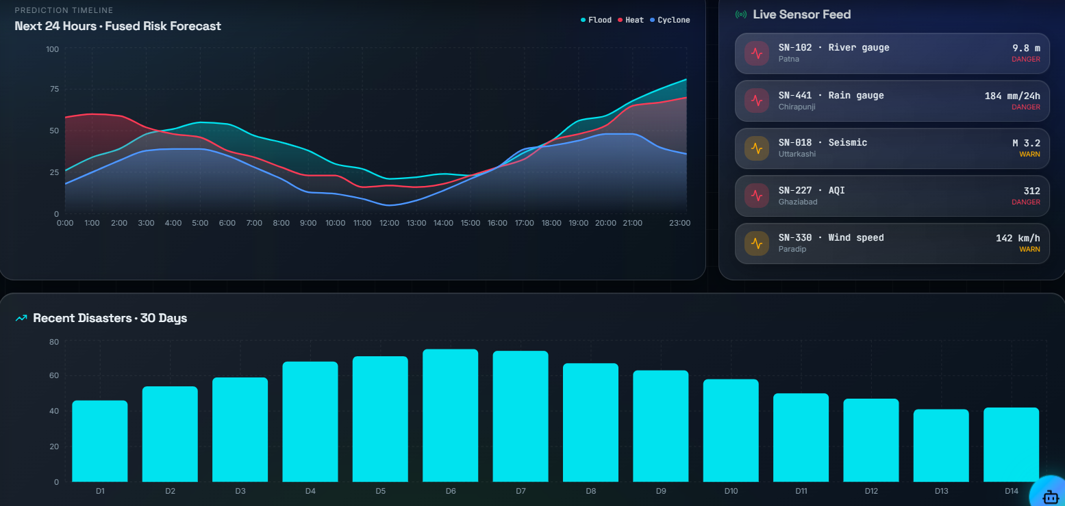
24-Hour Risk Forecast & Live Sensor Monitoring – Continuous prediction timeline fused with real-time sensor data for proactive disaster
-
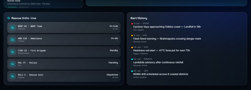
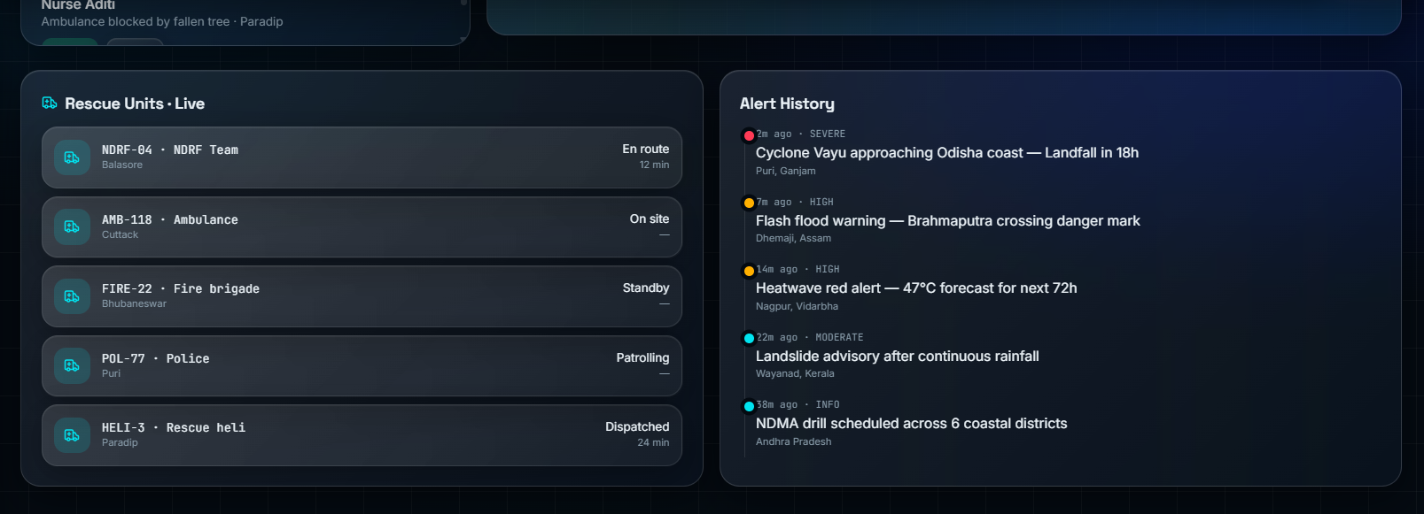
Live Rescue Coordination – Real-time tracking of emergency responders alongside a timeline of critical disaster alerts .
DisasterFusion AI: An Intelligent Multi-Hazard Prediction, Prevention, and Response Platform
Inspiration
Natural disasters are becoming more frequent and severe due to climate change and rapid urbanization. While studying recent disaster events, we observed that most existing systems focus on predicting only one type of disaster, such as floods or heatwaves. However, disasters are rarely isolated. Heavy rainfall can trigger floods, which in turn may cause landslides, infrastructure failures, and transportation disruptions.
This inspired us to build DisasterFusion AI, a unified platform capable of understanding the relationships between multiple hazards and supporting authorities throughout the disaster management lifecycle, from prediction and prevention to response and recovery.
What We Learned
Developing this project deepened our understanding of:
- Artificial Intelligence and Machine Learning for time-series forecasting.
- Geospatial Information Systems (GIS) and spatial risk analysis.
- Integration of heterogeneous data sources such as satellite imagery, IoT sensors, weather APIs, and historical disaster records.
- Emergency response planning and resource optimization.
- Explainable AI (XAI) for decision support in safety-critical applications.
We also learned that effective disaster management requires combining technology with human expertise rather than relying solely on automation.
How We Built the Project
Our solution follows a modular architecture that integrates multiple real-time and historical data sources into a unified AI pipeline.
Data Collection
We aggregate data from:
- Weather Forecast APIs
- Satellite Imagery
- River Water-Level Sensors
- Rainfall Sensors
- Temperature Sensors
- Soil Moisture Sensors
- Historical Disaster Datasets
- GIS Elevation and Land-Use Maps
AI Prediction Engine
The collected data is processed using AI models to estimate the probability of multiple hazards, including:
- Floods
- Landslides
- Heatwaves
- Cyclones
- Droughts
The prediction process can be represented as:
P(H_i | D) = f(X_1, X_2, ..., X_n)
where:
- H_i represents the probability of disaster i.
- D represents historical observations.
- X represents environmental variables such as rainfall, temperature, soil moisture, river level, and wind speed.
Cascading Disaster Analysis
Unlike traditional systems, our platform analyzes how one disaster can trigger another.
Example:
Heavy Rain
   |
   v
River Overflow
   |
   v
Flood
   |
   v
Road Failure
   |
   v
Landslide
The AI estimates the probability of cascading events using dependency analysis across multiple hazards.
Decision Support
Once a high-risk situation is detected, the platform recommends:
- Preventive actions
- Evacuation routes
- Resource allocation
- Emergency team deployment
- Public alert generation
The system acts as an intelligent decision-support platform for disaster management authorities.
Damage Assessment
After a disaster, satellite and drone imagery are analyzed using Computer Vision models to identify:
- Damaged buildings
- Blocked roads
- Flooded regions
- Critical infrastructure failures
This information helps prioritize rescue operations and accelerate recovery.
Technologies Used
Artificial Intelligence
- LSTM
- XGBoost
- Convolutional Neural Networks (CNN)
- Graph Neural Networks (GNN)
- Explainable AI (XAI)
Geospatial Technologies
- QGIS
- PostGIS
- Google Earth Engine
Backend
- FastAPI
- Python
Frontend
- React.js
Database
- PostgreSQL
Cloud and IoT
- AWS / Microsoft Azure
- ESP32-based Environmental Sensors
Challenges We Faced
One of our biggest challenges was integrating multiple data sources that differed in format, scale, and update frequency.
Other challenges included:
- Designing a unified prediction framework instead of isolated disaster models.
- Modeling cascading disaster relationships accurately.
- Handling incomplete or missing environmental data.
- Balancing prediction accuracy with real-time performance.
- Presenting complex AI outputs in a simple and actionable format for emergency responders.
Addressing these challenges required careful data preprocessing, modular system design, and the use of Explainable AI techniques to build trust in the recommendations.
Impact
DisasterFusion AI transforms disaster management from a reactive process into a proactive, intelligence-driven system.
Our platform enables authorities to:
- Predict multiple hazards simultaneously.
- Identify cascading disaster risks.
- Improve emergency preparedness.
- Optimize resource allocation.
- Reduce emergency response time.
- Minimize loss of life and infrastructure damage.
By integrating predictive analytics, geospatial intelligence, and real-time environmental monitoring, DisasterFusion AI contributes to building safer and more resilient communities.
Future Scope
We plan to enhance the platform by:
- Integrating autonomous drone surveillance.
- Developing Digital Twin models for disaster simulation.
- Supporting multilingual voice-based emergency alerts.
- Incorporating Reinforcement Learning for dynamic evacuation planning.
- Expanding prediction capabilities to include earthquakes, wildfires, and tsunamis.
Our long-term vision is to build a comprehensive AI-powered disaster intelligence ecosystem that enables governments and emergency agencies to make faster, data-driven, and life-saving decisions.

Log in or sign up for Devpost to join the conversation.