-
-

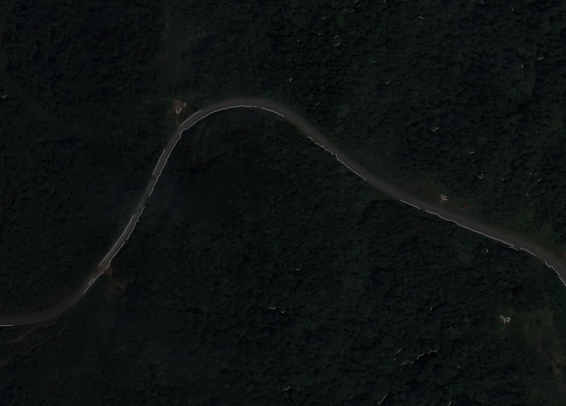
input
-
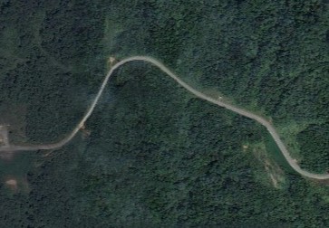
output

Inspiration
When crises strike, we often see landscapes being devastated, producing difficult to often untraversable terrain. Although we all have access to highly reliable map data like Google Maps, disasters quickly render our maps obsolete, where marked roads and paths can become unusable overnight. When timely and effective humanitarian aid literally saves lives, the lack of accurate and useful road network data can be incredibly costly.
What it does
Our quick generation maps help to reduce "surprises" on the ground, such as unexpected obstructions, so that humanitarian aid planners can quickly deploy their resources. We also chose to include gradient data, as steep slopes can prove difficult to traverse, as there may even be risks of landslides under rainy conditions.
How it works
Our program takes an input of a recent satellite image and outputs the same image with an overlay of all usable roads with their gradients colour coded for easy reference. This is achieved through a pipeline of computer vision tools and geospatial data resources. Firstly, the CANNY edge detection algorithm is used to detect road networks within the image. Afterwards, for each region of road, a digital elevation model from NASA's Shuttle Radar Topography Mission (SRTM) dataset is used to identify its height above sea level.
What's next for Disaster Response Mapping
Not to be limited to a 24-hour project, there are a plethora of useful features and improvements that we would like to implement to the program in the future. Firstly, the edge detection algorithm is not very robust in detecting roads, especially in urban areas where it detects a lot of unwanted noise such as the edges of buildings and vehicles. Hence, we hope to implement a road detector model using a convolutional neural network to perform this task in future. Furthermore, we also hope to train a model to be able to not just detect but also classify roads as either concrete / asphalt roads or dirt roads. This is because the type of road, together with the steepness, offers even more information for ground personnel. For instance, a steep and muddy slope would make it even more difficult for vehicles to pass. For this datathon, we were limited by a lack of time to label sufficient satellite imagery and train a neural network within 24 hours.

Log in or sign up for Devpost to join the conversation.