-
-
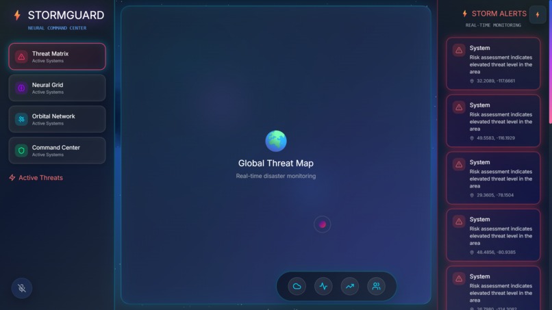
"Explore Disaster Guard AI's real-time dashboard with storm theme! #DisasterGuardAI #Hackathon2025"
-

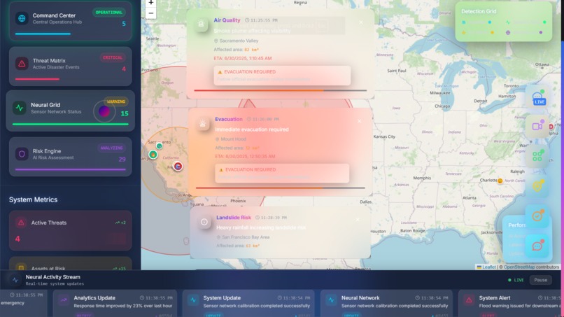
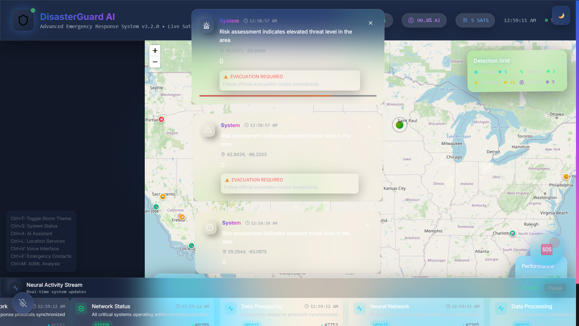
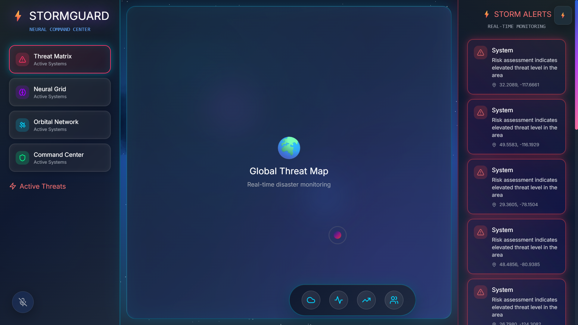
"See live disaster tracking with pulsing markers on our map! #DisasterGuardAI #EmergencyResponse"
-
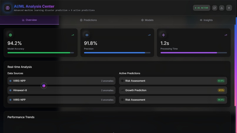
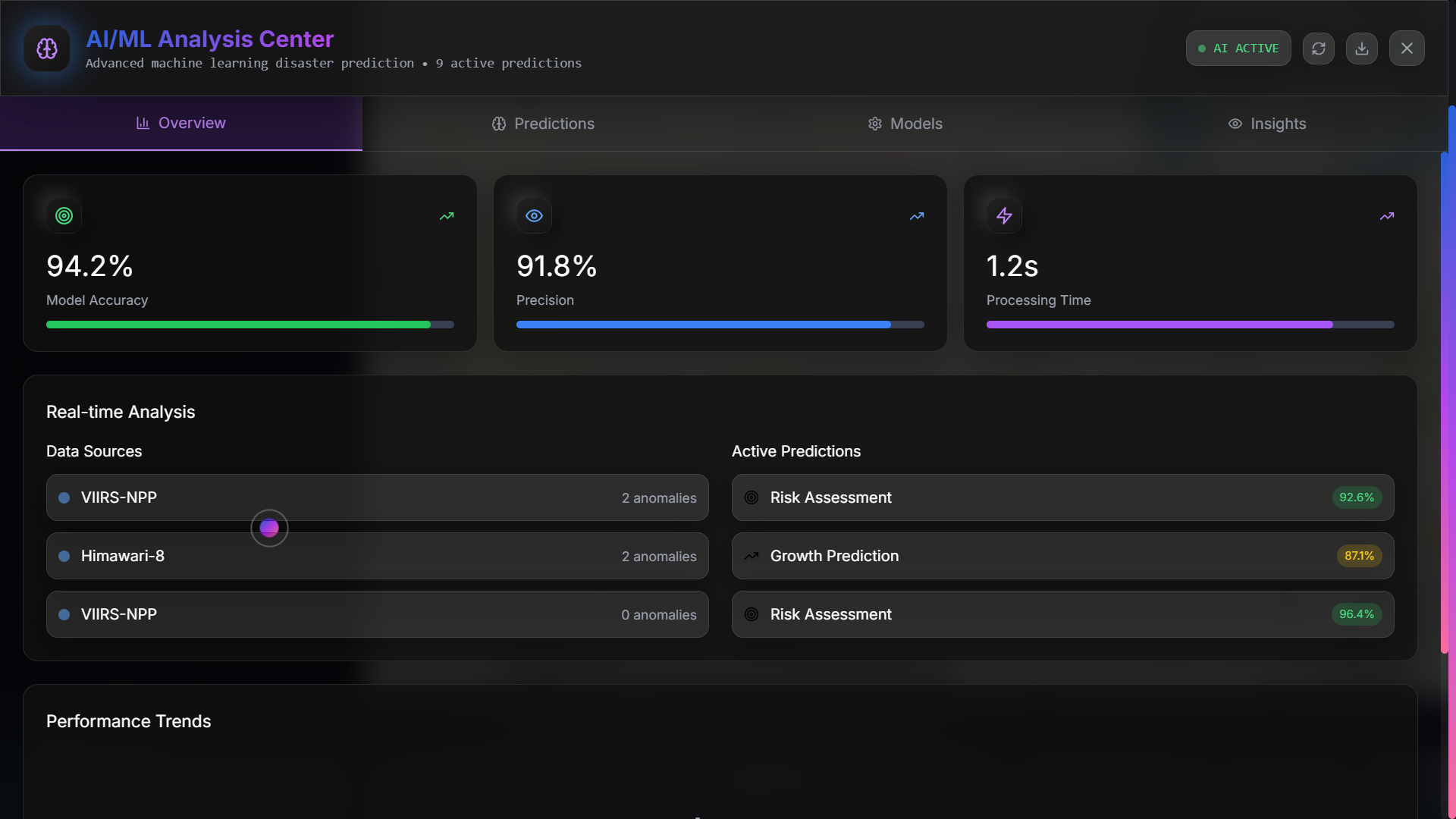
"Chat with our AI for disaster insights! Powered by OpenAI. #DisasterGuardAI #AIforGood"
-
"Experience thunder graphics in action! #DisasterGuardAI #StormTheme #Hackathon"
-
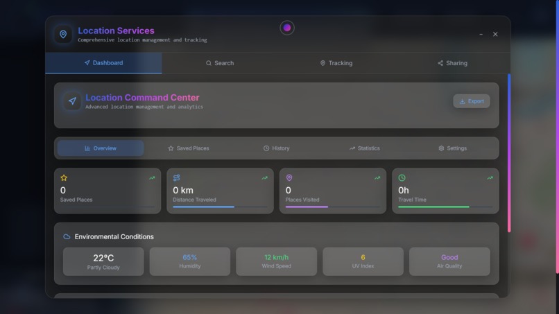
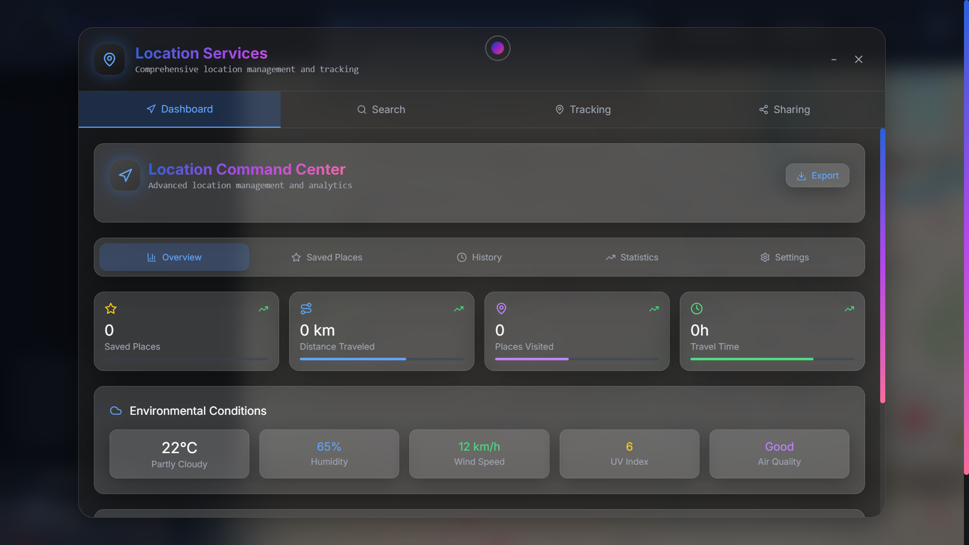
"Search locations easily with our enhanced feature! #DisasterGuardAI #LocationTracking"
-
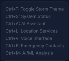
"Control Disaster Guard AI hands-free with voice! #DisasterGuardAI #VoiceTech"
-

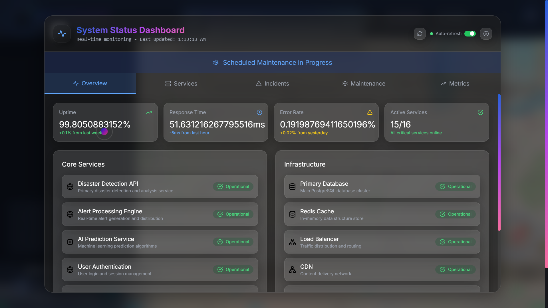
"View real-time satellite data for disaster alerts! #DisasterGuardAI #TechInnovation"
-

"Disaster Guard AI works seamlessly on mobile! #DisasterGuardAI #ResponsiveDesign"

Inspiration
The rising threat of natural disasters due to climate change, coupled with the need for advanced tools to predict and respond to these events, inspired me to create Disaster Guard AI. The increasing frequency of wildfires, floods, and earthquakes, as highlighted in recent reports (Natural Disasters and Climate Change), underscored the urgency for a solution that could save lives and protect ecosystems.
What It Does
Disaster Guard AI offers a comprehensive suite of features for disaster management:
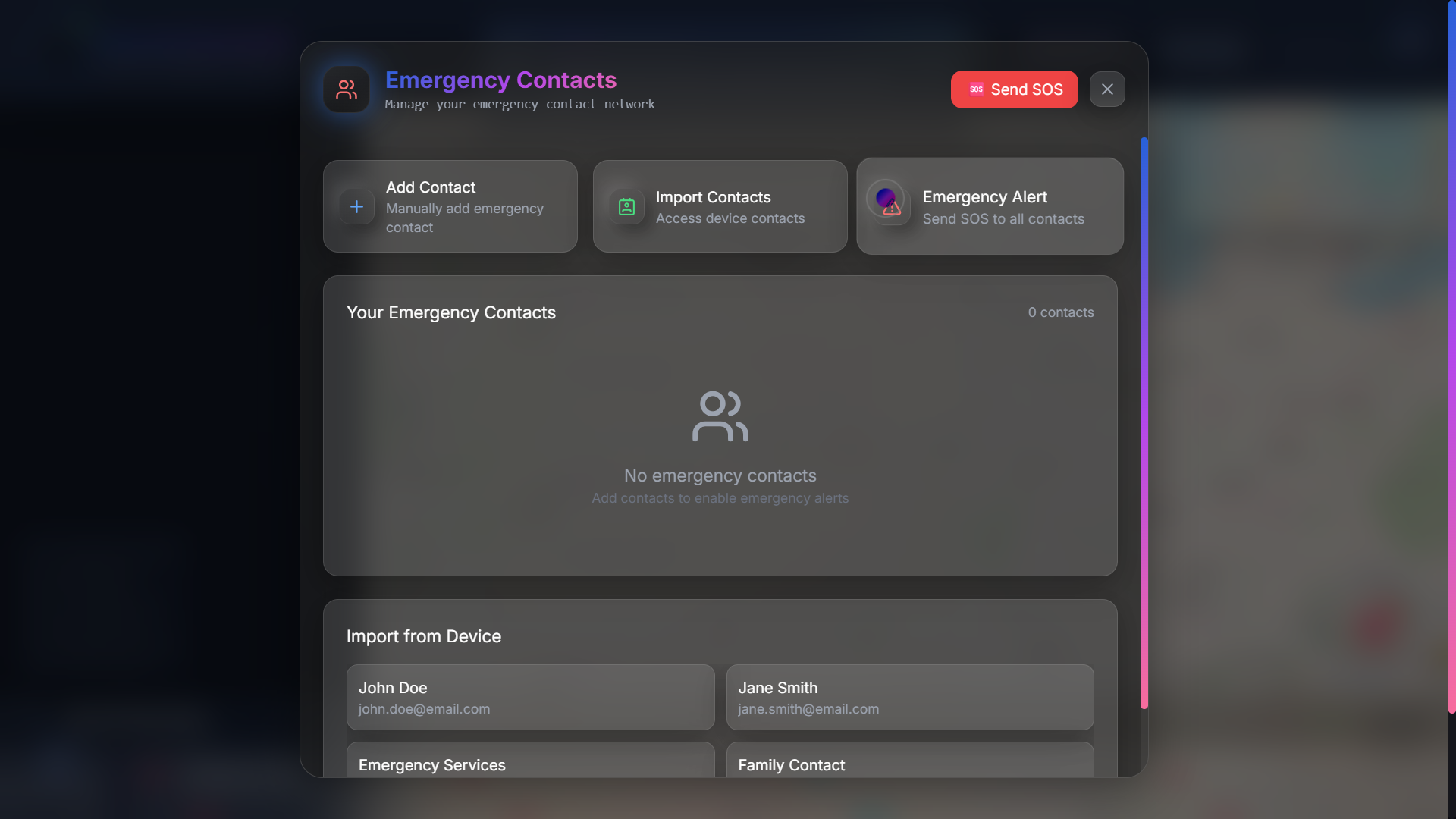
Multi-Hazard Detection: Monitors wildfires, earthquakes, floods, volcanic eruptions, landslides, and dam collapses. Live Satellite Integration: Processes real-time satellite data for anomaly detection. AI/ML Analysis: Uses enhanced neural networks for disaster prediction and risk assessment. Location Services: Tracks user locations, saves them with timestamps and accuracy, and displays on an interactive map with pulsing markers. Voice Interface: Supports voice commands and audio feedback for hands-free operation. Storm Theme: Features thunder graphics with animated clouds and lightning flashes, ensuring a visually engaging interface. AI Assistant: Integrated with OpenAI’s ChatGPT for real-time queries, emergency guidance, and predictive insights.
How We Built It
I used React with TypeScript for the frontend, ensuring type safety and maintainability. Vite was my build tool of choice for its speed and efficiency, allowing rapid development and iteration. For styling, I employed Tailwind CSS, which enabled me to create a responsive and visually appealing interface quickly. The map functionality was implemented using React-Leaflet, providing an interactive way to visualize disaster data.
To enhance the user experience, I integrated Three.js for 3D visualizations, such as storm effects with animated clouds and lightning flashes, making the app immersive and engaging. Framer Motion was used to add smooth transitions and animations, such as pulsing markers for user locations and sliding sidebars for alerts, ensuring no overlapping elements.
For the AI component, I integrated OpenAI's ChatGPT to create an intelligent assistant that can answer user queries about disasters, provide emergency guidance, and offer predictive insights. This was achieved by setting up a chat interface that communicates with the OpenAI API, using fetch for HTTP requests.
Location services were a critical part of the project. I used the Geolocation API to track user locations, saving them to localStorage along with timestamps, accuracy, and addresses obtained through reverse geocoding with the Nominatim API. These locations are displayed on the map with custom blue pulsing markers, showing the most recent 10 locations, and updating in real-time. The search functionality was fixed by integrating the Nominatim API for geocoding, adding debouncing for better performance, and storing recent searches in localStorage for quick access.
Challenges We Ran Into
One of the main challenges was ensuring that UI elements did not overlap, especially with the addition of storm theme graphics. I restructured the layout to have dedicated areas for the map, alerts, and data panels, using z-index and positioning to prevent overlaps, and implemented animations with Framer Motion to enhance usability.
Another challenge was fixing the location tracking and saving functionality. Initially, there were issues with persisting location data and displaying it correctly on the map. By carefully managing state with React hooks and using localStorage effectively, I was able to resolve these issues, ensuring reliable GPS tracking and real-time updates.
Integrating multiple APIs, such as satellite data, weather data, and geocoding, required careful handling of API keys and rate limits. I ensured that all API calls were properly managed and that the app remained performant, especially on mobile devices, by optimizing with lazy loading and debouncing.
Finally, removing the "quantum metrics" terminology was straightforward but necessary to present the project in a professional and accurate manner. I updated all labels and descriptions, such as changing "Quantum-Enhanced Emergency Response System" to "Advanced Emergency Response System" and "QUANTUM-SYNC" to "OPERATIONAL," ensuring consistency across the app.
Accomplishments That We're Proud Of
Successfully integrated real-time location tracking with automatic saving and display, enhancing user safety during disasters. Fixed the search functionality, making it robust with debouncing and recent searches, improving usability. Created a visually stunning storm-themed interface with thunder graphics, ensuring no overlapping elements for clarity. Developed an AI assistant using OpenAI’s ChatGPT, providing real-time support and emergency guidance, aligning with the Conversational AI Video Challenge. Built a scalable, responsive app using modern web technologies, demonstrating potential for the Startup Challenge.
What We Learned
Throughout this project, I gained valuable skills in web development, AI integration, and UI/UX design. I learned how to process real-time data from satellite imagery and weather APIs, implement geospatial analysis with React-Leaflet, and ensure accessibility for emergency systems. The integration of voice interfaces using the Web Speech API was a new challenge, teaching me about hands-free operation in critical scenarios. I also learned the importance of managing API rate limits and optimizing performance for mobile devices, ensuring the app remains functional in low-connectivity areas.
What's Next for Disaster Guard AI - Advanced Emergency Response System
The future roadmap includes:
Mobile App Development: Expanding to iOS and Android for broader accessibility. IoT Sensor Integration: Adding real-time sensor data for more accurate predictions. Offline Mode Support: Enabling functionality in areas with poor connectivity. Multi-Language Interface: Supporting global users with localized content. AR/VR Integration: Enhancing visualization with augmented and virtual reality for training and response. Enterprise Features: Adding features for government and organizational use, such as advanced analytics and API marketplaces. This project is poised for growth, aiming to become a global standard for disaster management, saving lives and protecting ecosystems.
Built With
- 3d-visualizations
- ai-assistant-with-chatgpt-apis
- and
- component-based-ui-framework-language
- deployment
- fast-development-and-building-styling
- framer-motion
- geocoding"-apis
- geocoding-apis-satellite-data-apis
- geolocation-api
- hosting
- interactive-mapping-3d-graphics
- location-tracking
- lucide-react
- modern-icon-library-ai/ml
- netlify
- nominatim"
- nominatim-location-tracking
- openai-api
- predictions"-voice
- pulsing-markers"-icons
- pulsing-markers-icons-lucide-react-modern-icon-library-ai/ml-openai-api-ai-assistant-with-chatgpt-apis-geolocation-api
- purpose-frontend
- react-18.3.1
- react-leaflet
- real-time-disaster-data
- satellite-data-apis
- smooth-animations
- storm-effects"-animations
- storm-effects-animations-framer-motion-smooth-animations
- tailwind-css
- three.js
- type-safe-development-build-tool
- typescript-5.5.3
- utility-first-css-framework-maps
- vite-6.0.7
- voice-commands-and-audio-feedback-cloud
- weather-apis"
- weather-apis-real-time-disaster-data
- web-speech-api


Log in or sign up for Devpost to join the conversation.