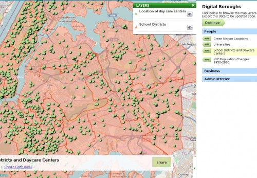
This application represents various data from the NYC Data Mine in an online atlas.
It draws on NASA, Yahoo, Microsoft, Google and OpenStreetMaps tiles as base maps.
The data is exportable to various formats including: Google Earth KML, CSV, ESRI Shapefile, JSON, and Spatialite.
The atlas can be edited by an administrator to exhibit community contributed data, official government data, data collected via various external API's, and RSS Feeds.
The application allows the adminstrator to run analysis, including correlation, on aspects of the data, which can then be placed in the atlas.

Log in or sign up for Devpost to join the conversation.