-
-
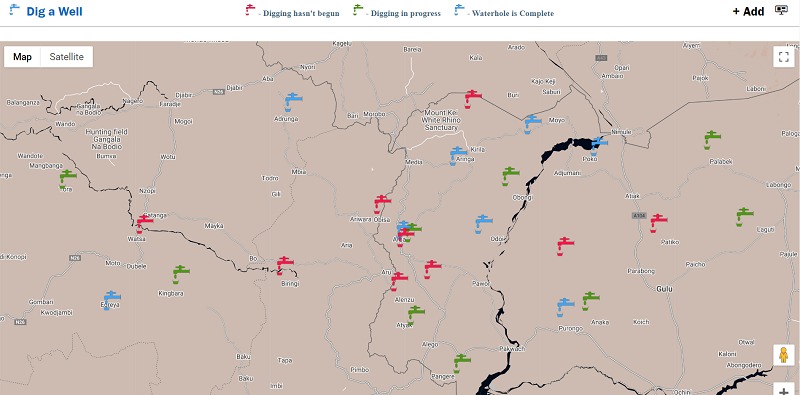
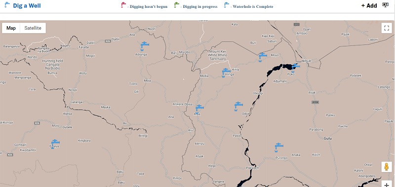
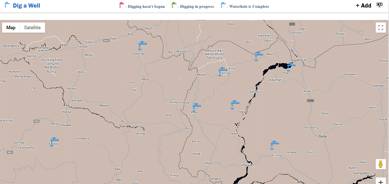
Dig A Well Front Page
-
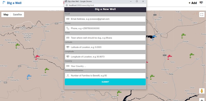
Add a New Well
-
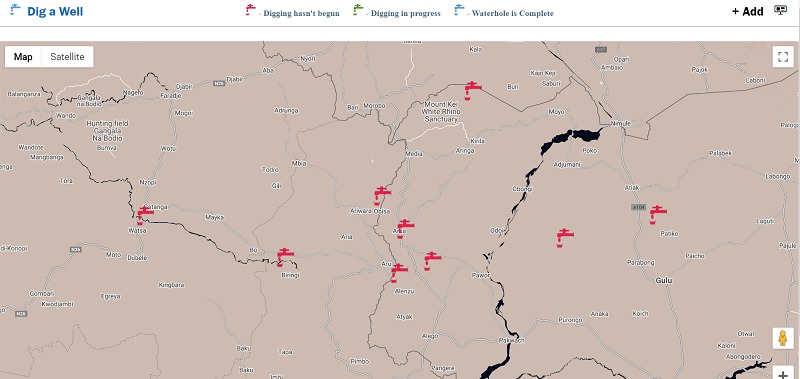
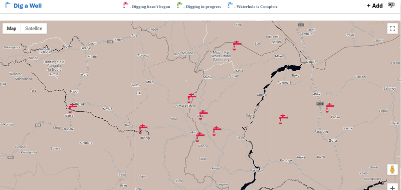
Map showing locations where wells are not yet dug.
-
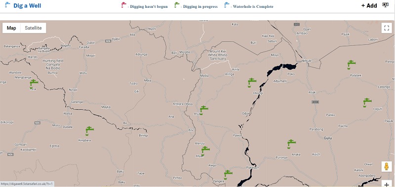
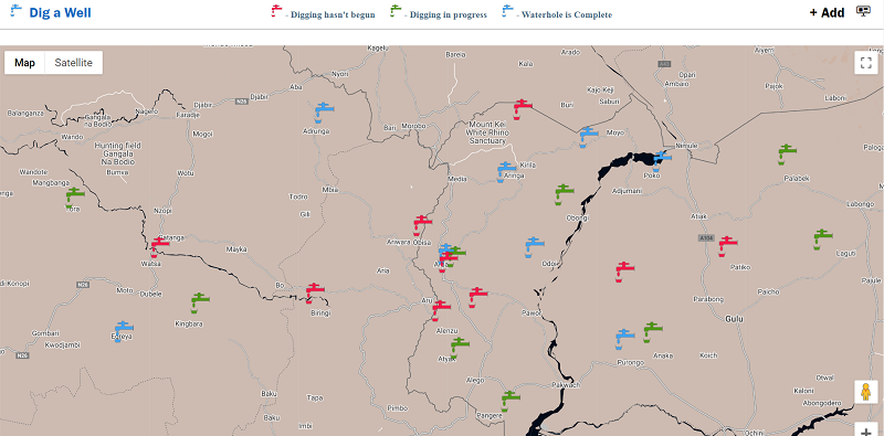
Map showing locations where well digging is in progress.
-
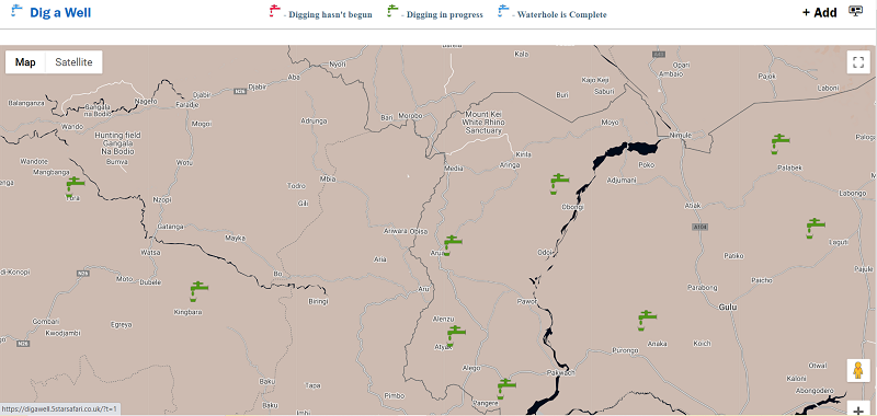
Map showing locations where well digging is complete.

Dig A Well
Dig a well is a platform built to improve access to clean water in remote communities by highlighting places on Google Maps where new waterholes should be dug.
Inspiration
Globally 2.3 billion people lack access to safe, readily available water and 1.5 million livestock are lost per year to acute drought (in Kenya alone). Dig a well is built to highlight deficiencies in water access.
What it does
Person's living in affected communities submit a gps location of where a well needs to be dug, we verify the location. The verified location is then added to the platform's json database and plotted on google maps, where person's interested can help dig the well.
How we built it
The platform is built with Node.JS, Google Maps, JavaScript and HTML5.
LIVE DEMO: https://digawell.5starsafari.co.uk/
GITHUB REPOSITORY: https://github.com/VakinduPhilliam/digawell
LICENSE (BSD-3-CLAUSE): https://github.com/VakinduPhilliam/digawell/blob/main/LICENSE
Map Guide:
- Red Marker - Waterhole NOT yet dug.
- Green Marker - Waterhole digging is in progress.
- Blue Marker - Waterhole is Complete.
Beneficiaries (Families): Also listed along with each marker title are the number of potential family beneficiaries after the waterholes' completion.
Add new Waterhole: Users can also submit new waterhole locations to the map by clicking + Add
Challenges we ran into
Getting basic information about drought-stricken areas is quite a challenge, given the low rate of smartphone penetration.


Log in or sign up for Devpost to join the conversation.