-
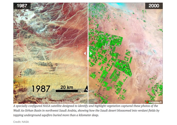
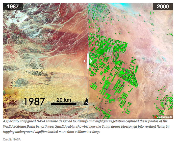
https://www.revealnews.org/article/what-california-can-learn-from-saudi-arabias-water-mystery/
-
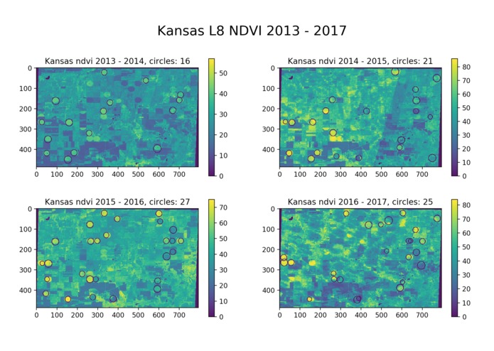
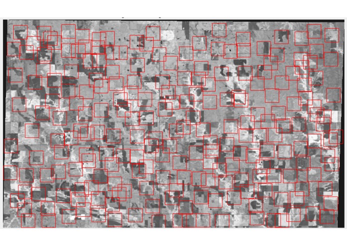
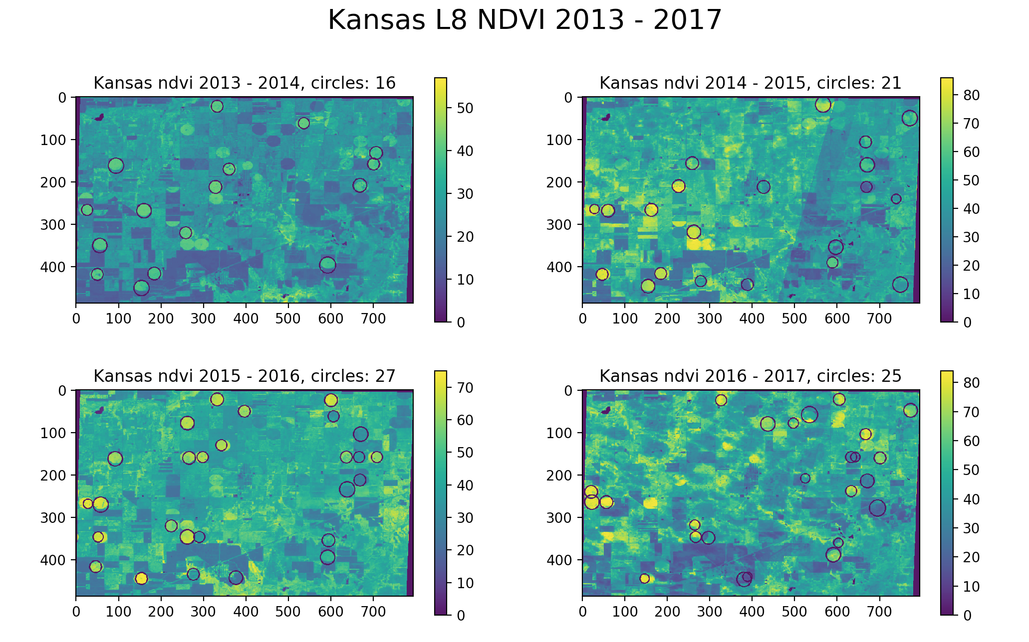
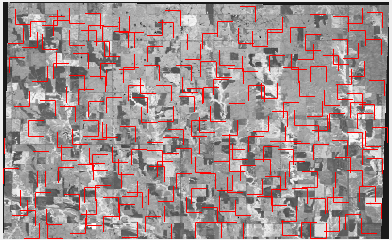
Baseline results applied to an area in Kansas over a 4 year period. Notice increase in irrigation, demonstrating need for monitoring.
-
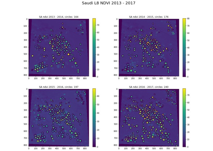
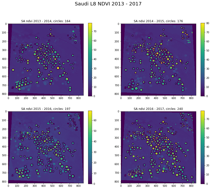
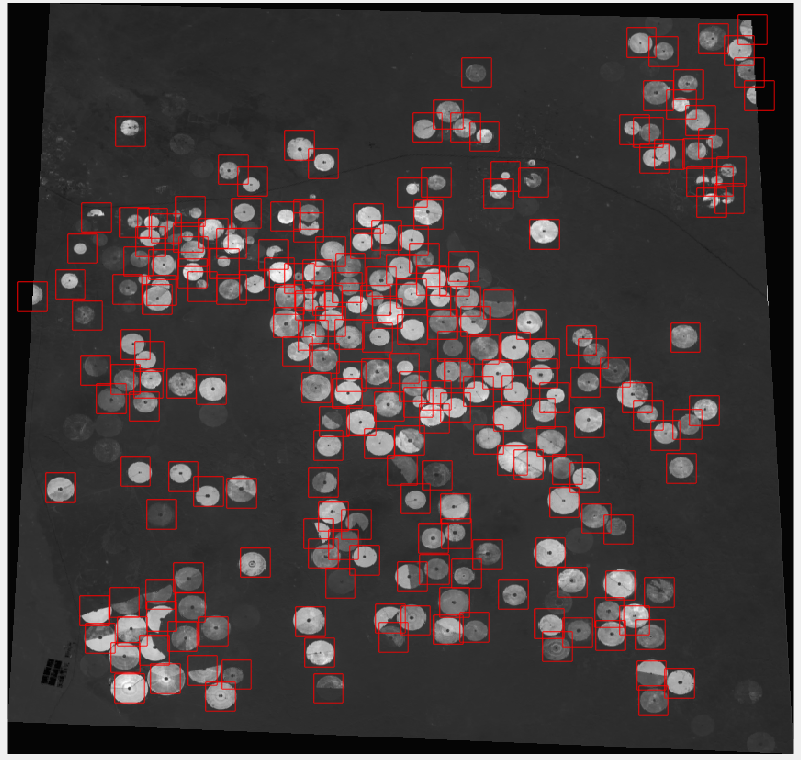
Baseline results applied to an area in Saudi Arabia over a 4 year period. Notice increase in irrigation, demonstrating need for monitoring.
-
Constructing our dataset: A small subset of hand labeled examples of central-pivot irrigation fields
-
Constructing our dataset: A small subset of hand labeled examples of NON central-pivot irrigation fields
The Team:
Aakash Ahamed, Noah Dewar, Ashwini Ramamoorthy, Rose Rustowicz
Problem Definition
Groundwater is a precious non-renewable resource that is gradually being depleted from beneath the earth’s surface. The water source for central pivot irrigation systems in arid regions is ground water, pumped from wells drilled into the earth. We aim to estimate usage of groundwater in irrigation systems by detecting central pivot irrigation fields and performing analysis on vegetation health (which we assume corresponds to water usage). link
Creativity / Innovation
The current method of measuring groundwater fluctuations is with expensive satellite technology such as GRACE or InSAR. Results from GRACE have extremely low spatial and temporal resolution, and InSAR is accurate but extremely expensive and not globally available. We propose a new way to monitor the usage of groundwater in arid climates by detecting central pivot irrigation systems. We hypothesize that a time lapse of the irrigation systems locations can be an indication of where groundwater is available, and where it has been depleted. Although it is known that central-pivot irrigation systems use groundwater, there does not seem to be much work in using them for monitoring of the resource or in exploring the correlations between the fields and the usage of groundwater being pumped.
Technical Complexity
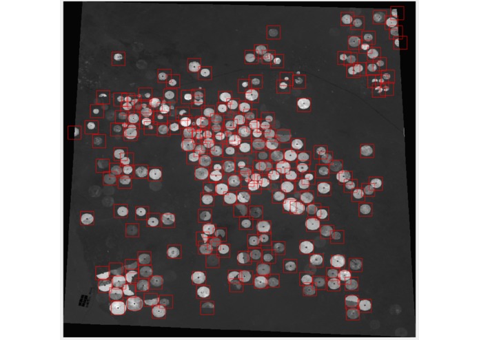
We explore two classification techniques. First, we use NDVI and apply the Hough transform to detect circles within the image. We specify a radius range and tune sensitivity. Second, we explore a convolutional neural network for image classification applied to an NVDI band, calculated from Landsat satellite imagery, data which is freely available. We create our own dataset of central pivot vs. not central pivot image chips to train, validate, and test the network. To see more regarding the data that we explored, see our github page: link
Data Visualization
We observe NDVI in an arid region of Saudi Arabia over a four year period in month of July (2013 - 2017). We observe an increase in irrigation systems each year (specified by ‘circles’ in the title of each subplot), which can indicate increased groundwater usage. The consistent use of central pivot irrigation systems in this area tells us that groundwater exists in the region. Increased usage of groundwater should be regulated in order to preserve the non-renewable resource. We see a similar trend in Kansas (see image gallery).
See more specific/close-up results on our github page: link
Impact
Groundwater is a precious non renewable resource that needs to be preserved and monitored. It is crucial to have a fast, inexpensive alternative to monitor and regulate it’s usage. If there is a correlation between central pivot irrigation location and plant health with groundwater levels, our solution can provide a fast, effective, and less expensive alternative to conventional ground level monitoring systems.
Does it work?
Our baseline method is successful, and is able to detect the location and area of most central pivot irrigation fields within a large image (see image gallery). In our study area of Saudi Arabia, we see an increase in number of irrigation systems over a span of four years. The more complicated deep learning approach is in the works.
Looking to the Future
To correlate our observations with groundwater data, we plan to explore GRACE, evapotranspiration, and/or InSAR datasets. We hope to find a correlation between patterns of irrigation fields with groundwater levels and fluctuation. It may be interesting to view the migration of the irrigation fields throughout time, to see where they migrate and if this can also give insight into active groundwater and/or areas that have been depleted due to overuse. We aim to scale up the algorithm to ingest global imagery for global monitoring of groundwater usage and to further investigate correlations of groundwater levels with central pivot locations, areas, and plant health to validate the motivation for this particular approach.

Log in or sign up for Devpost to join the conversation.