-
deQlassified's UI
Inspiration
As a queer person living in the United States, especially someone new to being queer, navigating the world around you can be difficult when taking your safety into account. The world can be confusing and cruel, and it can be hard to find places where you feel safe. We aim to make this process easier by presenting easily digestible information about queer safety in the USA, doing the heavy lifting so that others can see what they need at a glance.
What it does
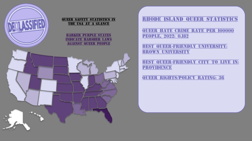
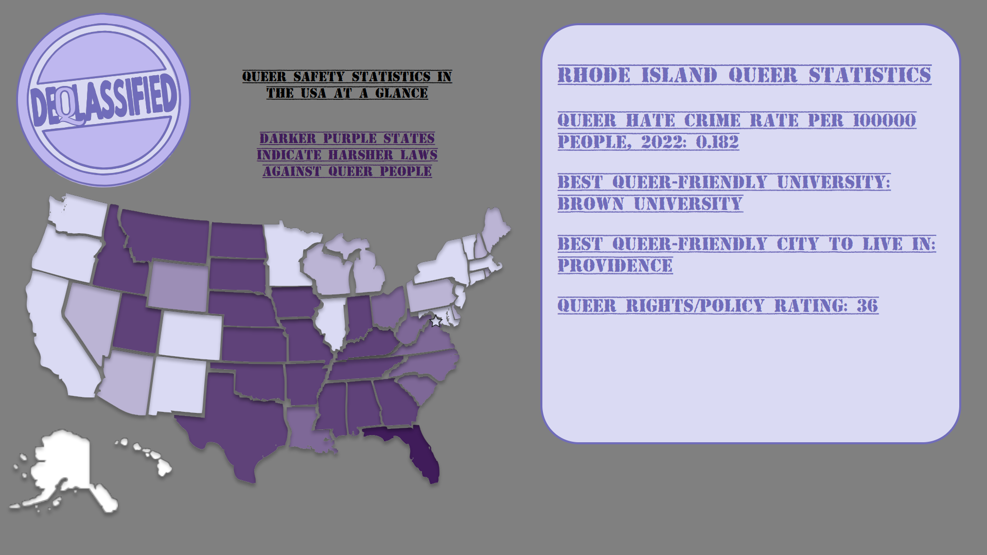
The main interface is an interactive map of the US, wherein users can click on a state to see information about how queer-friendly that state is, including information about the safest cities and universities, how favorable the law towards queer people is, and what the rate of hate crimes against LGBTQ+ people in that state is.
How we built it
deQlassified is built around the interactable map of the USA- this was made by importing images into the software Figma and arranging them in the correct layout, which took a long time, and then exporting the Figma project into an HTML file with the map being represented by a large SVG file, with groups for each state. The data displayed to the user is obtained from sources such as the FBI, for the hate crime statistics specifically, and this data is stored in CSV files which were programmatically analyzed and converted into JSON files that can be read by the code and displayed to the user when they click on a state.
Challenges we ran into
We used Pug as a template engine initially, but it didn't play well with the SVG's used for the interactive map, causing us to have to drop it, and a lot of the backend along with it. Another challenging thing was getting the Figma project to export to HTML code properly, and many of these issues came from the SVG's once again- in the end, some SVG files had to be manually edited to appear correctly.
Accomplishments that we're proud of
Getting the map to look nice, with the borders not being a mess, was quite a challenge, and it was very satisfying to see it come together.
What we learned
We learned a lot of the limitations associated with using SVG's and also some clever workarounds to those limitations. We also learned a lot about data analysis using python, and how to interface with CSV files.
What's next for deQlassified
There are a lot of avenues to expand upon from here- a smaller scale version of deQlassified could be used for cities and towns to identify safe restaurants, bars, salons, and lots more. There's also the route of more data displayed, because there is always more to analyze. Crowd-sourced data is also a possibility, since the best data comes from smaller-scale observers. A large survey or a census will not capture the individual experience better than an individual with experience.

Log in or sign up for Devpost to join the conversation.