-
-
-
-
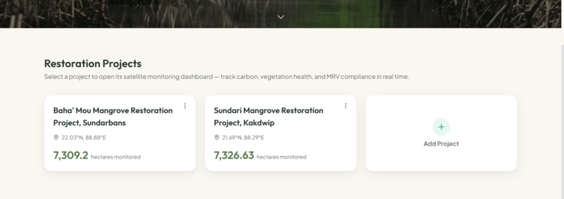
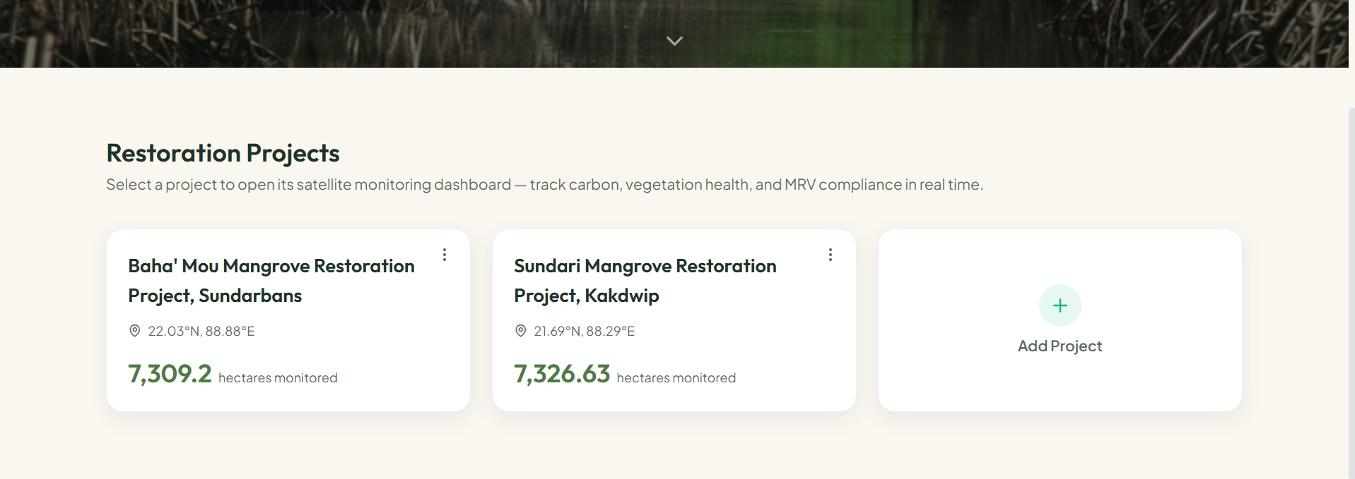
Projects Listed
-
-
-
-
-
-
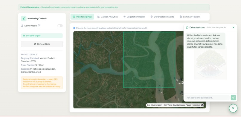
Monitoring Map and Chatbot
-
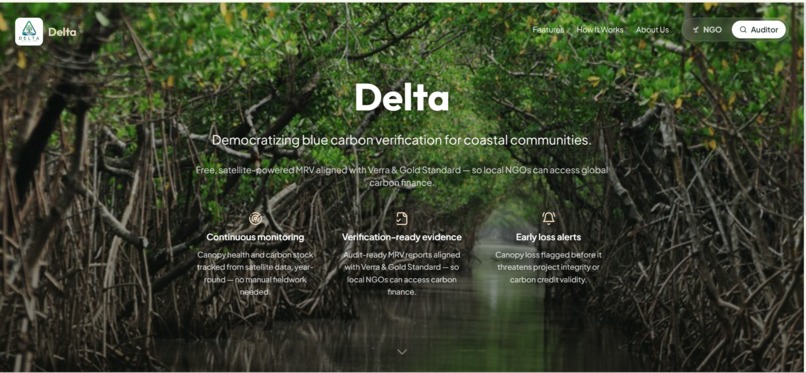
Landing Page
Inspiration
Growing up in West Bengal, the Sundarbans has always been more than a forest to us — it's home to millions of people, an irreplaceable ecosystem, and one of the world's most powerful natural carbon sinks. But we kept seeing the same story repeat itself: local NGOs and community forest teams would plant thousands of trees, restore hectares of mangrove, and then watch their efforts go unrecognized by global carbon markets — not because the work wasn't real, but because they couldn't afford to prove it.
Traditional MRV (Measurement, Reporting, and Verification) audits under Verra or Gold Standard can cost tens of thousands of dollars and take months. For a small coastal NGO in the Sundarbans, that's simply not an option. The result? Restoration happens, carbon gets sequestered, communities do the hard work — and the funding never comes.
We built Delta to close that gap. Not just for the Sundarbans, but for every blue carbon ecosystem on earth.
What it does
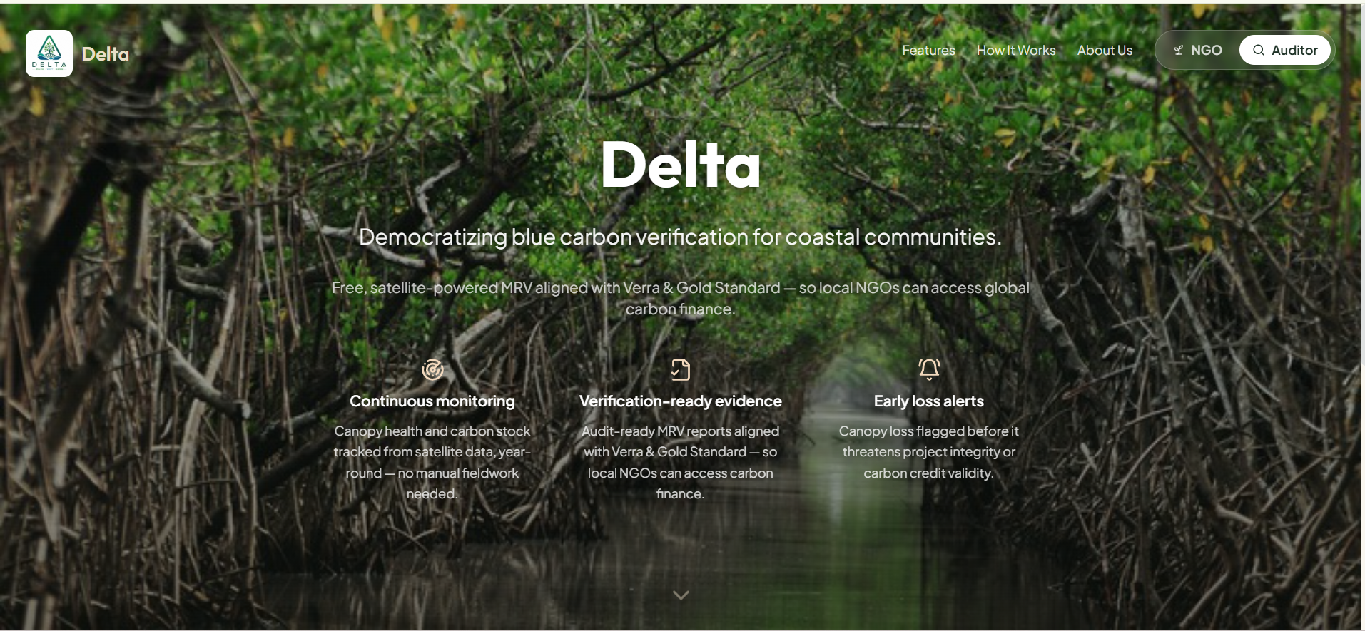
Delta is a free, satellite-powered MRV platform that gives mangrove restoration projects the same verification tools previously available only to large-budget organizations.
For NGOs and project managers:
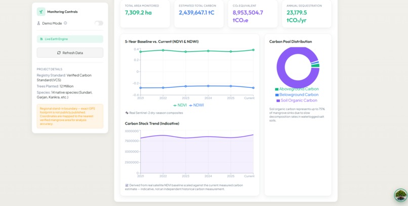
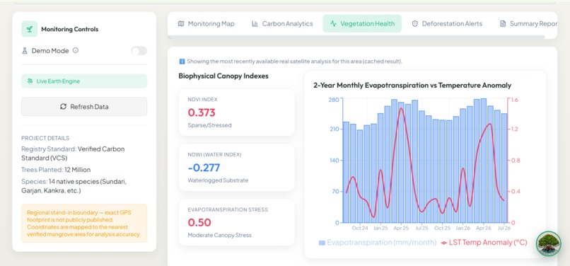
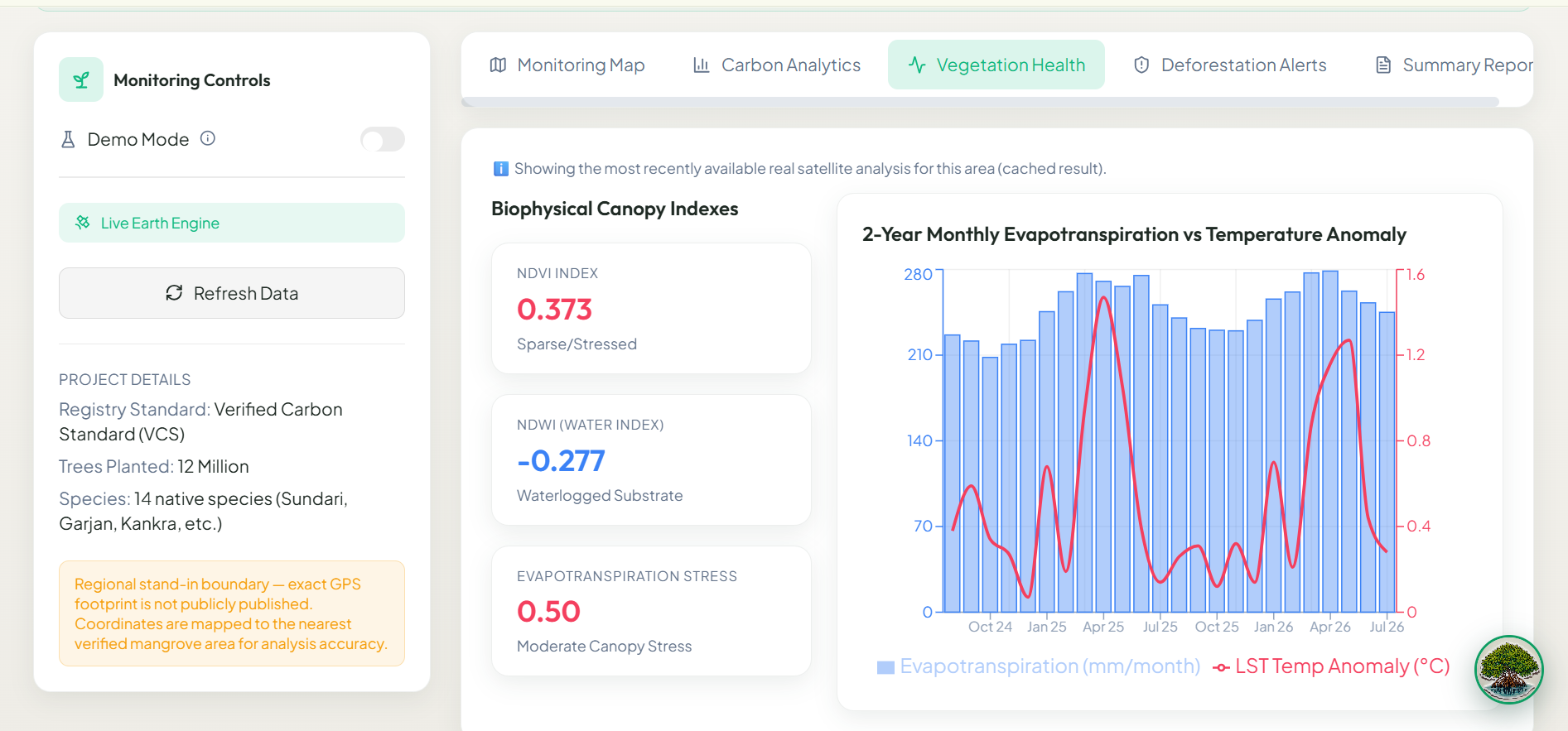
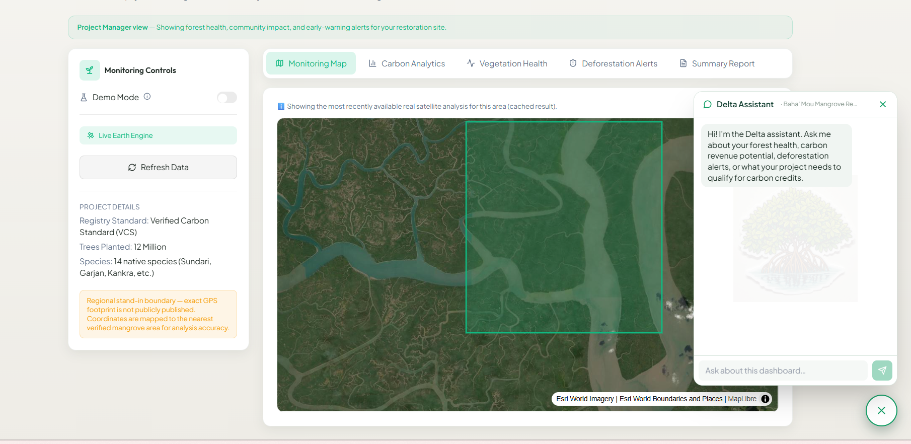
- Real-time vegetation health monitoring using ESA Sentinel-2 satellite data
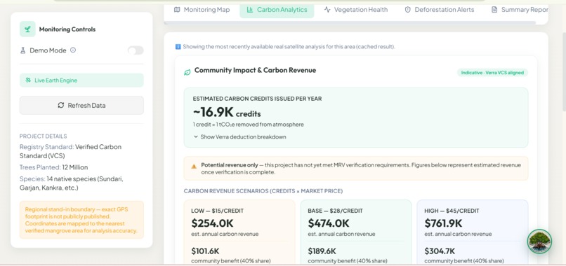
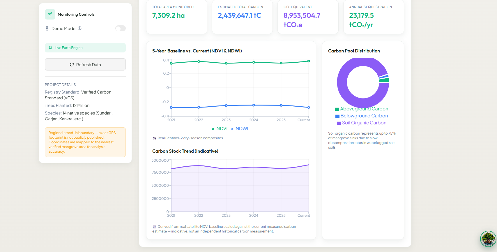
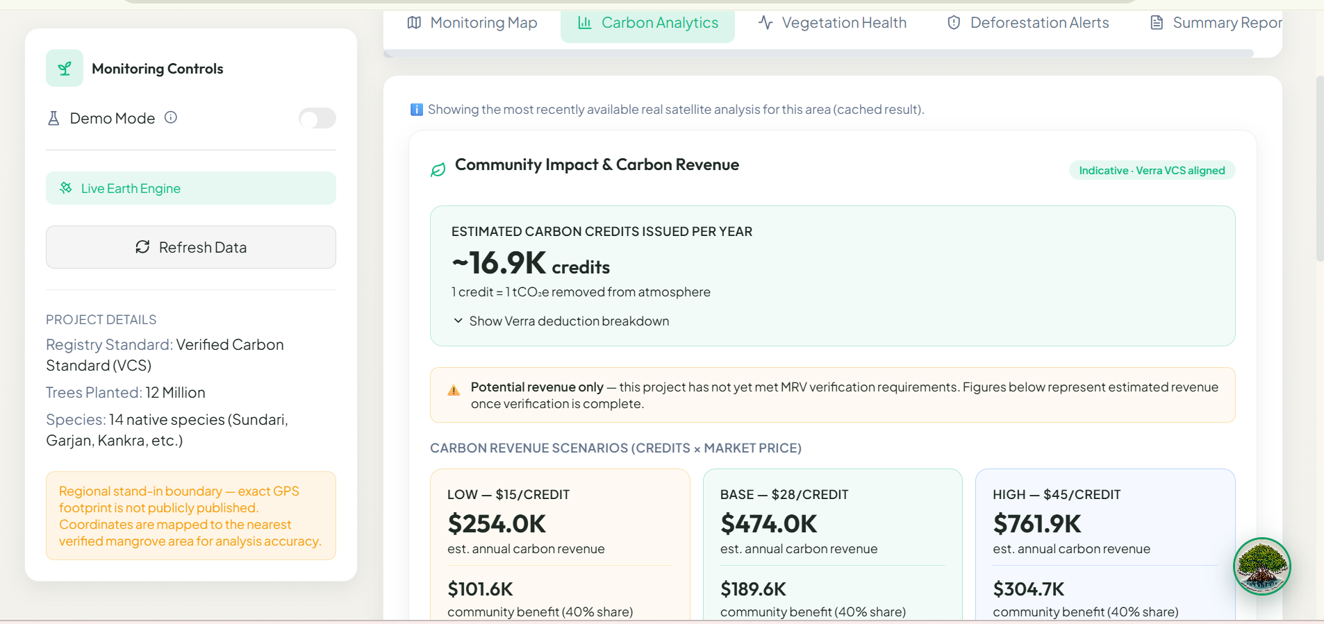
- Carbon credit revenue estimates using Verra VCS-aligned calculations — including buffer pool and leakage deductions — translated into plain-language community impact figures
- Early deforestation alerts that flag canopy loss before it threatens carbon credit eligibility
- A role-aware dashboard that speaks in plain English, not satellite science
For carbon auditors:
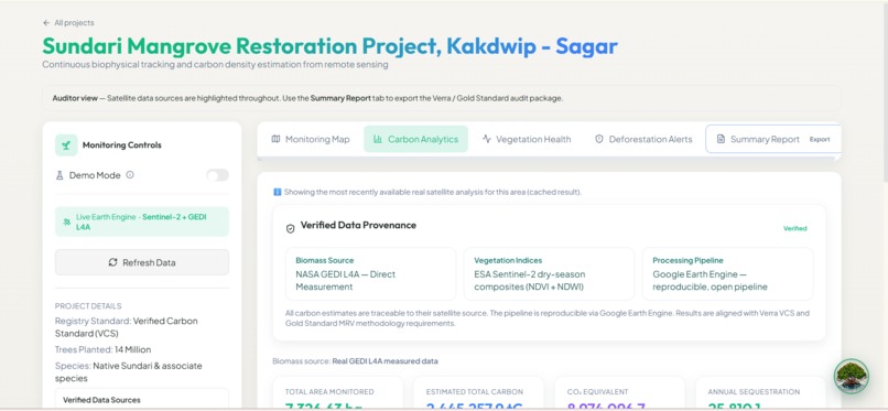
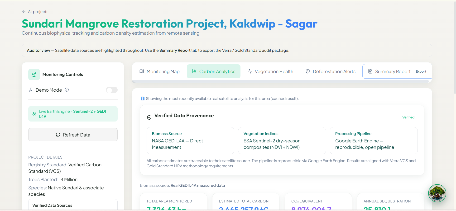
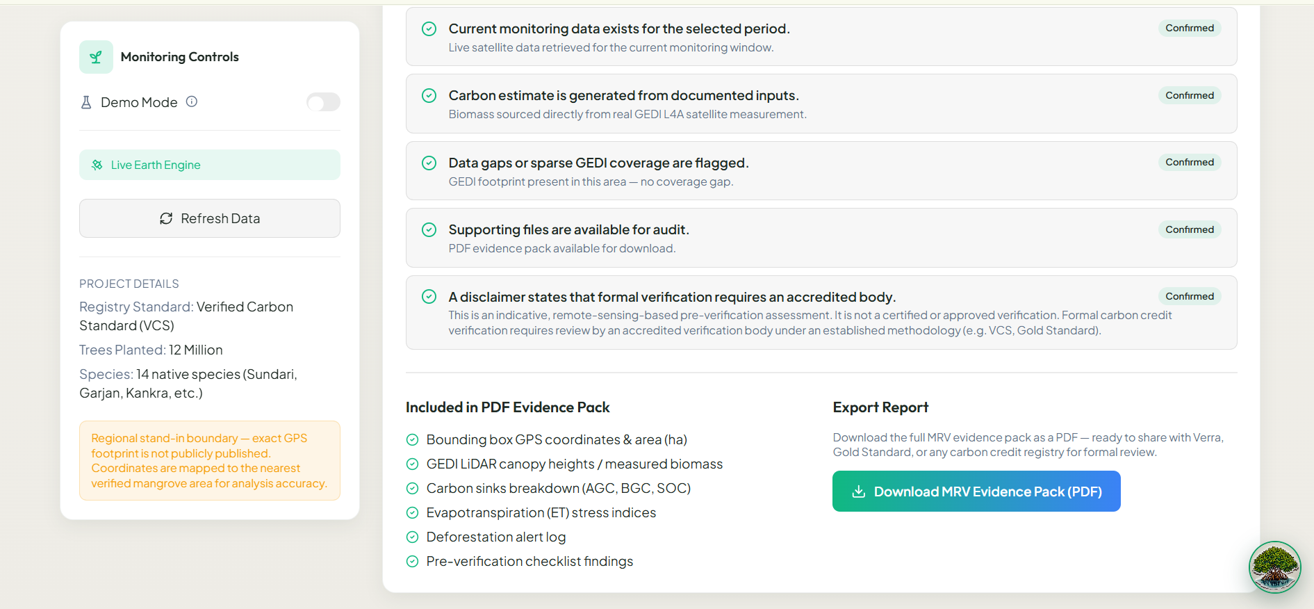
- Verified data provenance panel showing exactly which satellite sources back every number (NASA GEDI L4A, ESA Sentinel-2, Google Earth Engine)
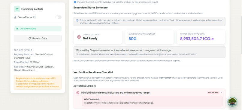
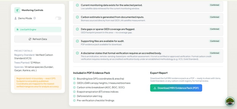
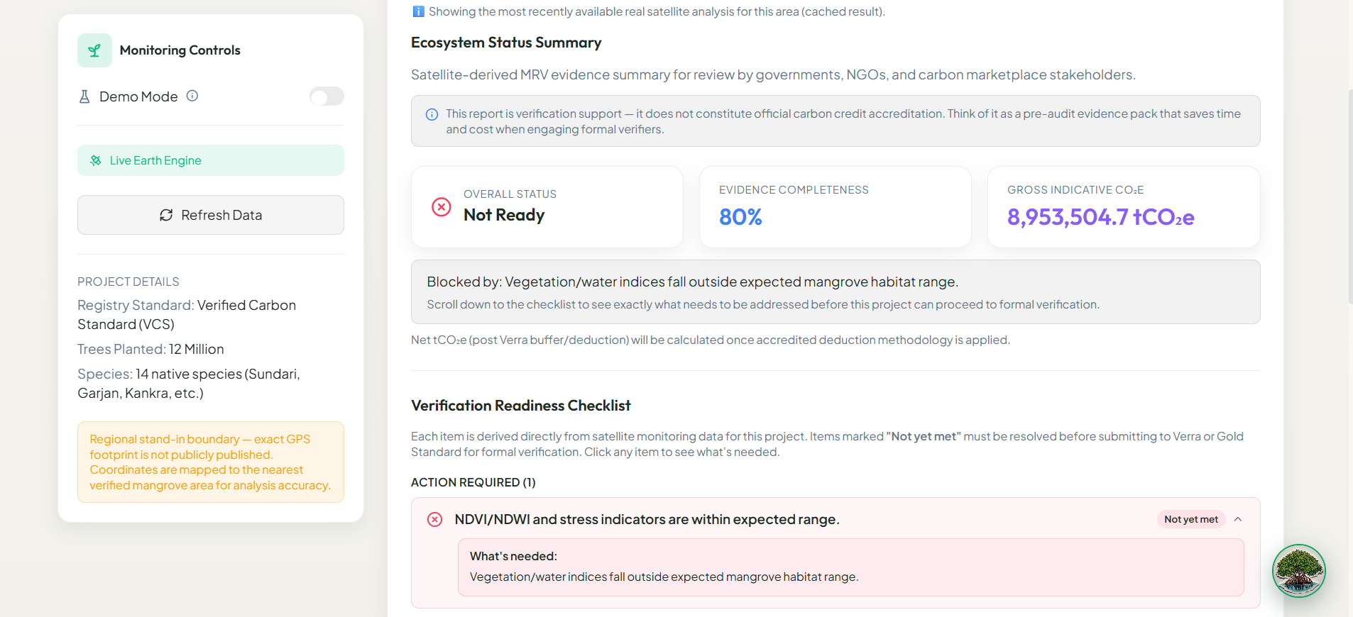
- A grouped verification readiness checklist aligned with Verra and Gold Standard methodology — items organized by status with plain-language explanations of what's needed
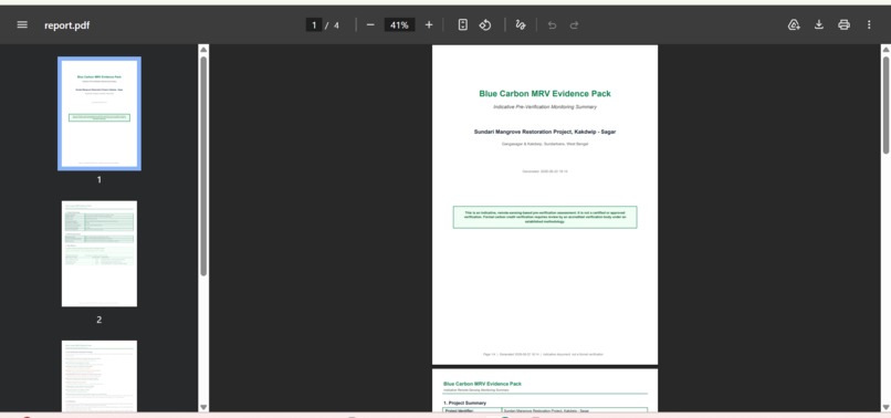
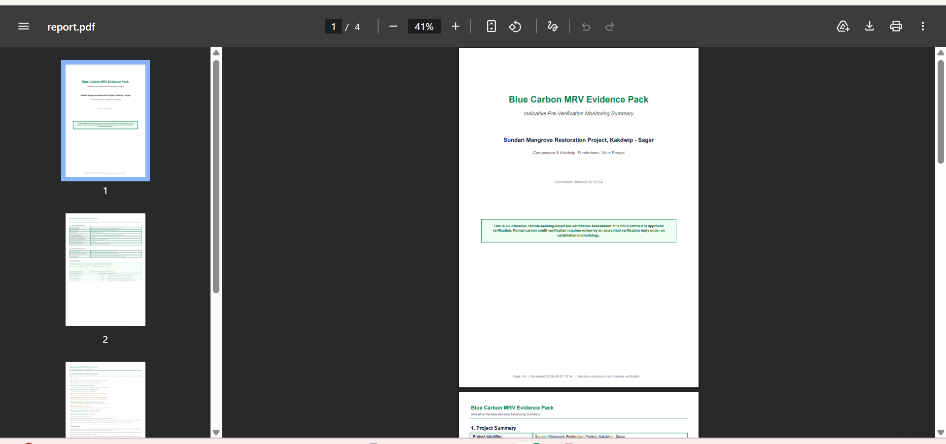
- One-click PDF export of the full MRV evidence pack, ready for registry submission
Delta Assistant — an AI chatbot grounded in the project's real satellite metrics — answers questions about carbon analytics, MRV compliance, and forest health in plain language, making carbon science accessible to anyone.
How we built it
Backend: Python + FastAPI, connected to Google Earth Engine for real satellite data processing. We pull Sentinel-2 imagery for NDVI and NDWI vegetation indices, NASA GEDI L4A for aboveground biomass measurements, SRTM for elevation, and MODIS for evapotranspiration stress indices. A custom ML model trained on real GEDI L4A + Sentinel-2 data from the Sundarbans estimates carbon stock where direct GEDI footprints aren't available.
MRV Engine: We studied the Verra VCS and Gold Standard methodology documents to build a verification readiness checklist that evaluates each project against real registry requirements — not invented criteria.
Carbon calculations apply standard Verra deductions:
$$\text{Credits Issued} = \text{Annual Sequestration} \times (1 - 0.17_{\text{buffer}}) \times (1 - 0.12_{\text{leakage}})$$
$$\text{Carbon Revenue} = \text{Credits Issued} \times \text{Price per tCO}_2\text{e}$$
Frontend: React + Vite + Tailwind CSS. A global role context (NGO / Auditor) shapes the entire dashboard experience — from default tabs to what information is surfaced first.
Deployment: Backend on Render with Google Earth Engine service account authentication. Frontend on Vercel.
Challenges we ran into
Understanding Verra standards was the hardest research challenge. Carbon accounting isn't straightforward — buffer pool deductions, leakage factors, additionality requirements, permanence periods. We had to dig deep into actual Verra VCS methodology documents to make sure our checklist and revenue calculations were defensible, not just plausible-looking numbers.
Google Earth Engine integration was technically the most demanding part. Getting real satellite composites, handling cloud cover, ensuring the GEDI L4A biomass data was quality-filtered, and building a fallback pipeline for areas without GEDI coverage — all while keeping response times acceptable — required significant iteration. Deforestation detection uses real Sentinel-2 NDVI change analysis comparing two 90-day satellite windows — when sufficient cloud-free imagery isn't available for both windows, the system gracefully falls back to indicative simulation, demonstrating real-world satellite data limitations that any production MRV system must handle.
Deployment threw unexpected challenges — Docker networking, GEE service account authentication in a containerized environment, and cross-origin issues between the frontend and backend all had to be solved before the platform could work end-to-end in production.
Accomplishments that we're proud of
- Real NASA GEDI L4A and ESA Sentinel-2 satellite data powering every carbon estimate — not synthetic numbers
- A Verra VCS-aligned carbon credit calculation with transparent, expandable deduction breakdown
- A dual-role experience (NGO / Auditor) that makes the same underlying data meaningful to completely different users
- Community impact figures that translate abstract satellite data into real economic value for coastal communities — estimated carbon revenue, community benefit share, and coastal defense hectares
- A verification readiness checklist that doesn't just list items but tells users exactly what action to take when something isn't met
- Scaling beyond the Sundarbans — any blue carbon project worldwide can be registered and monitored
What we learned
We came into this knowing how to build software. We came out understanding a completely different world — blue carbon science, MRV methodology, how carbon markets actually work, what Verra's buffer pool is and why it exists, and how satellite remote sensing translates into financial instruments that fund conservation.
Google Earth Engine alone was an entirely new paradigm — writing geospatial analysis pipelines that run on Google's infrastructure against petabytes of satellite imagery is genuinely unlike any other kind of programming. Getting it to produce numbers we could defend scientifically was humbling and rewarding in equal measure.
What's next for Delta
Delta was built on the Sundarbans — but the architecture is ecosystem-agnostic. Our immediate roadmap:
- Global blue carbon coverage — seagrass meadows, salt marshes, tidal flats
- Automated Verra submission package — generating the exact document formats registries accept, reducing the submission process from months to days
- Community dashboard — a simplified view for field teams with no technical background, showing health status and alerts in local languages
- Real-time alert notifications — SMS/email alerts to project managers when deforestation is detected
- Historical project tracking — longitudinal carbon stock verification across multiple audit cycles
The goal is simple: every mangrove restoration project on earth should be able to access carbon finance. Delta is how we get there.
Built With
- docker
- fastapi
- google-earth-engine
- python
- react
- scikit-learn
- tailwindcss
- vite

Log in or sign up for Devpost to join the conversation.