Inspiration
What it does
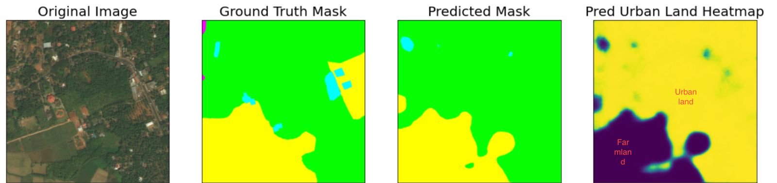
Our clients will provide co-ordinates of farmlands/plantations providing them raw materials and factories producing their final products. We then look at the present satellite images of these locations and compare them with the images on the cutoff date for deforestation, to infer if the land is currently carved out of forests. We then zoom out at these locations and check the proximity to forests, to evaluate future possibility of deforestation through expansion of the farmland or factory
How we built it
We collected and augmented data and implemented and trained our neural network classifier in kaggle notebooks. We coded the satellite image retriever in Python
Challenges we ran into
Google Earth Engine API was paid, so we had to pivot to Azure Maps
Accomplishments that we're proud of
We learnt a lot about EU regulations for companies with respect to forest cover loss and are glad were able to extract a business idea out of it
What we learned
We learnt about all the open source and proprietary datasets available for training and concluded that enough data will not be easily accessible. SOTA architectures need to be developed too.
What's next for DeFo Hunter
We increase performance of our forest cover segmentation model by adding attention mechanism. And we create a dashboard with low latency for immediate visualization of satellite images.

Log in or sign up for Devpost to join the conversation.