-
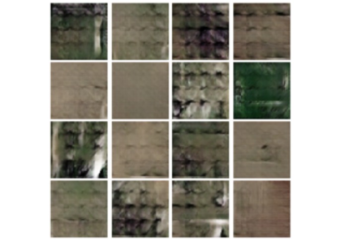
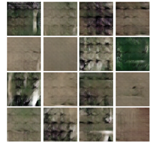
GAN generated farm output (early training)
-
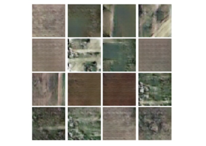
GAN generated farm output (mid training)
-
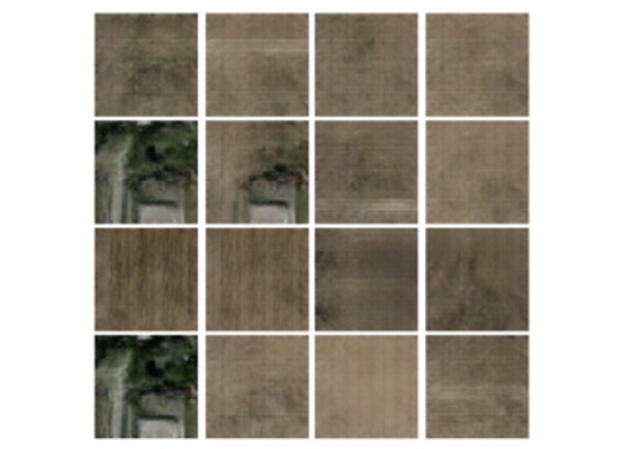
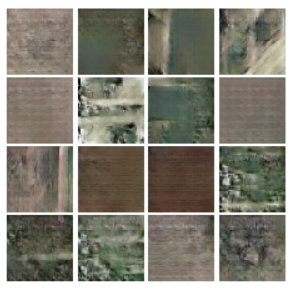
GAN generated farm output (mid-late training)
-
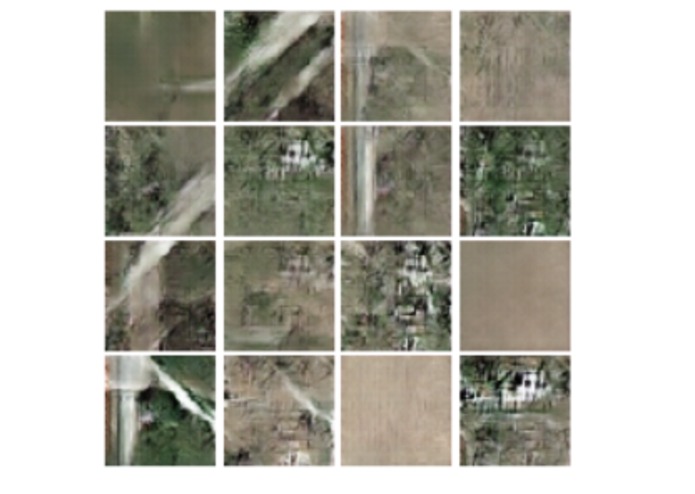
GAN generated farm output (mid training)
-
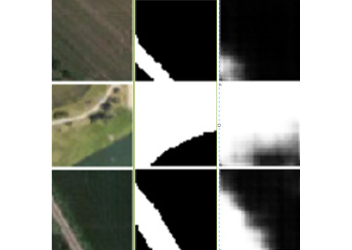
Left - Raw Image | Middle - Ground Truth Bit-Mask | Right - Generated Bit-Mask


CHALLENGE #2
Inspiration
Professor Sanjay Patel developed the startup Personify for hosting conference calls in a more interactive way. He eventually ran into the problem of not having enough data for faces. Recently, he went to CES and talked to another startup that he said had an amazing detection network (for faces). Although he thought they must have used millions of real images, they actually only used a fraction, using a GAN network to generate completely unique faces that they also used for training.
What it does
It generates unique, realistic looking farmland through the use of neural networks. These (deep) fake farmlands replicate the geographic properties that can be found throughout the world. With a large or specific enough farmland dataset, these fake farmlands can be used as supplementary data to help in real-world problems. In this project, I have also tackled trying to procedurally make boundaries to signify tillable land. By using both fake and real images, it can learn better and faster what makes tillable land, helping farmers be more efficient about crop yield.
How we built it
I used the Pytorch framework to build my deep learning models. The first part was a traditional generator/discriminator model trained on miniature "tiles" of real farm and landscape images. I decided to train on small 64x64 sub-images ("tiles") to not only speed up training, but to make a much larger dataset. I also used transfer learning to accelerate early training, saving hours of training time. I then also trained a masking network to make bit-masks of tillable land given the tiles. I only needed to use 5 snipped images of google maps training data for this part, which I then used the previously mentioned technique to create smaller tiles on which the masking network would run on.
Challenges we ran into
Since this idea was attempted halfway through the hackathon, there was a very limited amount of time. On top of that, training time required hours of training even with Tesla K80 GPUs.
Accomplishments that we're proud of
Outputs from the GAN were able to bit mask very similar to the ground truth. The bit mask is used to overlay on top of the map the tillable area, which is the goal of the challenge.
This model was able to create images of farmland that was fairly discernible from real images. This was the goal of this project to help increase the dataset size.
What's next for Deep Fake Farms
The theoretically infinite dataset that could be created from this GAN can be aimed to generate and find rare artifacts that may be in real-world data. Then, the bit masking process could be constantly updated to increase its accuracy and reliability of outputs. A large dataset for the bit masking network would be most beneficial for geofencing tillable land.
Built With
- google-colab
- google-maps
- jupyter-notebook
- open-cv
- python
- pytorch


Log in or sign up for Devpost to join the conversation.