-
-
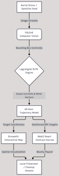
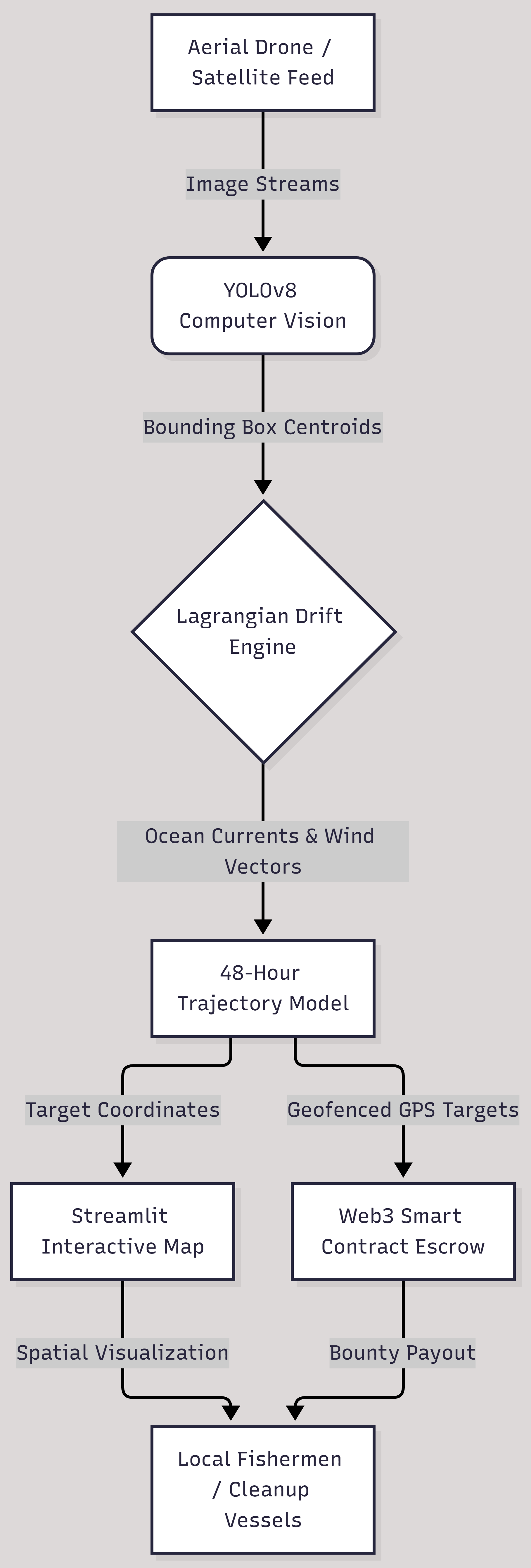
Flowchart for the idea
Inspiration
Marine ecosystems are facing an unprecedented crisis due to lost, abandoned, or discarded fishing gear—commonly known as "ghost nets". These untracked nets drift endlessly along ocean currents, entangling marine wildlife, destroying delicate coral reefs, and gradually degrading into hazardous microplastics.
Traditional ocean cleanup operations are strictly reactive and suffer from a critical operational flaw: because ocean surface currents move rapidly, reporting where a net was spotted becomes obsolete within hours. We were inspired to build DebrisGuard to bridge this gap by combining computer vision aerial tracking, hydrodynamic drift prediction, and Web3 bounty incentives to pinpoint where ghost nets will be and reward local maritime communities for retrieving them.
What It Does
DebrisGuard is an end-to-end autonomous monitoring, prediction, and retrieval pipeline for ocean debris:
- Autonomous Aerial CV Detection: Scans aerial drone and satellite imagery feeds using a custom YOLOv8 object detection model to identify floating ghost nets and plastic debris concentrations in real time.
- Hydrodynamic Drift Prediction Engine: Extracts detected debris GPS coordinates and models their future trajectory using 2D Lagrangian vector advection equations over a 24-to-48-hour window.
- Geofenced Web3 Escrow Bounties: Automatically mints a smart contract escrow bounty targeting the predicted future coordinate zone on-chain.
- Fishermen Retrieval Portal: Provides local fishermen and coastal cleanup vessels with an interactive spatial dashboard to view high-probability retrieval zones, navigate to projected coordinates, and claim crypto payouts upon photo verification.
How We Built It
The system architecture bridges three primary tech layers:
- Computer Vision (AI Layer): Built using Python, OpenCV, and YOLOv8 (trained on coastal drone feeds and marine debris datasets) to output bounding box centroids and detection confidence scores.
- Predictive Physics Engine (Data Layer): Implemented in NumPy and SciPy using the Lagrangian Particle Tracking Drift Equation (with the U.S. Coast Guard Leeway Model) to calculate projected spatial coordinates based on surface wind currents and ocean current vectors over time.
- Smart Contracts & Frontend (Web3 & UI Layer): Developed an interactive Streamlit dashboard integrated with Folium/Mapbox for geospatial vector rendering, connected to an EVM smart contract deployed on testnet that locks bounty tokens in escrow until photo verification triggers release.
Challenges We Ran Into
- Dynamic Drift Accuracy: Ocean surface dynamics fluctuate due to localized wind gusts and bathymetry. Tuning the windage leeway coefficient ($\alpha \approx 0.03$, representing a 3% wind velocity transfer) alongside ocean current velocity vectors required fine-tuning our SciPy integration bounds to prevent exponential error compounding over a 48-hour projection.
- Real-Time Map Rendering: Rendering dense current vector fields alongside animated drift heatmaps inside Streamlit without blocking the UI thread required optimizing spatial data frames using GeoPandas.
- Smart Contract Coordinate Validation: Storing floating-point GPS coordinates directly on-chain is gas-inefficient. We resolved this by encoding predicted target zones into fixed-precision geohashes off-chain before submitting them to the EVM escrow contract.
Accomplishments That We're Proud Of
- Successfully integrated three distinct domains—Computer Vision, Predictive Ocean Physics, and Web3 Smart Contracts—into a single, seamless pipeline.
- Built a lightweight, production-ready Streamlit dashboard that translates complex vector calculus into actionable GPS targets for fishermen.
- Developed an incentive model that directly turns climate action into economic opportunities for coastal maritime communities.
What We Learned
- How to implement 2D advection-diffusion physics equations in Python to simulate real-world fluid dynamics.
- Strategies for optimizing computer vision inference speeds to process high-resolution drone footage efficiently.
- How decentralized smart contract escrows can solve coordination failures in global environmental conservation.
What's Next for DebrisGuard
- Edge Processing Integration: Deploying lightweight YOLOv8 nano models directly onto custom drone hardware (like NVIDIA Jetson) for live on-board processing.
- IoT Buoy Validation Mesh: Deploying low-cost drifting telemetry buoys near major ocean current channels to dynamically calibrate drift predictions against real-time sensor data.
- DAOs for Coastal Conservation: Expanding the Web3 bounty contract into a decentralized autonomous organization (DAO) where NGOs and governments can pool funds into automated ocean cleanup pools.


Log in or sign up for Devpost to join the conversation.