-
-
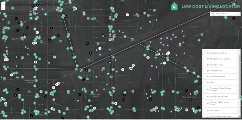
Landing Page - Design Mockup
-
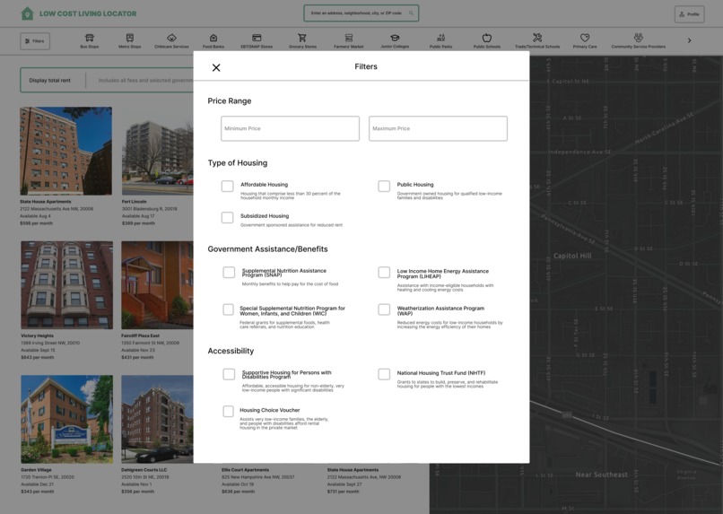
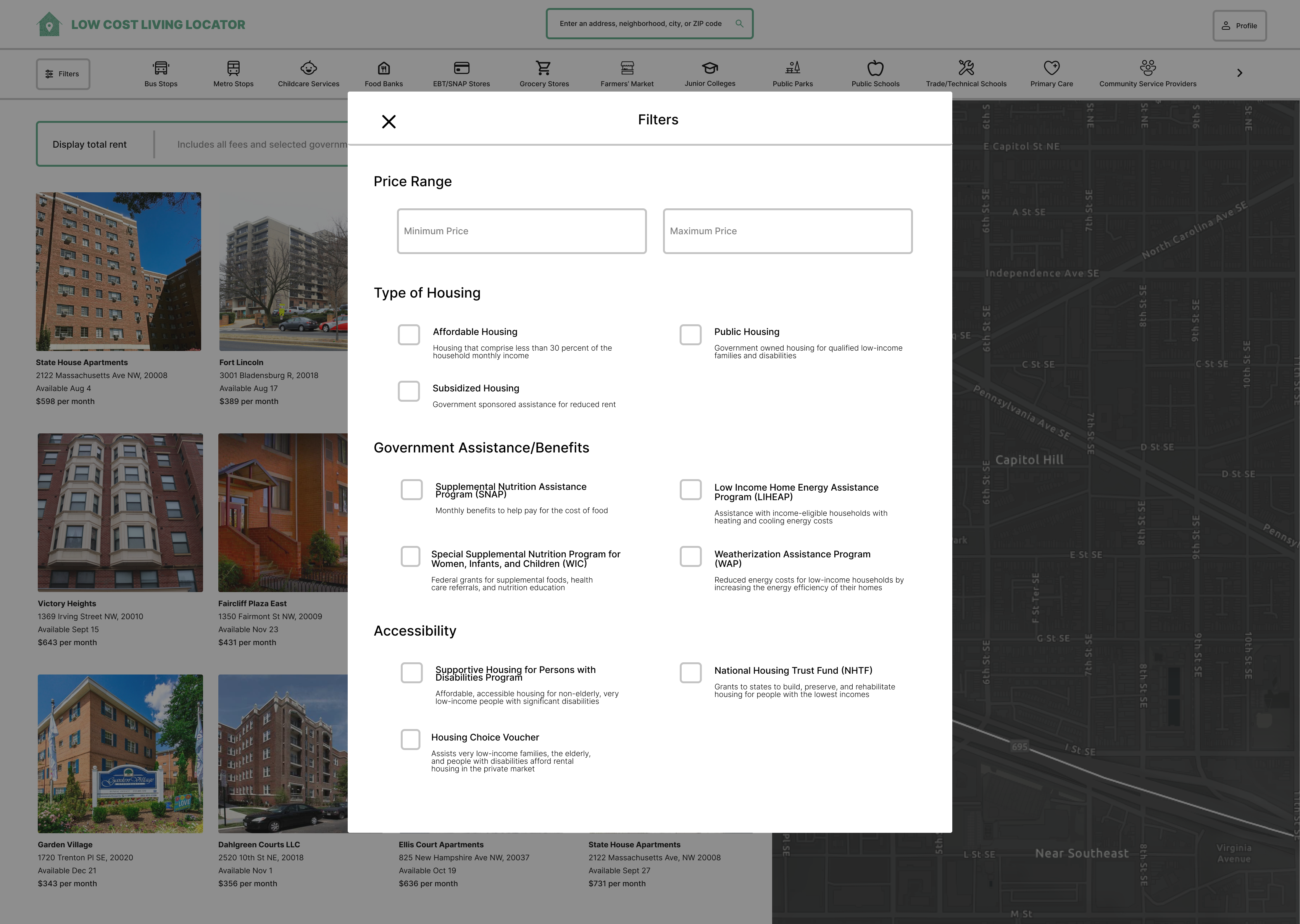
Filter Module Popup - Design Mockup
-
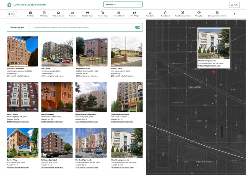
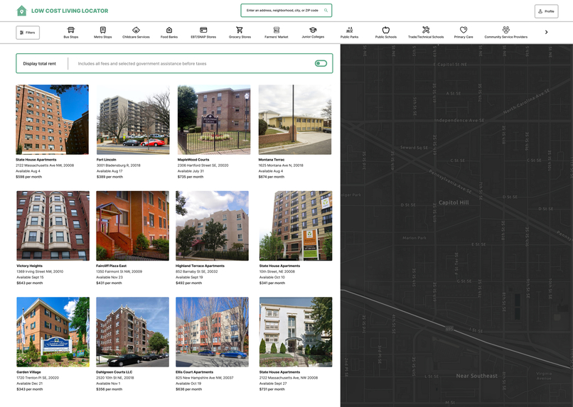
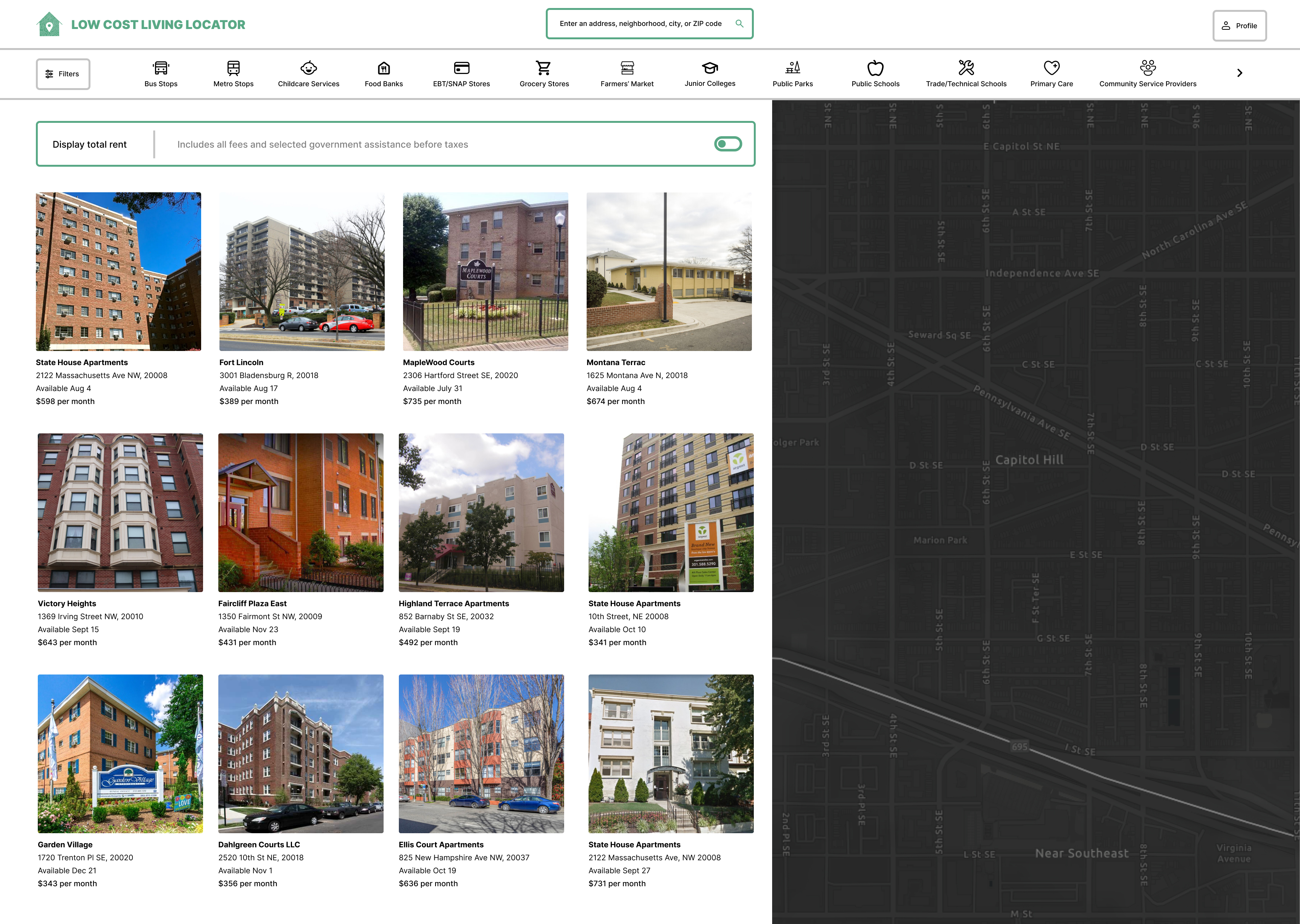
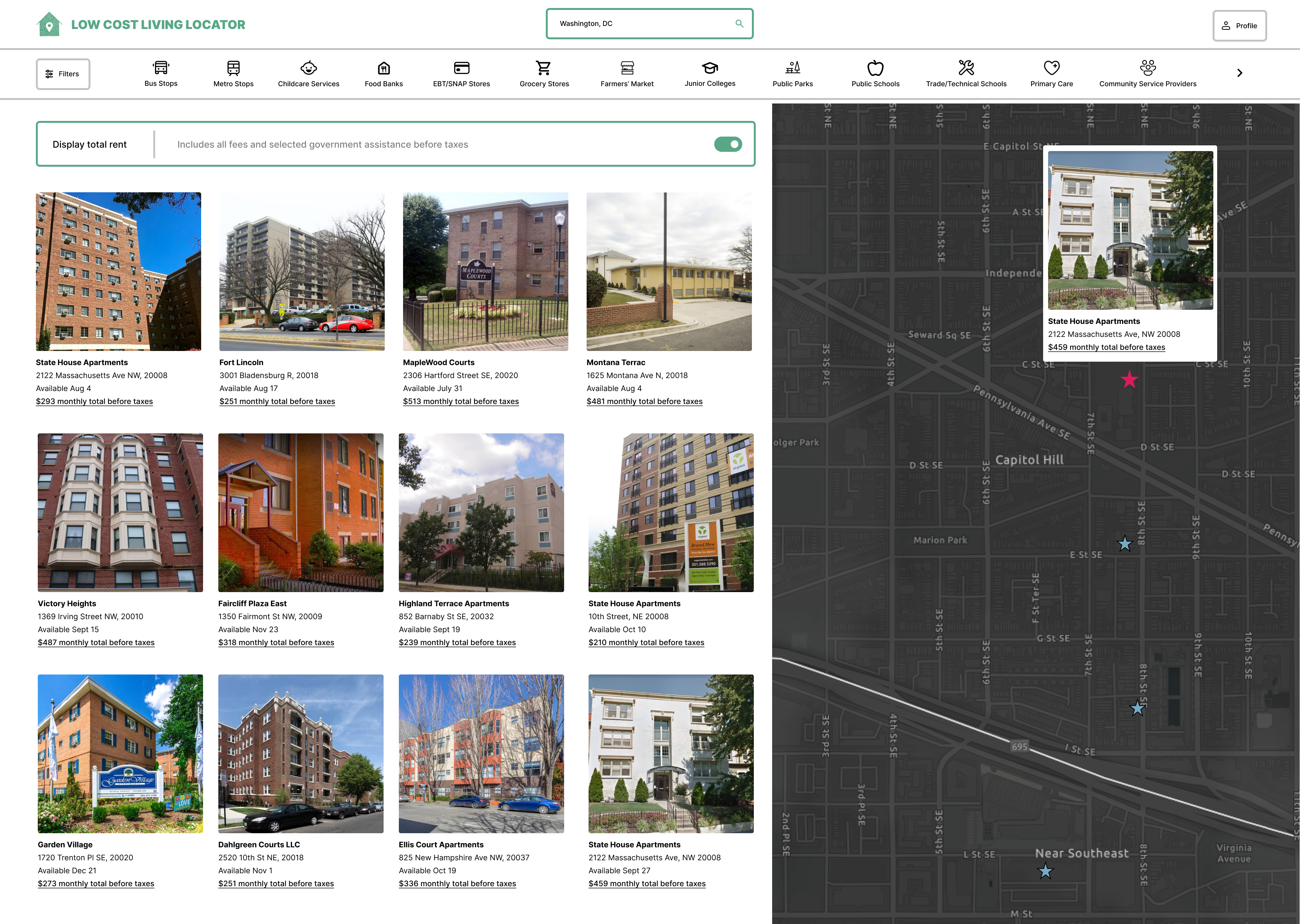
Affordable Housing Results - Design Mockup
-

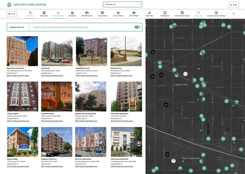
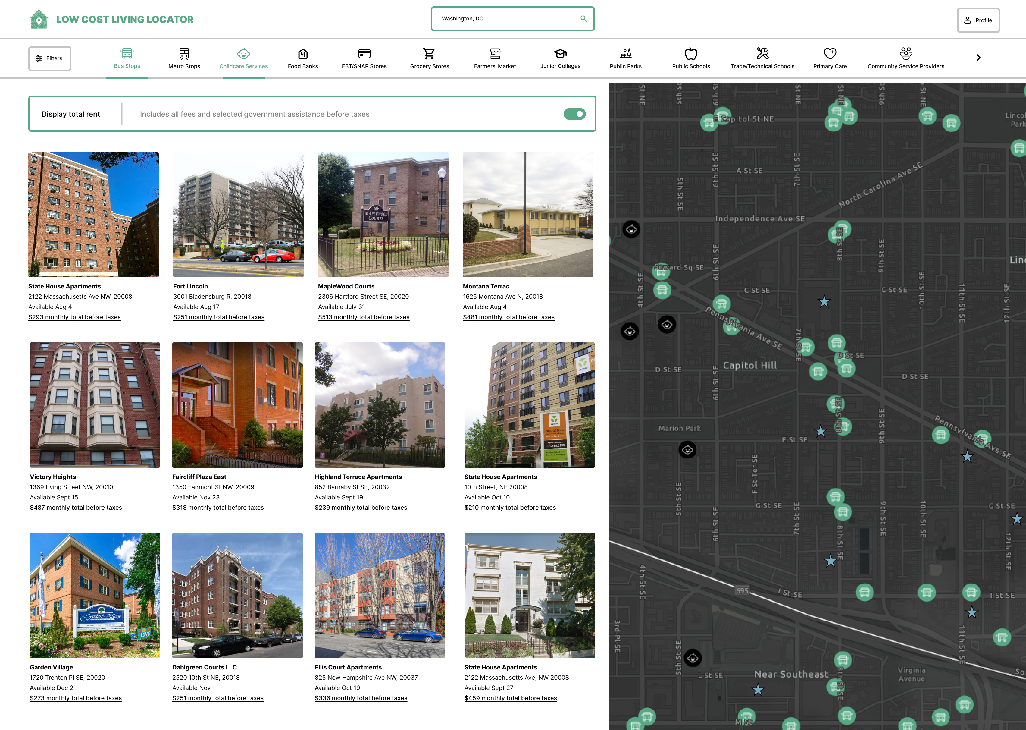
Bus Stops + Childcare Services Toggle Results - Design Mockup
-
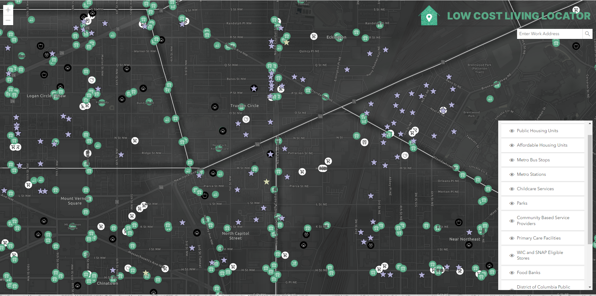
Bus Stops + Childcare Services + Primary Care Toggle Results - Design Mockup

Inspiration
Washington, DC is experiencing a widespread housing crisis. The average cost of rent for an apartment in DC ranges from 2-3k per month, a rate that is not affordable for many who are living near or below the poverty line. While there are units that are zoned for inclusive income-based pricing, they are often difficult to find online, as the DC government has not created an accessible central database of them. Any information that can be found often lacks the context of the surrounding area, making it difficult for many to find a rental that is suitable for their needs.
What it does
A user of our app starts by selecting what kind of housing they are looking to find, either affordable or public, as well as selecting for any neighborhood preference. Then, they can filter through units based on a variety of factors, including walk time to a metro station, SNAP eligible grocery stores, public schools, and other facilities. They are then provided with any units that fulfill their input requirements and can click on them to find out more information.
How we built it
The backend of the app is built using ArcGIS API for Python, and the front end is built using ArcGIS Maps SDK for JavaScript. When a user puts in a request, the Python API conducts a service area analysis, which selects all of the housing units that fulfill the inputs. This creates a JSON file which is then sent to the front end and is displayed with the JavaScript mapping SDK.
Challenges we ran into
Our developers had limited experience coding using ArcGIS SDKs and APIs, so there was a learning curve in learning to develop in the new environment. Additionally, due to the nature of our project a lot of the data was located in very disparate places, leading to a need for a lot of internet searching, data cleaning, and geocoding.
Accomplishments that we're proud of
We are proud that we were able to create an app that fills a very serious hole in existing services. Additionally, we were able to complete our app without using an existing app builder such as Experience Builder or Instant Apps, which added a level of difficulty to our project.
What's next for DC4L
If the District is able to fulfill its promise of creating a database of rent-controlled units, this information would also be incredible to add. Additionally, an expansion to other cities experiencing housing crises – such as Los Angeles or New York – would be a direction to move in for the future. We would also like to create an even more user friendly interface. We were able to mock up what that would look like during the hackathon, but if we had more time we would implement it to allow for a better user experience.
Built With
- arcgis-api-for-python
- arcgis-maps-sdk-for-javascript
- esri
- figma


Log in or sign up for Devpost to join the conversation.