-
-
Tech Stack

Curbsides
Inspiration
While our cities provide five public parking spaces per car, drivers waste an average of 17 hours of their year searching for spots and lose a collective $73 billion annually. This is the absurdity of urban parking in America. One-third of cars on residential streets are hunting for these spots—impeding walkability and emergency response, which relies on surface streets the most. In fewer words: this is expensive, inefficient, and just plain dangerous.
"Curbsides" harnesses the increasing prevalence of vehicle sensor data to make our urban centers work better for everyone.
What it does
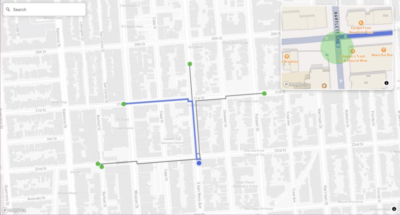
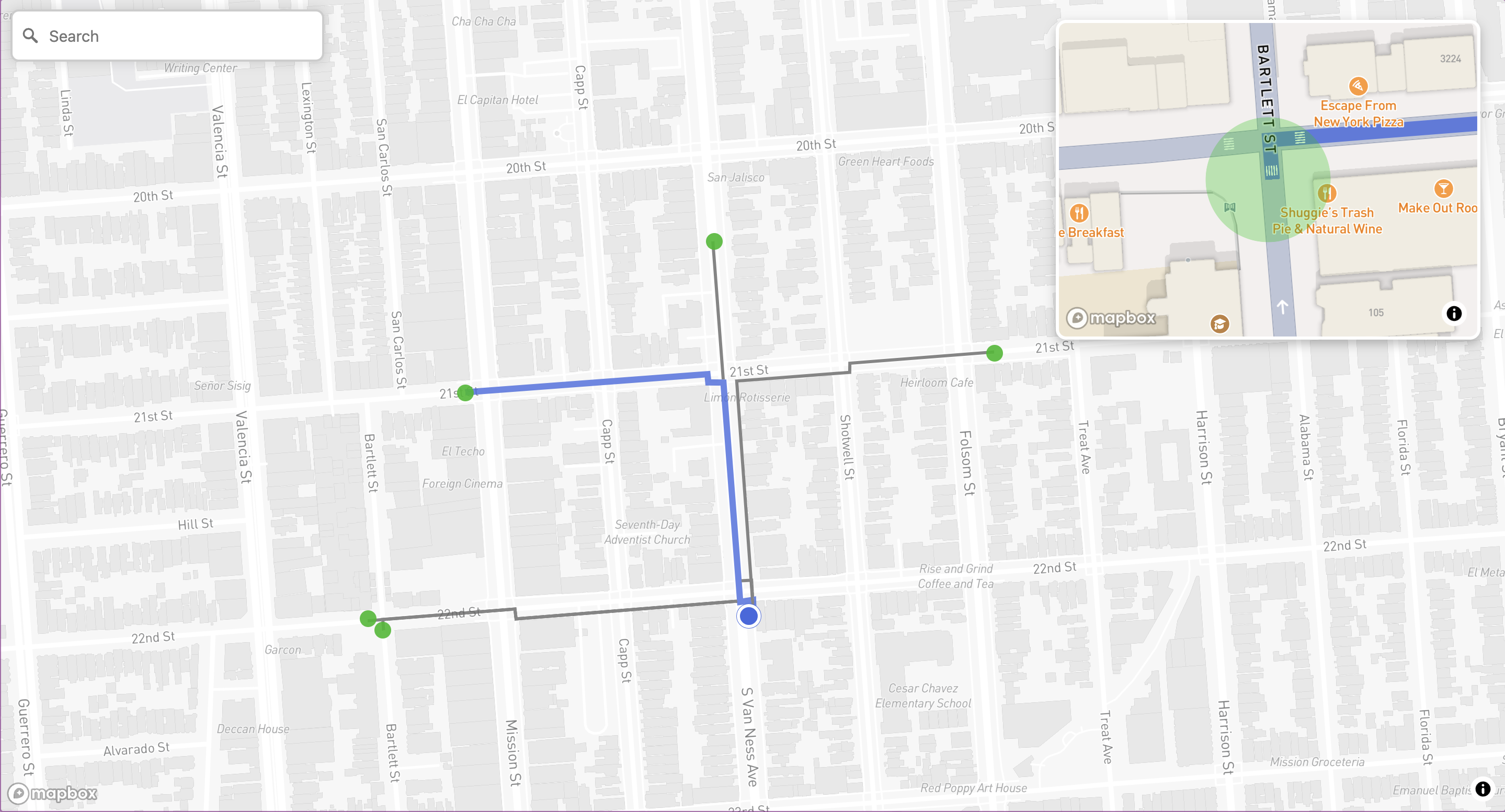
Curbsides is a smart urban parking solution that transforms the parking experience through real-time data analysis:
- Search: Users can input their destination or use their current location to initiate a parking search
- Real-time Availability: Our system performs proximity searches for empty curbside parking using our custom-trained visual transformer model
- Visual Navigation: The app displays multiple nearby open spots on an interactive map, with the nearest spot pre-selected
- Precision View: A detailed overlay provides users with a clear view of their parking destination, eliminating guesswork
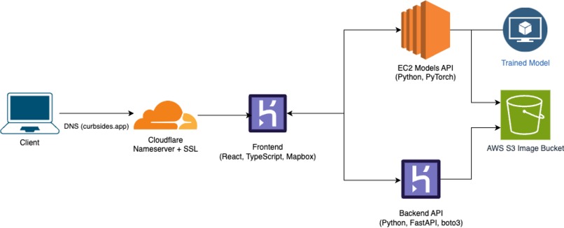
How we built it
We developed Curbsides using a sophisticated tech stack that combines machine learning with modern web technologies:
- Model Architecture: Implemented a visual transformer model in PyTorch that converts parking spot images into binary classifications
- Data Processing: Created a custom pipeline to process and geo-tag image data
- Frontend: Built an intuitive user interface using modern web technologies and integrated with Mapbox API
- Backend: Developed a robust API system to handle real-time queries and model predictions
- Deployment: Utilized AWS EC2 for model hosting and S3 for efficient data management
Challenges we ran into
Our development journey involved overcoming several significant technical challenges:
Data Challenges
- Initially attempted to use Waymo perception data for segmentation
- Pivoted from BiSeNet pretrained model due to parking spot labeling difficulties
- Transitioned to BDD 100k dataset for geo-location capabilities
- Created custom labeling tools to address insufficient data labeling
- Managed data consistency issues through careful preprocessing
Technical Hurdles
- Encountered deployment limitations with the 1GB model on Heroku
- Solved deployment issues by migrating to AWS EC2 with adequate RAM and GPU resources
- Implemented complex user location support in the frontend
- Optimized model performance for real-time predictions
Accomplishments that we're proud of
- Successfully deployed a full-stack application with a live URL
- Developed and deployed a functioning machine learning model for real-time parking detection
- Created innovative solutions for data supplementation and processing
- Implemented seamless integration with mapping services for real-world applications
What we learned
Our team gained valuable experience in:
- Practical machine learning implementation, including regularization techniques like dropout and backboning
- Dataset curation and the challenges of working with real-world data
- MapBox API integration for contextual data visualization
- AWS deployment strategies for machine learning models
- Iterative development and problem-solving in a complex system
What's next for Curbsides
The future of Curbsides depends on achieving a critical mass of sensor-equipped vehicles implementing open standards for data collection and sharing.
Modern vehicles already have the sensors, and we're rapidly approaching a critical mass of sensor-enabled cars on our roads. The technology to revolutionize urban parking exists today. Through Curbsides, we hope to have demonstrated that efficient urban parking is more than a pipe dream.


Log in or sign up for Devpost to join the conversation.