-
-
CrisisFlow
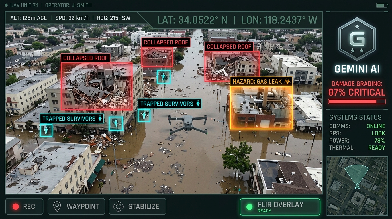
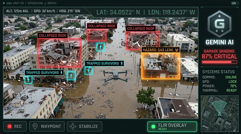
CrisisFlow AI — Autonomous Disaster Relief & Logistics Intelligence Grid 💡 Inspiration : recent dangerous floods in country of nepal . During catastrophic emergencies—such as flash floods, severe earthquakes, or urban building collapses—the primary factor dictating survival rates is the first 72 hours (the "Golden Window"). However, incident commanders on the ground face a severe "fog of war": Raw drone footage and thermal sensor feeds overwhelm command staff who must manually inspect thousands of image frames. Rescue units (swiftwater boats, heavy extrication teams, helo medevac) are dispatched via fragmented radios without automated capability-matching or real-time hazard routing. Civilians in affected zones receive delayed, single-language emergency warnings. We were inspired by real-world disaster relief operations (such as the recent Himalayan flash floods and urban river surges) to ask: What if we could build an autonomous, multimodal command grid that turns raw drone reconnaissance into instant damage grading, dispatches specialized rescue fleets around active hazards, and broadcasts life-saving voice alerts in seconds? That vision became CrisisFlow AI. 🛠️ How We Built It CrisisFlow AI is built as a full-stack, mission-critical real-time intelligence platform leveraging Google Gemini 3.7: Multimodal Vision & Drone Triage HUD: We connected raw aerial drone reconnaissance and FLIR infrared captures directly to Gemini 3.7 Multimodal Vision. The model performs structural integrity assessments, estimates casualty headcounts, assigns FEMA damage grades, and generates normalized coordinates to render dynamic tactical bounding boxes in real time. Tactical GIS Command Grid: Built with interactive geospatial vector layers featuring dynamic incident heatmaps, radar sweep animations, and toggleable hazard polygons for active flood inundation and wildfire thermal plumes. Autonomous Rescue Dispatch Engine: A priority-weighted capability matching algorithm that evaluates incident triage levels against specialized responder capabilities (USAR Heavy Extrication, Swiftwater Rescue, Canine SAR, Helo Air-Evac), computing safest-path ETAs that navigate around environmental hazard zones. Multilingual EAS Radio Broadcast System: Integrated multi-channel alert generation and the Web Speech Synthesis API to broadcast immediate, localized spoken radio dispatches and SMS alerts across 8+ languages. FEMA Incident Action Planner (ICS-201/202): Automated compilation of structured operational briefing documents, resource allocation manifests, and safety directives for multi-agency coordination. 🧗 Challenges We Faced Dynamic Bounding Box Normalization: Extracting consistent bounding box arrays from multimodal AI output across varying image aspect ratios required robust schema validation, post-processing filters, and visual clamping so that bounding boxes align over collapsed structures and victims. Real-Time Spatial Hazard Avoidance: Designing a dispatch algorithm that calculates realistic emergency ETAs while dynamically penalizing routes intersecting active flood or thermal hazard polygons. Emergency Radio Audio Synthesis: Ensuring smooth, multilingual speech broadcasting across browser environments without latency or audio context stuttering during high-stress simulation runs. Resilient Server-Side Proxying: Routing all multimodal Gemini prompts through a secure server-side Express backend to protect API credentials while supporting large Base64 drone image payloads. 🧠 What We Learned The Power of Gemini 3.7 Multimodal Reasoning: Beyond simple image tagging, Gemini 3.7 demonstrated deep contextual spatial reasoning—differentiating between cosmetic masonry damage and catastrophic foundation shear failure, which is vital for triage classification. Human-in-the-Loop Mission Control Design: Incident commanders need high-density, low-clutter situational awareness. Designing dark-mode tactical HUDs with clear visual hierarchies (WCAG AA contrast, distinct color-coded priority badges, clear tabular dispatch matrices) makes high-stress decisions faster and safer. Interoperability Standards: Adhering to established incident management frameworks like FEMA ICS-201 bridges the gap between modern AI prototypes and real-world disaster response protocols. 🚀 What's Next for CrisisFlow AI Edge-AI Offline Mesh Synchronization: Deploying lightweight quantized vision models to edge gateway devices mounted on drones to enable offline triage when cell towers are destroyed. LoRa & Satellite SOS Ingestion: Direct ingestion of citizen SOS beacons and satellite SMS pings into the Tactical GIS Grid. Predictive Flood & Wildfire Simulators: Integrating predictive physics models to forecast flood surge pathways 6 hours into the future.


Log in or sign up for Devpost to join the conversation.