Crisis Connect
Inspiration
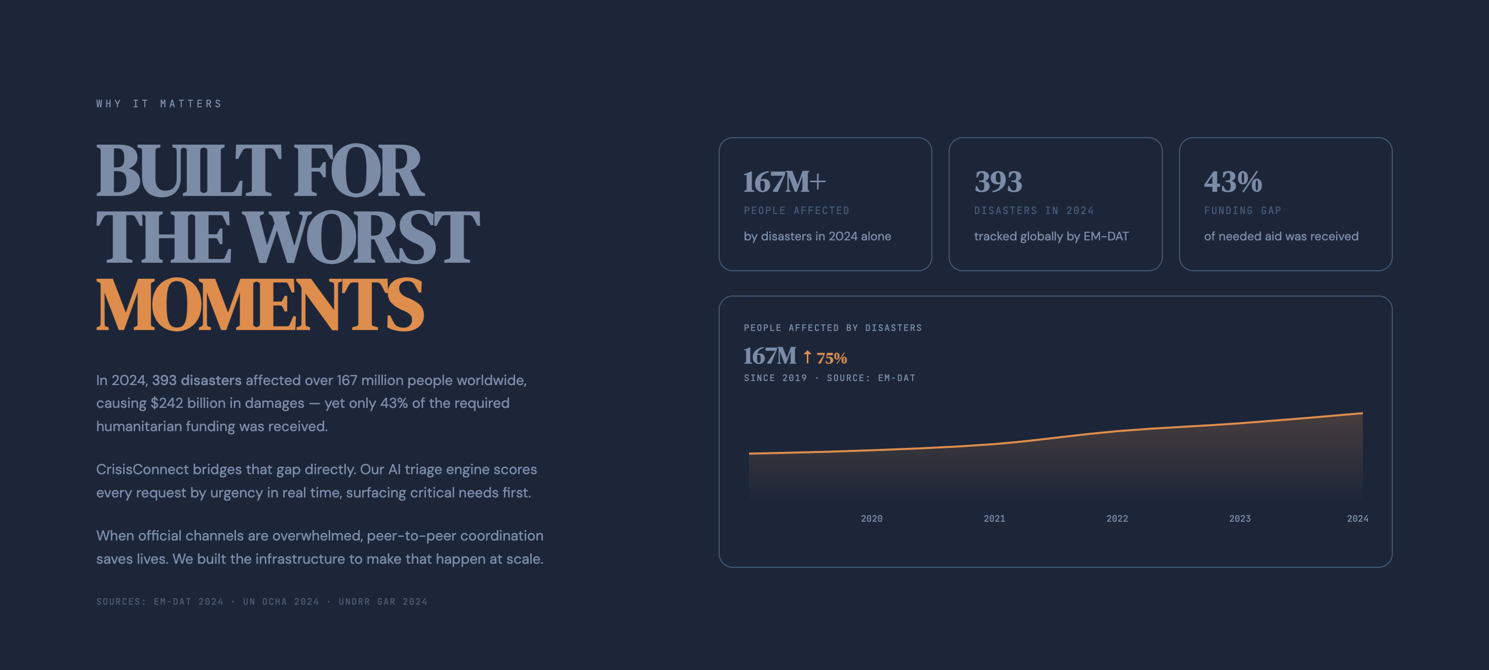
Today, over 2.3 billion people face food insecurity, and 123 million people are displaced by conflict and disaster. During crises, people often struggle to find help quickly and safely.
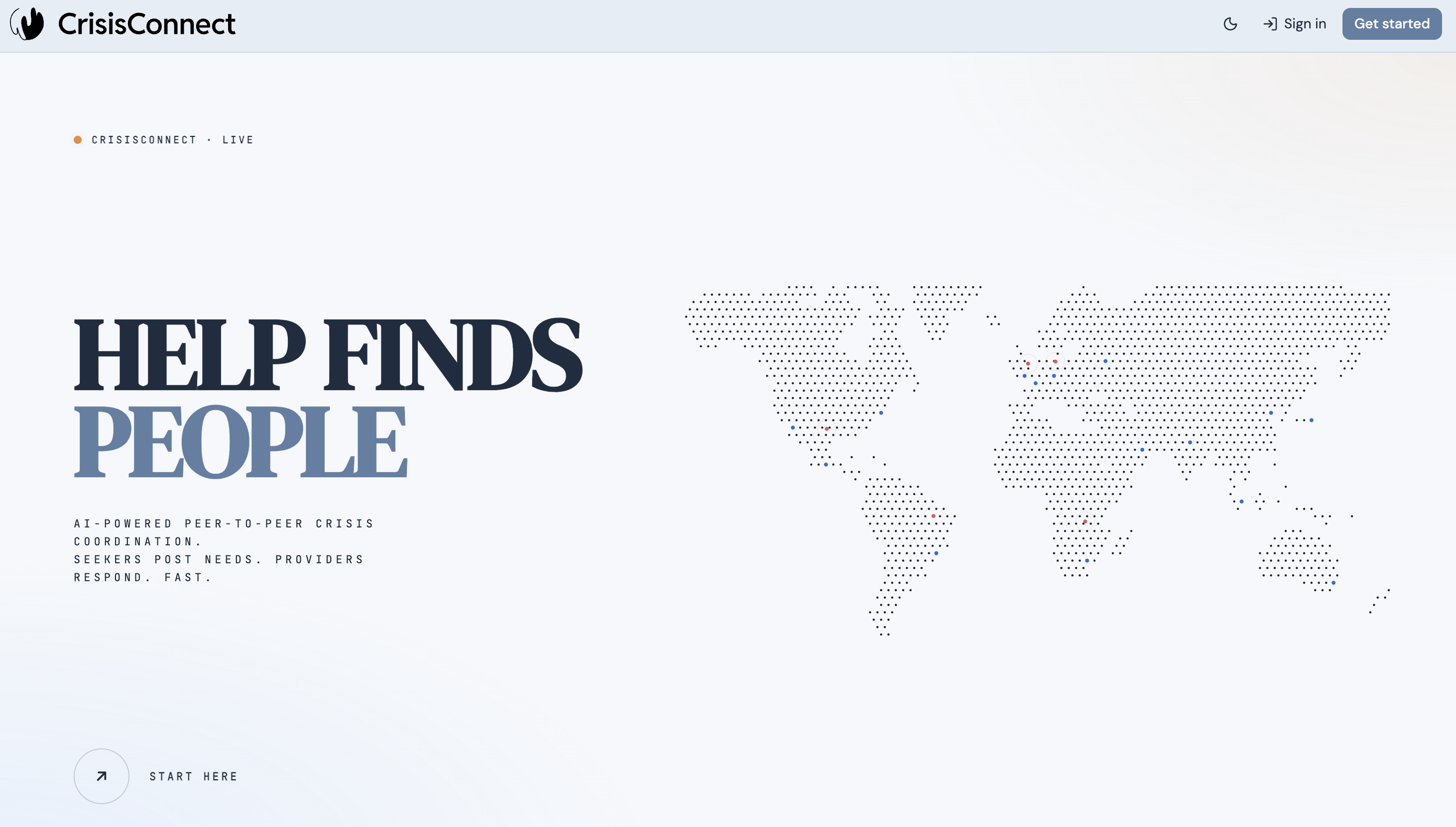
This inspired us to create Crisis Connect — a map-first platform that connects people who need help with those who can provide it in real time.
Existing platforms such as Ushahidi and Nextdoor either focus on documenting crises or only support small local communities. However, there is still no platform that can coordinate help at scale while protecting users' privacy. Crisis Connect aims to bridge that gap by enabling people to request or offer help on a live map while keeping their identities and precise locations private.
What It Does
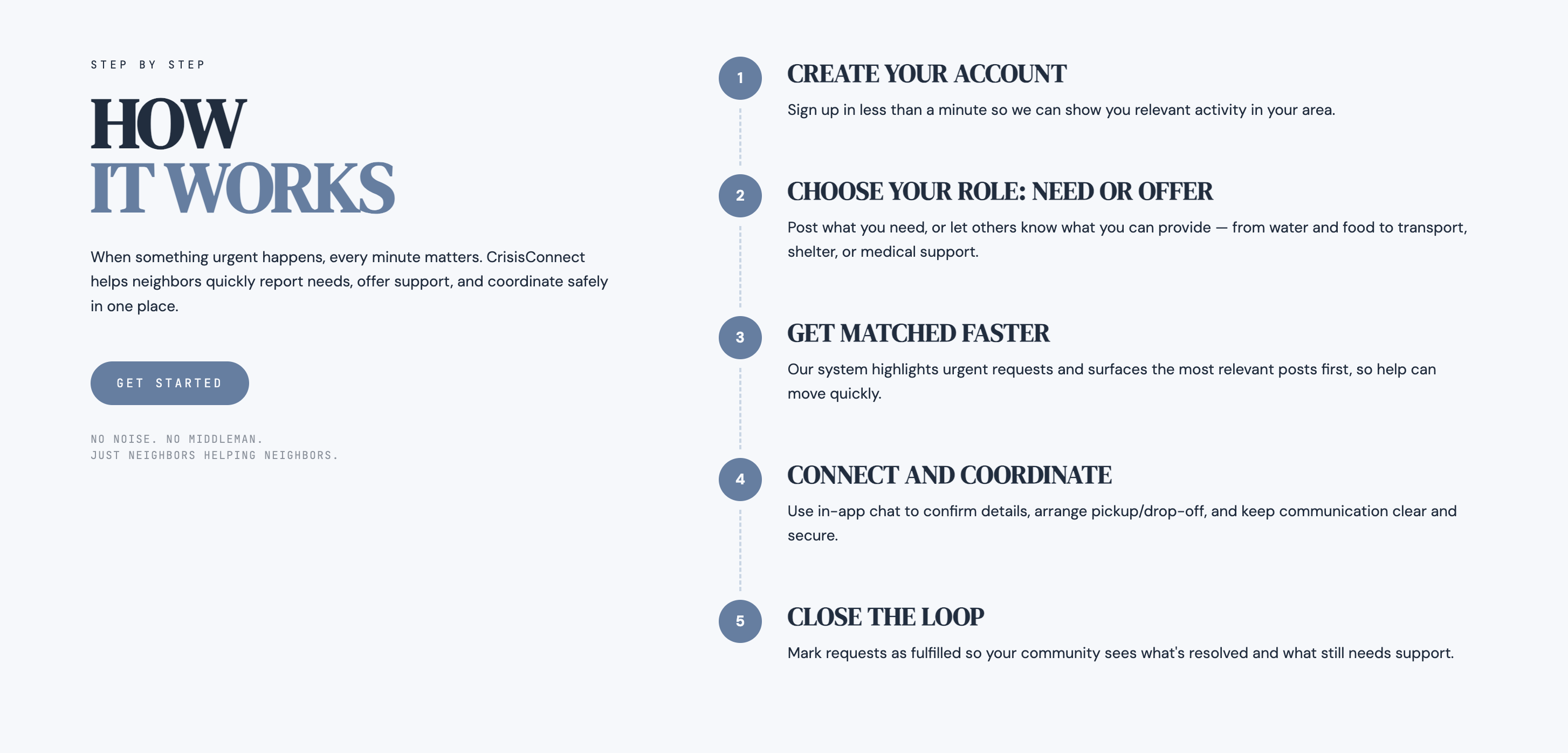
Crisis Connect enables people to request or offer help while keeping their identities and precise locations private.
- Users can post requests or offers directly on a live map, where each post appears as a colored dot based on its urgency
- AI analyzes each post and assigns a priority score to highlight the most critical situations
- Users can search for nearby needs using natural language
- In-app chat lets people communicate without sharing phone numbers or emails
- Voice features allow people to submit requests by speaking and listen to AI-generated crisis briefings, making the platform more accessible during emergencies when typing or reading may be difficult
How We Built It
Crisis Connect was built in 24 hours using a modern full-stack architecture.
- Frontend — React, TypeScript, Tailwind CSS, and Leaflet for a map-first interface
- Backend — NestJS and MongoDB on MongoDB Atlas, using geospatial queries to fetch nearby posts
- Real-time — Socket.IO for live updates and chat
- AI — Claude for urgency prioritization
- Voice — ElevenLabs for speech-to-text posting and audio crisis briefings
- Deployment — Vercel and Railway
Challenges We Ran Into
- Complexity at speed — coordinating the map interface, backend APIs, and real-time updates required careful integration to ensure posts appeared instantly for all users
- Geospatial queries — this was our first time building a map-based application; implementing proximity-based lookups was new territory for our team
- Reliable AI outputs — AI responses are not always structured, so making urgency scoring and search filters consistent required extra work
- Privacy vs. utility — balancing useful location information with user privacy, ensuring the map shows approximate areas without revealing exact coordinates
Accomplishments We're Proud Of
- Built a fully functional website within 24 hours
- Real-time crisis coordination with live map updates across all users
- End-to-end voice accessibility for submitting and receiving crisis information
- AI-powered urgency ranking deployed and working in production
Built With
- claude
- elevenlabs
- nestjs
- railway
- socket.io
- tailwind
- typescript
- vercel
- vite


Log in or sign up for Devpost to join the conversation.