UrbanIQ — Project Story 🌆🤖 Inspiration 💡
Cities generate huge amounts of information, but government departments often need to make decisions across fragmented data sources. We were inspired by a simple question: What if cities could identify emerging problems before they become crises? 🚨
For Lahore, we wanted to bring weather, air quality, geospatial, demographic, and historical data into one intelligent view that helps decision-makers understand where risk is increasing, why it is increasing, and where attention should be prioritized. 📊🗺️
What We Built 🛠️
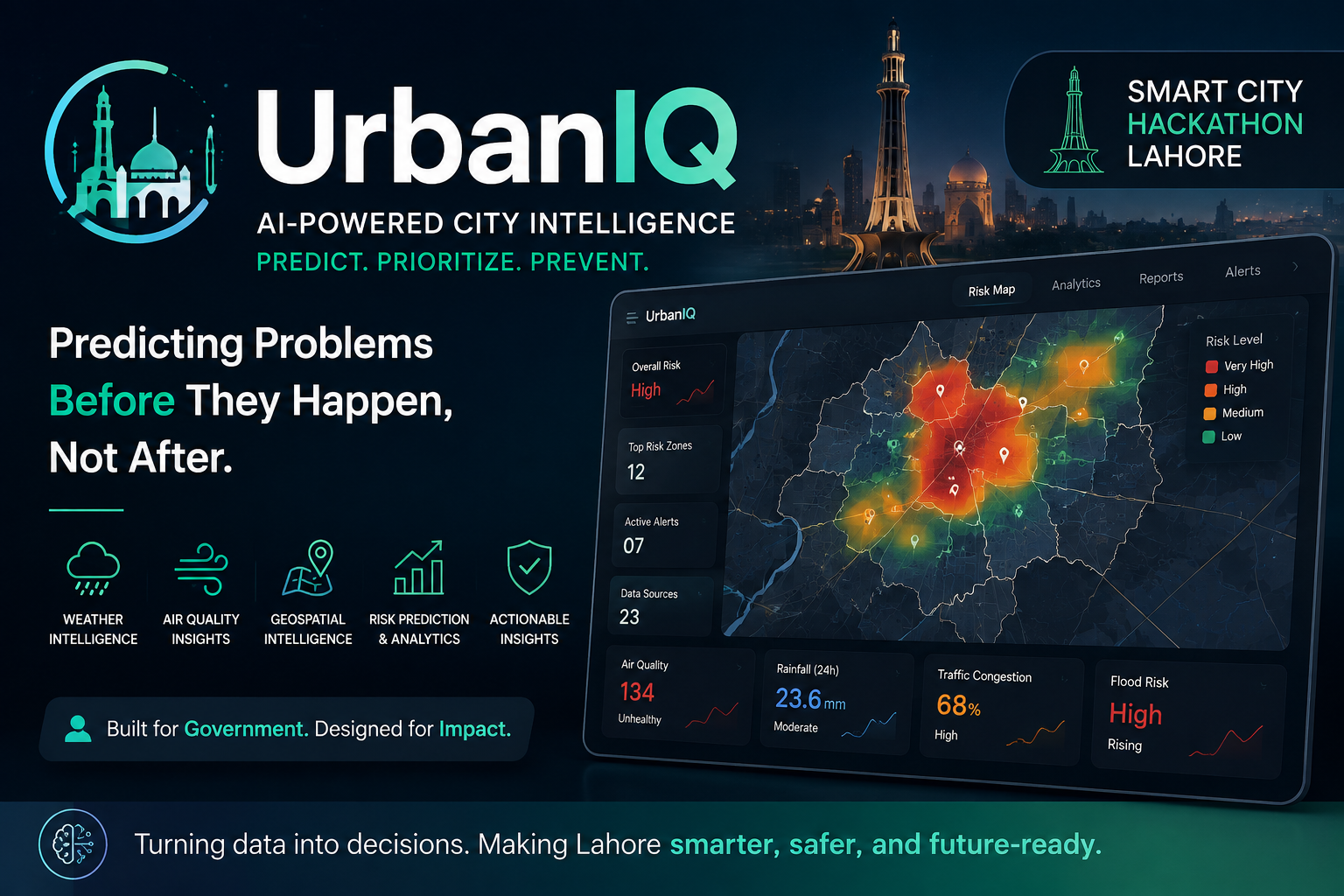
We developed UrbanIQ, an AI-powered City Intelligence and decision-support platform for Lahore. 🌐🏙️
The platform combines selected open datasets and transforms them into actionable urban risk intelligence. Its core experience is a map-first dashboard showing risk by location, supporting evidence, trends, contributing factors, and priority areas. 📍📈
Our MVP focuses on:
City-wide risk mapping 🗺️ Weather intelligence 🌦️ Air-quality intelligence 🌫️ Geospatial context such as roads, hospitals, and schools 🏥🏫 Transparent risk scoring and prediction where suitable historical data exists 🎯 A decision panel showing high-risk areas and contributing factors ⚠️ Data-source health and provenance 🔍 Optional citizen reports and AI-generated explanations 🧑🤝🧑🤖 How We Built It ⚙️
The system uses a layered architecture. Next.js powers the web interface, FastAPI handles the application API and business logic, and PostgreSQL with PostGIS provides spatial and time-based data storage. 💻🗄️
Python-based ingestion workers collect, validate, normalize, and cache external data. Machine-learning components use Python, Pandas, and scikit-learn for feature engineering, risk scoring, training, and inference. 🐍📚
Our data pipeline follows a clear process:
Collect data from selected external sources. 📥 Validate timestamps, coordinates, units, and missing values. ✅ Normalize the data into a common schema. 🔄 Connect spatial records to Lahore zones or a defined grid. 📍 Generate predictive features. 🧠 Calculate risk indicators and, where labelled historical data exists, generate forecasts. 📊 Store predictions with model and source metadata. 🗃️ Present the results through the UrbanIQ dashboard. 📱 What We Learned 📘
One of our biggest lessons was that prediction must be defensible. A system should not claim to predict something simply because an AI model can produce a number. ⚖️
We learned the importance of having a measurable prediction target, suitable historical data, proper validation, and protection against data leakage. Where labelled data is unavailable, the system uses a transparent risk index rather than falsely presenting a heuristic as a statistically validated prediction. 🔬✅
We also learned that AI should support decision-making rather than replace evidence. Our generative AI layer is therefore designed to explain structured model results without inventing numerical predictions. 🤖💬
Challenges 🚧
The project presented several technical challenges.
The first was data fragmentation. Weather, air quality, geospatial information, demographic indicators, and other datasets come from different providers and formats. We addressed this through provider-specific ingestion adapters, validation, normalization, and a common spatial-temporal data model. 🔗📊
The second challenge was limited historical labelled data. This directly affects how confidently certain risks can be predicted. Our solution was to distinguish between validated ML predictions and transparent prototype risk scoring rather than overclaiming model performance. 📉🎯
We also had to consider external API failures, rate limits, inconsistent providers, map performance, satellite-processing delays, and AI hallucination risks. We designed caching, source-health monitoring, degraded-mode support, spatial aggregation, and bounded AI prompts as mitigations. 🛡️⚡
What's Next 🚀
UrbanIQ is designed as more than a hackathon prototype. Our long-term vision is to create a scalable City Intelligence layer for Punjab that continuously ingests data, detects anomalies, forecasts risks, explains why risks are increasing, and helps government departments prioritize interventions. 🌍🏛️
The next stages include integrating official government feeds and historical incidents, adding IoT and sensor data, expanding satellite and environmental intelligence, introducing automated alerting, and eventually supporting multiple departments and cities. 📡🛰️🔔
UrbanIQ is built around one idea: move cities from reactive response toward proactive intelligence — predict problems before they happen, not after. 🌆✨


Log in or sign up for Devpost to join the conversation.