-
-
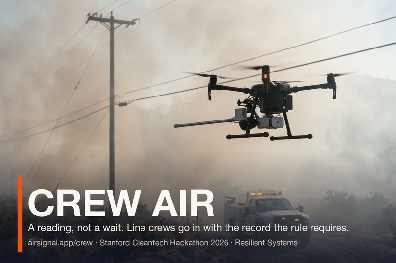
Crew Air: a reading at the downed line, and the record the rule requires, before the crew goes in
-
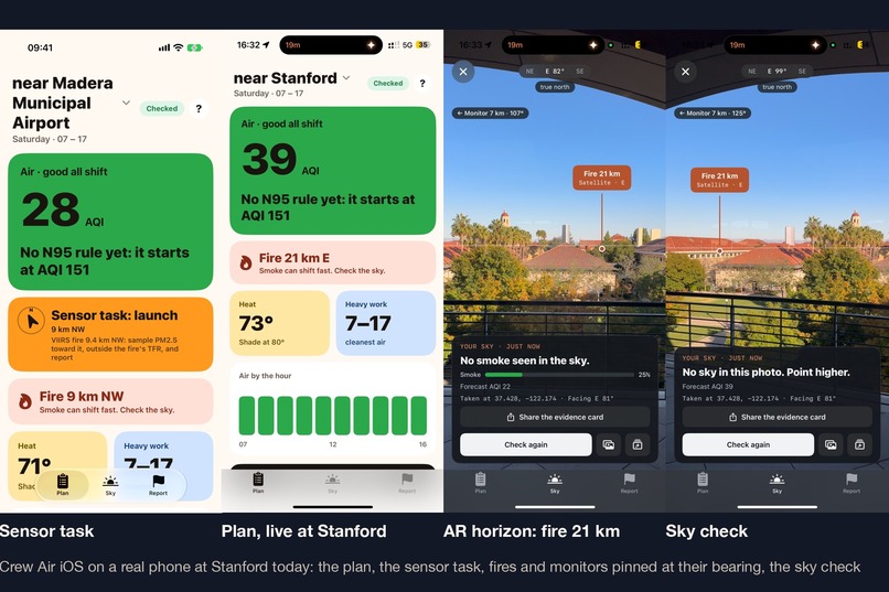
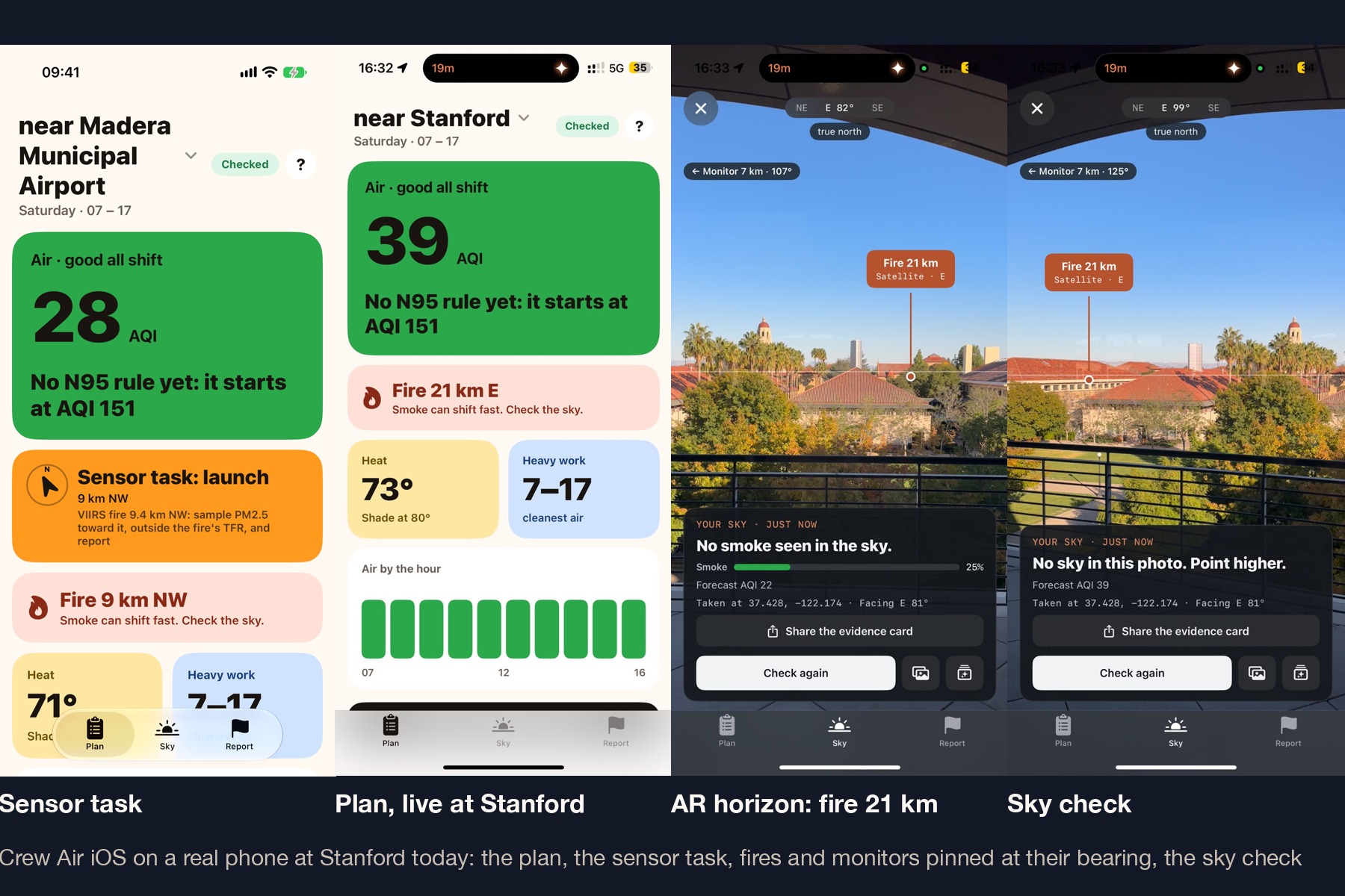
Crew Air iOS on a real phone at Stanford: the sensor task with the fire's bearing, the plan, AR horizon with the fire 21 km east, sky check
-
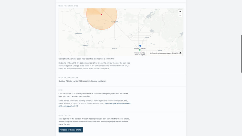
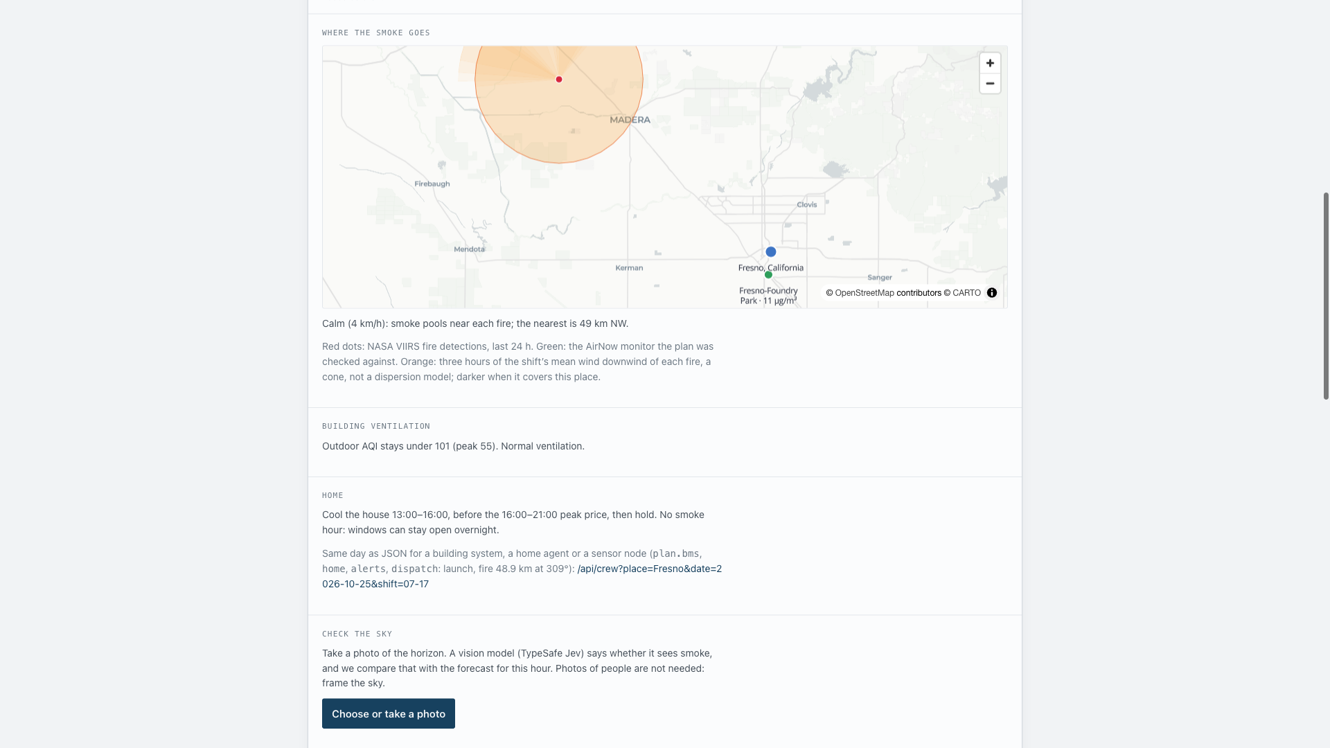
Where the smoke goes: satellite fires, the monitor the plan was checked against, a downwind cone per hour
The problem
When climate hazards like wildfires cause power outages, utilities must dispatch line crews immediately. But California law (Cal/OSHA §5141.1 for smoke, §3395 for heat) heavily regulates outdoor work in these conditions. Global smoke models have a 40 km resolution, and the nearest ground monitor is often 30 miles away. Utilities face a costly dilemma: dispatch crews blindly and risk Cal/OSHA fines and liability, or wait hours for the smoke to visibly clear, losing hours of grid downtime and wasted truck rolls.
What Crew Air does
Crew Air is a Micro-Local Compliance-as-a-Service platform that gets the grid back online faster and safely.
Place and shift in. Out: a Shift Plan and Compliance Log, the record the rule requires, that gives dispatchers the green light, detailing exactly when the smoke rule starts, the clean window for heavy work, and when to mandate N95 masks.
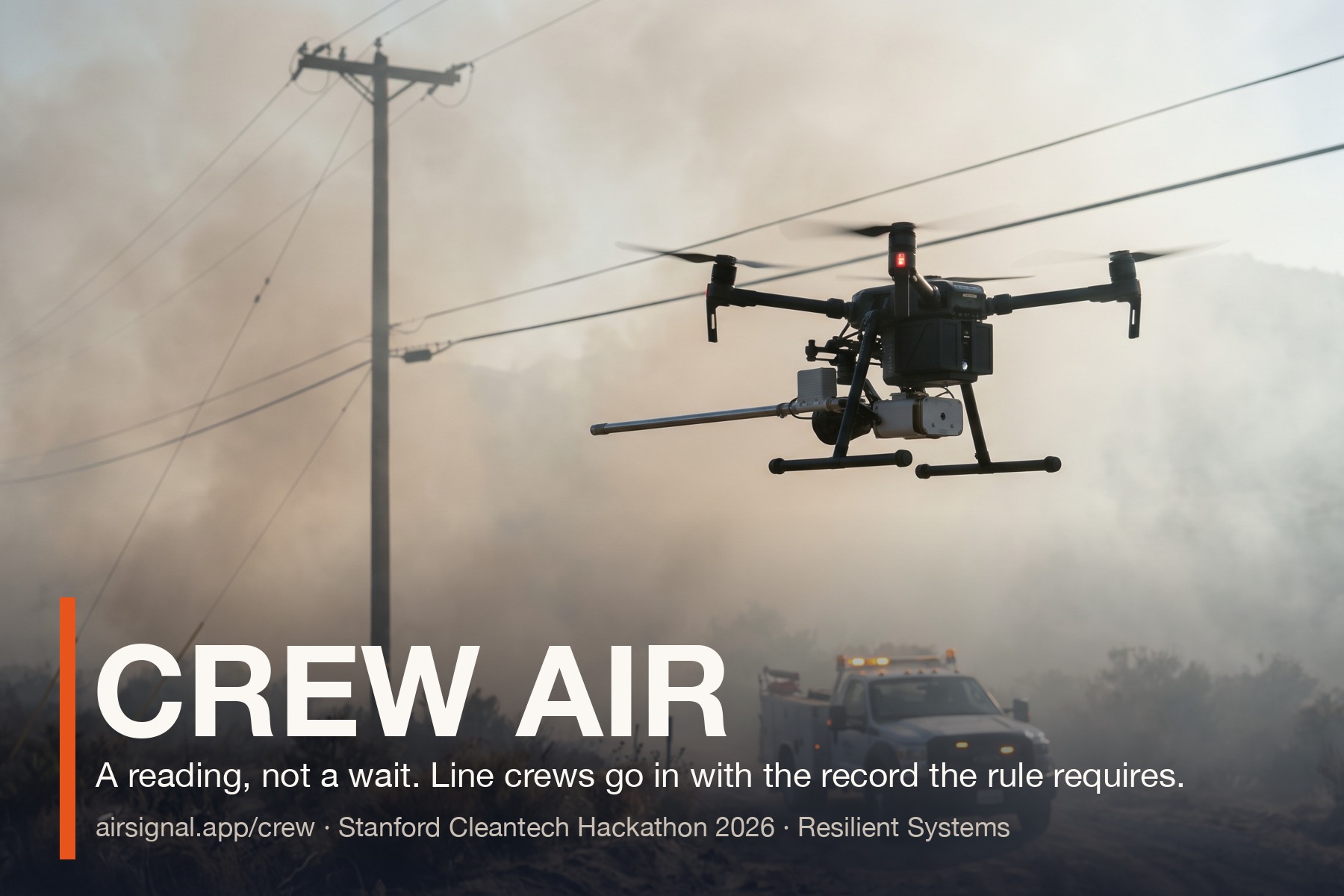
We don't just rely on lagged forecasts. When our engine detects a NASA VIIRS fire within 50 km of an outage, the Crew Air API tasks our hardware concept: the SE Airborne Scout. This is a drone payload integrating a Schneider Electric SpaceLogic PM2.5 sensor (with a custom downwash-protected snorkel) that flies to the exact coordinates of the broken line, outside the FAA flight restriction, to sample the air just-in-time.
The micro-local reading streams back to our endpoint, creating the compliance log. Crews deploy with a reading and a record hours earlier, saving the utility money and liability. Simultaneously, the same granular smoke and heat hours are exported as JSON to a DERMS or home agent, signaling the grid to pre-cool homes during cheap hours before the smoke front forces everyone to shut their windows and crank the AC during peak pricing.
Live: airsignal.app/crew · thirteen SVCE communities on one map: airsignal.app/crew/grid · every endpoint, no key: airsignal.app/api.
How we built it
Software: a Rust engine compiled to WASM inside a Cloudflare Worker, Astro SSR, D1, MapLibre, a Swift 6 app, and a Python CLI. We merge public data from Open-Meteo, NASA FIRMS, AirNow, NWS, and the EPA.
Hardware concept (SE Airborne Scout): a bridge linking industrial-grade BMS sensors (Schneider Electric SpaceLogic PM) via an ESP32/Raspberry Pi micro-controller directly to the Crew Air API for autonomous drone deployment.
What we learned
Forecast feeds publish a 24-hour mean that lags a smoke front by a shift. Satellites see heat, not smoke. A vision model alone isn't enough for legal compliance. To bridge the 40 km data gap and actually reduce outage times (SAIDI), utilities need physical, on-demand micro-sampling.
Disclosure: built in the hacking hours on top of our earlier open-source work (the Air Signal site, the AQI merge, camera geometry); the README specifies which is which. The drone hardware integration is a conceptual architecture built for the SE Ventures Resilient Systems track.

Log in or sign up for Devpost to join the conversation.