-
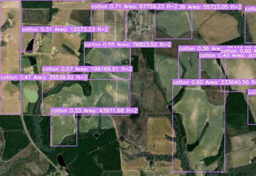
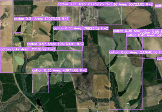
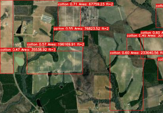
Labeled Image after detection through ML model
-
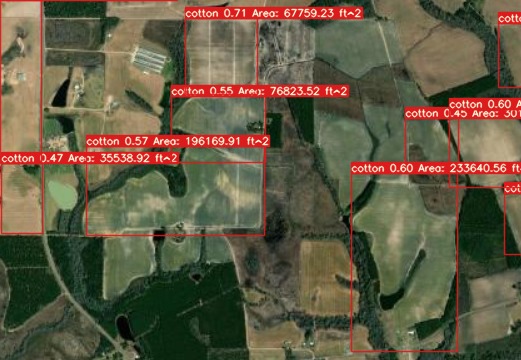
Another labeled image after detection through ML model
-
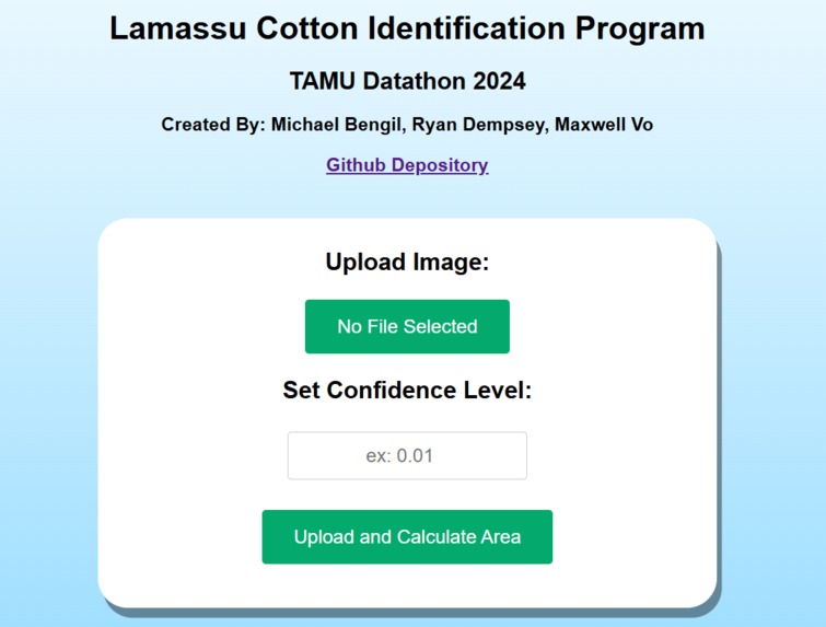
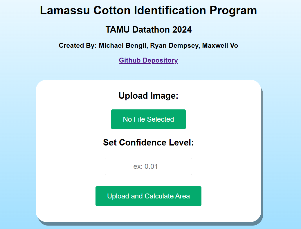
Website example
Our project aims to develop an AI-based tool to detect and identify cotton fields within satellite imagery for improved agricultural monitoring. Our tool was specifically developed for Coffee county in Georgia, US.
Our group first used RoboFlow to label the cotton fields within satellite aerial photos. Obtaining satellite images and how we determined which fields Seventy percent of the labeled images within the dataset were used for testing, 20% were used for validation, and the final 10% were used for testing.
We trained a YOLOv7 model with PyTorch, fine-tuning it to accurately recognize cotton fields in satellite images. After initial training, the model was evaluated and further adjusted to enhance its precision in detecting cotton fields based on labeled data. This refined model now serves as the core of our system, capable of analyzing new satellite images for cotton field detection. Finally, we developed a straightforward Flask website as the front-end interface. This allows users to select an image file for analysis and set a confidence threshold for the model’s detections, providing an accessible way to engage with our model’s capabilities. The model outputs an image with identified cotton fields labeled, along with the model’s percent confidence and estimated area of said field.
In regards to the scalability, our model is able to pretty accurately identify cotton fields, but with relatively low confidence intervals due to the small dataset. The model can definitely be expanded to be trained on a much larger dataset, improving accuracy of cotton field detection. Additionally, the model can be utilized in other counties outside of Coffee county, Georgia, due to this training. Lastly, the area calculation can be “tightened” and made to be more accurate, as our solution is relatively rudimentary due to time constraints.
The development of this program can prove beneficial to the agriculture industry for a number of reasons. Firstly, with enough training, this program can outperform existing datasets like CroplandCROS, allowing for a more accurate and representative analysis of cotton fields in the United States. Secondly, the program can help farmers optimize resource allocation, further reducing waste and improving crop yields.


Log in or sign up for Devpost to join the conversation.