-
-
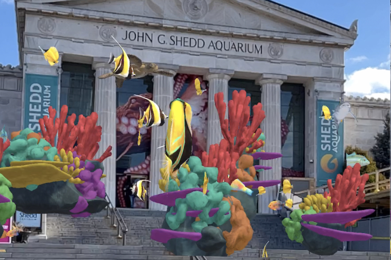
Covering the Shedd Aquarium in Coral
-

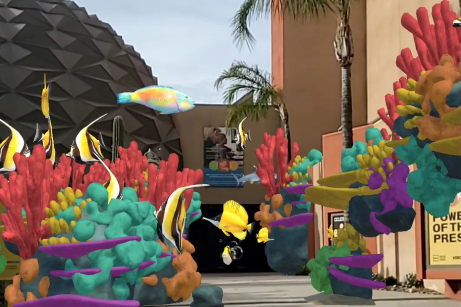
Covering the San Bernardino County Museum in Coral
-

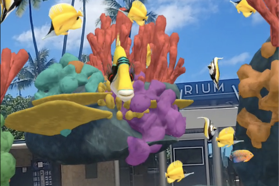
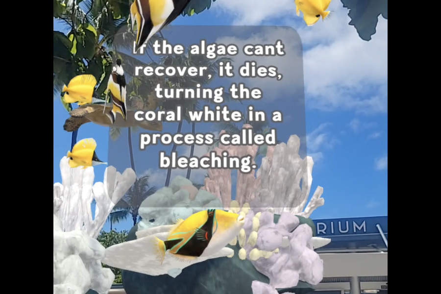
Covering the Honolulu Aquarium in coral.
-

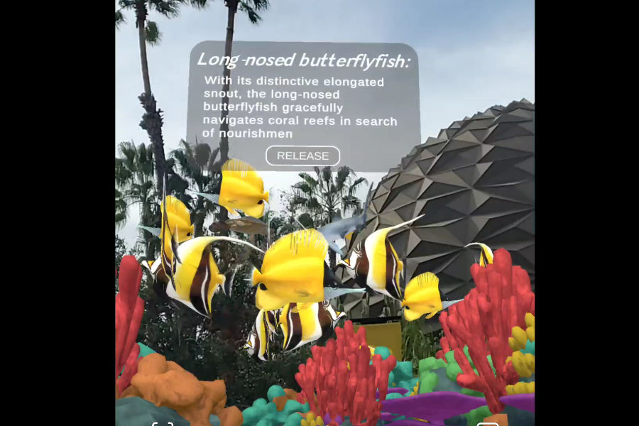
Meet the fish of the reef
-

Learn about what happens when corals bleach.
-

Restore the reef after seeing the effects of bleachings
-

CoralsARLife logo in progress


CoralsARLife
Bringing the wonders of the ocean's coral reefs on land to raise awareness through the power of augmented reality and geospatial mapping.
What inspired us?
It is well documented that exposure breeds empathy, and empathy leads to action. Augmented Reality can harness that power by bringing other worlds into a person's physical space, increasing their exposure, even if only digitally. For over a decade, two of our team members lived in Hawaii, where the ocean was a short drive away and the plight of coral reefs and the health of coastal communities were front and center in everyday discussions. A year ago, I moved to Southern California's Inland Empire, several hours from the nearest ocean, and it hit me how easy it is to forget how important issues in one area can seem so distant when separated by miles of desert. This project allowed us to bring coral reefs on land, letting people get up close and personal with fish in a way that just isn’t possible without dive equipment or snorkel gear. Even the glass tanks of an aquarium offer only so much interaction. Our hope with this project was to submerge and immerse diverse communities and allow them to experience the plight of coral reefs as they undergo stresses caused by the warming of the planet and increased pollution.
What it does
The app is designed to extend the tanks of an aquarium out into space where viewers can walk around and interact with marine inhabitants. They simply select their city, point their phones at the front of the corresponding aquarium, and are submerged in an ocean they can walk through. Viewers are then able to feed fish, select individual marine life and learn about them, and learn about the devastation caused by higher temperatures and pollution as reefs die. The enhanced speed of the bleaching process in the application is designed to showcase what few, if any, can experience in real-time, emphasizing the urgency of the situation. And while there are no permanent solutions to bring reefs back, the app seeks to foster some hope based on recent research in seeding dying reefs with heat-resistant coral. As the viewer places new coral polyps and watches them grow, they will begin to see the return of marine life. With Geospatial Creator, we were also able to play with a sense of scale, making our marine inhabitants larger than life. This shift in size is not only visually appealing but helps create a sense of wonder, displacing the viewer's natural sense of scale and adding a subtle psychological shift of importance to the creatures they interact with. The aim is to engage the user with both awe and interactivity and encourage them to learn more about reef health and take action in maintaining and restoring them.
How we did it
We built the app using Google’s Geospatial Creator with Unity as our game engine and ARfoundation as the augmented reality driver. Being able to load each location via Google-verified latitude and longitude made the placement of content extremely easy, and with some minor adjustments to altitude, we were able to place content relatively accurately. The base coding language is C#, and thanks to Unity’s cross-platform publication, we have tested the application on both iOS and Android successfully. All assets were modeled, animated, and textured in Blender, and all UI was created using Affinity Photo. Stable Diffusion was used to create the background reef image. The music used was written by LeaveTrace (Chris Hanes) and is used with permission.
Challenges we faced
We ran into several challenges while building the project, primarily navigating Google’s Cloud portal and activating the proper packages and APIs to use Geospatial Creator. Once the project was set up, we ran into challenges building the application on separate computers and, in the end, opted for building everything, both iOS and Android, from one machine and sharing the .ipa and .apk files via Dropbox for testing. While not ideal, this solution allowed for fairly rapid iteration and testing spanning a distance of over 4000 miles. The learning curve was steep on the back end, specifically how to integrate Google Cloud's API keys and packages, but once the project was set up, we found it extremely easy to localize content wherever we could find a latitude and longitude. We consistently had trouble with VPS and are unsure if that is due to being out of VPS range or improper setup of the project. GPS seemed more than sufficient in most locations except for the RoundHouse Aquarium in L.A. This may be due to the location being out on a pier making it harder to read latitude, longitude and altitude. With more time we will revisit this location and optimize the experience, for the challenge we elected to focus on the sites where gps readings were more reliable: Honolulu, Chicago, and San Bernardino.Another challenge we ran into was navigation within Unity. Cesium seems to take up an excessive amount of RAM to operate in Unity. We found it easier to deactivate the Geospatial Creator once our anchors were localized to speed up the working process, then reactivate it before building out to the device.
What Worked
We are quite happy with how the app came together on a tight timeline for the hackathon, despite varying work schedules over multiple time zones. While there’s always room for improvement, the state of the application at the moment is a good stepping stone we are excited to build upon, and we hope that future iterations can be used to educate and inspire the next generation of marine biologists, divers, and lovers of the ocean.
What's next?
Google Geospatial Creator not only allowed us to create large-scale augmented reality experiences but also allowed us to place them in locations that we couldn’t travel to individually. To test and learn how the system worked, we limited ourselves to cities one of us could travel to easily. But now, with a firmer grasp of how the geospatial anchors work and their accuracy in placement, our hope is to expand the project, placing interactive reefs on land globally to help raise awareness of the normally hard-to-reach marine ecosystems. With a basic reef template, adding local fish species or tailoring reefs to the wide variety of marine life globally, we are hoping to turn CoralsARLife into a global tool for education to help save the rapidly declining habitats. Geospatial Creator will allow us to place reefs at schools and educational institutions that may not have the means to travel to aquariums, not to mention actual reefs, further encouraging interest in what many only see through documentaries or passing social media posts. We also hope to work with marine biologists studying the decline of reefs to increase the scientific accuracy of not only the process leading to their decline but to other potential solutions that will help maintain or restore reef health.


Log in or sign up for Devpost to join the conversation.