Inspiration
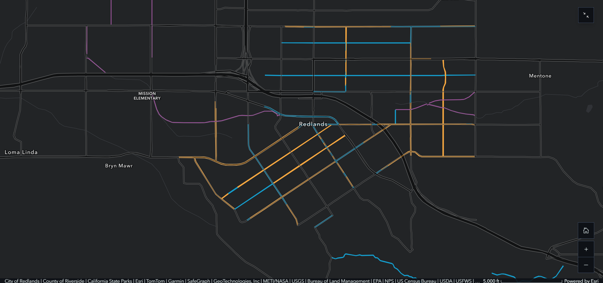
Each year, the City of Redlands hosts their annual Bicycle Classic, bringing people together from around the Inland Empire for a weekend-long event of wheels, competition, and community. Because of its prominent bike culture, the city has made significant investment in its bike lane network. However, gaps still remain.
Esri is pillar of the Redlands community, and we should leverage our technology to not only improve safety within our city, but also across the country to protect our cyclists and bridge the gap between sustainable transportation and safety.
What if cities could see where bike lanes would help the most people, prevent the most risk, and provide the greatest return on investment? Our tool automates that process.
What it does
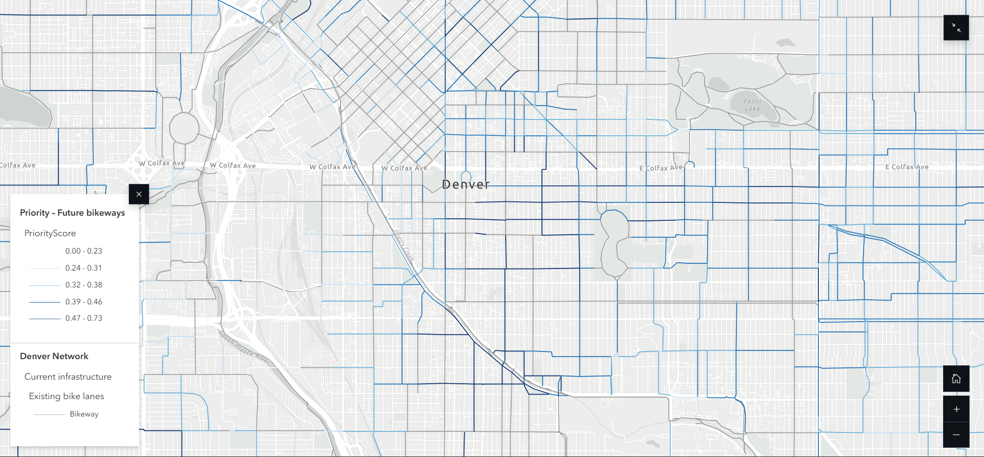
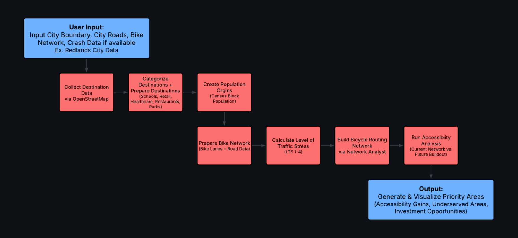
Using ArcGIS, network analysis, crash history, accessibility modeling, and public survey data to identify gaps in the bike lane network, planners can rank bike lanes by impact. Instead of guessing where to build next, projects can be prioritized based on safety, demand, connectivity, and cost.
How we built it
We built a tool using ArcGIS Pro, ArcGIS Network Analyst Toolbox, ArcPy Library, Open Street Map API overpass, ArcGIS Instant Apps, ArcGIS Solutions Assistant, ArcGIS Notebooks, Survey123, and ArcGIS Online to build a Web App for city planners to plane and improve bike lane infrastructure.
Challenges we ran into
- Data management
- Packages available in ArcGIS Pro
- Team reconfiguration
Accomplishments that we're proud of
Despite facing several setbacks leading up to the weekend, we turned our idea into an end-to-end solution. Our developer built the API integrations and geoprocessing workflows, our geographer designed the GIS analysis and web application with an integrated AI assistant, and our entrepreneurs developed the community survey, public web map, and presentation materials. We are proud of the technology, resilience, determination, and teamwork of our group.
What we learned
Have a back-up to the back-up.
What's next for CycleNet
Looking forward, we would like to continue refining the CycleNet workflow using datasets from additional cities so it can be adapted to be used across all metropolitan areas in the country. By continuing to train the Assistant, we can also develop it to handle complex questions. We would also like to package the current notebook-based workflow into a single toolbox, creating a more streamlined solution for city planners.
Built With
- arcgisinstantapps
- arcgisnetworkanalyst
- arcgisnotebooks
- arcgisonline
- arcgispro
- arcgissolutionsassistant
- arcpylibrary
- openstreetmapapioverpass
- survey123


Log in or sign up for Devpost to join the conversation.