-
-
PinHelp
-
Tech Flow
-
Logo
Inspiration
Communities are filled with organizations working to make a difference and people who want to help, yet connecting those resources with community needs remains surprisingly difficult. This challenge became especially clear when one of our team members, Julia, conducted GIS research using network analysis and public transportation data to map access to community fridges, food pantries, hot meal services, and community gardens. Through that work, she saw firsthand how dispersed critical resources can be and how accessibility barriers often prevent people from reaching the services they need. In addition, many nonprofits struggle to gain visibility and communicate their most urgent needs, while donors and volunteers often don't know where their support can have the greatest impact.
As a team, we saw an opportunity to use GIS and location intelligence not only to visualize community resources, but also to better connect nonprofits, donors, volunteers, and local communities. PinHelp was created to bridge that gap by combining mapping, community demographics, and accessibility analysis into a single platform that makes nonprofit needs more visible, accessible, and actionable.
What it does
PinHelp is a GIS-powered web application that helps nonprofit organizations connect with donors, volunteers, and community members.
Organizations can:
- Create profiles
- Display their location on an interactive map
- Share their mission and services
- Post specific donation needs
Community members can:
- Discover nonprofits near them
- Search by cause or organization type
- View requested donation items
- Explore community demographic information
- Calculate drive times and accessibility to nonprofit locations
Using ArcGIS technology, PinHelp transforms a traditional nonprofit directory into a geographic community engagement platform that helps users identify where support is needed and how they can make an impact locally.
How we built it
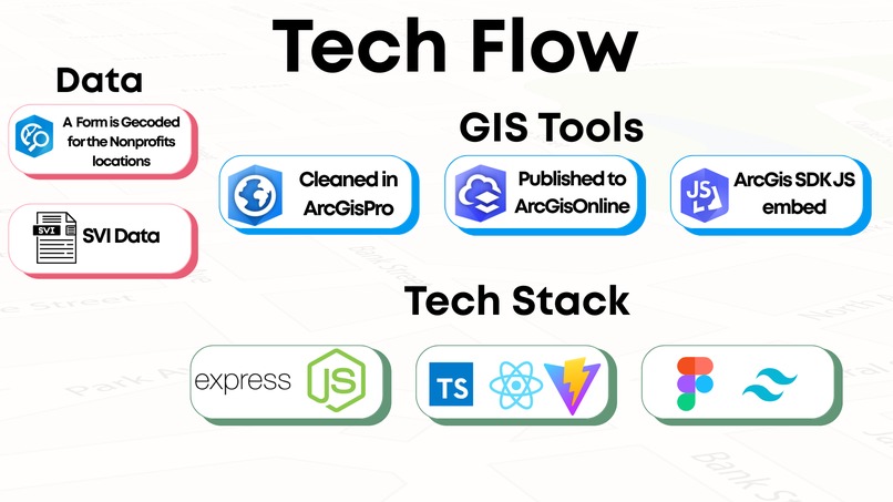
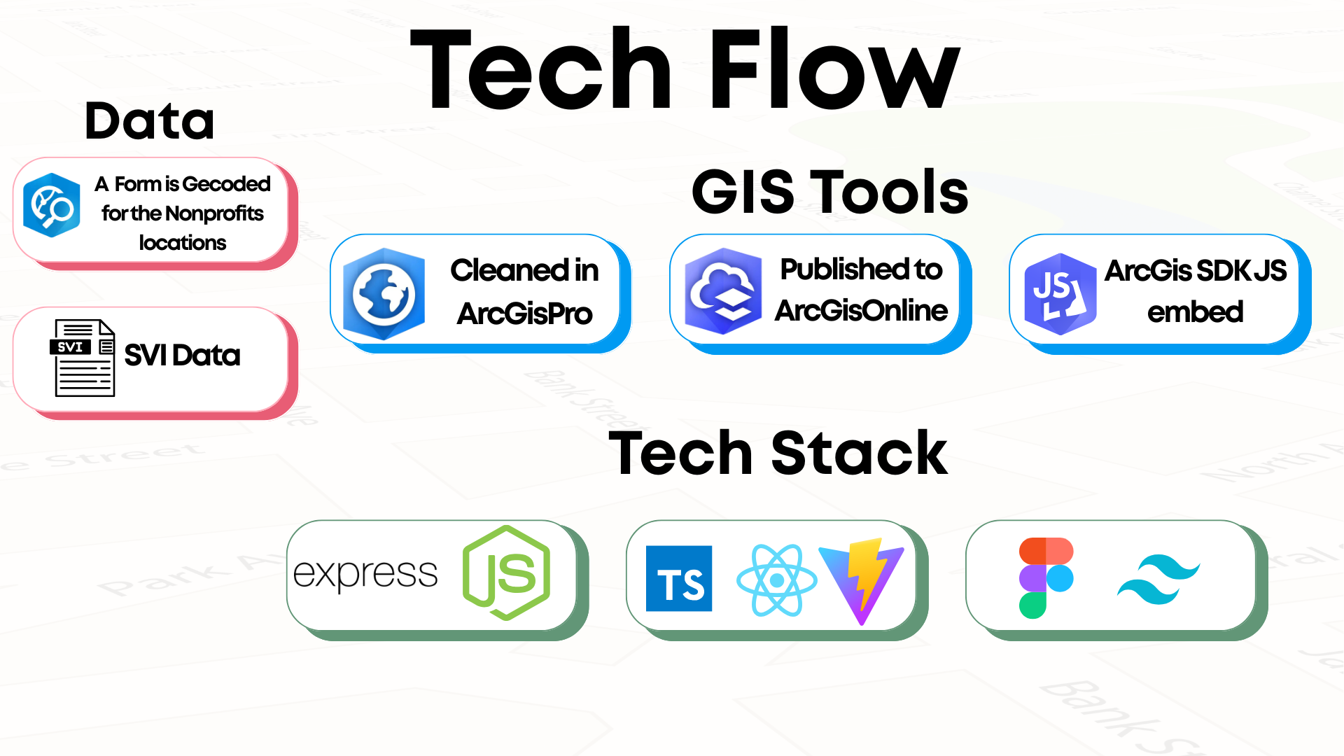
PinHelp was built using Esri's ArcGIS ecosystem combined with modern web development technologies.
Frontend:
- React
- Tailwind CSS
- ArcGIS
- Javascript SDK
Backend:
- Express js
- ArcGIS Javascript SDK
- REST APis (request, geocoding, routing, feature-service)
- csv files
We designed the application around a map-first experience, allowing users to visually explore nonprofit organizations, community needs, and accessibility information within a single interface.
Challenges we ran into
One of the biggest challenges was balancing powerful GIS capabilities with a user-friendly experience. We wanted PinHelp to provide meaningful geographic insights without overwhelming users who may have little or no GIS experience. Along the way, we worked through challenges related to sourcing reliable nonprofit data, integrating demographic information, and designing a platform that effectively serves both nonprofits seeking support and community members looking to help
Accomplishments that we're proud of
We are proud that PinHelp goes beyond simply mapping nonprofit organizations by combining nonprofit discovery with location intelligence and community insights. The platform makes donation opportunities easier to find and understand while providing valuable context through demographic and drive-time analysis. Most importantly, we transformed an idea centered on community connection into a functional solution that demonstrates how GIS can drive meaningful social impact.
What we learned
Throughout this project, we learned how powerful GIS becomes when it is woven directly into the decision-making process. Building PinHelp reinforced the importance of combining data, analysis, and user experience into a seamless workflow that helps people move from information to action. We gained valuable experience integrating multiple ArcGIS products into a single application, balancing technical capabilities with usability, and translating geographic insights into real-world outcomes. Most importantly, we saw how GIS provides a foundation for solving complex challenges across industries by revealing patterns, adding critical context, and empowering more informed decisions
What's next for PinHelp
Future enhancements include:
- Real-Time Nonprofit Management: Allow nonprofits to create accounts and directly update donation needs, events, and organization information.
- Intelligent Matching: Use AI and GIS analysis to recommend nonprofits based on user interests, location, donation history, and community needs.
- Resource Gap Analysis: Identify underserved areas and highlight where additional nonprofit services could create the most impact.
- Partnership Discovery: Help organizations discover nearby nonprofits, businesses, and government agencies for collaboration opportunities.
- Mobile Experience: Develop a mobile-first experience that allows users to discover and support local organizations on the go.
- Community Impact Dashboard: Track donations, volunteer contributions, and community outcomes through interactive dashboards and reporting tools.
Ultimately, we envision PinHelp becoming a geographic hub for local impact to help communities understand their needs, connect resources with opportunities, and strengthen the network of organizations working to make a difference.
PinHelp demonstrates how GIS can move beyond mapping places to connecting people, organizations, and resources through a shared understanding of community needs.
Built With
- arcgisjavascriptsdk
- arcgisonline
- arcgispro
- arcgisrestapis
- canva
- csv.files
- excel
- express.js
- figma
- react
- tailwindcss


Log in or sign up for Devpost to join the conversation.