-
-

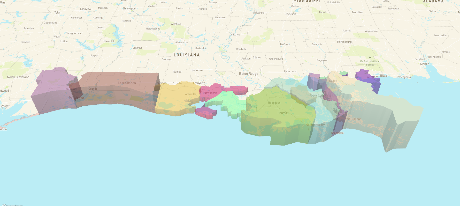
Example of our Mapbox Interactive Map
-

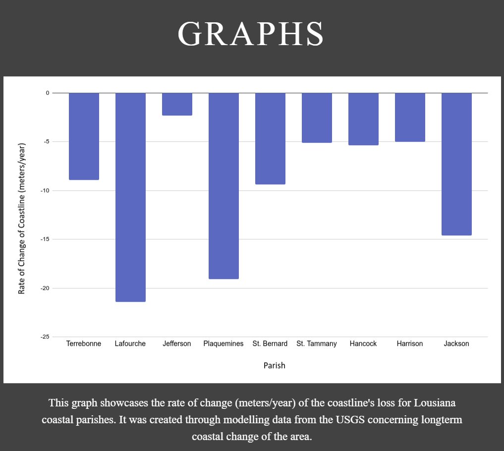
Graph showing Coastal Erosion for Louisiana Parishes
Inspiration
Our inspiration for this project was coastal erosion being an ecological phenomenon that affects many people, both in our local communities and across the globe.
What it does
Our project is a website that is intended to educate users using an interactive map & website combo to learn information about coastal erosion and how it affects the communities that live in those regions.
How we built it
We built this tool through the use of Figma, HTML, and CSS for the frontend in conjunction with the Mapbox API and Javascript for the backend.
Challenges we ran into
We ran into challenges finding data to model to make the included map interactive with the userbase and adding conditions for the Mapbox API to use so that all the layers were displayed properly.
Accomplishments that we're proud of
We are most proud of the interactivity of the website because it better showcases the monumental issue that is erosion in a way that interests the user.
What we learned
We learned the process to create an application, from designing the website to working on the backend everything/everybody needs to be on the same pages so that the user gets the best experience possible.
What's next for Coastal Erosion, What it is and Why it Matters
Our next steps would be to model more data for different states so that we can emphasize that coastal erosion is not just a local issue but one that affects people nationally. This would entail repeating the process that we followed for the test state, Louisiana, for all the coastal states.


Log in or sign up for Devpost to join the conversation.