
Inspiration
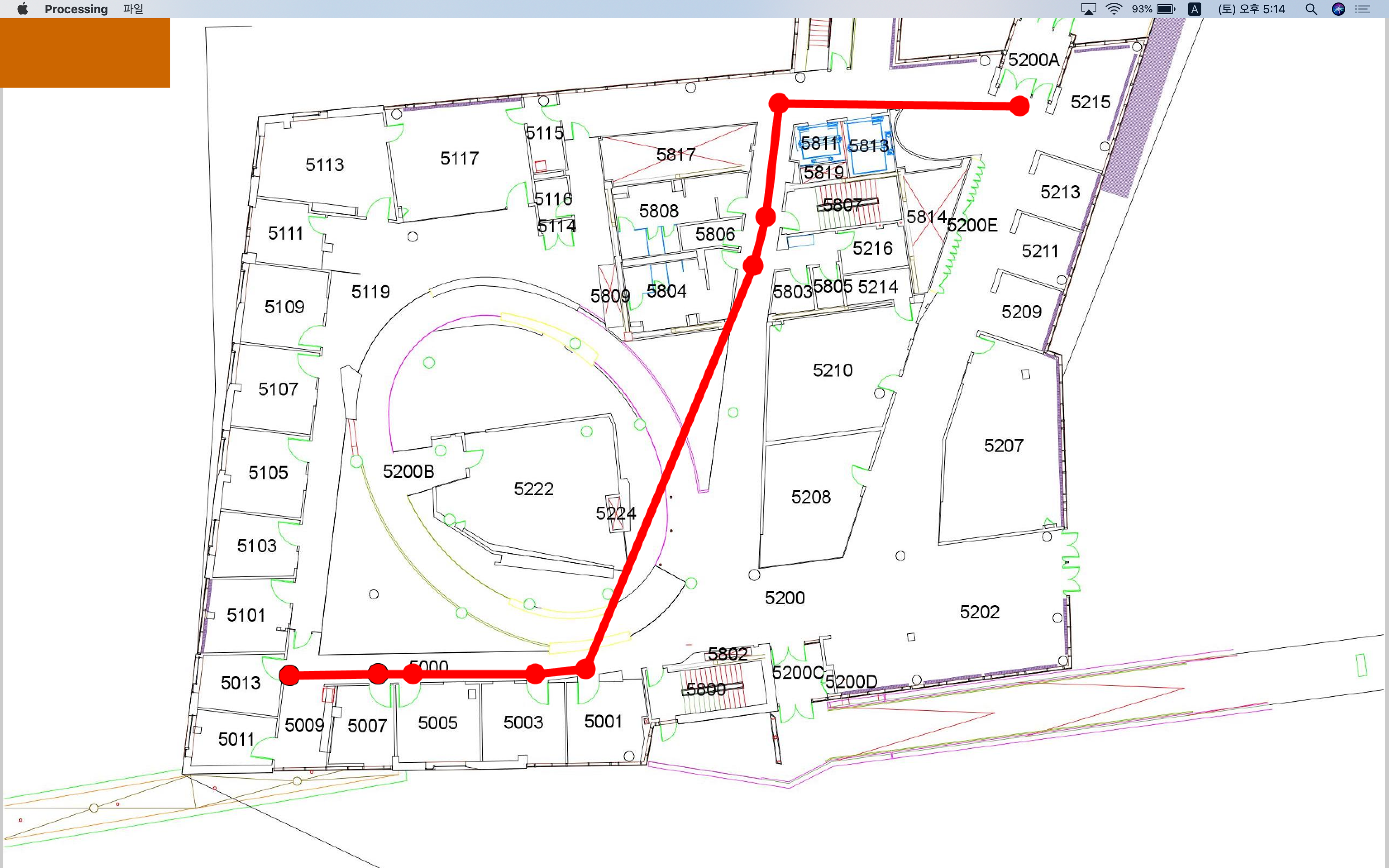
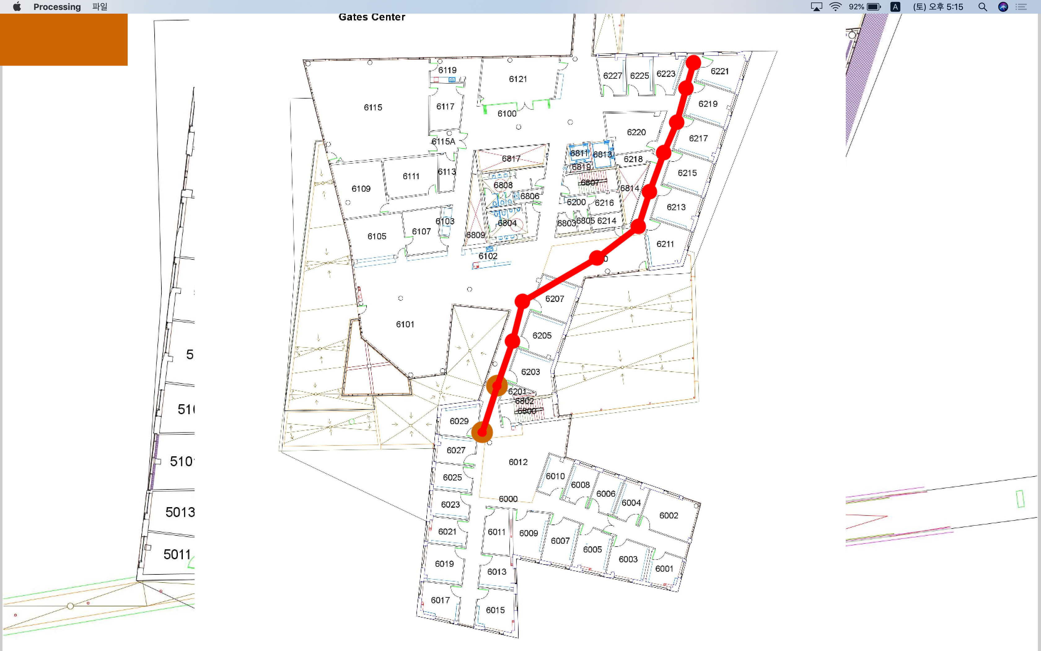
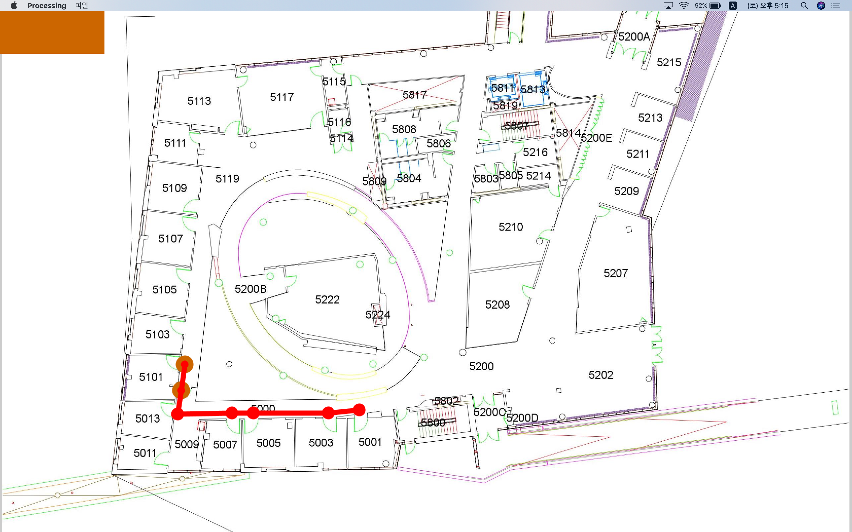
When you leave for a class, you usually have a set route on how to get there in the most efficient way possible. Unfortunately though, sometimes these routes are not obvious to new students or temporary visitors who can get lost in winding corridors and confusing room numbering systems. At Carnegie Mellon University, it might be hard traveling in the Gates and Hillman Center(GHC) building in particular. It's important for students and even visitors to easily navigate the building in an efficient and timely manner to arrive at their destination. Getting stuck in student traffic and people walking slowly can make you become late to a class; So, we created CMU Maps specifically for GHC to solve that problem! With this application, people can use an optimal route to travel to their destination punctually.
What it does
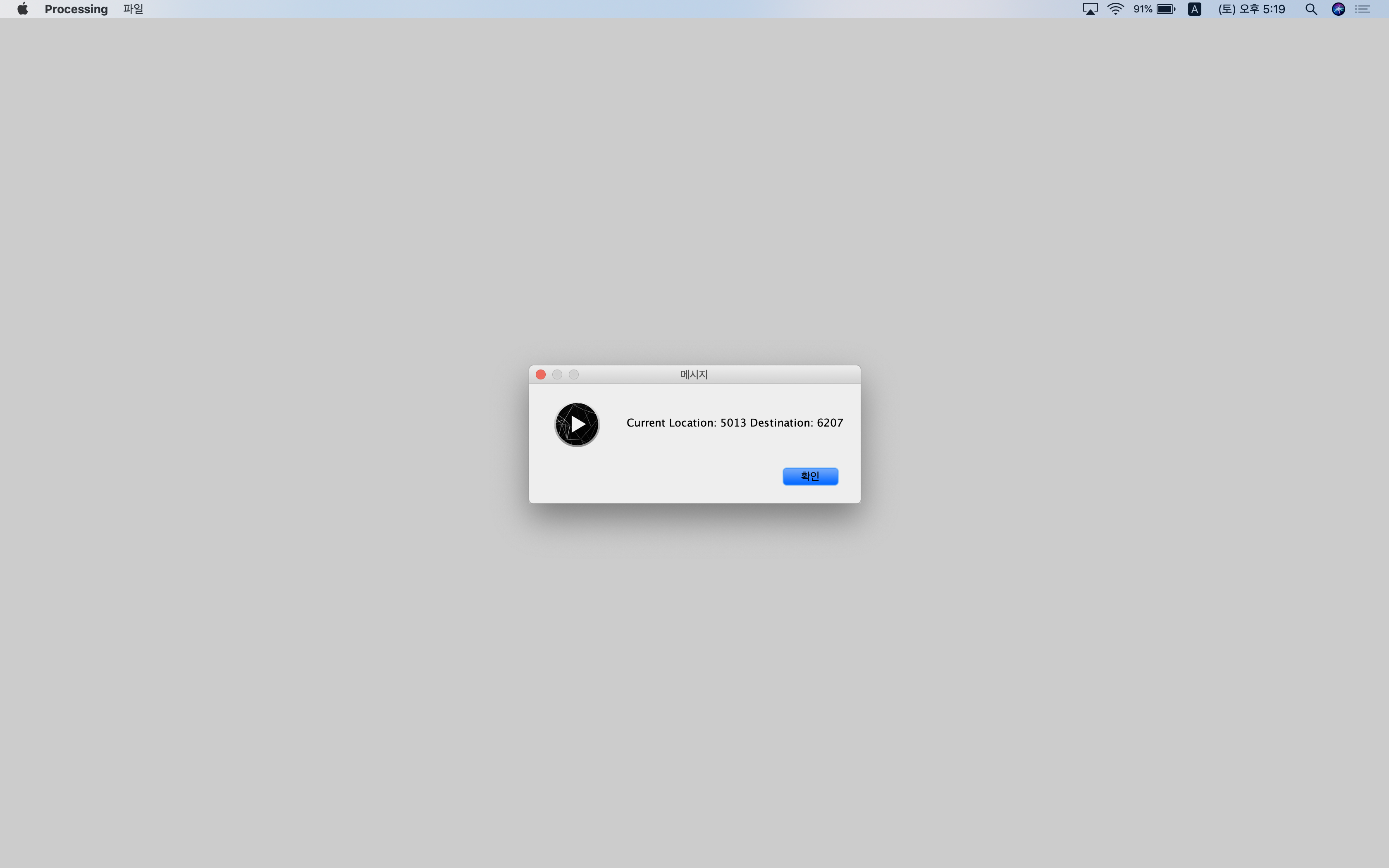
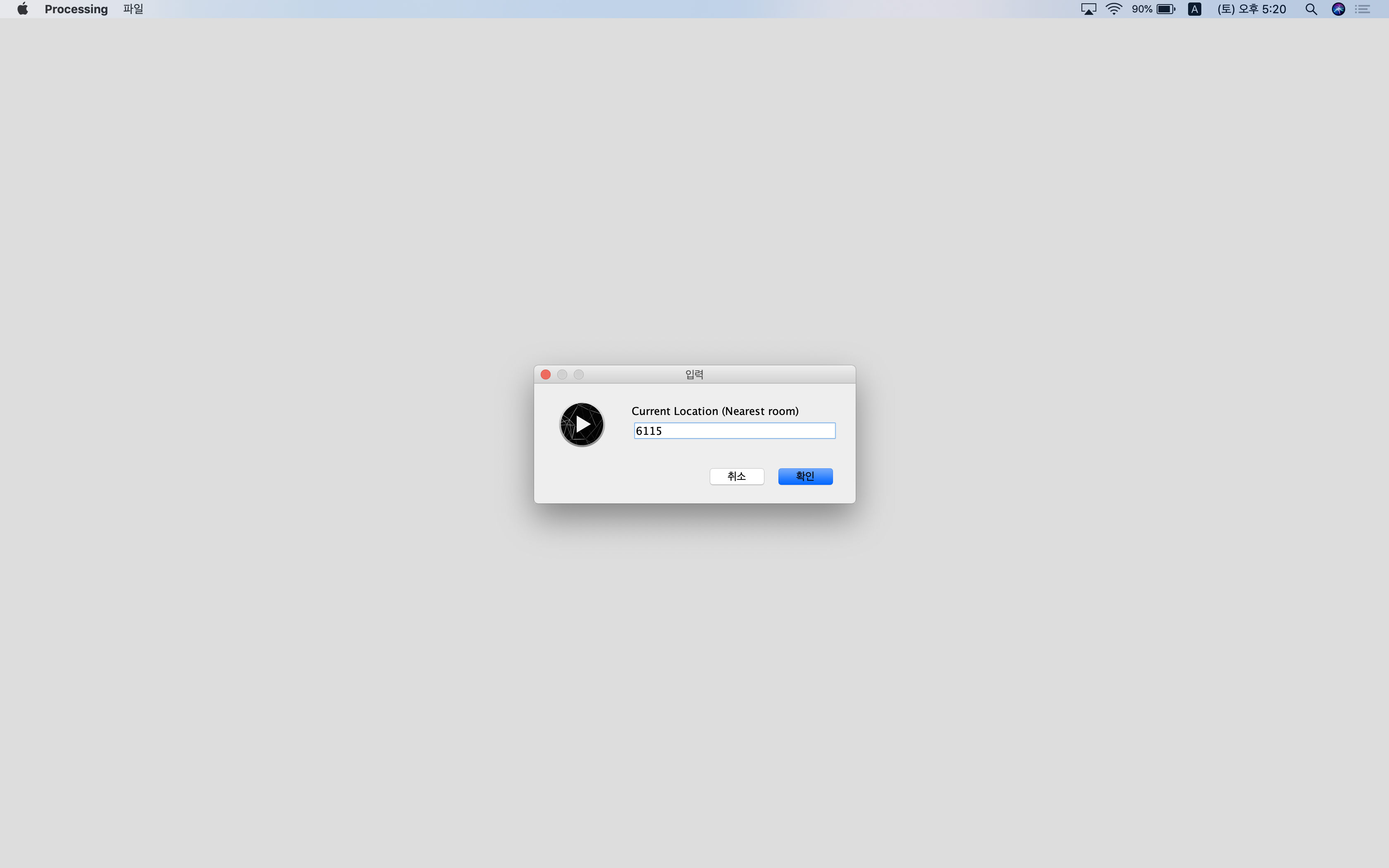
CMU Maps acts as a new map location platform for students and visitors to navigate their way in the GHC building. Once on the website, you can select what floor and location you want to arrive to. The application puts into consideration the optimal route and whether if there is suggested student traffic or not. You input where you're located at and the application calculates the suggested steps and time it takes for you to arrive at your location.
How we built it
We built CMU Maps using Dijkstra's algorithm in Python and graph theory. We also utilized HTML, CSS and Google Storage data for our data. Alex and Dongkyuk worked on the back end of the application. Annie and Youssef worked on the front end to design the application.
Challenges and What we Learned in the Process
Since our algorithm kept large and numerous tracks of data, we had to test every one of them out to see if the optimal route worked. This took us a while to debug and fix the coding for that. We needed a platform that can run our application efficiently but we weren't quite sure what. At first, we decided to use PhoneGap to make a phone app, but we were not able to translate our code into Javascript within the time constraints provided. We were trying to use Python to create the visualization app in a stand-alone mobile application. Alex wasn't sure how to size the maps out, so we decided to simply make a website application instead.
Accomplishments that we're proud of
Collaborating and sharing the work efficiently. While not all of us were deeply exposed to the tools we incorporated in the creation of our project, through hard work and some significant googling we were able to accomplish our goals and learn a lot in the process. We're happy that we agreed on a topic that all of us can contribute to and learn new things we never knew about. Most imperatively, we're proud that we made something potentially useful to CMU students and that can be developed and further improved upon.
What's next for CMU Maps
This project allowed us to explore an up and coming idea that has the potential to transform the way we travel in school buildings.


Log in or sign up for Devpost to join the conversation.