-
-
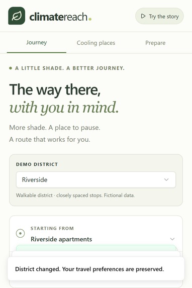
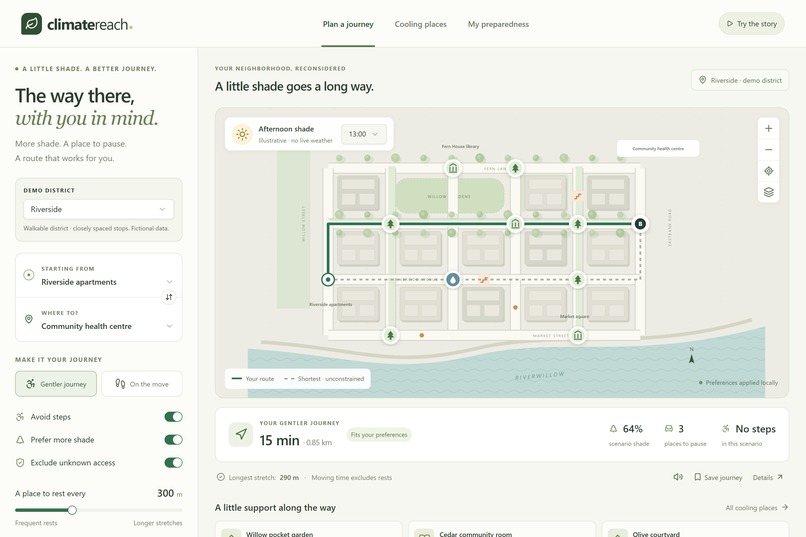
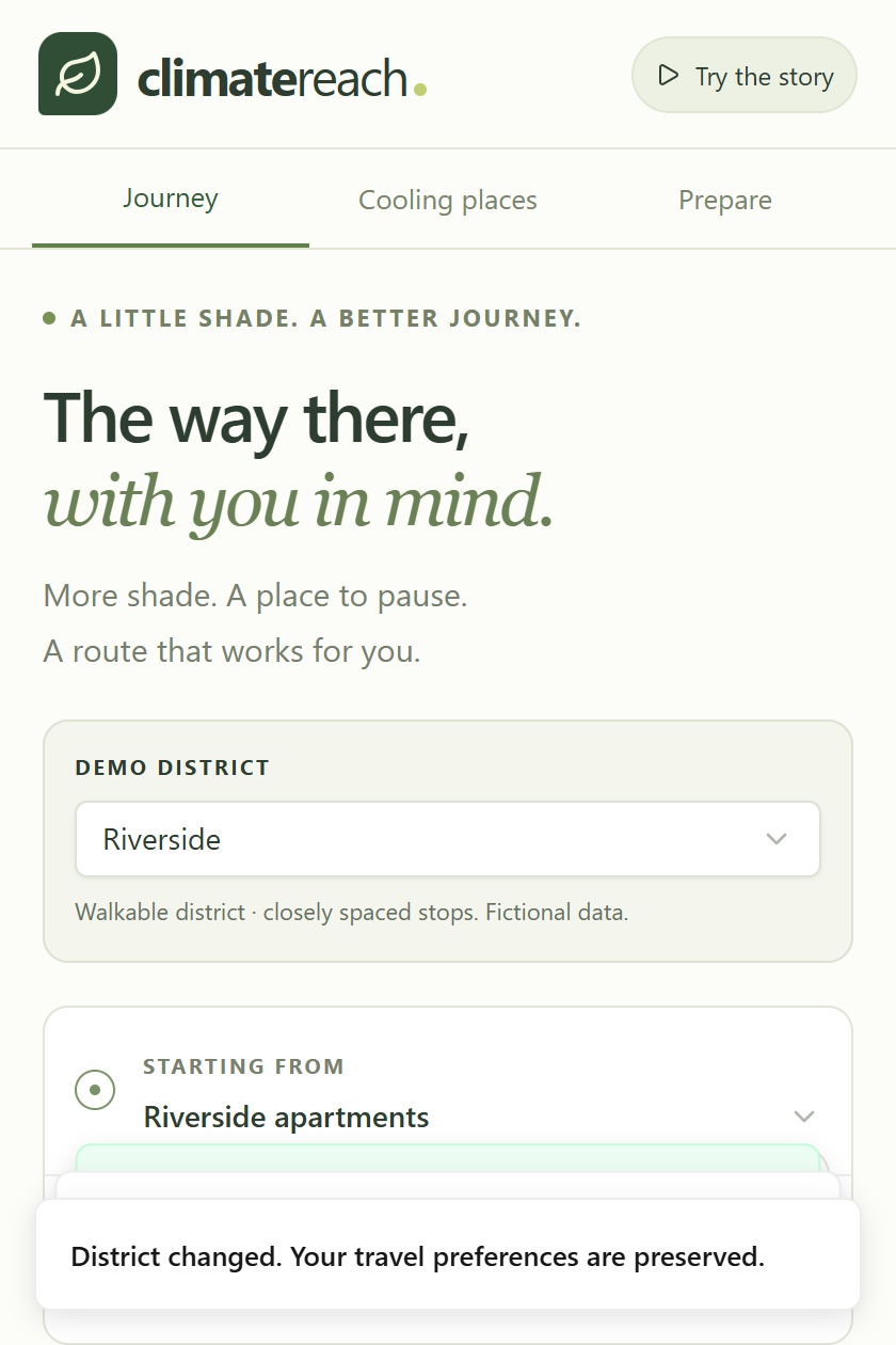
Mobile-first responsive interface: optimized for pedestrians navigating extreme heat outdoors with keyboard and touch accessibility.
-
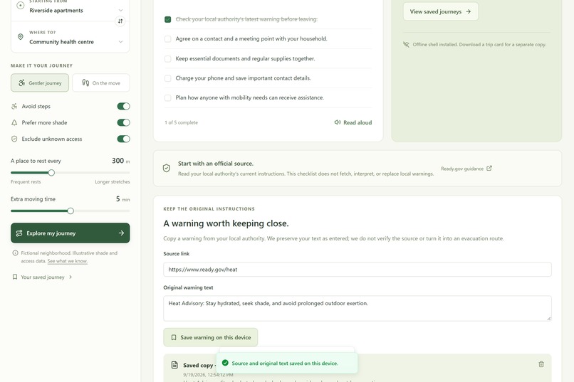
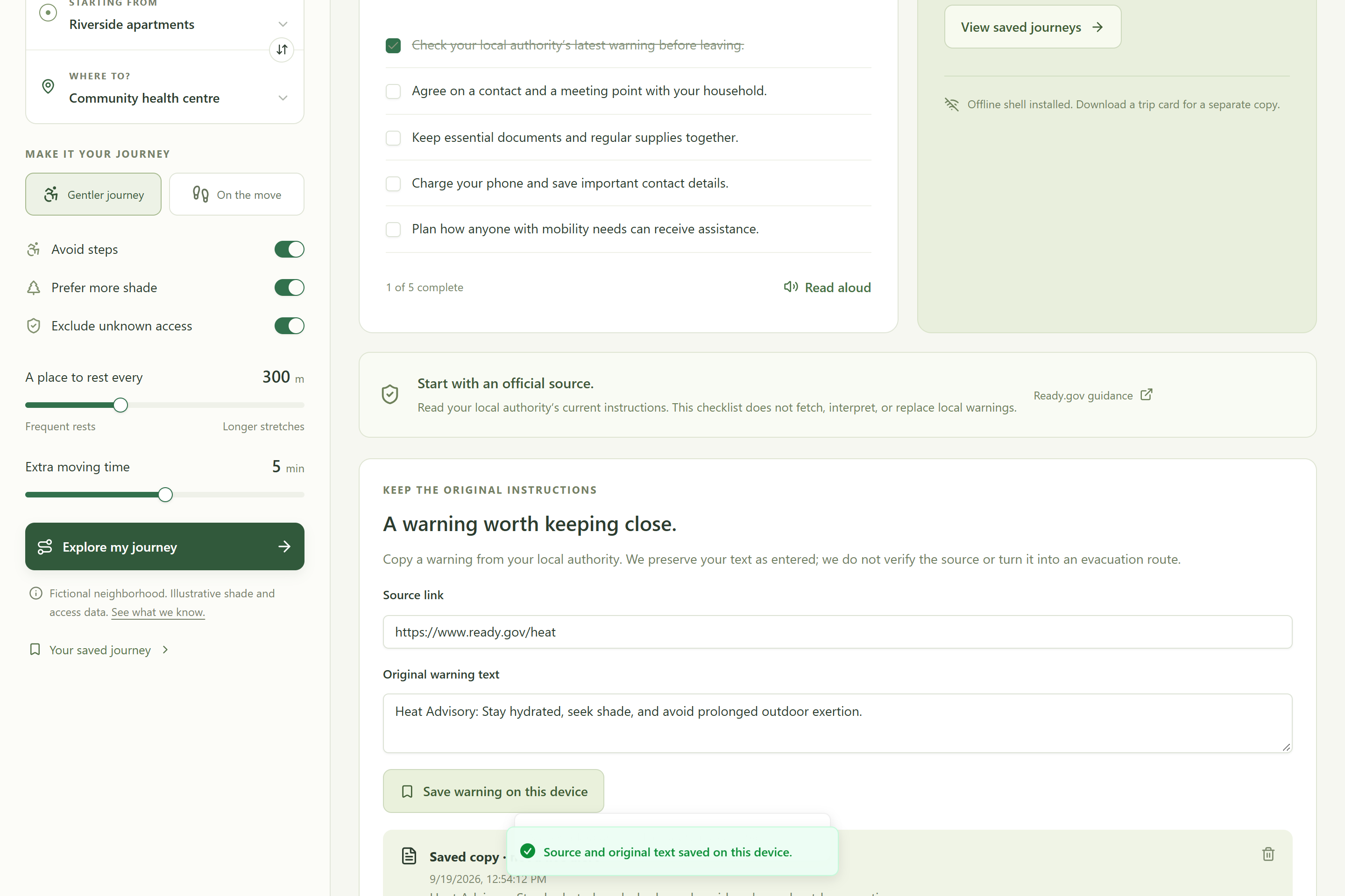
On-device emergency readiness: household checklists and source-verified heat warnings saved locally for 100% offline access.
-
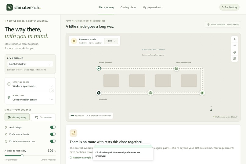
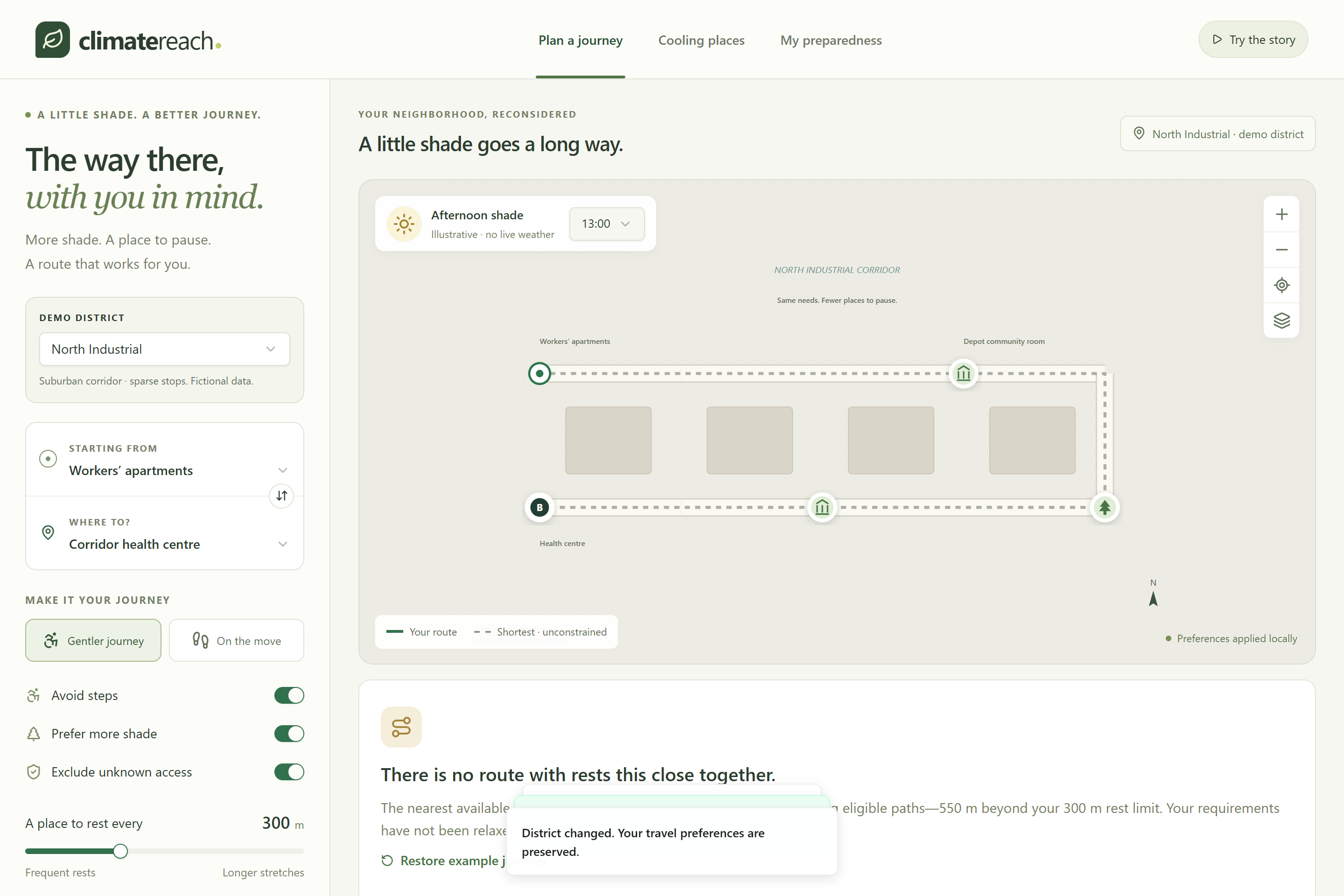
District infrastructure analysis: identifying underserved areas where the nearest seated rest stop is 850m away (550m shortfall).
-
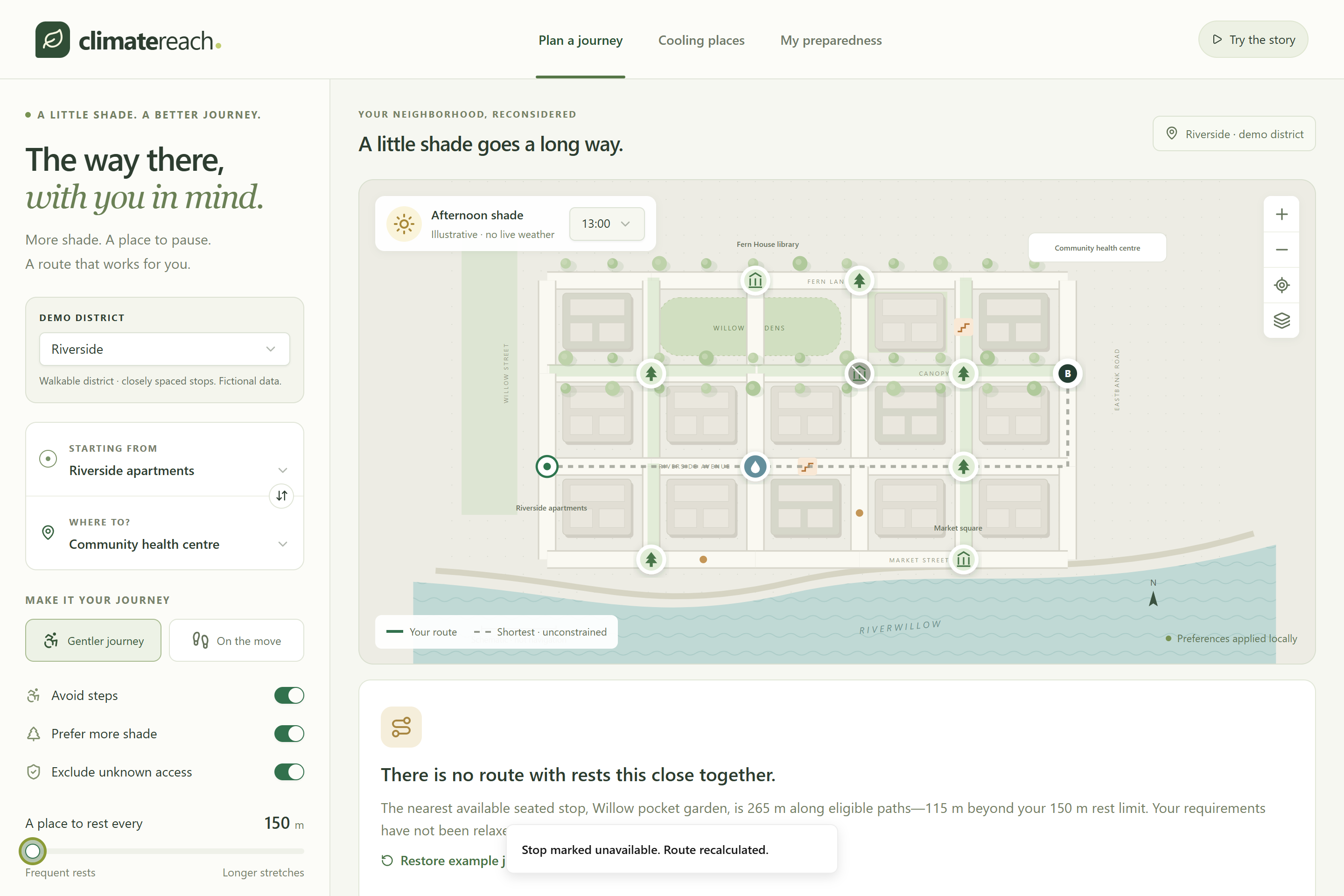
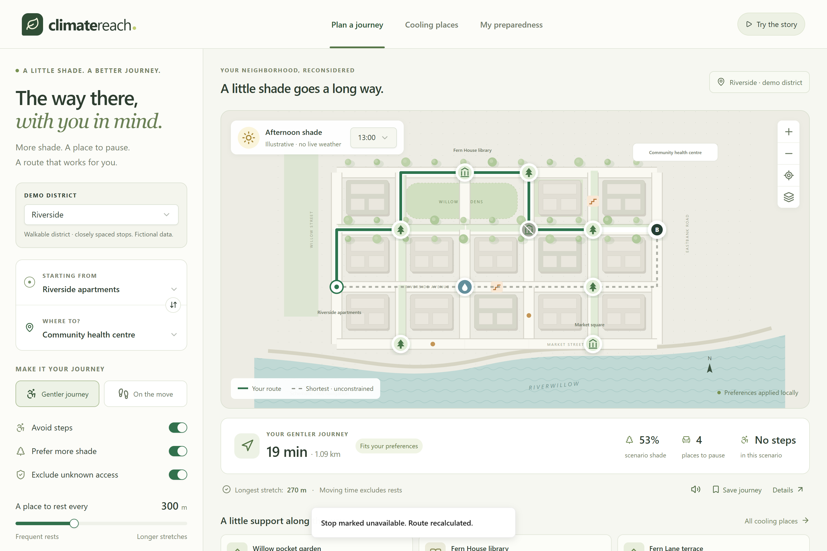
Dynamic closure rerouting: when a cooling shelter closes, the engine recomputes an alternate route without relaxing rest limits.
-
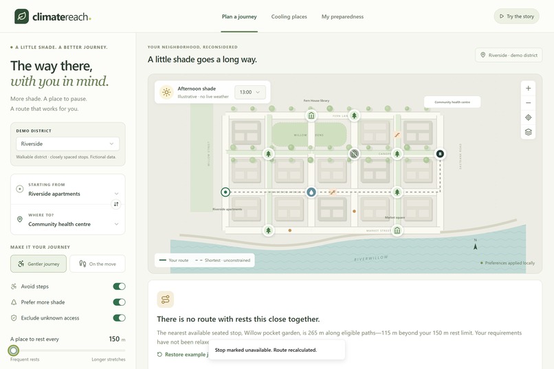
Explicit constraint feedback: if a 150m rest limit cannot be safely met, the app explains why rather than forcing an unsafe journey.
-
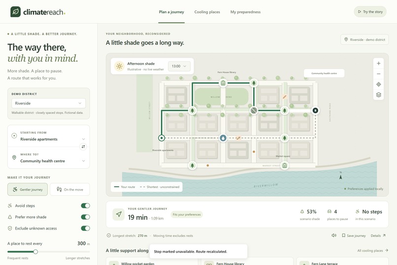
Shade-aware journey planning: routes prioritize tree canopies, step-free access, and a 300m maximum interval between rest stops.

Inspiration
Climate-adaptation advice is only useful when people can actually act on it. An essential journey—like walking to a health center or grocery store during extreme heat—can become hazardous when someone needs frequent rests, cannot take stairs, or is sensitive to heat exposure. Most mapping apps only calculate the fastest or shortest path, ignoring physical human constraints. We built ClimateReach to plan journeys around shade corridors, maximum walking limits, step-free access, and verified places to rest.
What it does
- Constraint-Aware Route Solver: Computes walking routes bounded by hard rest-distance intervals (e.g. max 300m without resting), step avoidance, and shade preferences over time-of-day solar windows.
- Dynamic Closure Rerouting: If a community cooling center or park bench closes, the route instantly recalculates via alternative safe stops. If no route meets the person's needs, the planner explicitly explains why rather than silently forcing an unsafe walk.
- District Shortfall Demonstration: Compares a well-shaded neighborhood (Riverside) with an underserved area (North Industrial), mathematically demonstrating infrastructure gaps where the nearest seated stop is 850m away.
- 100% Offline Emergency Trip Card: Users can export a standalone, self-contained HTML trip card that works completely offline with zero external network requests.
- On-Device Preparedness: Household checklists and source-linked emergency heat warnings persist locally without surveillance or account sign-ups.
How we built it
- Frontend & UI: Built with Next.js / React 19, TypeScript, Tailwind CSS, accessible Radix UI primitives, and custom interactive SVG neighborhood mapping.
- Algorithmic Engine: Custom deterministic Pareto multi-label graph solver (
lib/routing.ts) optimizing across multi-resource constraints (distance, shade cost, and distance-since-last-rest). - Offline & Storage: Progressive Web App (PWA) service worker shell caching and browser LocalStorage for offline resilience.
Why Deterministic Routing Instead of Generic AI?
We deliberately avoided using an unverified LLM black box for core navigation. When routing vulnerable pedestrians through 40°C heatwaves, a hallucinated or probabilistic path is a genuine safety risk. Navigation constraints must be mathematically guaranteed and provable.
Validation & Testing
- 48-Case Independent Oracle: The multi-label solver is continuously validated against an independent expanded-state reference oracle covering endpoint permutations, rest limits, closures, and detour budgets.
- Sub-Millisecond Execution: Median calculation time of ~0.18ms for instant interactive response.
- Automated Browser Tests: Playwright integration test suite verifying responsive mobile layouts, offline reload persistence, and state transitions with zero runtime errors.
What we learned
Standard single-label shortest-path algorithms (like Dijkstra) fail when resource counters (distance walked since last rest) can reset to zero at designated rest stops. We learned how to formulate this as a Pareto-dominant multi-label search, preserve non-dominated states at junctions, and build rigorous automated validation oracles.
What is next
- Pilot testing in a real municipality with field-verified accessibility surveys and sensor-backed tree canopy shade data.
- Integration with open transit GTFS data to connect walking journeys with air-conditioned public transport.
Build Disclosure
The application framework and reusable UI primitives predate this hackathon. The ClimateReach-specific multi-label routing engine, synthetic district datasets, closure simulation, offline export card, automated test suites, and documentation were authored during this hackathon session.
Built With
- accessibility
- algorithms
- cloudflare-worker
- graph-theory
- nextjs
- pwa
- radix-ui
- react
- service-worker
- tailwindcss
- typescript
- vite


Log in or sign up for Devpost to join the conversation.