🌍 Inspiration
🌾 Climate change is making life harder for farmers. Extreme heat, unexpected rainfall, high humidity, and air pollution can damage crops and reduce harvests.
When farmers experience crop losses, getting insurance or financial support can be slow and difficult. Traditional assessments may take 45–90 days, and verifying damage can be expensive.
💡 We started ClimaSphere AI with one important question:
What if farmers could assess crop damage, check environmental risks, and create secure digital evidence in one place?
Our goal is to make climate risk assessment more transparent, accessible, and easier to verify using environmental data, image processing, and blockchain technology. 🌱🔐
⚡ What ClimaSphere AI Does
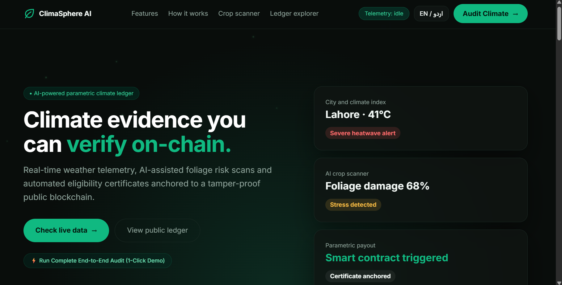
🌍 ClimaSphere AI is a web application that combines environmental monitoring, crop leaf image analysis, risk assessment, and secure digital evidence.
Here is what it offers:
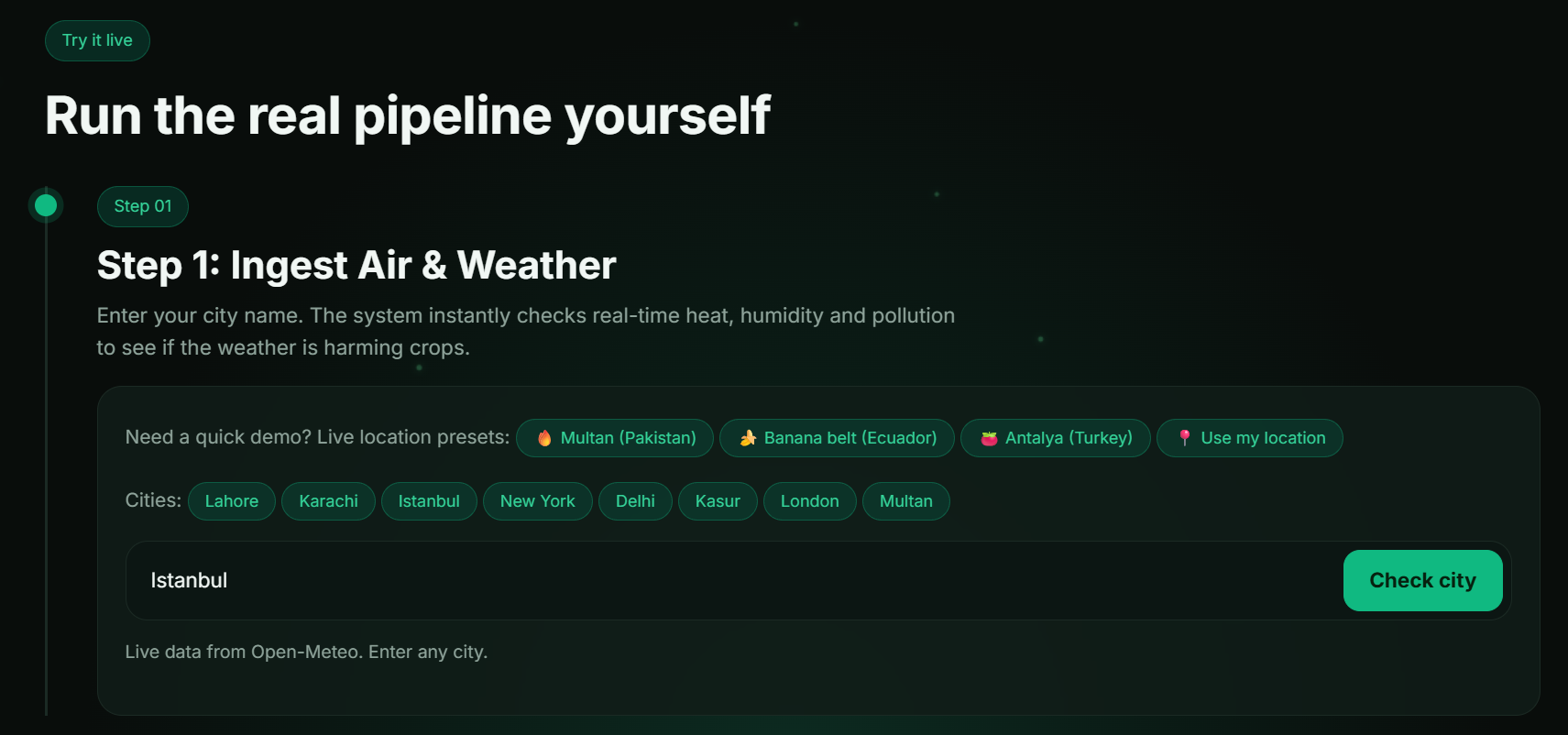
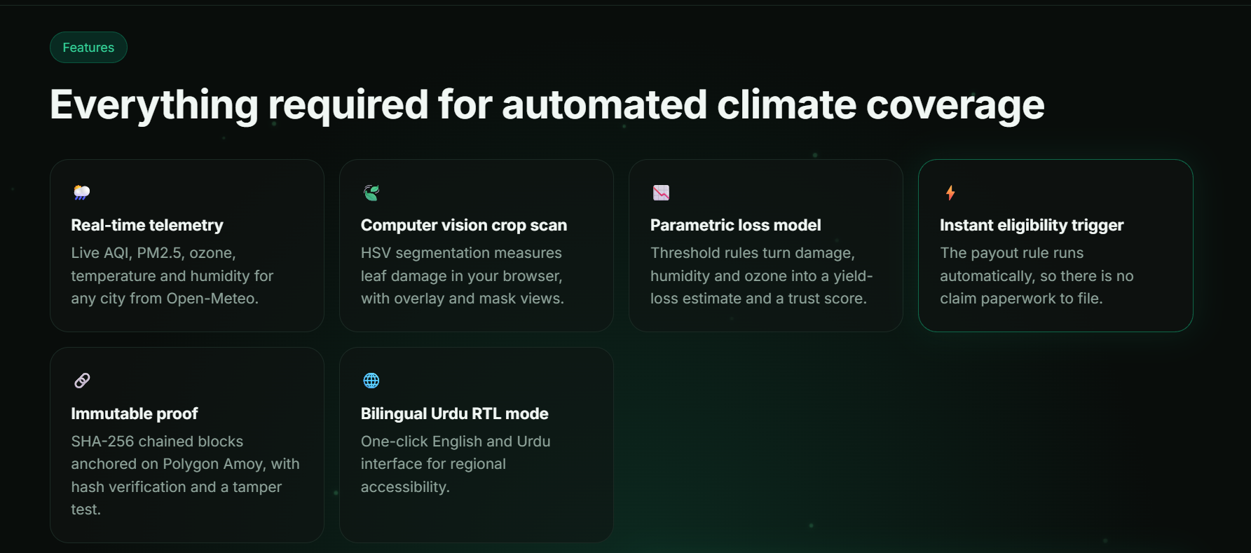
🌦️ Weather and Air Quality Monitoring: Fetches environmental data through Open-Meteo APIs, including temperature, humidity, air pollution, and ground-level ozone.
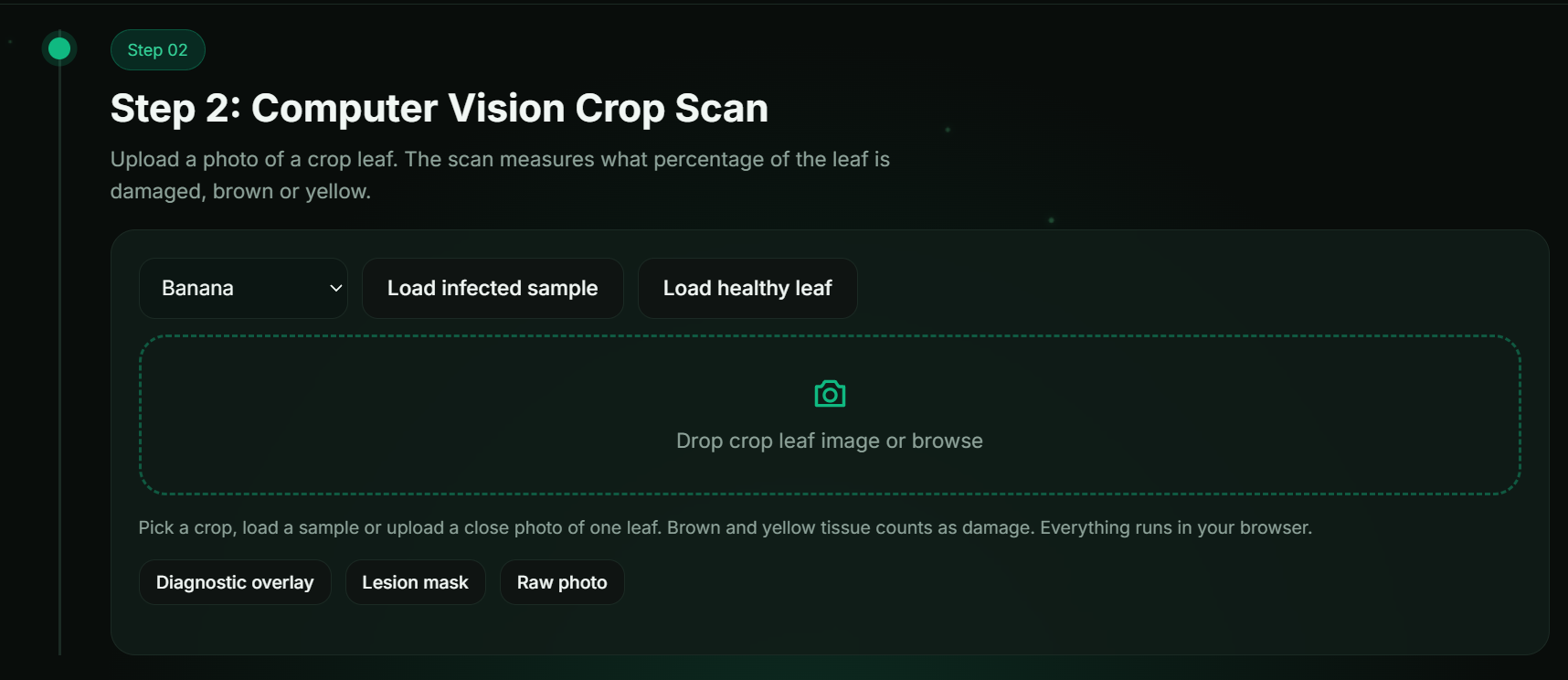
🍃 Crop Leaf Scanner: Analyzes leaf images directly in the browser to estimate visible discoloration using HSV color segmentation. Raw images stay on the user's device during this scanning process. 🔒
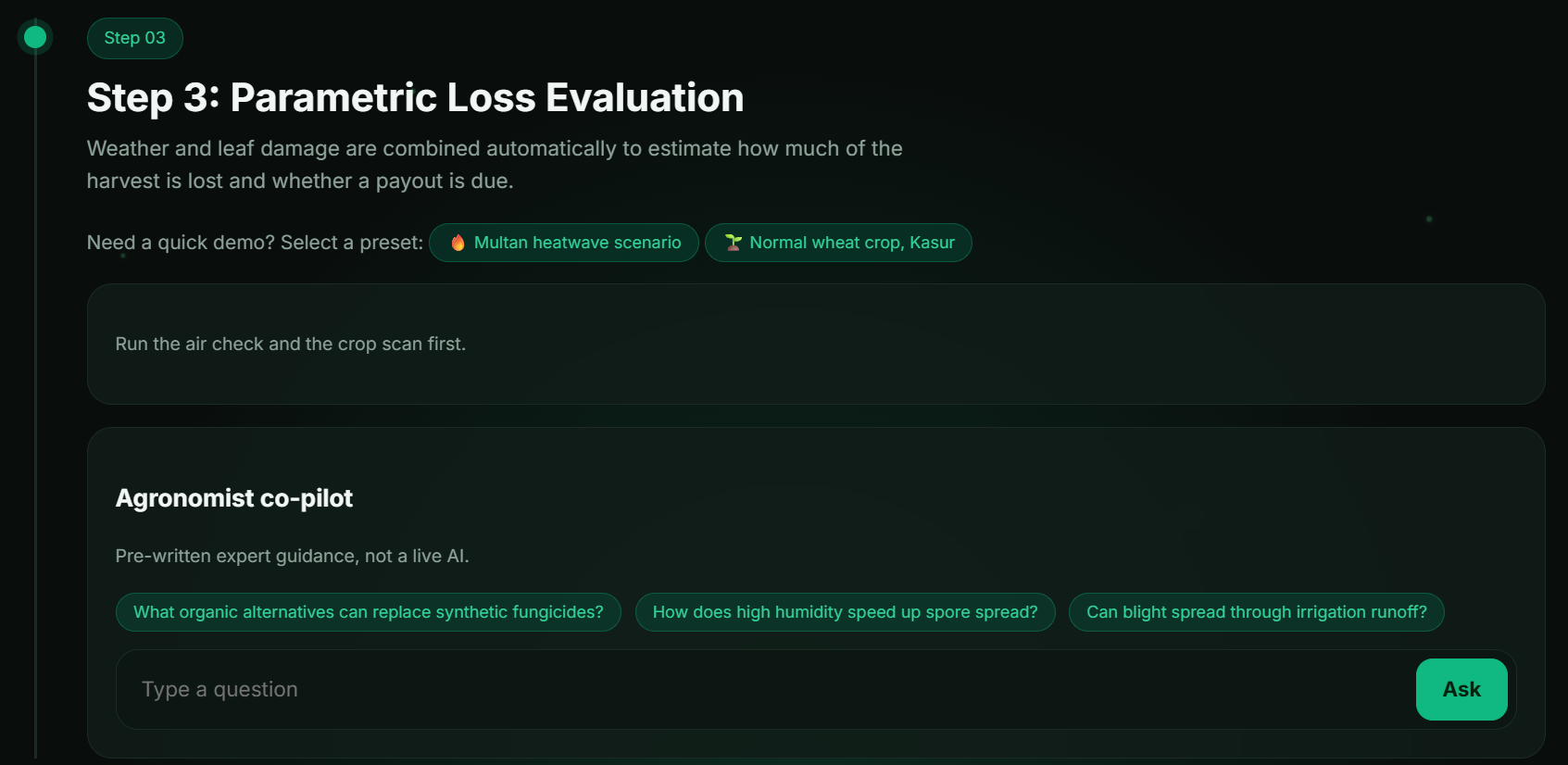
📊 Climate Risk Assessment: Uses clear, predefined rules to estimate visible crop damage and evaluate environmental stress. The results are easier to understand because the system uses explainable thresholds.
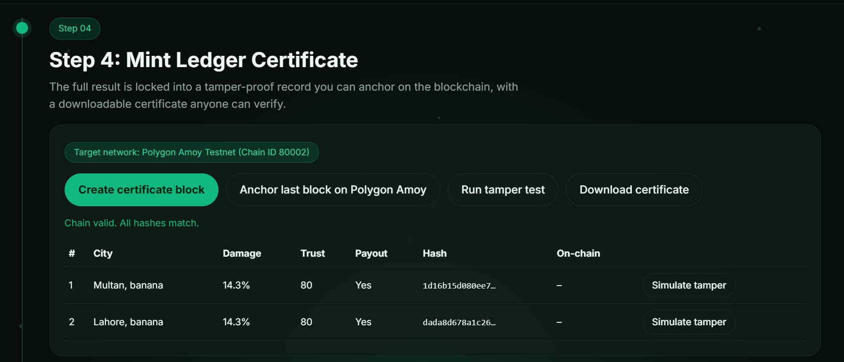
🔐 Digital Evidence Certificates: Creates a unique assessment record and calculates a SHA-256 hash to help detect changes to recorded data.
⛓️ Blockchain Verification: Supports anchoring evidence hashes to the Polygon Amoy testnet, providing an additional way to verify recorded evidence.
🕵️ Tamper Simulation: Lets users change a demonstration record and observe how the hash chain detects changes.
🇵🇰 English and Urdu Support: Offers a bilingual interface with right-to-left Urdu layout, making the application more accessible to regional users.
Our aim is to demonstrate how climate data and secure digital records can support more transparent agricultural risk assessments. 🌎🌾
🛠️ How We Built It
We combined web technologies, environmental APIs, image processing, and cryptography to build ClimaSphere AI.
- 🌐 Frontend: HTML5, CSS3, and JavaScript to build the web application.
- 🎨 UI Styling: Tailwind CSS for interface styling.
- 🌦️ Environmental Data: Open-Meteo APIs for weather and air quality information.
- 🍃 Image Processing: HTML5 Canvas and HSV color segmentation to estimate visible leaf discoloration directly in the browser.
- 🔐 Cryptography: Web Crypto API and SHA-256 hashing to create verifiable evidence records.
- ⛓️ Hash Chain: Links assessment records so changes to earlier records can be detected.
- 📜 Smart Contract: Solidity-based
ClimateLedger.solfor evidence hash anchoring on Polygon Amoy. - 🔗 Blockchain Integration: Ethers.js for interacting with the blockchain.
- 🧪 Testing: Node.js test runner for checking certificate generation, risk rules, and tamper detection.
- 🚀 Deployment: Vercel for hosting the web application.
🧗 Challenges We Ran Into
Building ClimaSphere AI came with several challenges, and each one helped us improve the project.
🔐 Keeping Hashes Consistent: Even small differences in how data is arranged can produce different hashes. We used a fixed field order and consistent data serialization to make certificate verification reliable.
🍃 Processing Crop Images: Leaf images can have different sizes, lighting conditions, and colors. We had to consider how to analyze visible discoloration in the browser without making the application unnecessarily slow.
🇵🇰 Supporting Urdu Properly: Urdu uses a right-to-left layout and needs suitable text spacing and line height. Making the interface readable in both English and Urdu required special attention.
🌱 Avoiding Misleading Results: Visible leaf discoloration does not always mean a specific disease is present. We designed the project to present image analysis as an estimate rather than a confirmed plant disease diagnosis.
⛓️ Making Blockchain Evidence Understandable: Blockchain concepts can be difficult for non-technical users. The tamper simulation helps demonstrate how hash chaining can reveal changes in recorded evidence.
🏆 Accomplishments That We're Proud Of
We are proud to have brought several important features together in one working prototype. 🎉
- 🌍 Built a platform that combines environmental monitoring, crop image analysis, and climate risk assessment.
- 🍃 Created a browser-based leaf scanner that processes raw images locally.
- 🔐 Implemented SHA-256 evidence hashing and a tamper-evident local hash chain.
- 🕵️ Added an interactive tamper simulation to demonstrate how changes can be detected.
- ⛓️ Added support for blockchain evidence anchoring through Polygon Amoy.
- 🇵🇰 Developed an interface with English and Urdu language support.
- 🧪 Created automated tests for certificate validation, risk rules, and hash chain behavior.
Most importantly, we turned our idea into an interactive prototype that demonstrates how environmental information and cryptographic verification can work together. 🌱💻
📚 What We Learned
This project taught us valuable lessons about building practical technology for real-world problems.
🌦️ Environmental data matters: Weather and air quality measurements can provide useful context when assessing climate-related agricultural risks.
🔐 Data integrity is important: Consistent data formatting and cryptographic hashing are essential when creating records that need to be verified later.
⛓️ Blockchain has specific strengths and limits: It can help verify recorded hashes, but it cannot prove that the original data was accurate.
🍃 Image analysis requires care: Visible discoloration can be measured, but reliable disease identification requires more advanced methods and proper validation.
🌐 Accessibility matters: Supporting local languages can make technical tools easier for more people to use.
💡 Simple explanations build trust: Clear rules and understandable results help users see how an assessment was produced.
🚀 What's Next for ClimaSphere AI?
We have several ideas for improving ClimaSphere AI in the future. 🌍✨
🛰️ Satellite Data Integration: Explore Sentinel-2 imagery and vegetation indices such as NDVI to provide additional information about crop health.
🌱 Improved Crop Analysis: Test more advanced computer vision models using properly labeled crop images and expert-verified data.
📊 Better Risk Models: Validate the assessment rules using real agricultural observations and local farming conditions.
⛓️ Expanded Blockchain Integration: Explore smart contracts and trusted data sources for more automated evidence verification.
💸 Parametric Relief Systems: Investigate how verified environmental triggers could support insurance or relief workflows, subject to appropriate validation and safeguards.
📱 Offline Accessibility: Explore a progressive web app (PWA) with offline support for users with limited internet connectivity.
💬 SMS-Based Verification: Investigate simple verification receipts for farming communities with limited access to reliable internet.
🌐 Wider Regional Support: Expand language options and adapt the platform for different crops and farming regions.
Our long-term vision is to make climate risk information and verifiable agricultural evidence more accessible, understandable, and useful for farming communities. 🌾💚
Built With
- agritech
- api
- blockchain
- climate
- computer
- cryptography
- css
- insurance
- next.js
- open-meteo
- parametric
- polygon
- react
- sha-256
- tailwind
- tech
- typescript
- vision
- web3


Log in or sign up for Devpost to join the conversation.