Inspiration
We kept asking ourselves why Google Maps can route you across the country but can't tell a wheelchair user if the curb cut at the end of their block is broken: the "last 10 feet" problem affects 26 million Americans daily and nobody had solved it, so we did.
What it does
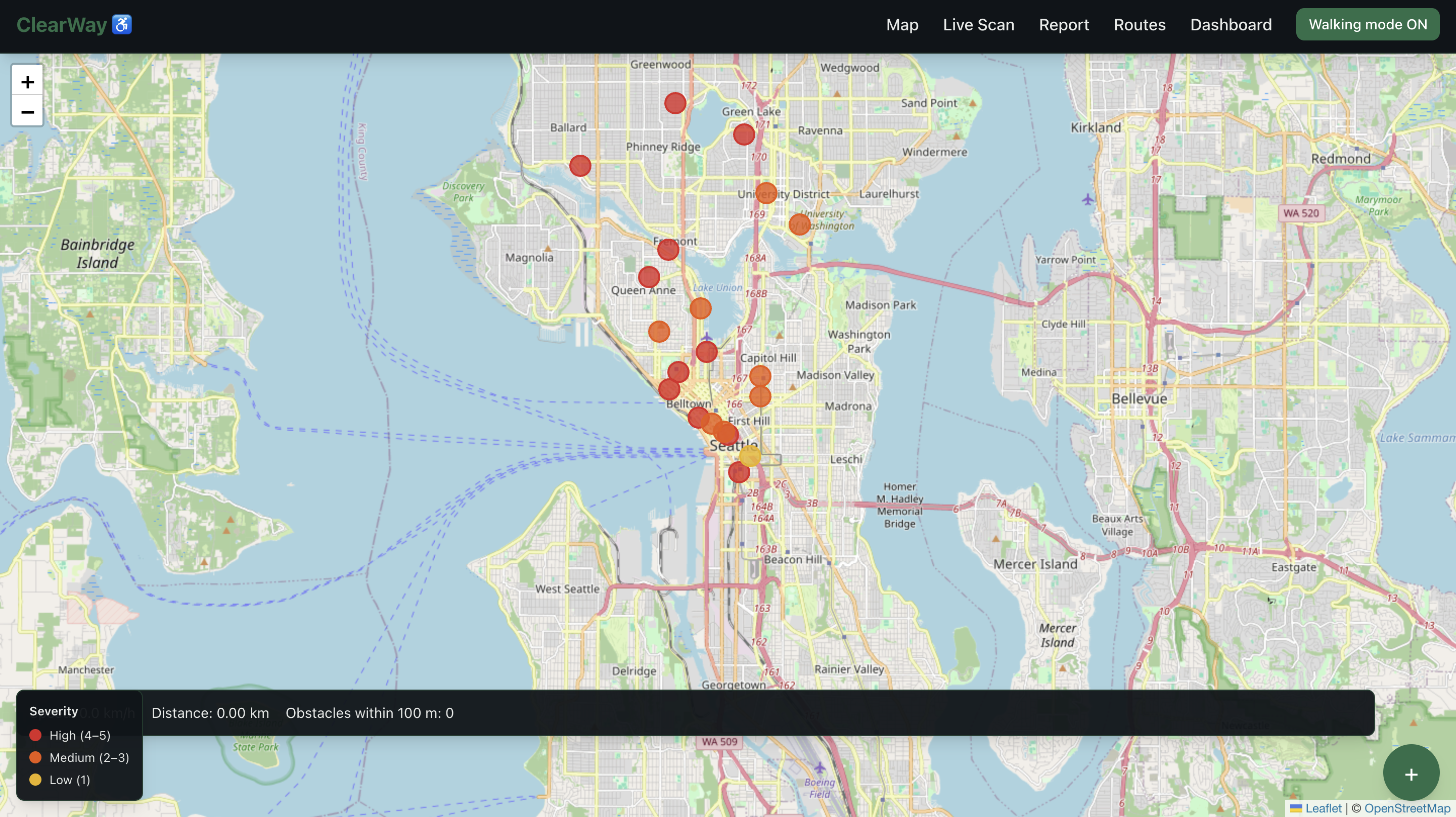
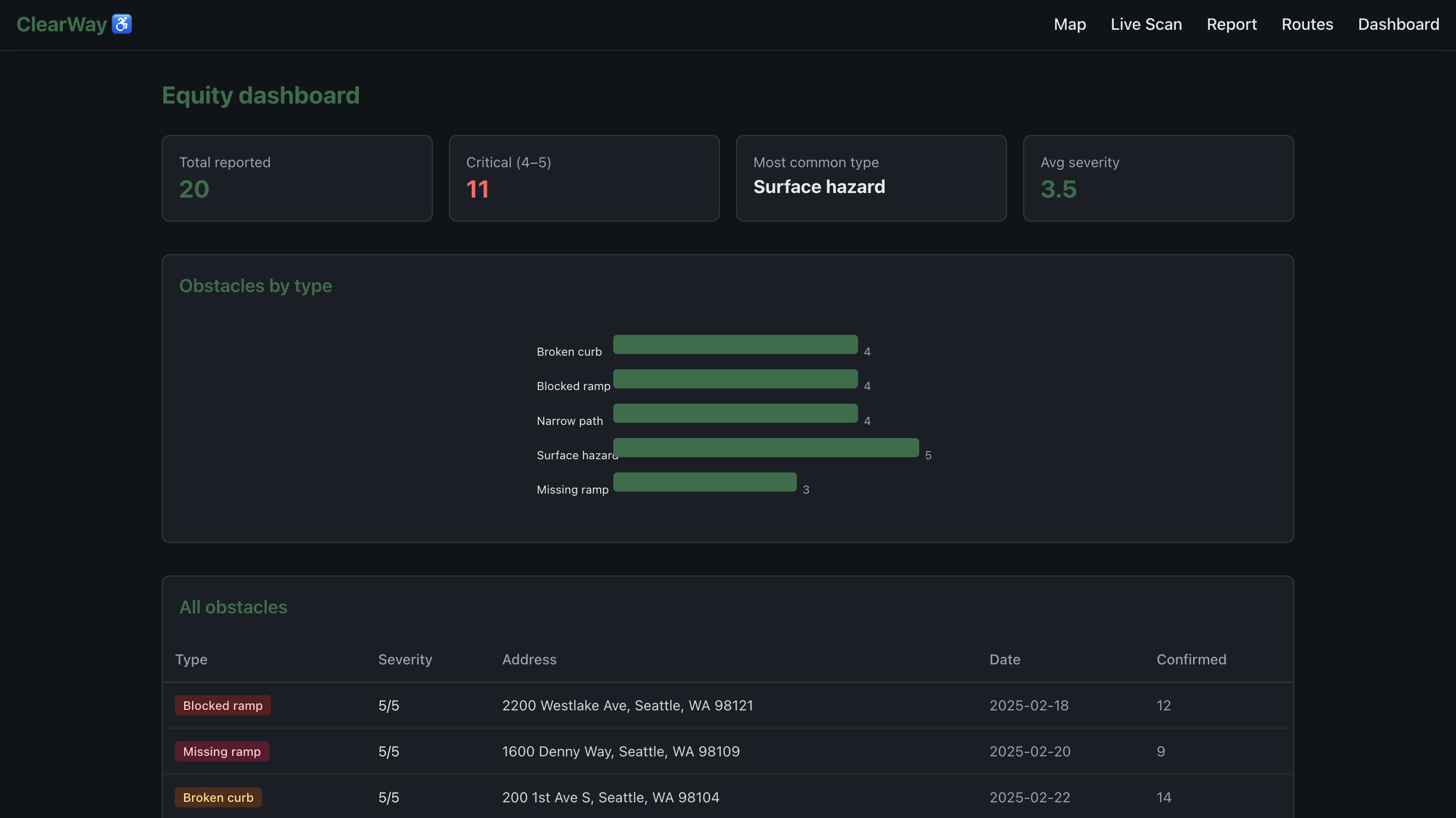
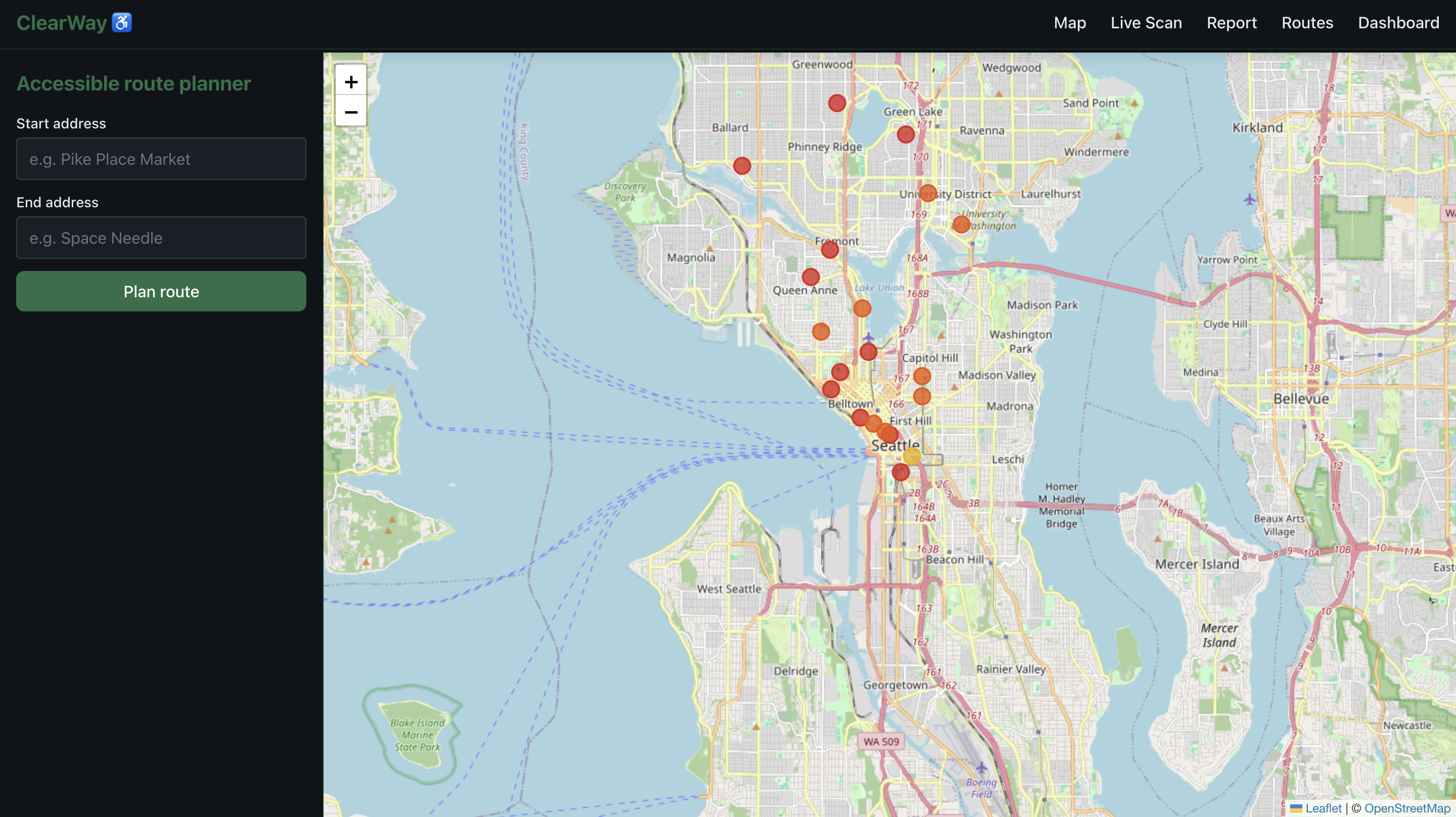
CurbCut is a live accessibility intelligence map that lets users snap a photo of any sidewalk obstacle, instantly classifies it with AI against real ADA standards, and pins it on a real-time equity map, while passively detecting surface roughness through your phone's accelerometer and warning you about obstacles ahead through live camera scanning, all without storing a single photo.
How we built it
We built the backend in Next.js with OpenRouter Llama Vision handling photo classification, TensorFlow COCO-SSD running real-time object detection in the browser, the native DeviceMotion API powering passive surface quality scoring through a 50-reading accelerometer buffer, OpenRouteService generating obstacle-aware walking routes, and Leaflet rendering a dark CartoDB map with live severity-colored pins.
Challenges we ran into
Getting 3 completely different AI systems, cloud vision, in-browser object detection, and sensor-based anomaly detection, to work together in real time without any of them blocking the UI was the hardest technical challenge, alongside iOS requiring explicit user permission for DeviceMotion which broke our jolt detection until we added a permission request flow.
Accomplishments that we're proud of
We're most proud of the passive surface detection: the fact that your phone silently scores the quality of the sidewalk beneath you as you walk, with zero user input, using just the accelerometer, is something no accessibility platform has ever done and it works.
What we learned
We learned that the hardest part of accessibility tech isn't the AI, it's earning trust from a community that has been failed by technology repeatedly, which is why we made privacy non-negotiable from day one: photos are analyzed and immediately discarded, never stored, never logged.
What's next for ClearWay ♿
We're expanding to 3 city government pilots to replace manual ADA sidewalk audits, integrating Project Sidewalk's 300K+ validated label dataset from UW to improve our CV model accuracy beyond 80%, and building an API so Google Maps, Apple Maps, and Uber can license our obstacle data as the authoritative accessibility layer for navigation.
Built With
- coco
- figma
- javascript
- llamavision
- next
- openrouteservice


Log in or sign up for Devpost to join the conversation.