-
-
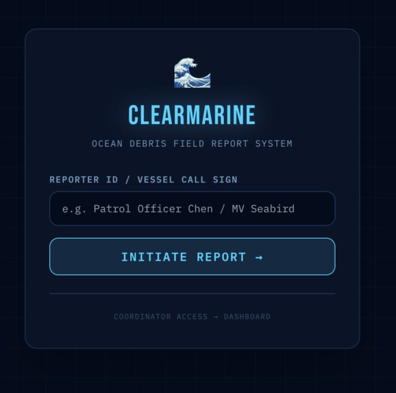
Report page for waste sitings
-
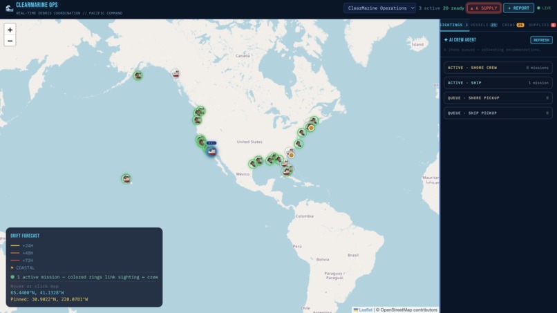
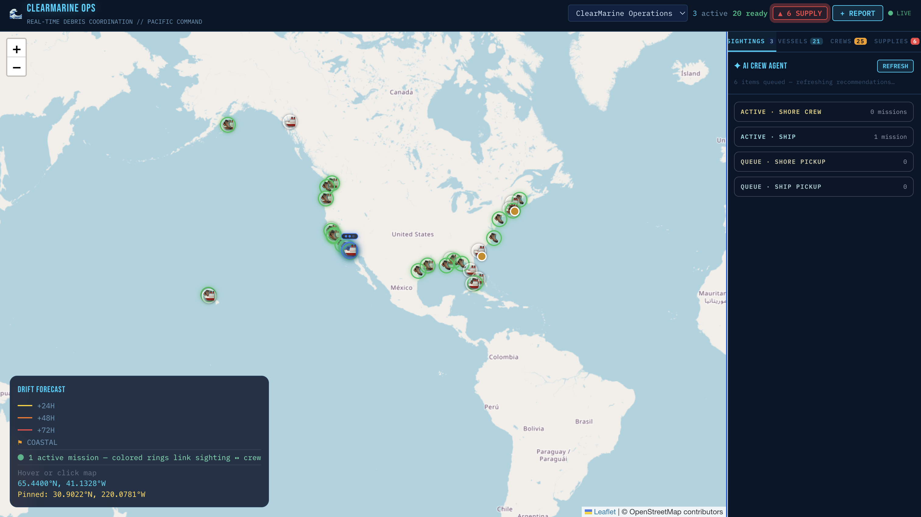
Coordination and deployment page with vessels, missions, and important status updates
-
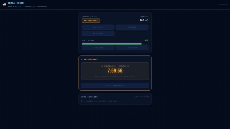
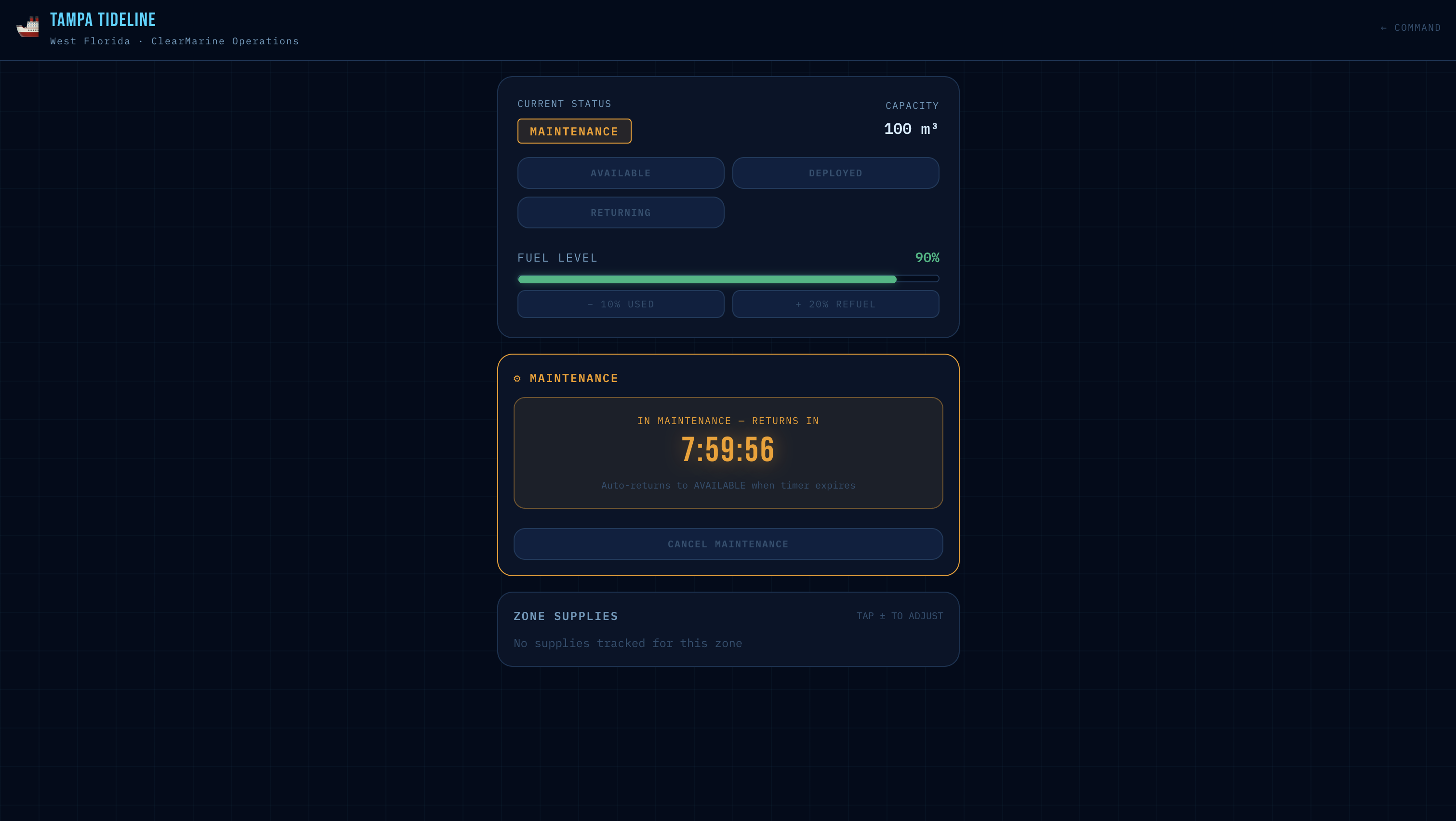
Individual ship management systems

Inspiration
Every day, 8 million pieces of plastic enter our oceans. We have the crews, the vessels, and the ability to fight it. What we don't have is coordination.We came across NOAA's Marine Debris Program reports and kept seeing the same pattern: multi-agency responses to ocean incidents required formal "Unified Command" structures just to get organizations to work with each other. For major declared spills, systems exist. For the 8 million daily pieces spotted on routine patrol? Nothing was there. A coastguard officer radios in a debris sighting, someone writes it on a whiteboard, and by the time the right crew gets dispatched, the debris has drifted two miles in a different direction.That gap, between a sighting and a coordinated response, is where ClearMarine can help.
What it does
ClearMarine is an end-to-end AI coordination platform for ocean debris response. It connects field reporters, cleanup vessels, and multiple government agencies through a single real-time system. The full operational cycle includes:
Report: A field officer spots debris and submits a photo and GPS location via mobile. Gemini Vision and a pre-trained CV model on trash debris analyzes the image, estimates debris density and urgency, and saves a structured record instantly.
Predict: NOAA real-time ocean current data drives an Euler-based drift simulation, showing where the debris cluster will be in 24, 48, and 72 hours as an animated path on the live map.
Dispatch: A Gemini AI agent ranks available cleanup vessels by ETA, capacity, and fuel level, then generates a full mission brief in seconds. One click dispatches the optimal crew.
Intercept : The assigned vessel sees their mission on the vessel station interface. When debris is confirmed intercepted, the dashboard updates instantly across all agencies and the vessel returns to available.
Handoff: When debris drifts across jurisdiction boundaries, ClearMarine auto-generates a structured handoff brief and routes it to the receiving agency's dashboard. Full chain of custody tracked with zero phone calls.
All five steps automated.
How we built it
Frontend: React with Tailwind CSS, three interfaces:
- report for mobile field submission
- dashboard department for agency coordinators
- room-id for vessel status updates. Leaflet.js handles the live map with animated drift path overlays Backend/Database: Supabase as the single source of truth for all agencies. Real-time Postgres subscriptions push updates to every dashboard instantly; when ER dispatches a crew, every other agency sees it in under a second without any page refresh.
AI Layer: Google Gemini API powers four distinct agent calls — debris photo analysis, 60-second coordinator suggestions, vessel dispatch ranking, and inter-agency handoff brief generation. Roboflow CV pretrained model helps with image classification of biodiversity and trash to verify images. Elevenlabs API used as a voice agent to communicate with users to fill out charts and be as descriptive as possible.
Drift Simulation: NOAA's real-time ocean current API provides surface current vectors at reported debris locations. We apply Euler integration to simulate debris movement over 72 hours, updating trajectory estimates as new current data arrives.
Multi-Agency Architecture: Each department — Coast Guard, local marine patrol, EPA — has its own dashboard view filtered by jurisdiction, but all read from and write to the same Supabase database. Handoffs update the source_department, destination_department, and handoff_status fields, triggering real-time notifications on the receiving dashboard.
Challenges we ran into
Real-time drift accuracy: Computing meaningful drift trajectories without full oceanographic modeling was the core technical challenge. We couldn't build a full fluid dynamics simulation in 36 hours, so we designed an Euler-based approximation using NOAA current vectors that produces visually and directionally accurate results for demo purposes while being honest about its limitations as a prototype.
Multi-agency real-time sync: Getting three separate dashboard views to update simultaneously from a single database without conflicts or race conditions required careful Supabase subscription design. We had to think carefully about which events triggered which re-renders across which departments.
Scope: The hardest challenge wasn't technical, it was deciding what to not build. We had ideas for CCTV monitoring, satellite imagery integration, and vessel AIS tracking. Cutting those features to ship a complete, polished core loop in 36 hours was the right call but not an easy one.
Gemini response consistency: Getting Gemini to return clean structured JSON reliably across all four agent calls required careful prompt engineering, explicit format instructions, and fallback parsing logic for edge cases.
Accomplishments that we're proud of
We are proud of the fact that we built a genuinely complete operational loop which includes report, predict, dispatch, intercept, handoff with zero manual steps left in the chain. Additionally we included real-time multi-agency synchronization working across three simultaneous dashboard views from a single Supabase instance. Using NOAA live current data, we are proud of integrating and driving actual drift path visualization, not just static mock data. Additionally with four distinct Gemini agent calls with consistent structured outputs, each serving a different coordination function we were able to create a demo that tells a complete story that non-technical judges can immediately understand and care about, which was a genuinely proud accomplishment for us.
What we learned
Building for real operational contexts is fundamentally different from building for users. Cleanup coordinators don't need beautiful interfaces; they need fast and reliable information under time pressure. Every design decision we made (the color coding, the one-click dispatch, the auto-generated briefs), was driven by asking "what does someone need to see in the first three seconds?" We also learned that the hardest part of multi-agent AI systems isn't the individual LLM calls, it's the data architecture underneath them. Gemini is only as good as the structured context you give it. This was why we had to spend more time on feature engineering than we anticipated. Getting the Supabase schema right early was what made every feature build much faster. Additionally, the coordination gap in ocean debris response is real, verified, and entirely unsolved at the operational level for routine patrol sightings.
What's next for ClearMarine
Satellite debris detection: We want to partner with providers like Planet Labs or Copernicus to ingest satellite imagery of known high-density zones and automatically generate sighting reports without requiring a human in the field. Improved drift modeling: We want to replace the Euler approximation with OpenDrift or a Parcels-based simulation to include wind stress, Stokes drift, and debris buoyancy. Mobile native app: We want to create a dedicated iOS/Android app for field reporters with offline capability and automatic GPS tagging, replacing the mobile web interface. Pilot partnership: We want to see this model actually work in the real world by connecting with NOAA's Marine Debris Program or a coastal cleanup organization to run a real-world pilot. The architecture is already built for it.
Built With
- coco
- css
- elevenlabs
- gemini
- javascript
- leafnet
- python
- react
- robloflow
- supabase

Log in or sign up for Devpost to join the conversation.