Inspiration
In Botswana and many regions across Africa, access to functioning ATMs is often unpredictable. Customers frequently arrive at ATMs only to find no cash or long queues. Meanwhile, banks spend heavily on maintaining ATMs without real-time insights into usage patterns, security risks, or replenishment needs.
We asked ourselves: What if ATM networks could be managed with the same intelligence used in urban planning, logistics, and smart cities? That inspired us to build a GIS-powered ATM Management System that uses spatial data and predictive insights to transform ATM operations.
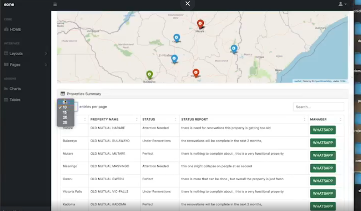
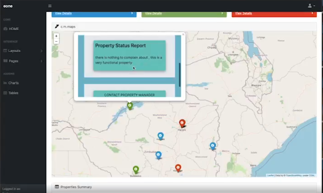
What it does Our solution is a Geographic Information System (GIS) dashboard that empowers banks to:
Visualize ATM locations across a city or country.
Monitor ATM status, last maintenance, uptime, and cash levels in real-time.
Predict cash demand using historical usage, time of day, and foot traffic.
Overlay crime data and population density to suggest safer or underserved ATM locations.
Optimize cash delivery routes and maintenance schedules using spatial analytics.
Provide a management dashboard for executives, plus a mobile-friendly view for field teams.
Challenges we ran into
Data availability: Real-time ATM data and foot traffic info was limited, so we had to simulate live feeds and rely on public datasets.
Mapping precision: Integrating multiple data layers (e.g. crime, demand) in a way that was both informative and not overwhelming was a UI/UX challenge.
Time constraints: Packing predictive logic, map integration, and a functioning UI into a 48-hour window was a major sprint!
Accomplishments that we're proud of
We built a fully interactive, location-aware dashboard in less than 48 hours.
Our model can predict high-usage zones and recommend where FNB can expand ATM coverage for financial inclusion.
We layered risk data (crime stats) to propose smarter, safer ATM placements, something we haven't seen in most African banking solutions.
Designed the system to be scalable, with the potential to integrate real APIs, machine learning models, and even solar feasibility maps in future iterations.
What we learned
GIS tools are incredibly powerful in the fintech space — combining spatial awareness with financial data opens up new levels of insight.
User experience matters simplifying a complex system for non-technical banking staff was a rewarding design challenge.
Team synergy is everything in a hackathon. From coding to strategy to pitching, we learned how to adapt quickly and communicate effectively under pressure.
What's next for
We plan to refine the cash forecasting algorithm with real transaction data and machine learning.
We want to pilot the system with real ATMs working with FNB or another partner to test deployment in Gaborone.
Add mobile app support for field agents to receive route updates and ATM status on the go.
Integrate ESG features: mapping solar-friendly ATM locations and tracking carbon impact of cash delivery routes.
This is just the beginning we envision this platform as a core part of smart banking infrastructure across Africa.
Built With
- cloud
- figma-(ui-design)
- github
- leaflet.js
- mapbox-api
- node.js
- postgis
- postgresql
- python-(for-prediction)
- react

Log in or sign up for Devpost to join the conversation.