-
-
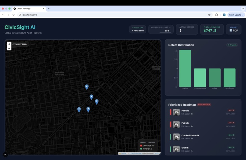
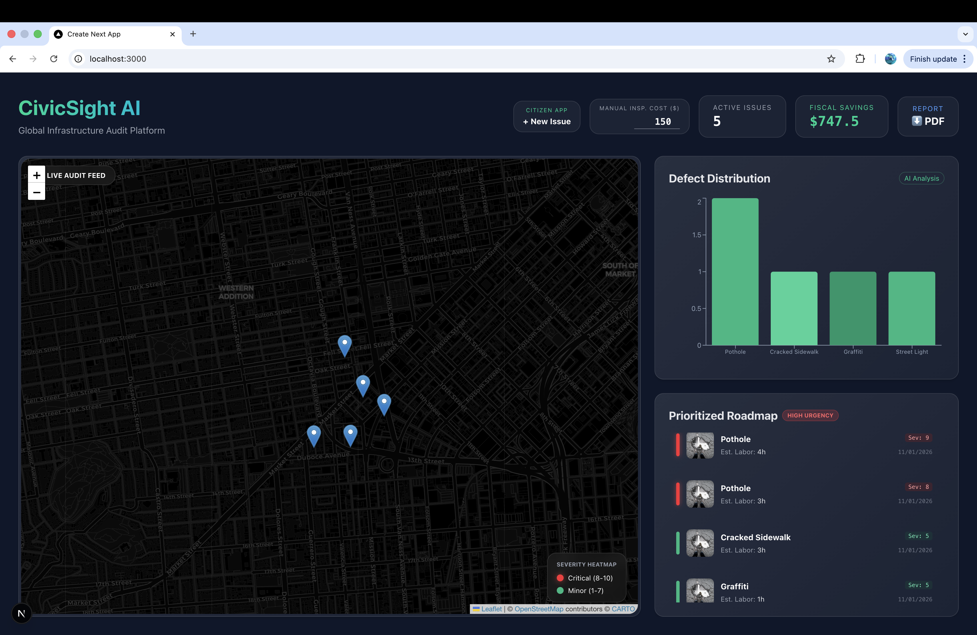
initial webpage
-
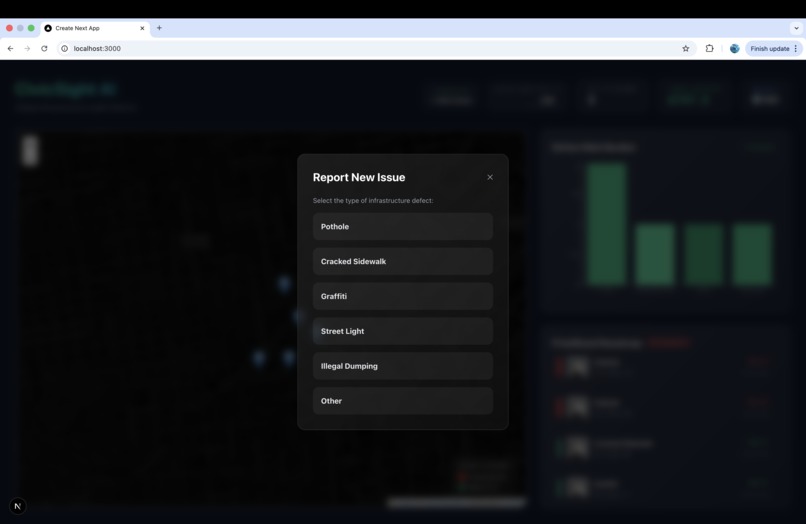
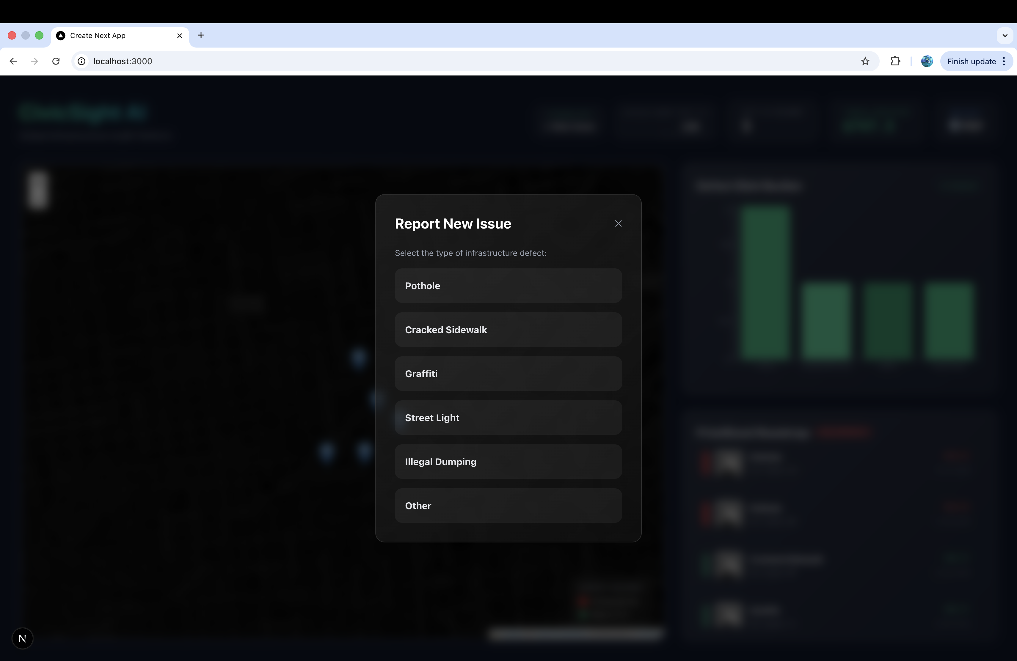
various options to choose from while reporting
-
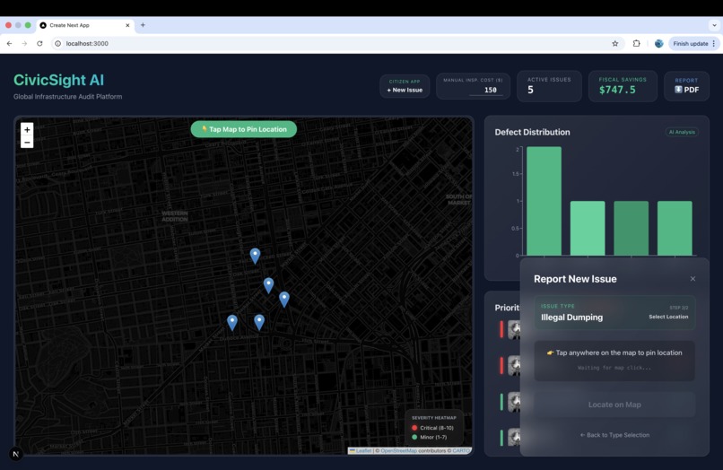
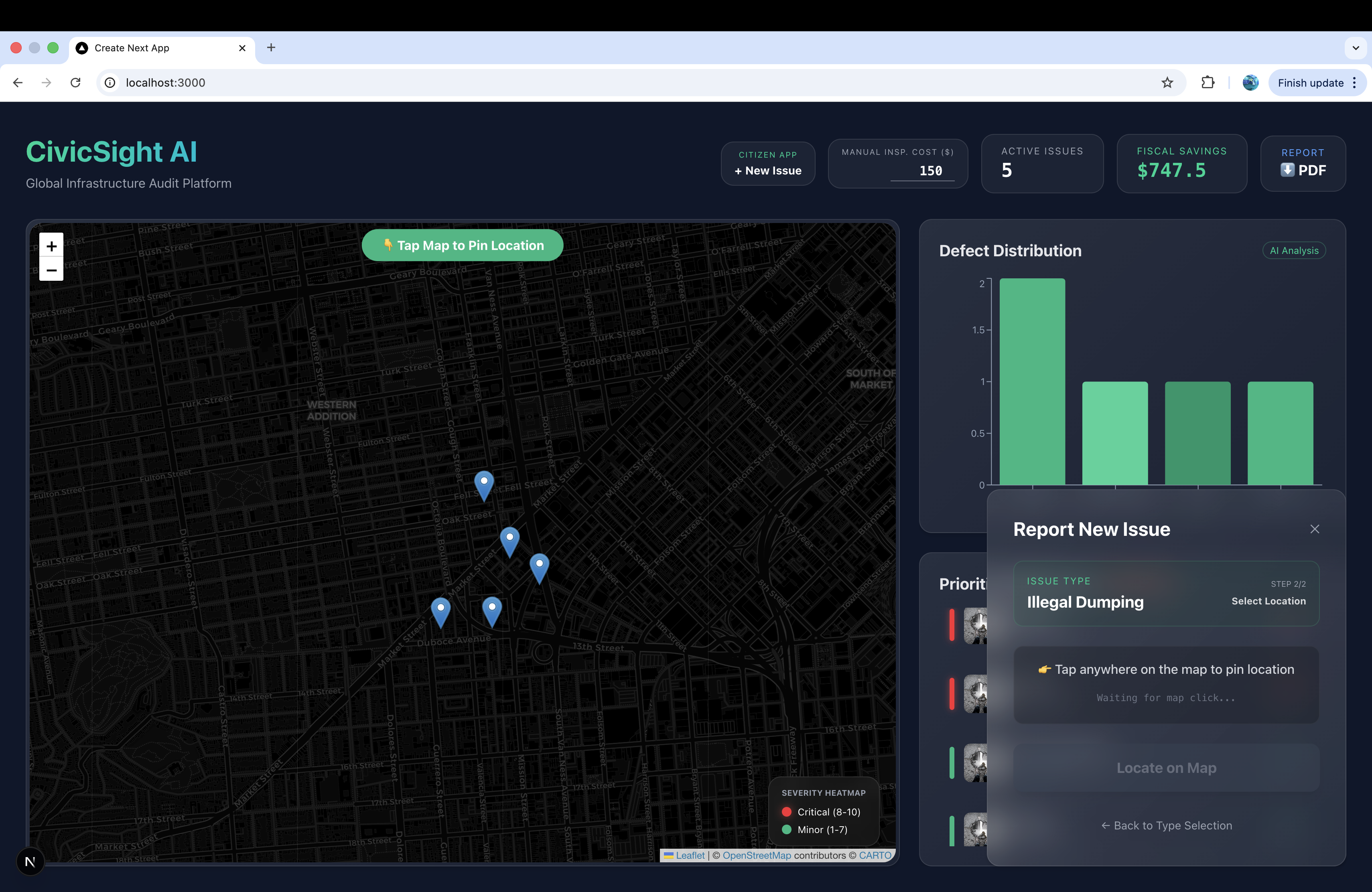
website waiting for user to locate the area where the issue exists
-
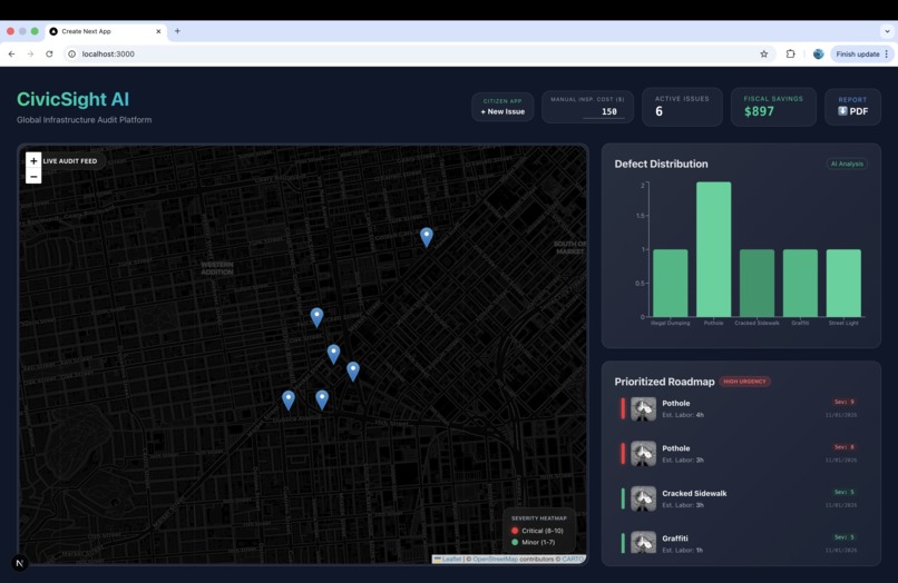
Added new issue on the map
-
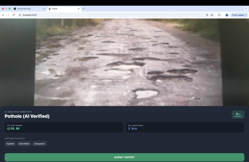
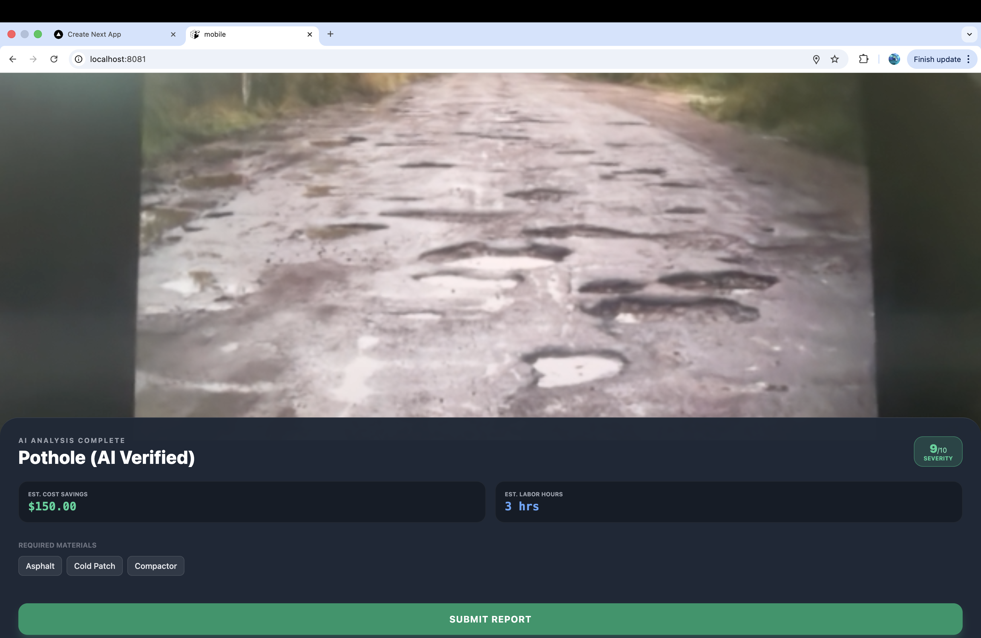
GPT-4o analyzes the image gives it a severity rating, approx cost and time of repair
-

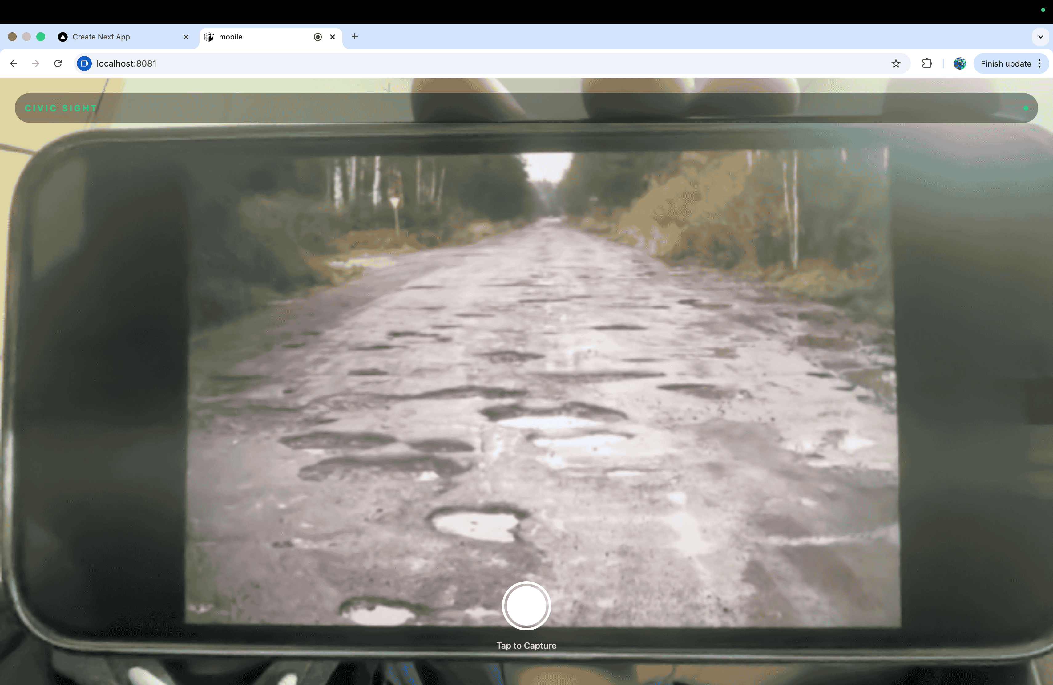
capturing image of potholes using camera for GPT-4o to analyze the condition.

Inspiration
We noticed that urban decay and accessibility barriers often go unreported because traditional reporting systems are friction-heavy. We were inspired to turn every smartphone into a professional-grade city auditor to bridge the gap between citizens and city maintenance.
What it does
CivicSight AI allows users to snap a photo of infrastructure issues (potholes, broken ramps, etc.). Our AI analyzes the image to identify the problem, assess severity, and estimate repair costs, instantly plotting the data on a geospatial dashboard for city officials to prioritize and fix.
How we built it
We built a Turborepo monorepo using React Native (Expo) for mobile and Next.js 14 for the dashboard. The backend is powered by Supabase with PostGIS for mapping. We integrated GPT-4o Vision via Edge Functions to handle real-time image auditing.
Challenges we ran into
Synchronizing geospatial data across mobile and web while ensuring the AI provided consistent, structured JSON outputs for severity scores was difficult. We overcame this by implementing strict Zod schema validation and custom system prompts.
Accomplishments that we're proud of
We successfully built a full-stack, "startup-ready" platform in 10 days that doesn't just report problems but actually calculates the fiscal ROI for cities, making a strong case for real-world adoption.
What we learned
We gained deep experience in Geospatial Engineering with PostGIS and learned how to orchestrate Agentic Vision AI to perform complex analytical tasks that traditionally require human inspectors.
What's next for CivicSight AI
We plan to integrate predictive analytics to forecast where infrastructure will fail next and expand our Public API to allow integration with popular navigation apps like Google Maps or Waze.
Built With
- github-actions
- gpt-4o-vision-api
- nativewind
- next.js-14
- openapi-(swagger)
- postgis
- postgresql
- react-leaflet
- react-native-(expo)
- react-native-maps
- recharts
- supabase
- tailwind-css
- turborepo
- typescript
- zod

Log in or sign up for Devpost to join the conversation.