-
-

Home Page
-
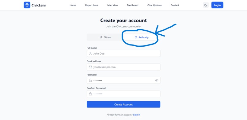
Register As Authority to access extra features (Authority Panel)
-
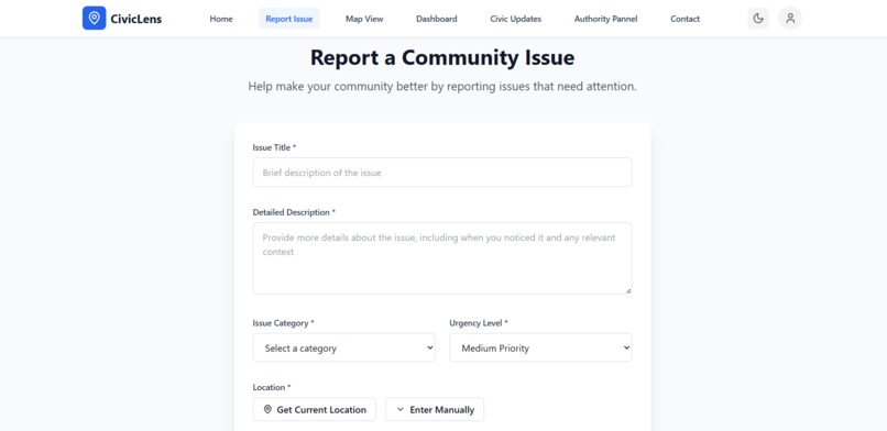
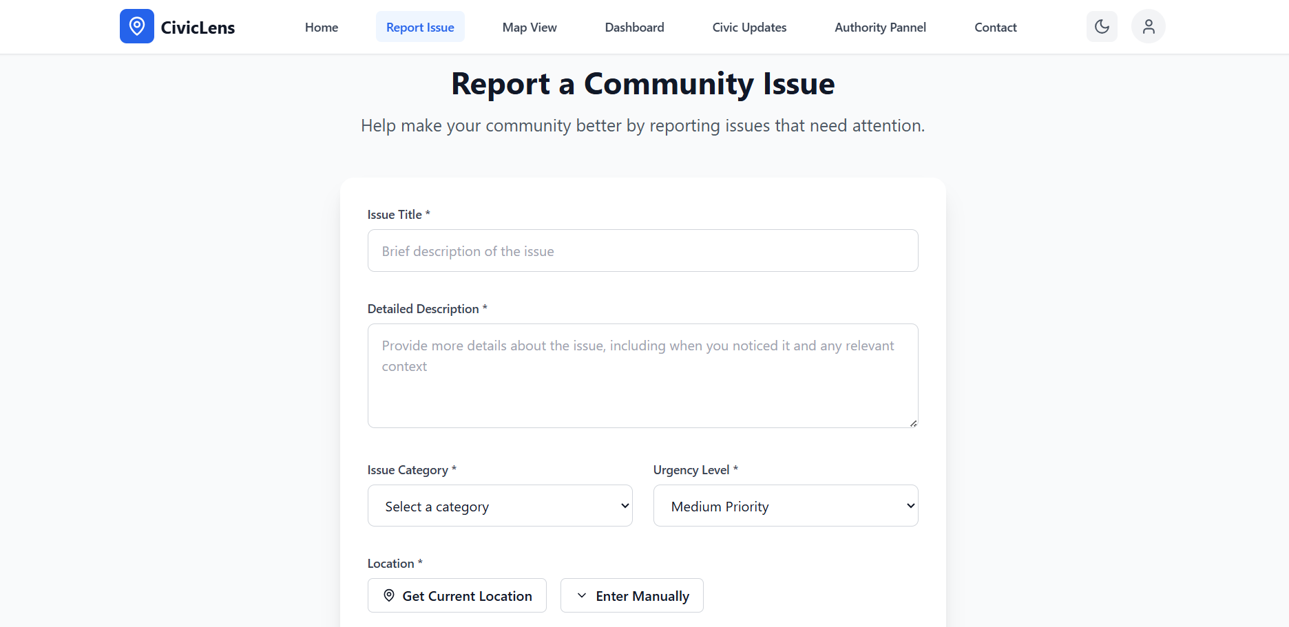
Report Problems in your Area
-

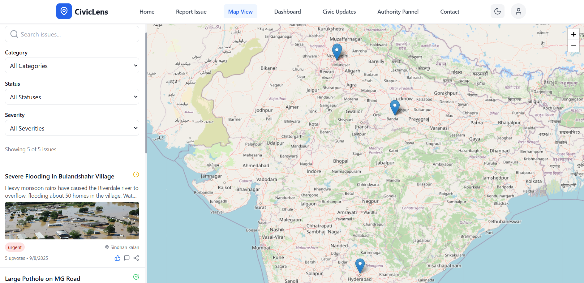
View Map, upvote/comment on issue posts
-
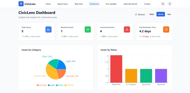
Dashboard to view all data at one Place
-
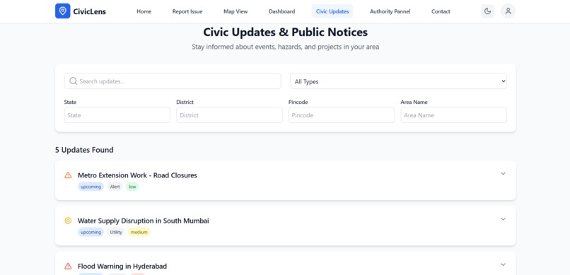
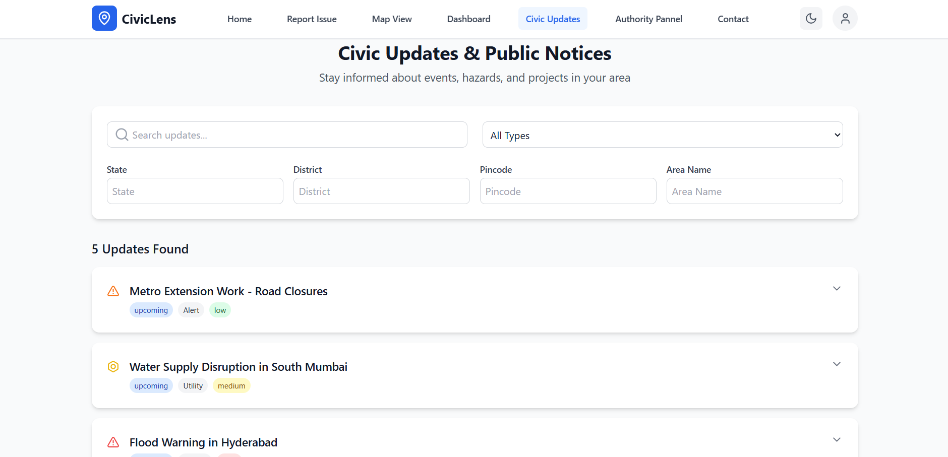
Updates from Authority/Government
-
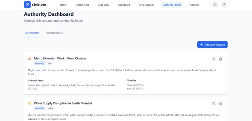
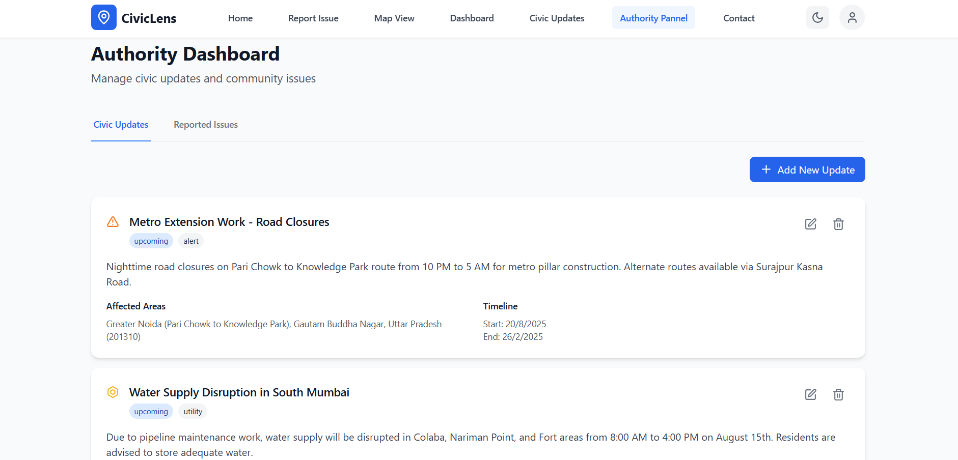
Authority Panel to upload/edit informations
-
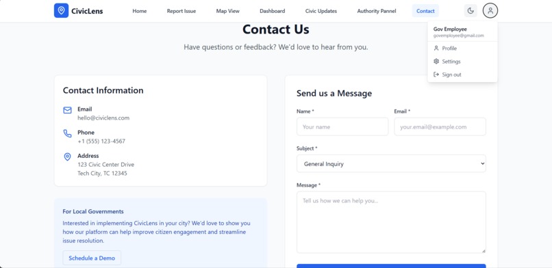
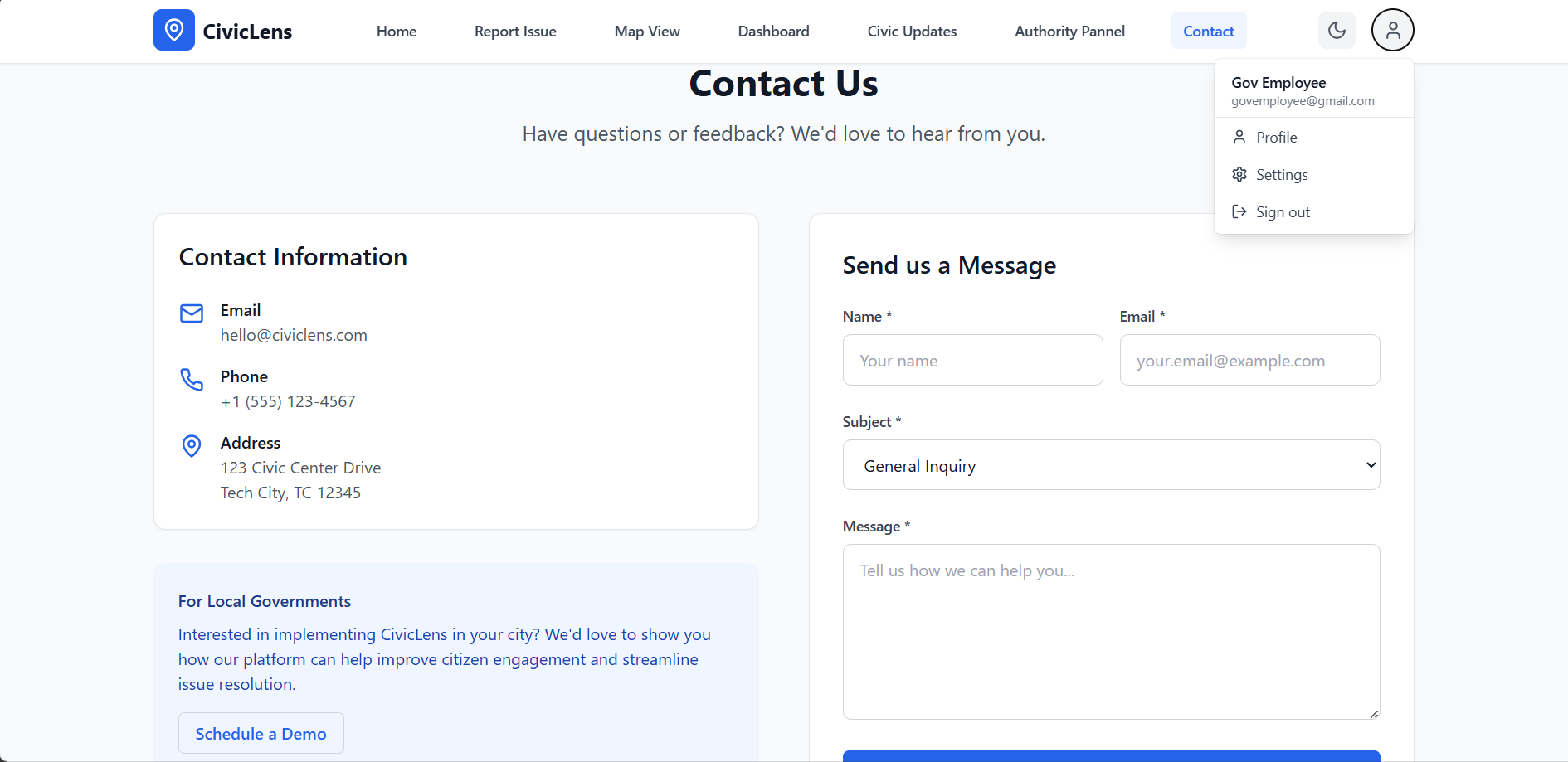
Contact Us for inquiry/support/suggestion/Collaboration
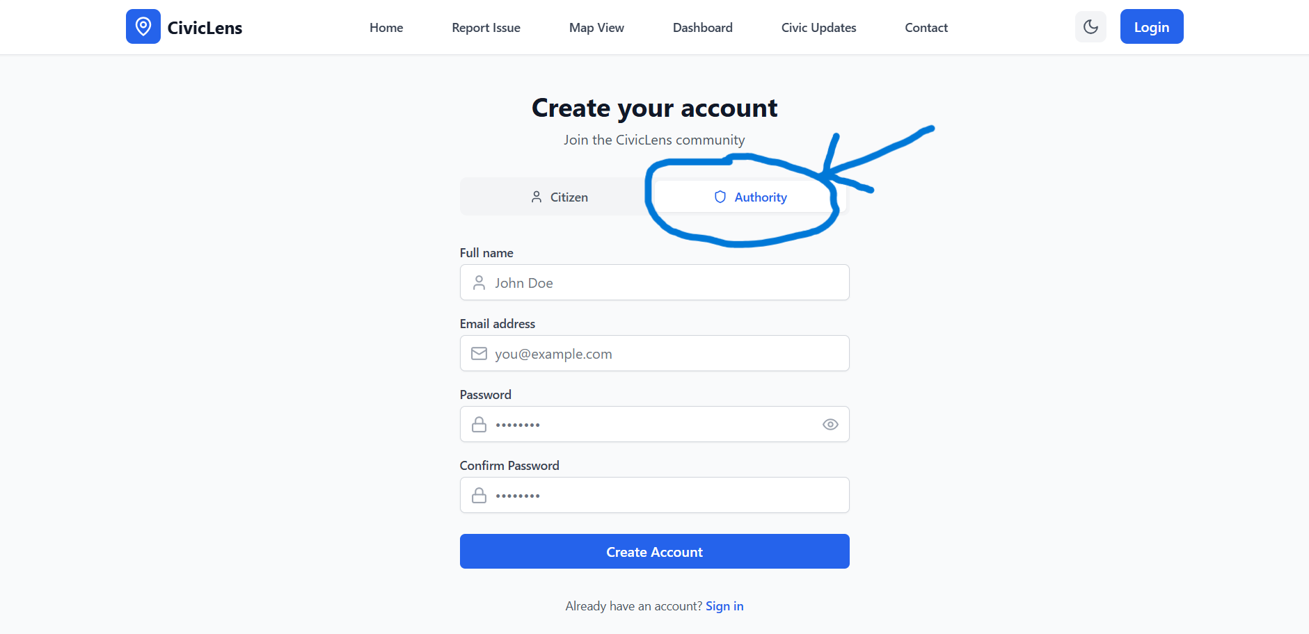

Note: Register as authority to access extra features like "Authority Panel".
Authority Login: mail: govemployee@gmail.com ,password: qwerty12
Citizen Login: mail: randommail@gmail.com ,password: qwerty12
Inspiration
Last year, our town was hit by a massive landslide. Overnight, the streets were buried under rocks, roads were blocked, and electricity was cut off. Days turned into weeks, and still, there was no clear communication from the authorities. We didn’t know which department was coming, what actions were planned, or how long it would take to restore basic services. If we had known it would take a month to restore electricity, many families—including mine—could have relocated temporarily, saving time, money, and health. But instead, we lived in uncertainty.
Sadly, this is not just our story. Across India and the world, people silently suffer during civic crises because there’s no transparent, real-time bridge between citizens and authorities. Another example: India loses ₹6,000 crores annually due to delayed infrastructure fixes (NITI Aayog, 2023). Yet, 83% of citizens don’t report issues because they don’t know how or whom to ask (Urban Governance Survey 2024). That frustration and helplessness inspired us to build CivicLens.
What it does
CivicLens is a community-driven platform that:
- Lets citizens upload photos of problems (potholes, garbage, broken streetlights).
- Uses AI to categorize & prioritize them by severity.
- Shows real-time government updates: infrastructure projects, outages, hazard alerts.
- Lets users search updates by State, District, Area, or Pincode.
- Uses maps to show all active issues & planned fixes.
- Rewards users with points & badges for reporting or verifying resolved issues.
- Automatically escalates reports to the right authorities and tracks progress.
- Publishes public dashboards for transparency.
Example: If a water pipeline bursts in your area, CivicLens will:
- Detect it from your photo and mark it “urgent.”
- Forward it to the water department automatically.
- Show you a timeline of repair actions.
- Notify you when repairs are complete.
How we built it
- Frontend: React.js + TypeScript, integrated with Google Maps API for live location plotting.
- Backend: Node.js + Express, MongoDB Atlas with geospatial queries for fast area searches.
- AI/ML:
- TensorFlow.js (client-side photo classification).
- Python (CNN model with 91% accuracy in civic issue categorization).
- APIs:
- Mapbox for mapping.
- Google Translate API for multilingual support.
- Government open data sources for civic updates.
- Hosting: Render + Cloudinary for image storage.
Challenges we ran into
- Building a photo classification AI that works even with low-light or blurry images.
- Getting accurate geolocation data in rural areas.
- Designing a system to prevent spam or fake reports while keeping reporting simple.
- Integrating multiple APIs while keeping latency low for real-time updates.
Accomplishments that we're proud of
- Built a working AI-powered civic issue detector in under a week.
- Achieved 91% AI accuracy in detecting and categorizing civic issues from photos.
- Designed an interactive public dashboard showing real-time civic activity in any district/pincode.
- Enabled photo-to-report flow that takes less than 30 seconds for a user.
What we learned
- Cooperation: Citizens are willing to help, but only if they see impact and response.
- Awareness: Clear, real-time information in a crisis is as valuable as the actual repair work.
- Proof of work: Visual proof (photos/maps) increases official accountability by multiple times
What's next for CivicLens
- Expand AI Training: Add regional language support (Hindi/Bengali/Tamil image captions)
- Disaster Mode: Automatic SOS routing during floods/earthquakes
- Policy Integration: Direct integration with government dashboards for faster resolution.
- Mobile App: (Android/iOS) with offline-first reporting.
Built With
- cloudinary
- express.js
- mapbox
- mongodb
- node.js
- python
- react
- render
- tailwind
- tensorflow
- typescript

Log in or sign up for Devpost to join the conversation.