
CivicFlow — AI-Powered Urban Intelligence Platform
Inspiration
- Cities receive large amounts of information from citizens through complaints, images, voice reports, and service requests.
- This information is often fragmented and difficult to convert into actionable insights.
Major events such as FIFA 2026 can increase pressure on urban systems, including:
- Waste management
- Public infrastructure
- Mobility
- Environmental conditions
- Public health
We wanted to build a system that goes beyond simply collecting complaints.
Our goal was to transform citizen-generated information into structured, location-aware insights that can help cities identify problems and prioritize responses.
This led to CivicFlow — a platform designed to connect citizen reporting, AI, geospatial information, and urban decision-making.
What it does
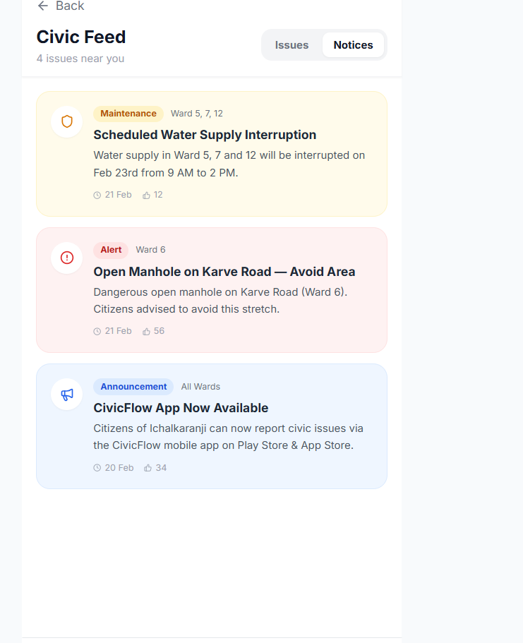
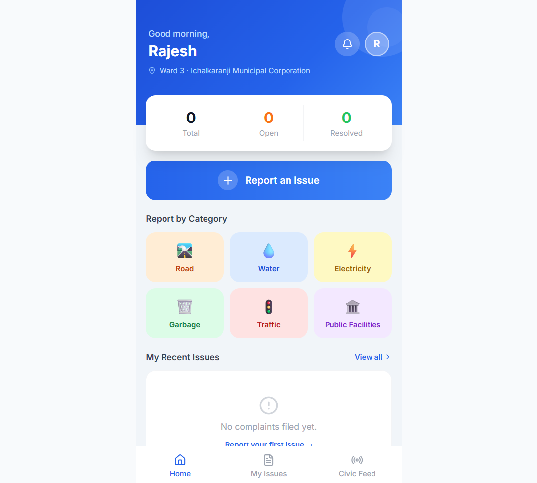
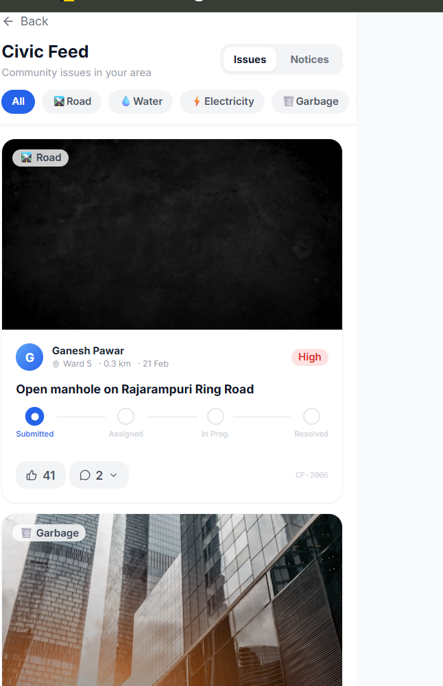
CivicFlow is an AI-powered civic intelligence platform that converts citizen reports into structured information and actionable urban insights.
1. Multimodal Reporting
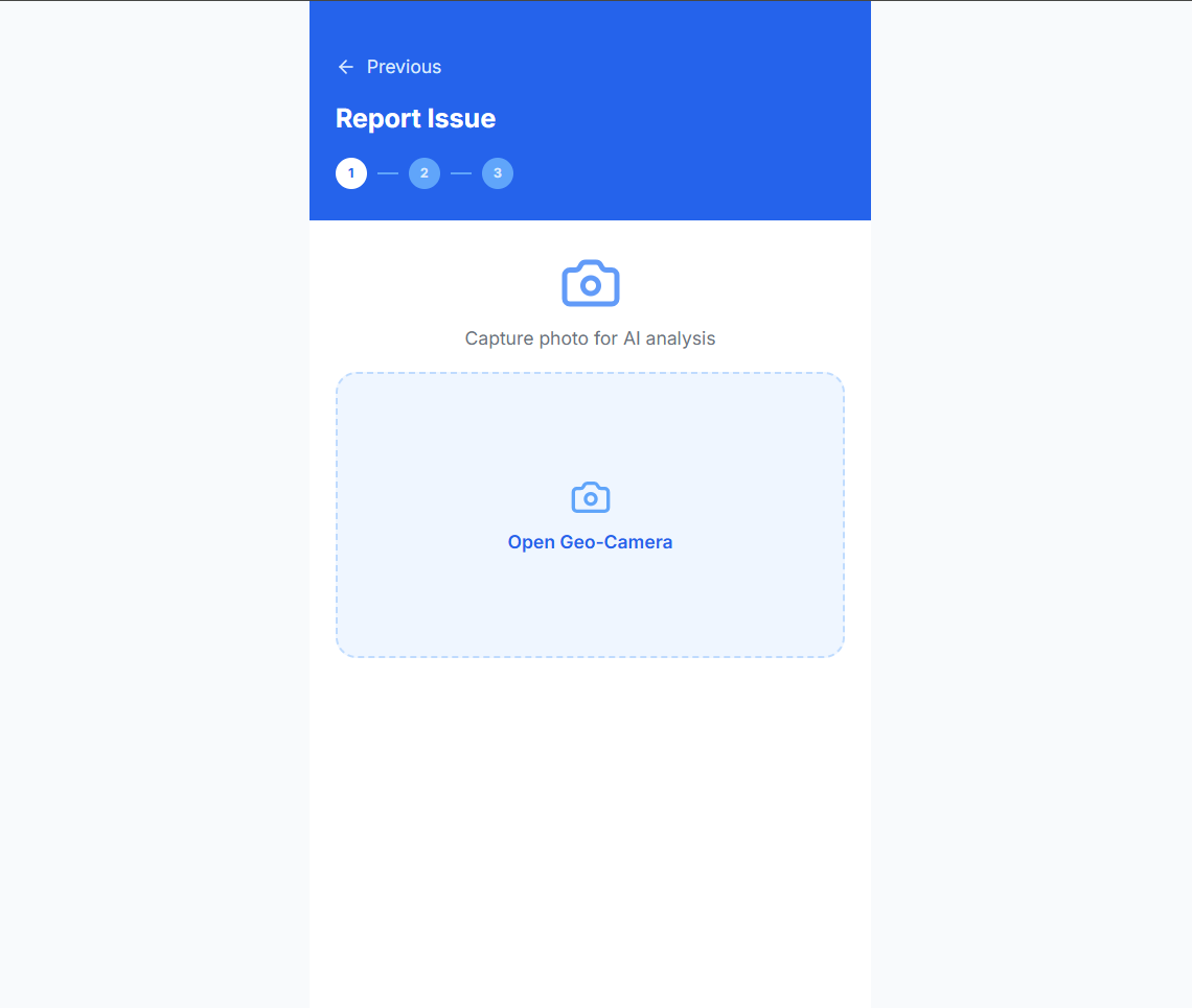
Citizens can report issues using:
- Text
- Images
- Voice
2. AI-Assisted Processing
CivicFlow processes incoming reports and helps:
- Identify the type of civic issue
- Structure unorganized information
- Extract relevant information from reports
- Organize issues for further analysis
3. Location-Aware Intelligence
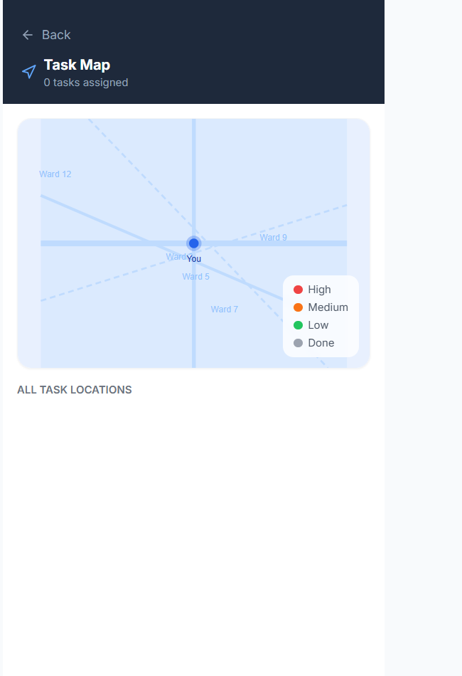
Each report can be associated with geographic information to help identify:
- Problem locations
- Recurring issue areas
- Geographic concentrations
- Potential hotspots
4. Priority Identification
The platform organizes reported issues so that decision-makers can focus on areas requiring greater attention.
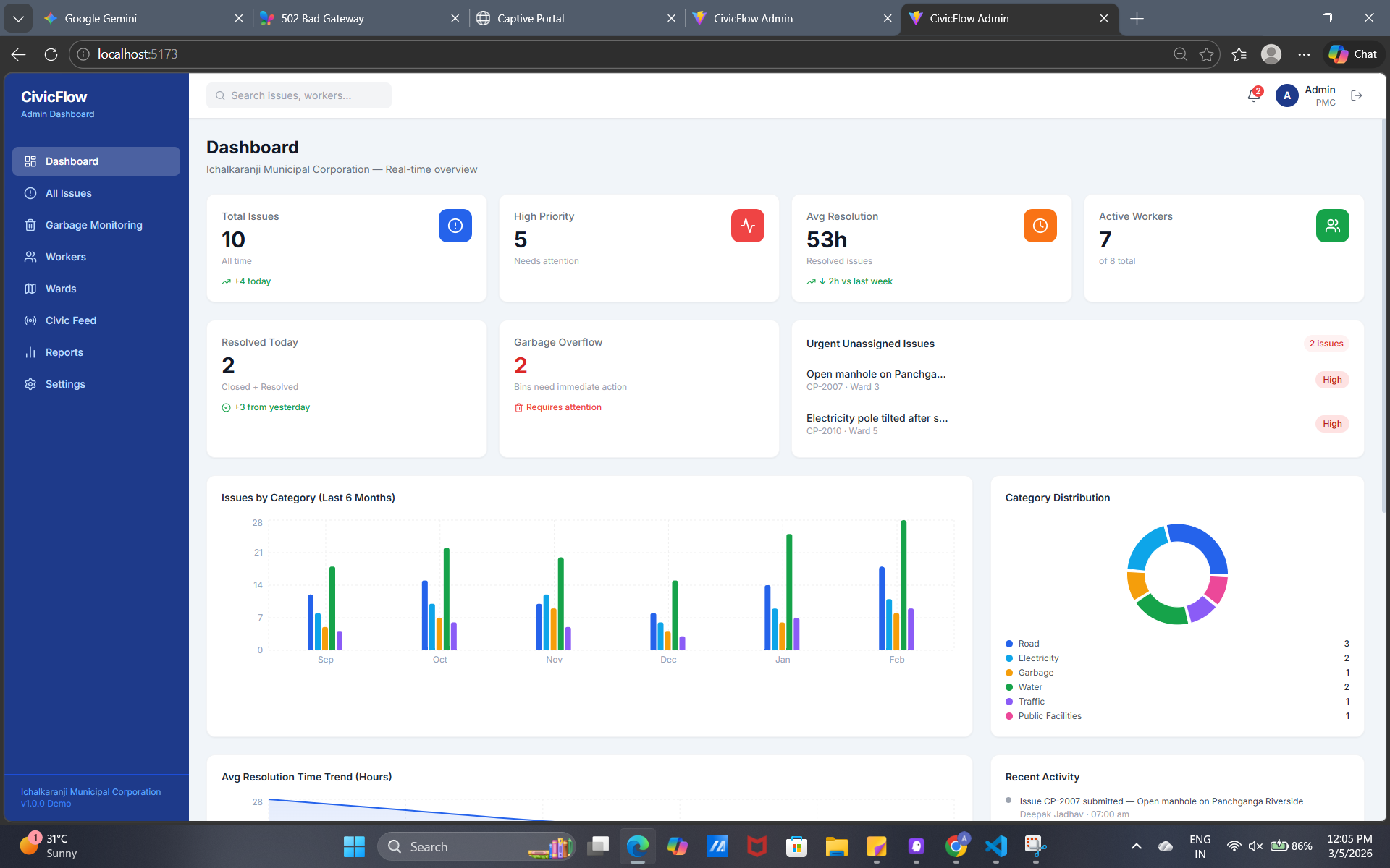
5. Decision-Support Dashboard
The dashboard provides a centralized view of:
- Reported issues
- Categories
- Locations
- Priorities
- Emerging patterns
6. Major-Event Use Case
For events such as FIFA 2026, CivicFlow can be extended to analyze urban pressure around:
- Event venues
- High-traffic corridors
- Visitor-heavy areas
- Surrounding neighborhoods
This can help cities understand where additional attention or resources may be required.
How we built it
We designed CivicFlow as a modular, cloud-oriented system.
System Workflow
Citizen Input → AI Processing → Structured Civic Data → Location Analysis → Priority Identification → Decision Dashboard
Technology Stack
- Python — backend logic and processing
- AWS Lambda — serverless backend functions
- Amazon DynamoDB — civic data storage
- REST APIs — communication between system components
- AI-assisted processing — issue classification and information extraction
- Web technologies — user-facing interface and dashboard
- Voice interface — voice-based civic interaction
Development Approach
We focused on building an end-to-end prototype consisting of:
- Citizen reporting
- Backend processing
- Data storage
- AI-assisted classification
- Location-aware records
- Priority handling
- Visualization
- Decision support
This modular approach also allows additional city datasets to be integrated in the future.
Challenges we ran into
1. Multimodal Data
- Text, images, and voice contain information in very different formats.
- Converting these inputs into consistent civic records was a major challenge.
2. Unstructured Information
- Citizen reports can be incomplete, inconsistent, or ambiguous.
- We needed a structured representation that could support downstream analysis.
3. Geographic Context
- A civic issue becomes more useful when its location is understood.
- Connecting reports with geographic information was important for identifying spatial patterns and hotspots.
4. AI + Real-World Workflow
- AI classification alone does not solve a civic problem.
- We needed to connect AI output with storage, APIs, visualization, and decision-making.
5. Scalability
- We wanted the architecture to support additional datasets and users in the future.
- Using modular components and cloud-oriented services helped us create a foundation that can be expanded.
Accomplishments that we're proud of
We are proud of creating an end-to-end civic intelligence prototype rather than building only an isolated AI feature.
Key accomplishments
- ✅ Multimodal citizen reporting
- ✅ Text, image, and voice input support
- ✅ AI-assisted civic issue classification
- ✅ Structured civic issue records
- ✅ Location-aware reporting
- ✅ Priority and hotspot analysis workflow
- ✅ Decision-support dashboard
- ✅ Voice/calling interaction layer
- ✅ Cloud-oriented backend architecture
- ✅ Expandable foundation for urban sustainability analytics
Our biggest accomplishment is bringing these components together into a single workflow:
Report → Understand → Locate → Prioritize → Visualize → Act
What we learned
1. AI needs context
An AI model is much more useful when its output is connected to real-world data, location, and decision-making.
2. Data quality matters
Inconsistent citizen-generated data can directly affect the quality of analytics. Structured data pipelines are therefore essential.
3. Location adds significant value
Understanding where an issue occurs can reveal patterns that are difficult to see from individual reports alone.
4. Visualization is critical
Decision-makers need information that is easy to understand. Maps, dashboards, and clear summaries can make complex datasets more actionable.
5. Accessibility matters
Providing multiple reporting channels, including voice, can make civic technology more accessible to different users.
6. Build for long-term use
A solution designed for a major event should ideally remain useful after the event. This influenced our focus on creating CivicFlow as a reusable urban intelligence platform.
What's next for CivicFlow
Our next goal is to evolve CivicFlow from an AI-assisted reporting platform into a predictive urban sustainability and resilience system.
Planned improvements
1. Environmental Data Integration
Integrate:
- Temperature and heat-risk data
- Weather information
- Air-quality indicators
- Environmental datasets
2. Mobility Data
Integrate:
- Traffic patterns
- Transportation demand
- Event-related mobility
- High-density corridors
3. Event Intelligence
Use event-related data to understand how increased activity affects different areas of a city.
4. Advanced Geospatial Analytics
Develop:
- Heatmaps
- Spatial clustering
- Risk hotspots
- Geographic trend analysis
5. Scenario Modeling
Allow decision-makers to compare potential interventions and understand their expected impact before deployment.
6. Predictive Analytics
Move from:
“Where is a problem happening?”
toward:
“Where is pressure likely to increase, and where should the city prepare?”
Long-Term Vision
Our long-term vision is to make CivicFlow an urban intelligence layer that helps cities combine citizen-generated information with environmental, mobility, and event data.
The goal is to help cities move from:
Reactive Reporting → Data-Driven Response → Proactive Urban Resilience
while creating a system that remains useful beyond FIFA 2026.
Built With
- amazon-web-services
- awsbedrock
- awslambda
- awss3
- javascript
- python
- restapi

Log in or sign up for Devpost to join the conversation.