-
-
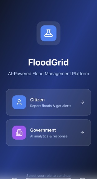
home page
-
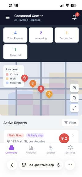
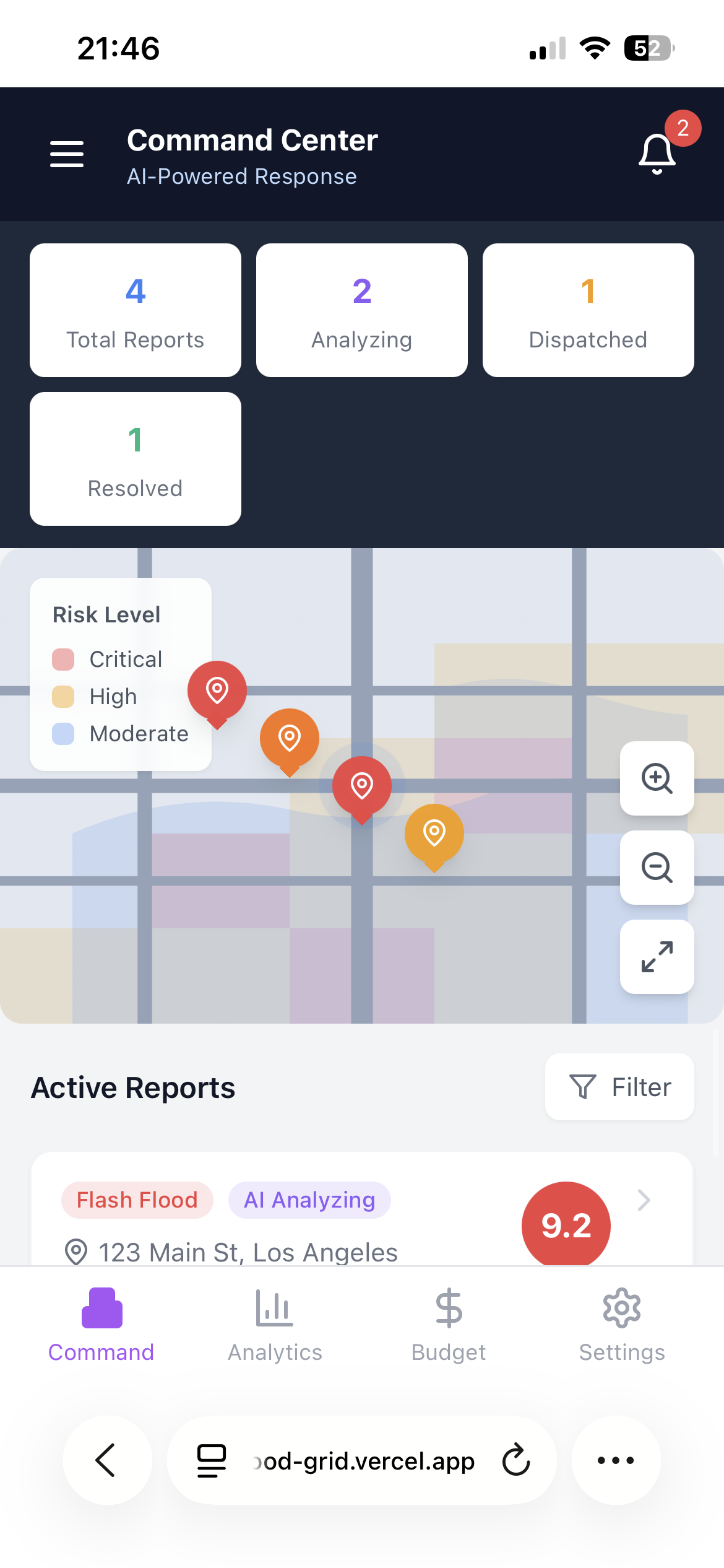
government view
-
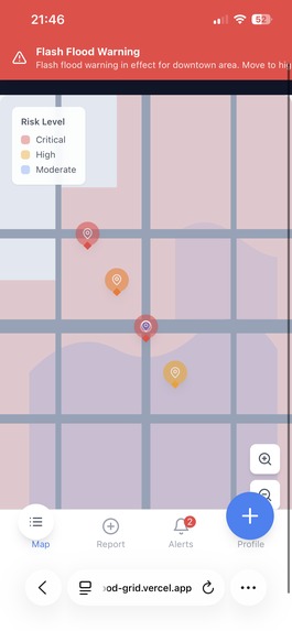
citizen view

Inspiration
In 2011, a major flood devastated my neighborhood in Thailand. Homes were destroyed, infrastructure collapsed, and lives were lost. What stayed with me most was not just the water, but the lack of coordination, visibility, and data-driven response. In southern Thailand, floods occur almost every year. Yet many communities continue to suffer repeated damage because response planning is reactive rather than predictive. Citizens often feel unheard, and resource allocation decisions are not always transparent or data-backed. FloodGrid was built from a simple belief: Flood response should not rely only on seasonal expectation — it should be powered by real-time data, predictive intelligence, and citizen participation. FloodGrid aims to transform flood management from reactive disaster response into coordinated, data-driven resilience infrastructure.
What it does
FloodGrid is a real-time flood intelligence and coordination platform designed for both citizens and government agencies.
For Citizens: -Report flood conditions (location, severity, affected population) -Receive early warnings and risk notifications -View live flood maps and high-risk zones -Stay informed about dangerous areas to avoid
For Governments and Organizations: Access real-time citizen-generated flood data View AI-prioritized response zones Receive budget and resource allocation estimates Monitor flood severity trends and risk forecasting
FloodGrid integrates three core intelligence layers:
Citizen Reporting Layer Real-time geotagged reports provide ground-level visibility during floods.
Predictive AI Layer -A Python-based machine learning model analyzes: -XGBoost grident boosting classifier trained on historical flood and rainfall
data to predict flood risk levels and generate a priority response score -Historical flood data -Rainfall patterns -Report frequency and severity -Population impact -The model generates: -Risk level classification -Priority response scores -Budget estimation projections outputs: Risk level classification:Low/medium/ high /critical Priority response score(0-100 scale) estimate emergency budget allocationDecision Dashboard -A live visualization interface displays: -Active flood reports -Severity clustering -High-risk zones -Resource allocation recommendations -historical comparison analytics
How we built it
Teck Stack: Frontend:
- React Native(mobile reporting + alerts) Backend and database:
- Firebase ( real-time database + authentication) AI Engine: -Python based machine learning model
- Risk scoring + budget estimation algorithm -REST API integration -automated processing triggered on new report submission. Dashboard -Web-based monitoring interface for authorities.
System Architecture User → Submits Flood Report ↓ Firebase stores structured report data ↓ Python AI engine processes severity, frequency, rainfall, and population impact ↓ Priority score + budget estimate generated ↓ Dashboard updates in real-time ↓ Government agencies use insights for response planning Architecture Characteristics: Event-driven data pipeline Scalable backend Cloud-compatible deployment Modular AI service layer Real-time synchronization
Data model: ID,location,severity level, description, date, people_affected, priority score, budget estimate
Challenges we ran into
Limited historical data for AI prediction
- AI models require historical flood and budget data to make accurate predictions. However, this data may be unavailable or incomplete. Without sufficient data, the AI’s budget estimates and priority analysis may be less accurate, especially during the early stages of the system.
- Difficulty in obtaining reliable flood prediction data Finding reliable sources to predict when floods will occur can be challenging, as floods can be caused by many factors such as intense or prolonged rainfall, rapid snow or ice melt, coastal storm surges, and infrastructure failures like dam breaches. This makes it difficult to provide accurate early warnings and predictions.
- Technical integration complexity Integrating React Native, Firebase, the Python AI model, and the dashboard can be complex. Challenges include transferring data between Firebase and the AI system, running AI analysis automatically, and updating the dashboard in real time. Ensuring smooth communication between all components is essential for the system to function effectively. 4.Location and GPS accuracy Accurate location data is critical for flood analysis and resource planning. Incorrect or imprecise GPS data may lead to inaccurate analysis, misidentified high-risk areas, and inefficient resource allocation.
Accomplishments that we're proud of
- Developed a functional flood reporting and alert system Flooding has been a long-standing problem in my community, affecting people’s safety and daily lives every year. We successfully integrated machine learning into a civic coordination platform, generating: risk classification, Priority ranking, and Budget estimation. This bridges citizen data and government planning.
- Created an AI-powered analysis system for decision support We implemented a supervised ML pipeline. The AI system analyzes flood data to generate priority levels and budget recommendations, helping support more informed and data-driven decision-making. This accomplishment also helped me develop new technical skills in AI and data analysis.
- Contributed to the Sustainable Development Goals (SDGs) This project contributes to multiple SDGs by using technology to improve disaster response and infrastructure planning: SDG 11: Sustainable Cities and Communities – Improves disaster preparedness and strengthens community resilience, helping reduce the impact of floods. SDG 16: Peace, Justice, and Strong Institutions – Increases transparency and accountability by providing clear data and insights for decision-making. SDG 9: Industry, Innovation, and Infrastructure – Uses modern technology and AI to improve infrastructure planning and support smarter, more efficient solutions.
What we learned
Through this project, I learned more about the flooding situation in the south of Thailand and how it affects people’s daily lives, infrastructure, and safety. This helped me better understand the importance of disaster preparedness and effective planning. I also learned how to integrate AI into my project and connect it with the Firebase backend. This experience helped me understand how data can be collected, stored, and analyzed to support decision-making, and how different system components work together to create a complete solution.
What's next for FloodGrid
The next step is to complete all components of the project and present it to government agencies for testing and evaluation. This will help assess the effectiveness of FloodGrid and explore opportunities for real-world implementation and future expansion.

Log in or sign up for Devpost to join the conversation.