Inspiration
Every neighborhood has places that make you curious: an empty storefront, a construction site behind a fence, or an old building with a notice taped to the window. You walk past and wonder: What's happening here?
We wanted that everyday question to be easy to answer. Relevant information lives across building permits, planning applications, address records, and property maps. Even when it is public, finding and interpreting it takes effort.
CivicChange starts with the moment of curiosity. Our goal is to make understanding your neighborhood feel as natural as opening your camera or tapping a place on a map.
What it does
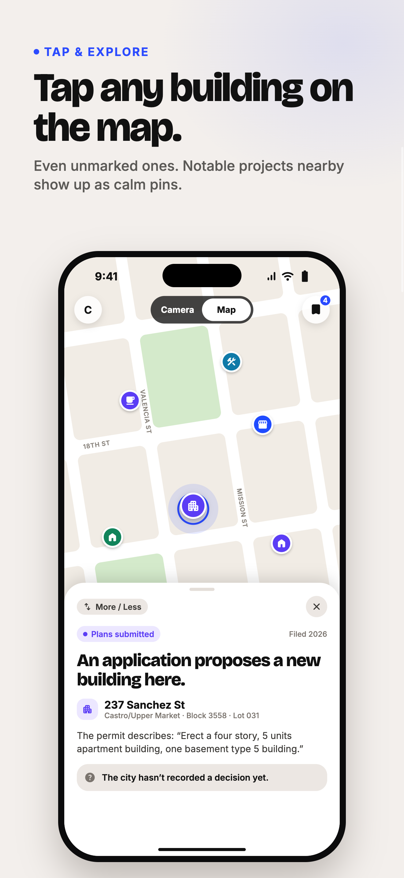
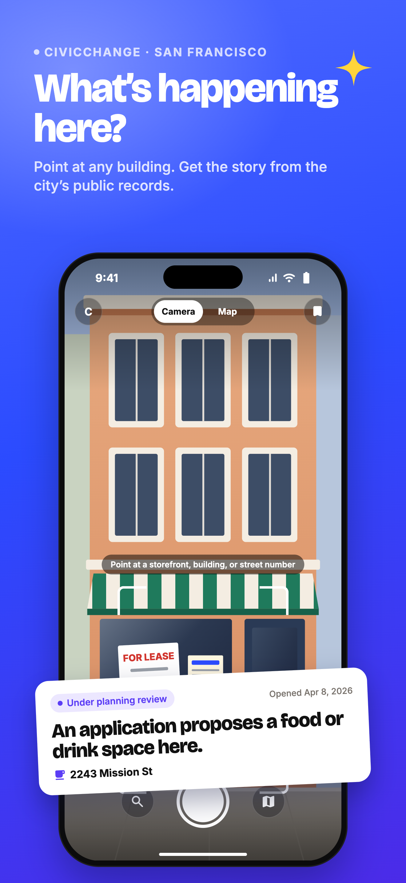
CivicChange is a camera-first city discovery concept with three ways to explore: photograph a place, tap a location on a map, or ask a question.
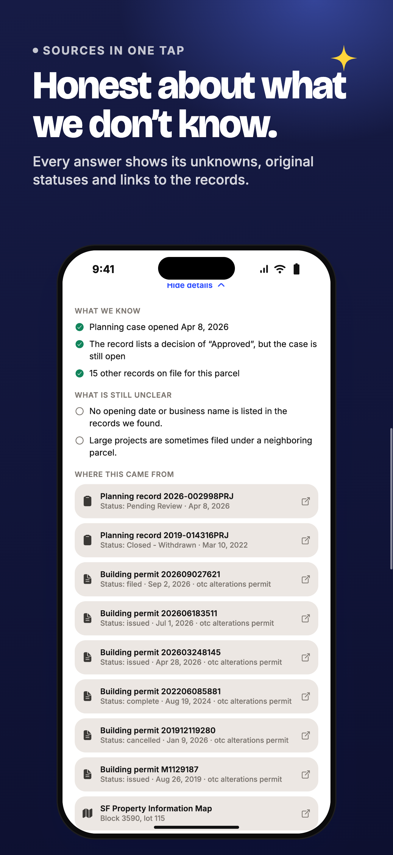
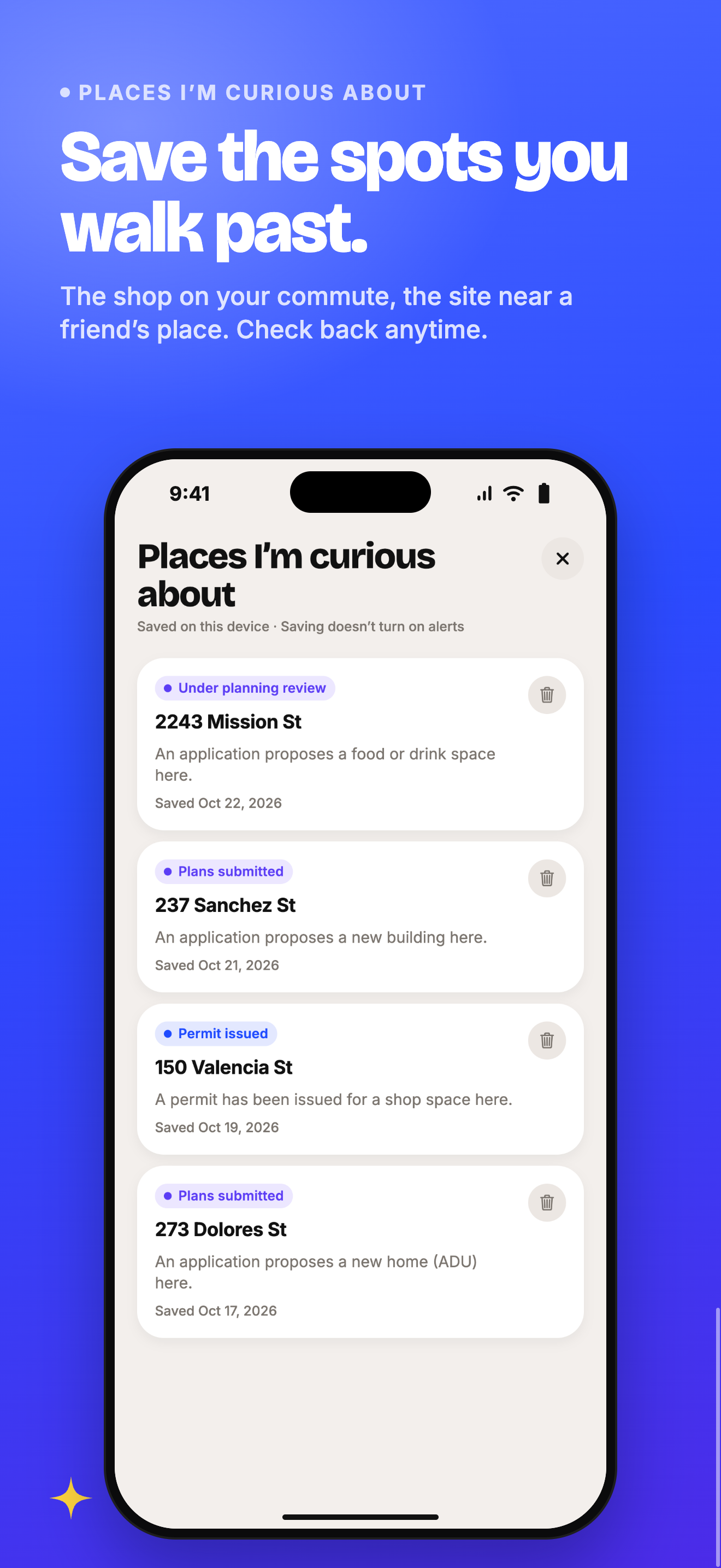
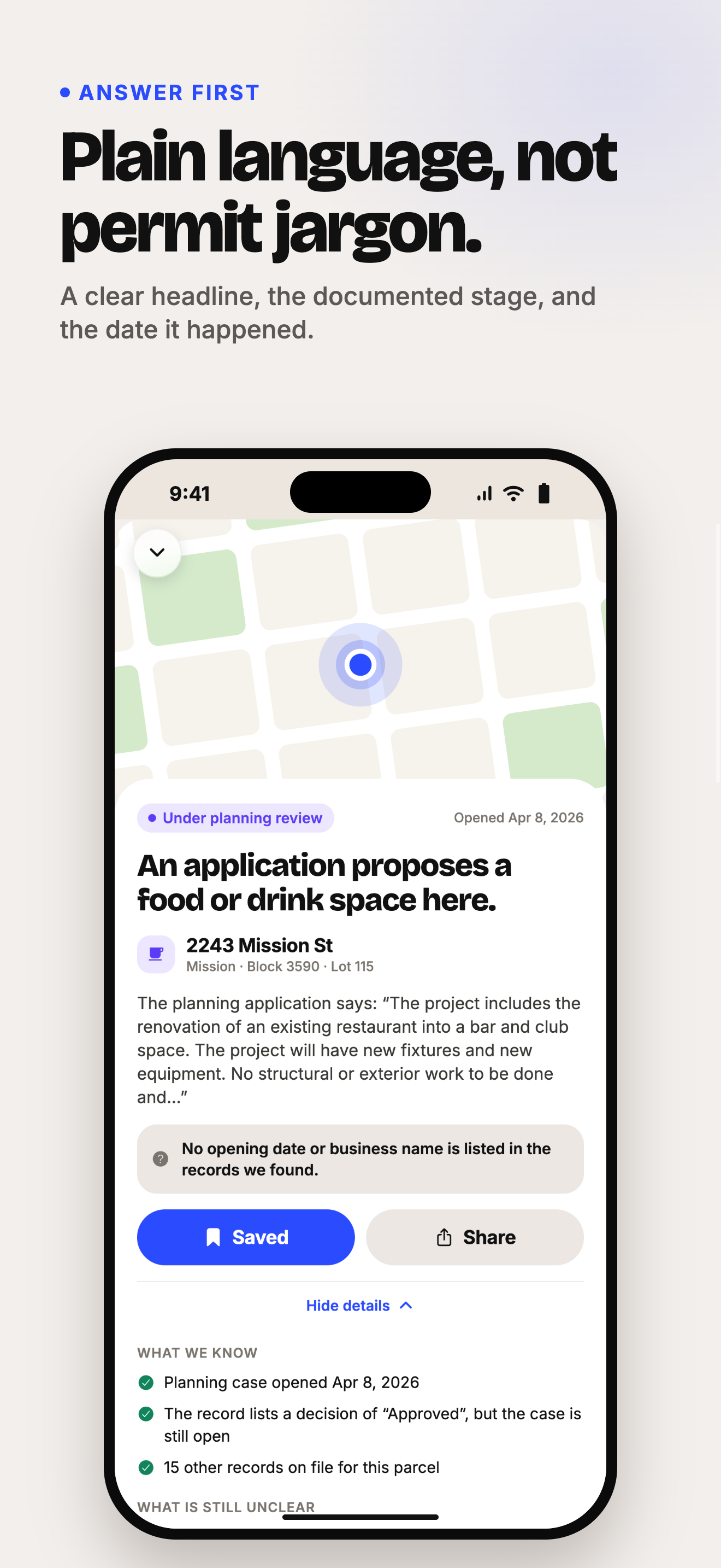
All three lead to one simple place card: what the records describe, the documented stage, what remains unknown, and the evidence behind the answer. People can save places they are curious about and share an understandable explanation.
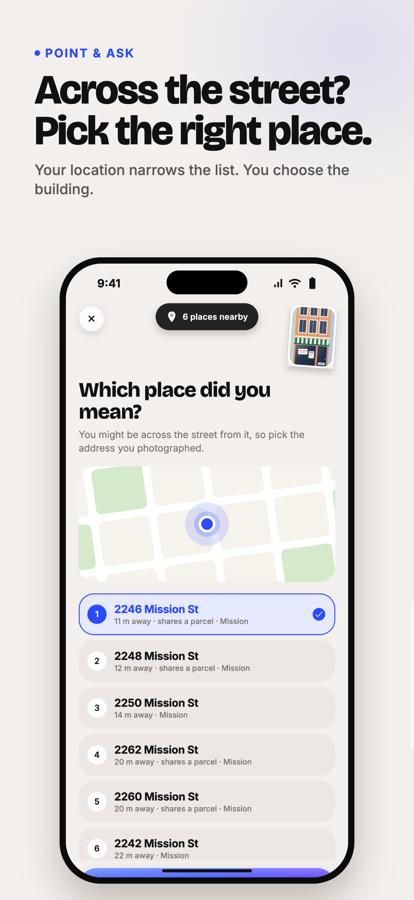
Our interactive prototype demonstrates the journey with a San Francisco neighborhood map, a simulated camera capture and location confirmation flow, example questions, place details, and saved places. The map uses real public street and parcel geometry. The project stories are clearly labeled fictional examples used to demonstrate the experience.
The intended audience is anyone who walks through a neighborhood and wants to understand how it is changing, without needing expertise in city government.
How we built it
We began with public-data research for a focused San Francisco pilot. We investigated DataSF's building permits, planning projects, address records, and parcel datasets, including the identifiers and status fields needed to connect a record to the right place.
We built the interactive concept with HTML, CSS, JavaScript, and D3. Published geographic data supplies the map context, while a reusable place-card interface connects map selection, the camera simulation, questions, and saving.
The prototype keeps its interactions local. Live record retrieval and photo-assisted identification are the next integration steps. This lets us demonstrate the interaction clearly while distinguishing the current prototype from the full product vision.
A key design decision was to confirm the target location: the building someone photographs may be across the street from their phone.
Challenges we ran into
The hardest challenge was defining what the app could responsibly conclude.
A proposal is different from an approval. An issued permit does not prove construction has started. A completed permit does not establish that a business has opened. An empty-looking storefront does not explain why it is empty.
These distinctions shaped the interface: plain-language status labels, dated evidence, and a clear statement of what is unknown.
We also had to make a complex data problem feel simple. We focused on one place and one useful answer, with deeper information available when someone wants it.
Accomplishments that we're proud of
- Turning a familiar neighborhood question into a concrete consumer experience.
- Connecting map exploration, a simulated camera journey, questions, and saved places through one coherent interface.
- Using real San Francisco geography to ground the prototype.
- Researching a practical public-data foundation for a city pilot.
- Making evidence and uncertainty part of the product design from the beginning.
What we learned
Making information public is only one part of making it useful. People also need help identifying the right place, interpreting the record, and understanding what the record does not establish.
We learned that trust belongs in the main experience. A short answer becomes more useful when someone can inspect its source and see when it was checked.
What's next for CivicChange
Connect the San Francisco pilot to live records, implement photo-assisted address and permit-notice recognition, and test the experience with people walking through their neighborhoods.
After validating the core lookup, add meaningful updates for saved places and expand to more cities as their data allows.
Our ambition is simple: help everyone understand the changes happening around them.
Public data and credits
This project aligns with Track 1: Hacking with Public Data APIs.
The prototype uses published San Francisco street geometry and parcel geometry. Integration research includes building permits and planning projects.
Developed with AI assistance, using D3 for geographic rendering and Lucide for interface icons.


Log in or sign up for Devpost to join the conversation.