-
-
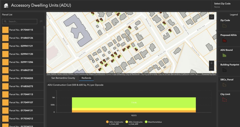
ArcGIS Dashboard
-
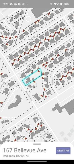
MObile app launch page, with map page
-
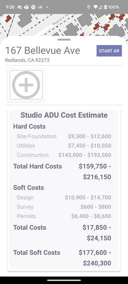
Unit overview and Cost estimator
-
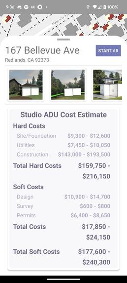
Unit overview with attachments uploaded
-
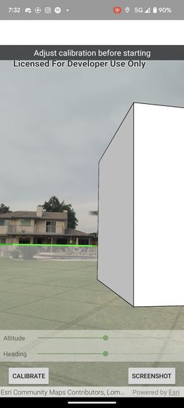
AR effect


Inspiration
ADUs also known as granny flats, in-law units, backyard cottages, secondary units and more have grown exponentially in number as more cities, counties, and homeowners become interested in ADUs as one solution to increasing the supply of affordable housing. Individual tenants are hesitant to invest and always have little clue about the feasibility of such construction in their backyard. On the other hand, the county government, despite their effort in promoting ADUs among communities, faces inefficiency in targeting specific neighborhoods and collecting data on where the new ADUs are being built.
What it does
As a software company specializing in geoinformatics, Esri could help both customers and government agencies by analyzing and visualizing potential and ongoing ADU constructions. Our solution is two-fold. Firstly, we are proposing a web application mapping potential residential parcel for urban planners, utility companies, and construction companies for them to make better decisions on planning works, surveys, and promotions. Secondly, we are also proposing a mobile application for targeted customers to calculate investment returns and the cost of construction on their lot. Furthermore, the application will have built-in Augmented reality functionalities for homeowners to visualize how their backyard could be transformed with a new ADU.
How we built it
ArcGIS Dashboard: We created a dashboard that shows ADU construction for 500 & 600 Sq.Ft per zip code in San Bernardino county. We collected parcels, zoning, Zip code boundary and building footprint for the study area and processed all data in ARCGIS PRO. The map was published to ArcGIS Online as hosted feature layers and latter used in creating web map and dashboard. Mobile App: The App took inspiration from the runtime API sample project. By leveraging the sample projects as building blocks, we manage to integrate different mobile features into one application. We also draw inspiration of UI/US design and code structure from the internship experience.
Challenges we ran into
It was difficult translating the project concept into the product development but after brainstorming we were able to overcome that. The main feature of the app, the augmented reality feature, is only available with API version 100, as we continue to migrate to kotlin especially compose and coroutine, it would be ideal to provide a full migration sooner than later.
Accomplishments that we're proud of
We have mobile app and dashboard that works and the team effort to see the project through is amazing.
What we learned
ArcGIS Developer tools, Team collaboration


Log in or sign up for Devpost to join the conversation.