-
StreetDiagram
-
BusDiagram
-
RBusesApp


Inspiration
Google maps traffic capabilities and the traffic overview from Cities:Skylines.
What it does
Uses cameras, pressure plates and motion sensors to send information over the LoRa network of how many people are on public transport, how many seats are taken on public transport and to measure the density of people on the city streets.
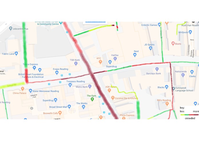
Using recognition software a series of cameras overlooking a city street will split the image of the street into a grid, checking grid square by grid square for shapes the algorithm recognises as human, every time it detects a new one it adds to the total count of people in the street. Once it completed the grid it transmits the number of people currently in the city street.
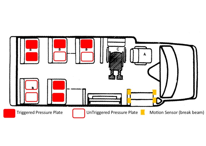
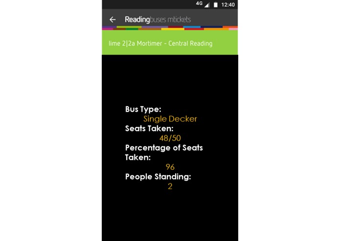
For public transport three data sets will be transmitted. A count of total people on bus/train carriage, how many seats are taken, how many people are standing. The number of people in total will be taken by having two break -beam motion sensors on the door to count how many people get on and off the bus. There are two so the computer can differentiate between getting on and off the bus, If sensor A is triggered before sensor B they are getting on the bus, if sensor B is triggered before sensor A they are getting off the bus. The number of people sitting will be taken when the computer counts how many of the pressure sensors are triggered. The number of people standing will be taken by subtracting the amount of people sitting from the total amount of people on the bus. These will be processed and turned into three values by a small raspberry pi type device, then sent to the SODAQ board which will transmit it through the LoRa network to be made us of.
The LoRa network is ideal for this as it has a high range from a small ariel, it allows small values to be sent within a large radius.
Built With
- arduino
- lora
- python
- raspberry-pi
- sodaq-explorer
