-
-
Cinepath: Frances Ha
-
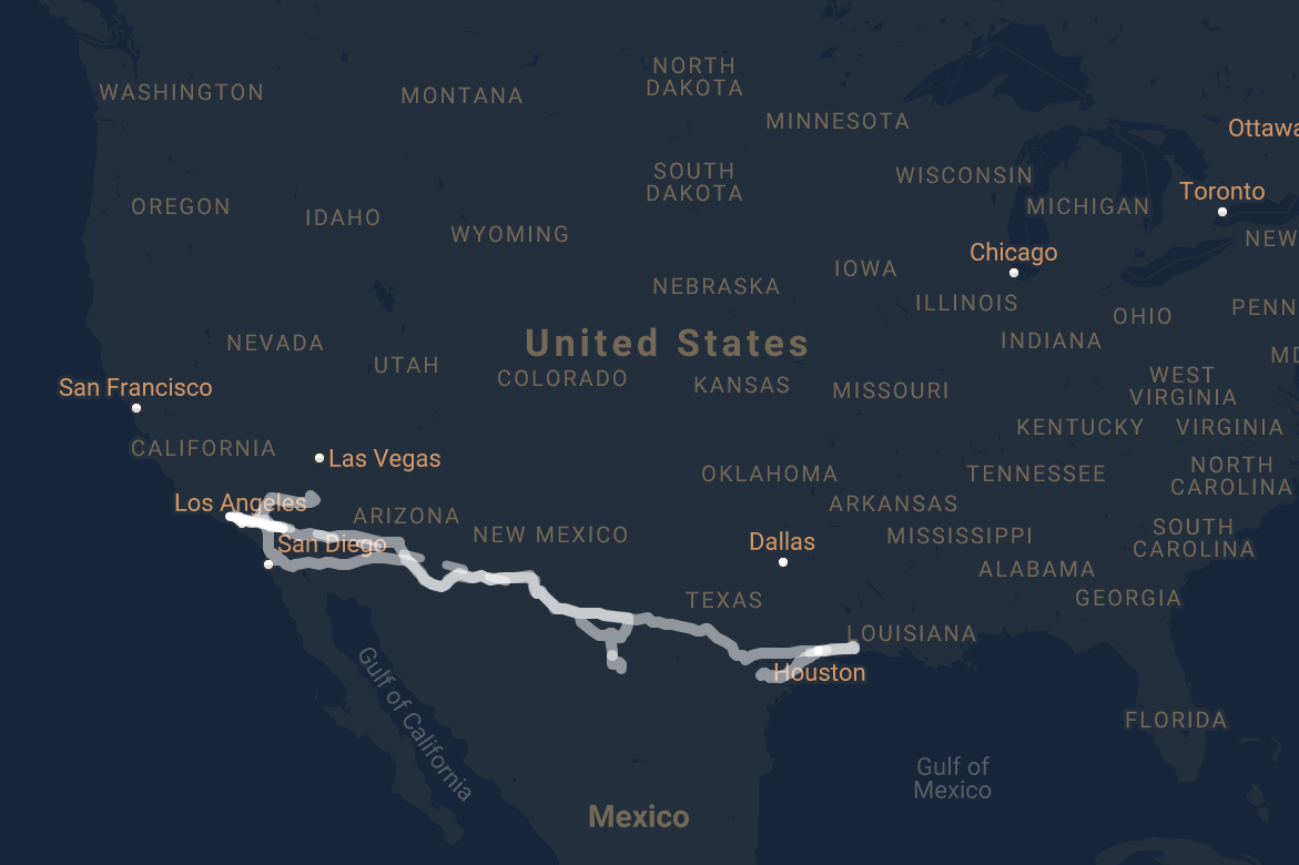
Cinepath: Paris, Texas - LA
-
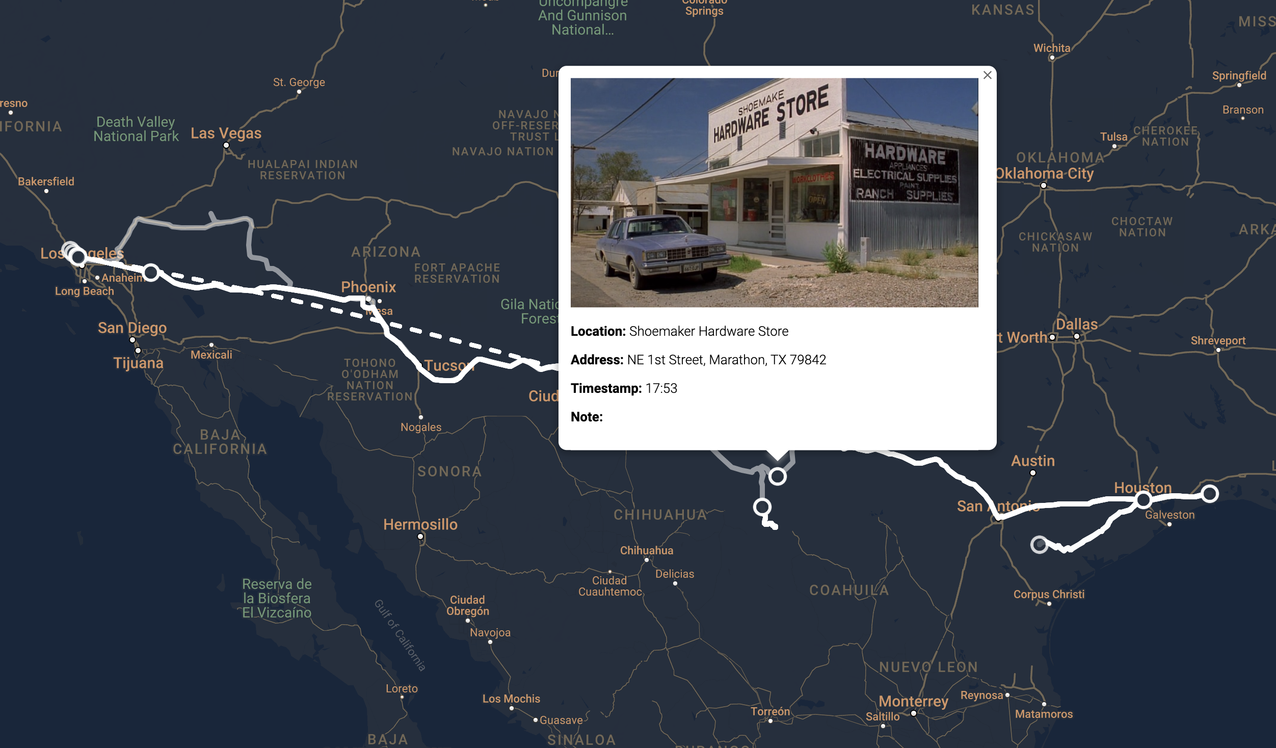
Cinepath: Paris, Texas
-
-

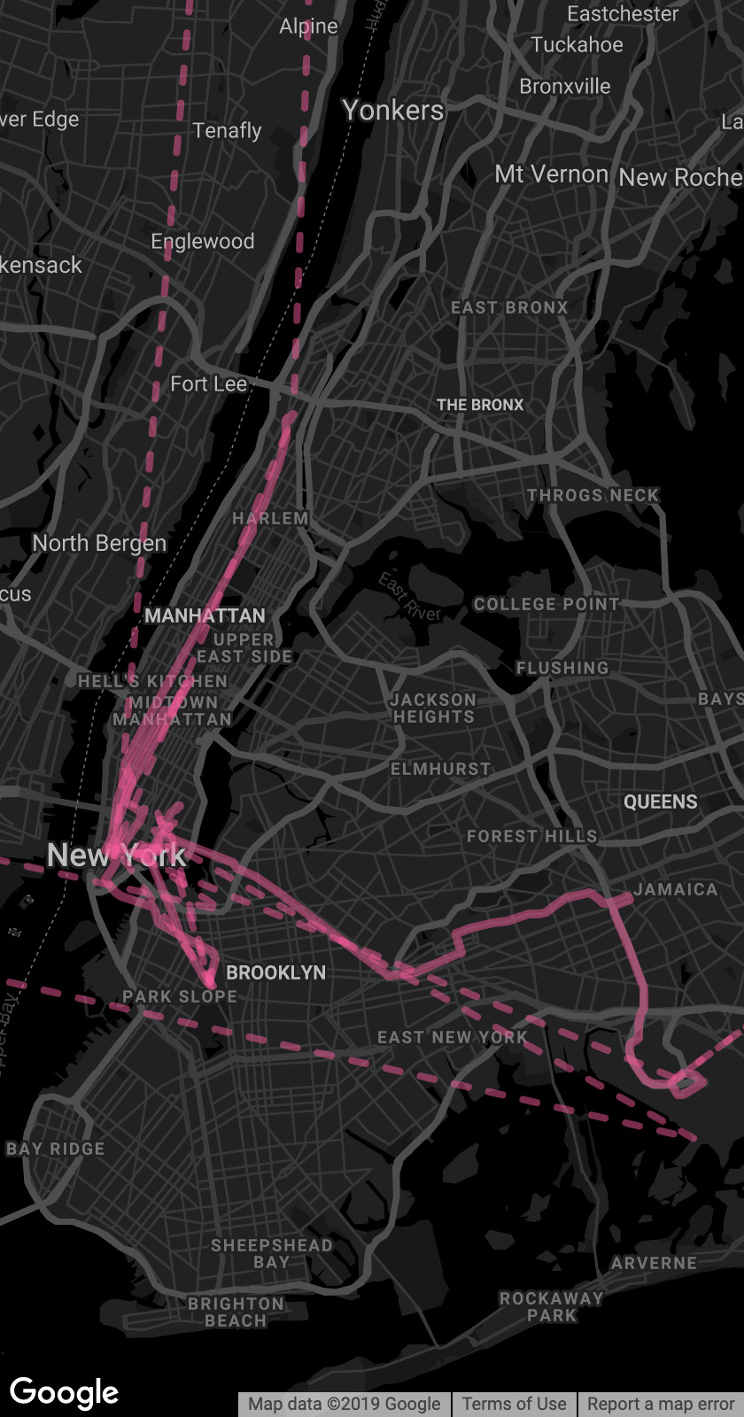
Cinepath: Frances Ha - NY
-

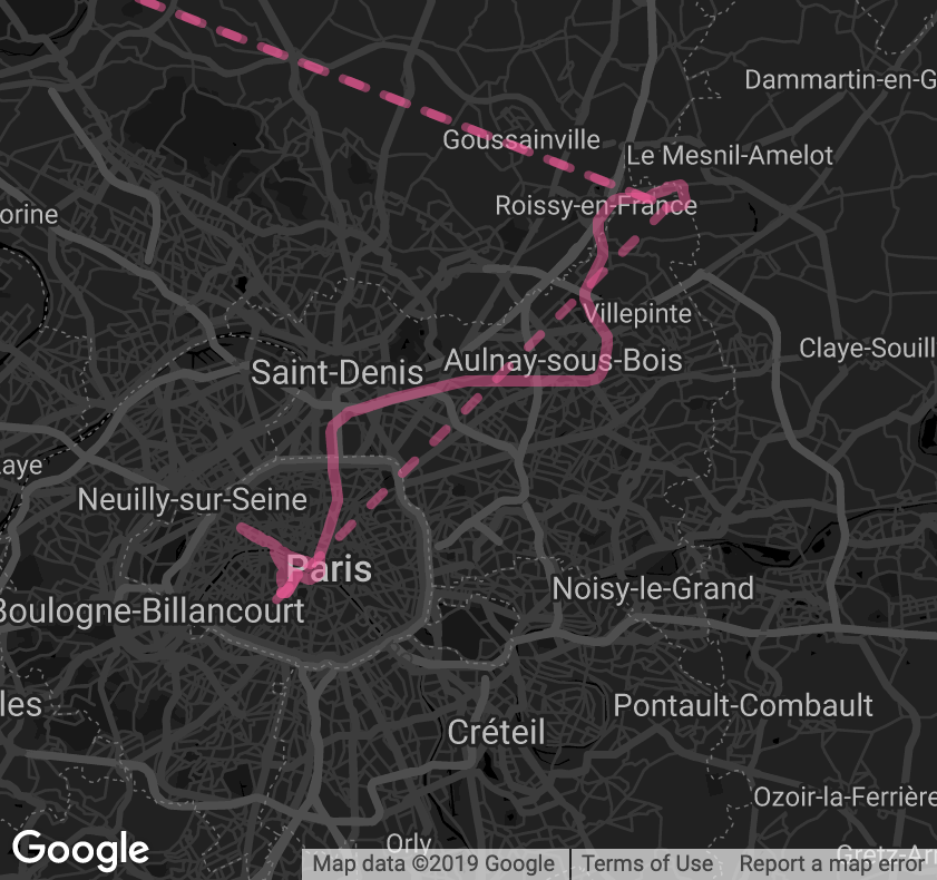
Cinepath: Frances Ha - Paris
-
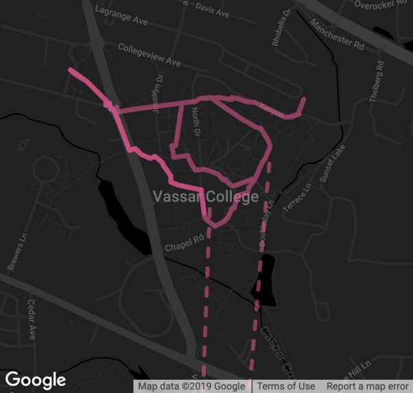
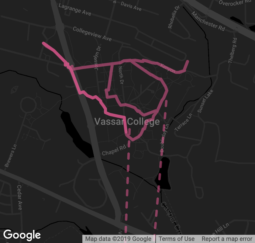
Cinepath: Frances Ha - Poughkeepsie
-

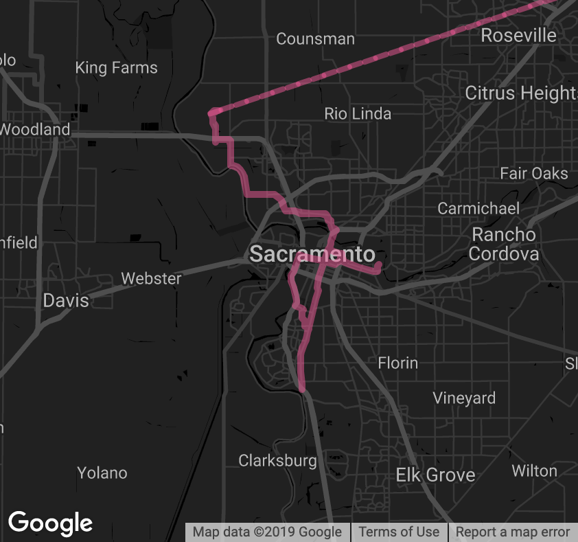
Cinepath: Frances Ha - Sacramento


Cinepath
Links to see the visualizations:
Testing instructions to run locally:
python3 -m http.server
Inspiration
As a cinephile and an avid traveler, the way I learn about unfamiliar places and people and ultimately attempt to understand the world, is through the lens of cinematography. Both academically and personally, these interests have led me to ponder: how do filmmakers choose the locations to shoot? Where are those film locations in real life? And how would the visualization of the patterns be like through mapping between fiction and reality?
I was inspired by a video which mapped the opening scene of Baby Driver. However, instead of making a video with tools much as Adobe After Effects to animate all the routes, I had this visualization automaton in mind which uses webpages as the medium and allows user interactions to explore the map online.
Data Collection
The most time-consuming process while developing Cinepath was to go through each film, breaking down a movie frame by frame to get actual timestamps, then researching the real filming locations. I used a multitude of resources: original scripts, director’s commentary, Internet Movie Database, other cinephile’s film location blogs, and even Google Maps Street Views as a cross-referencing tool.
However, as I dive deep into research, I found out that directors would intentionally choose their film locations that may not add up to the plots but serve either personal or atmospheric purposes. For instance, the director Wenders revealed in his commentary for Paris, Texas that he chose to film in a byway town just because of its same name with his grandfather.
Implementation
Now we have coordinates, but how can we show the movement from point A to point B? Online Google Maps API Documentation has been extremely helpful resources to request a route with specific transportation methods varied from walking to public transportation. I wrote codes in JavaScript using Google Maps API as the generic method of visualization. Finally, I designed map layouts and customized colors based on the theme of and my emotional response to the film itself.
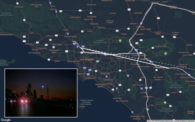
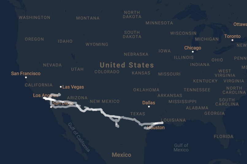
Paris, Texas
The way I see road films as poetry to America was deeply influenced by Paris, Texas (1984) directed by Wim Wenders. It's fascinating to just watch protagonists driving back and forth between Texas and California as the scenery unfolds: gas stations, motels, diners, and the neon signs. The intention is to not only map all these places frame by frame, but also analyze the dynamic geographical movements that could evoke the viewer's experience of moving through space. As for the layout, I made a design choice to only have one map of the Southeastern part of the United States and create an overlay that covered additional sea areas to play snapshots of the film to get audiences a geographical sense of the places when a 145-min film shrinking into 30 seconds.
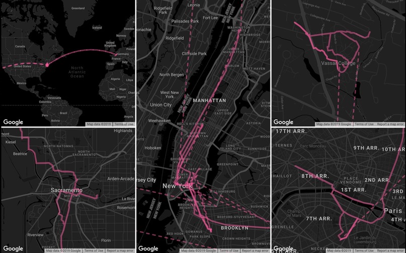
Frances Ha
Comparatively, Frances Ha (2013) by Noah Baumbach is a more recent production takes places mostly in New York City. There was also a fair amount of travels in this film where the protagonist visited Sacramento, Paris and Upstate New York. Since there were multiple places, the decision is to have maps for each of the location with an additional world map to get a big picture. Styling in black and white fashion is to appreciate the film visuals and the choice of pink lines refers to the posters. In another sense, film productions provide a new type of landmarks for tourists when a place was given a new meaning in the cinematic world, turning the mundanity into imaginative experience. Phenomenally these places become new attractions for movie-goers to take pictures, but could it also be something problematic?
Progress during Hackathon Period
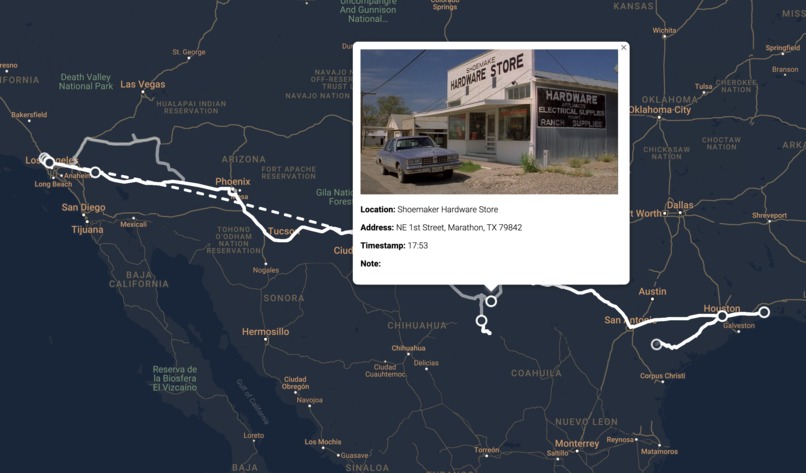
I have integrated a series of customized markers that allows users to click on several points on the map to see detailed information regaring that one physicial location. Using Google Sheets API, I have successfully provide location, addess, timestamps, notes and film stills to associate a fictional location to a real geographical location.
What's next for Cinepath
To further understand a director's film locations throughout their career, more data visualizations could be created on one film director, to better analyze their moving patterns, interests of certain regions and transportation preferences throughout their career.
Technically, the data collection process could also be optimized with deep-learning programs to recognize locations by video processing to extract frames in the film, In this way, it could reduce the time and efforts to generate more visualizations with the utilization of a back-end database.


Log in or sign up for Devpost to join the conversation.