-
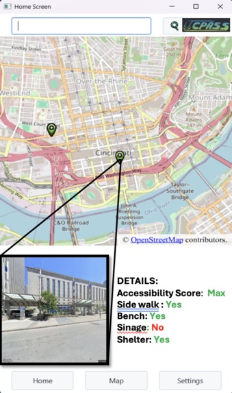
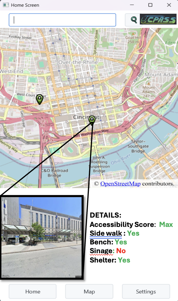
User Interface
-
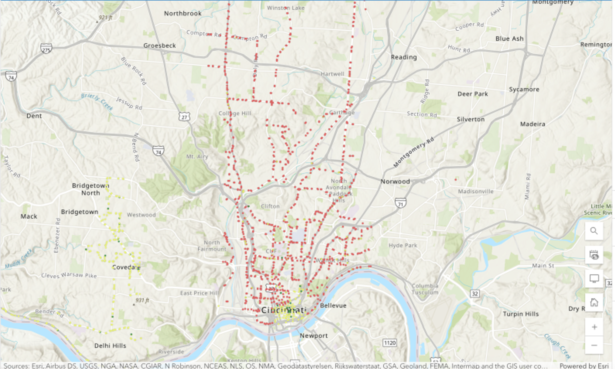
Accessibility Scores
-
Logo
Purpose
In the US that are 44 million individuals living with disabilities. Of those 5 million utilize a wheelchair or electric scooter for mobility and over 500,000 never leave their house due to transportation difficulties.
The goal of our project is to develop a tool that can help to alleviate at least part of the burden associated with engaging in transportation.
Inspiration
More than anything else, we were inspired by the results of Project Sidewalk. A initiative that has combined AI and public data to map accessibility of 1700 thousand kilometers of public infrastructure across 7 cities.
Building on their work we chose to tackle a similar but novel problem. Utilizing two stages of vision AI: one to identify accessibility features and another to identify necessary infrastructure we extended previous work in the field to examine a unique combination of features supporting accessibility.
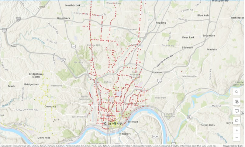
Stats
12,000 images downloaded from Google Street View
3000+ Cincinnati bus stops analyzed
Next Steps
This in many ways is the start of the work we would like to do. From here, our goal is to integrate the estimated accessibility of bus stops with an open-source data on the accessibility of bus routes.
With that we hope to create a publicly available path-finding application for individuals with physical limitations. Rather than going on public transportation, and hoping to find stops that provides for their needs, we want to ease their burden by automating this process.
In the future we hope to combine this data with an interface that allows an individual to specify their level of physically ability and find routes through urban settings that allow them to utilize public transportation with minimal disruption.
Built With
- amazon-web-services
- api
- artificial-intelligence
- deep-learning
- git
- github
- java
- json
- machine-learning
- opencv
- pandas
- python
- roboflow
- vision-ai
- yolo


Log in or sign up for Devpost to join the conversation.