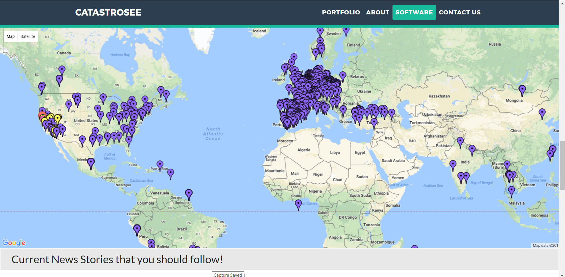
We were inspired by the natural disasters that recently struck the United States, from the multitudes of hurricanes that hit the east coast and the midwest, to the still present fires in Napa Valley and Sonoma County. Our application shows the locations of current weather patterns, such as thunderstorms, air quality, earthquakes, and fires to people who are nearby these events. In the event that these disastrous conditions were to reach closer to their homes, our application would give users the ability to find places nearby that would serve as relief sites, ranging from Red Cross to simple Relief Centers. We built it using Satori, which is a live data platform that serves as a almost zero latency service that provides thousands of data streams. From here, we could filter out specific data using SQL and scrape the live data for specificities that we wanted. Some challenges we ran into were errors with integrating google maps and google places into the code; it wasn't as easy as we thought it was, but once we got the hang of it, it was pretty simple! We're proud that we could learn and use Satori so rapidly; I had been on a team that used it for two previous hackathons, and I am proud to say that I have learned fully how to use Satori and its vast array of services and streams for our project. For Catastrosee, we want the next step to be big; big enough that we could help those in need with directions and safety teams to get to shelter in case of an emergency: quickly, and before the worst time strikes.
Built With
- css
- google-maps
- google-places
- html
- javascript
- satori
- weather-api


Log in or sign up for Devpost to join the conversation.