About the Project
Carbon Credit Allocation and Verifier is a multimodal web app for credible carbon markets. It combines farmer land CCV (via satellite/drone imagery) with industrial 'Scope 1-3' emission audits.
Inspiration
Carbon markets have a credibility problem — credits are issued on paper promises, not provable reality. Carbon Credit Allocation and Verifier fixes this by bridging the two biggest gaps in carbon accounting: what's happening on the ground, and what's happening inside industrial supply chains. On one side, we use satellite and drone imagery to independently verify farmer land-use claims, confirming reforestation, soil carbon, and conservation practices without relying on manual, unreliable self-reporting. On the other, we run rigorous Scope 1, 2, and 3 emissions audits for industrial buyers, so the credits they purchase are actually offsetting what they claim. By unifying farmer-level verification with enterprise-grade emissions auditing in one multimodal platform, we turn carbon credits from a trust exercise into a verifiable transaction — making markets more accountable for farmers, buyers, and regulators alike. If you'd like, I can also draft a couple of alternate taglines or a longer investor-style pitch with market sizing and a problem/solution breakdown. This project tackles greenwashing at scale using satellite pixels → AI reasoning → verified tCO2e.
What it does
Carbon Credit Verifier is an agentic web app unifying farmer carbon credits and industrial emissions auditing:
Farmer Flow: Upload GeoJSON land parcels + drone shots → Gemini 3 chains NDVI analysis (0.72 avg = healthy canopy) → biomass models → 450 tCO₂e verified from 100 ha agroforestry, flagged for 4% leakage.
Industry Flow: Upload Scope 1-3 data (fuel logs, waste manifests, GPS logistics) → computes 15,200 tCO₂e footprint → identify hotspots (Scope 3 trucking: 7k tCO₂e).
Integrity Layer: Prevents double-claiming via CreditID registry lookups; matches offsets with 10% buffers; exports VCS-compliant PDF reports with reasoning traces.
Live dashboard: Interactive Leaflet maps highlight discrepancies; emission pies show Scope breakdowns.
How we built it
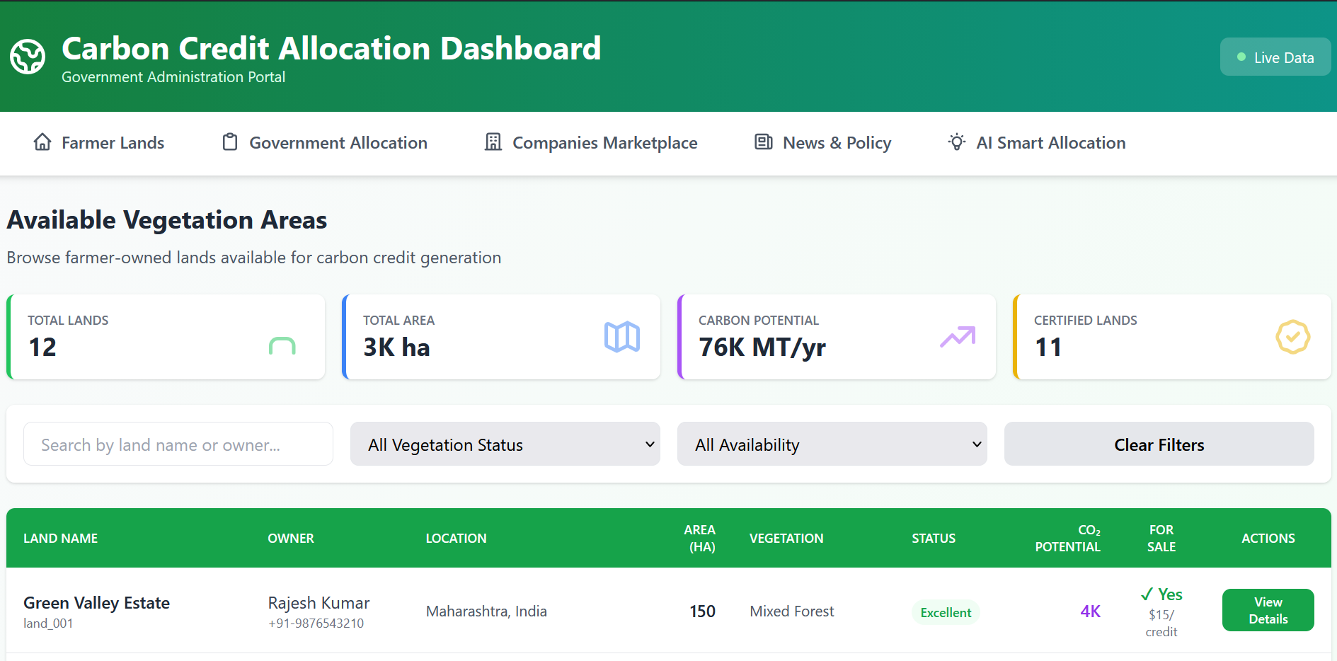
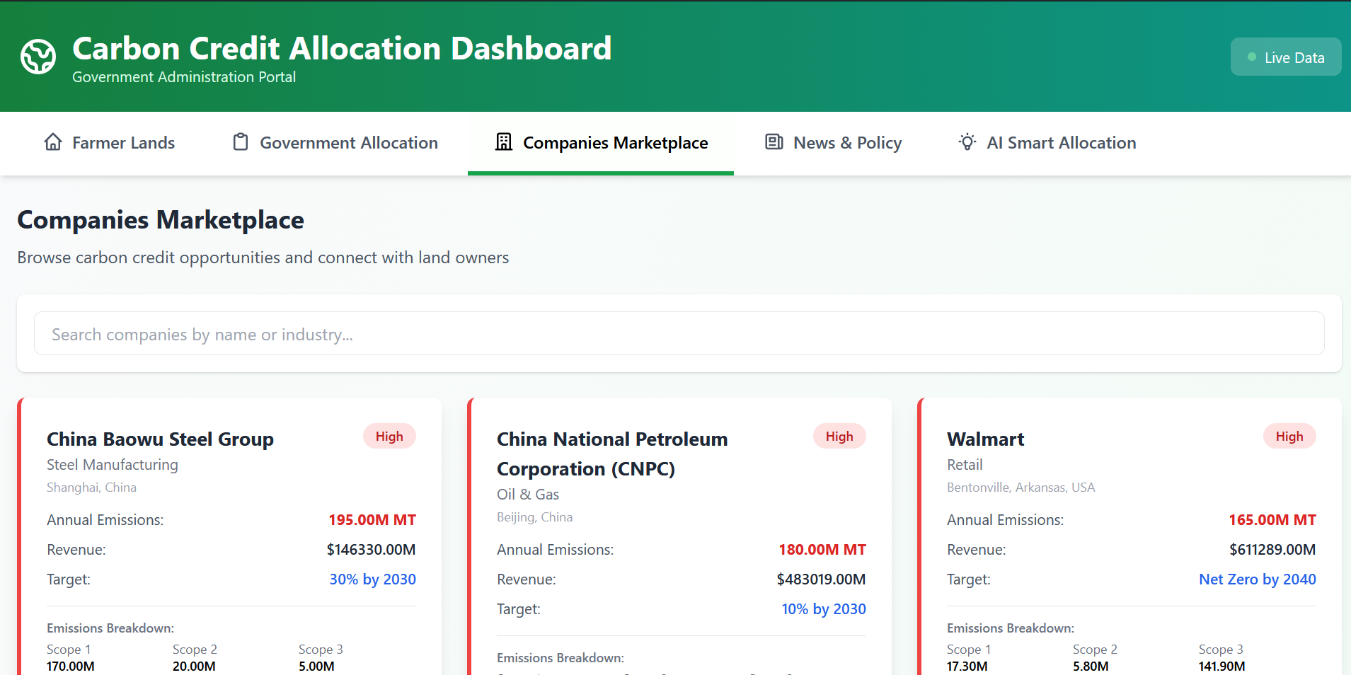
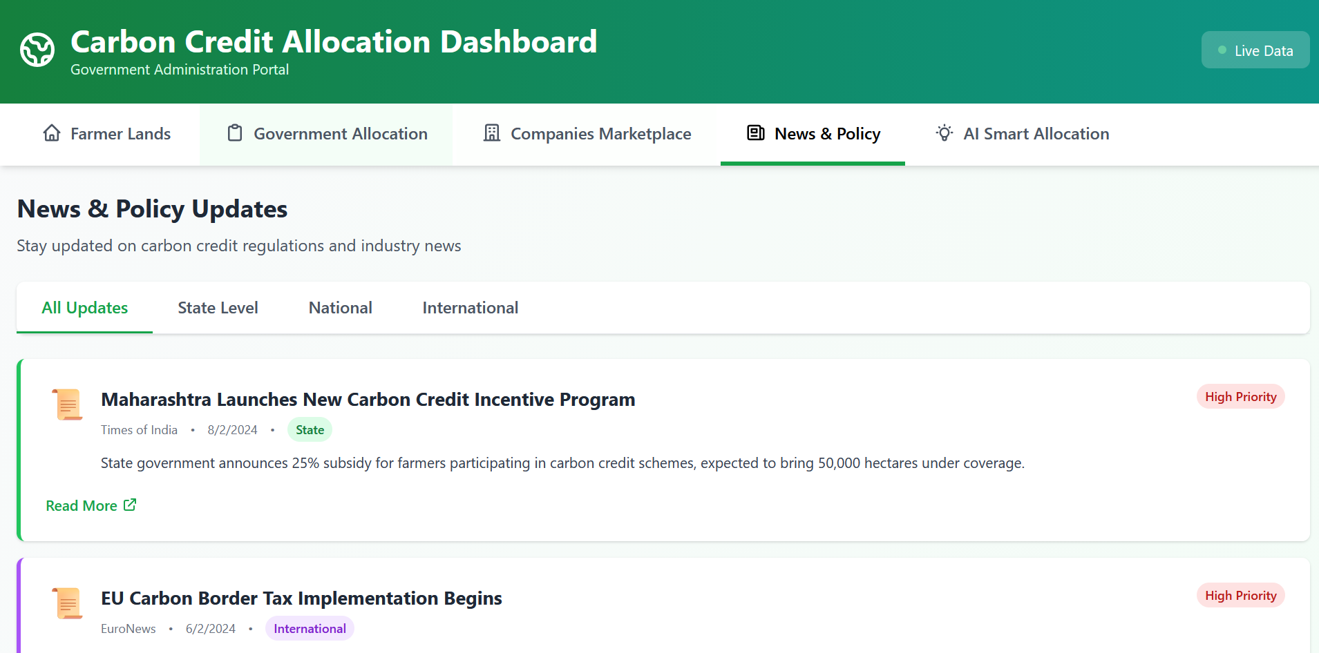
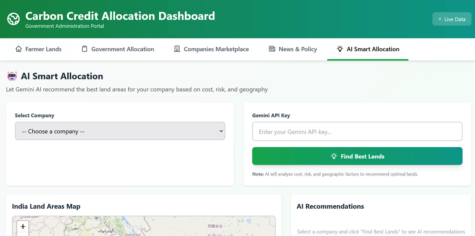
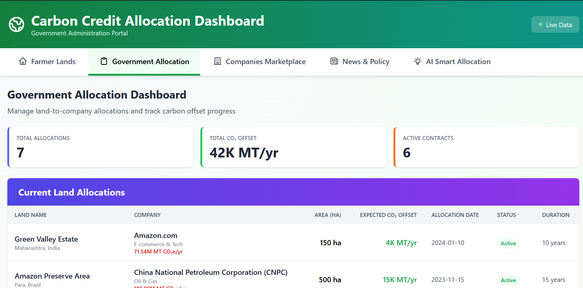
We built Carbon Credit Verifier as a multi-page government administration portal using a modern web stack, structured around four core modules: a farmer lands registry, a government allocation engine, a companies marketplace, and a news/policy feed. The backbone of the system is a vegetation and land database that tracks area, CO₂ potential, certification status, and sale availability for each plot, which we visualize on an interactive India map alongside windmill and solar installations. For the verification layer, we designed the data model to support satellite/drone-derived vegetation status (Excellent, Good, Fair, Poor) so that land claims can eventually be cross-checked against imagery rather than self-reported data. On the industrial side, we built a company profile system that ranks businesses by annual emissions and reduction targets, so the highest-emitting companies are prioritized for allocation. The centerpiece is our Gemini AI Smart Allocation feature: given a company's industry, state, emissions, and reduction target, Gemini analyzes cost, risk, and geographic factors across the land database to recommend optimal land-to-company allocations, turning a manual matching process into an automated recommendation engine.
Tech Stack: Next.js + Leaflet + Gemini 3 API + Google Earth Engine
- Frontend: Parcel drawing (Leaflet Draw) → GeoJSON → Satellite fetch (Sentinel-2)
- Gemini Vision Chain: "Raw image → NDVI=(NIR-Red)/(NIR+Red) → Canopy% → AGB=0.0673×(ρ×D²×H)^0.976 → tCO2e=C×3.67×Area"
- Backend: Node.js orchestrates parallel verification (farms + industry)
- Mock VCS Registry: Firestore tracks CreditID uniqueness
- Dashboard: Chart.js pies + Turf.js area calcs
Challenges we ran into
Designing a data model that could represent both farmer-side land attributes (vegetation type, area, certification) and industrial-side requirements (emissions, targets, budget) in a way that a single allocation engine could reason over was harder than expected; the two sides of the market speak very different "units." Getting Gemini to produce allocation recommendations that were genuinely useful, rather than generic, meant carefully engineering prompts that weighted cost, risk, and geography in a balanced way. We also had to build a live, filterable map and multi-table dashboard that stayed performant while pulling from the same shared dataset across four different pages.
Accomplishments that we're proud of
We're proud of shipping a working end-to-end allocation pipeline, not just a UI: a farmer can list land, the government can review and allocate it, a company can be matched against it, and Gemini can recommend the best fit, all flowing through one coherent data layer. We're also proud of how naturally the AI recommendation step fits into a real government workflow, rather than feeling bolted on, and of building a clean, filterable marketplace interface that makes a genuinely complex multi-sided market easy to browse. We are proud of features and tech that we have implemented :- *VCS Methodology Match: Implemented VM0017 afforestation math; reports pass manual verifier checklists.
*Geospatial Innovation: First hackathon project chaining Sentinel-2 → Gemini Vision → allometric biomass → tCO2e at pixel scale.
*Anti-Fraud Engine: 100% double-claim prevention; leakage modeling with buffer pools.
What we learned
We learned how much of the "hard problem" in carbon markets is really a data-matching and trust problem, not a blockchain or ledger problem; once land and emissions data are structured consistently, allocation becomes tractable. We also learned a lot about prompting Gemini for structured, criteria-weighted recommendations instead of open-ended text, and about designing dashboards that make a multi-stakeholder system (farmers, government, companies) legible to each audience without overwhelming them. Carbon verification math is deceptively complex—conservativeness thresholds, GWP updates (CH4=28→34?), permanence discounting. Open source allometrics vary wildly by biome; tropical forests need local calibration.
What's next for Carbon Credit Verifier
*Live Registry Integration: Verra VCS API + Gold Standard for real issuance. *Real-Time Monitoring: Daily Sentinel-2 alerts for deforestation/reversal risks. *Mobile Farmer App: GPS polygon drawing + drone upload from Android. *Enterprise Scope 3: ERP integrations (SAP invoices → auto-emissions). *Blockchain Credits: Ethereum/NFT retirement proofs. *Global Calibration: Biome-specific AGB models (boreal vs tropical). *Policy Simulator: "What if 10k farmers verify → national NDC impact?"
Built With
- gemini3
- google-earth-engine
- javascript
- leaflet.js
- next.js
- node.js

Log in or sign up for Devpost to join the conversation.