-
-
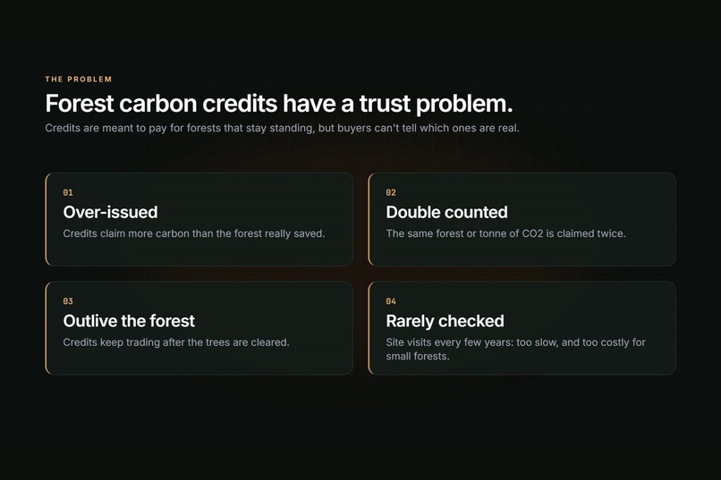
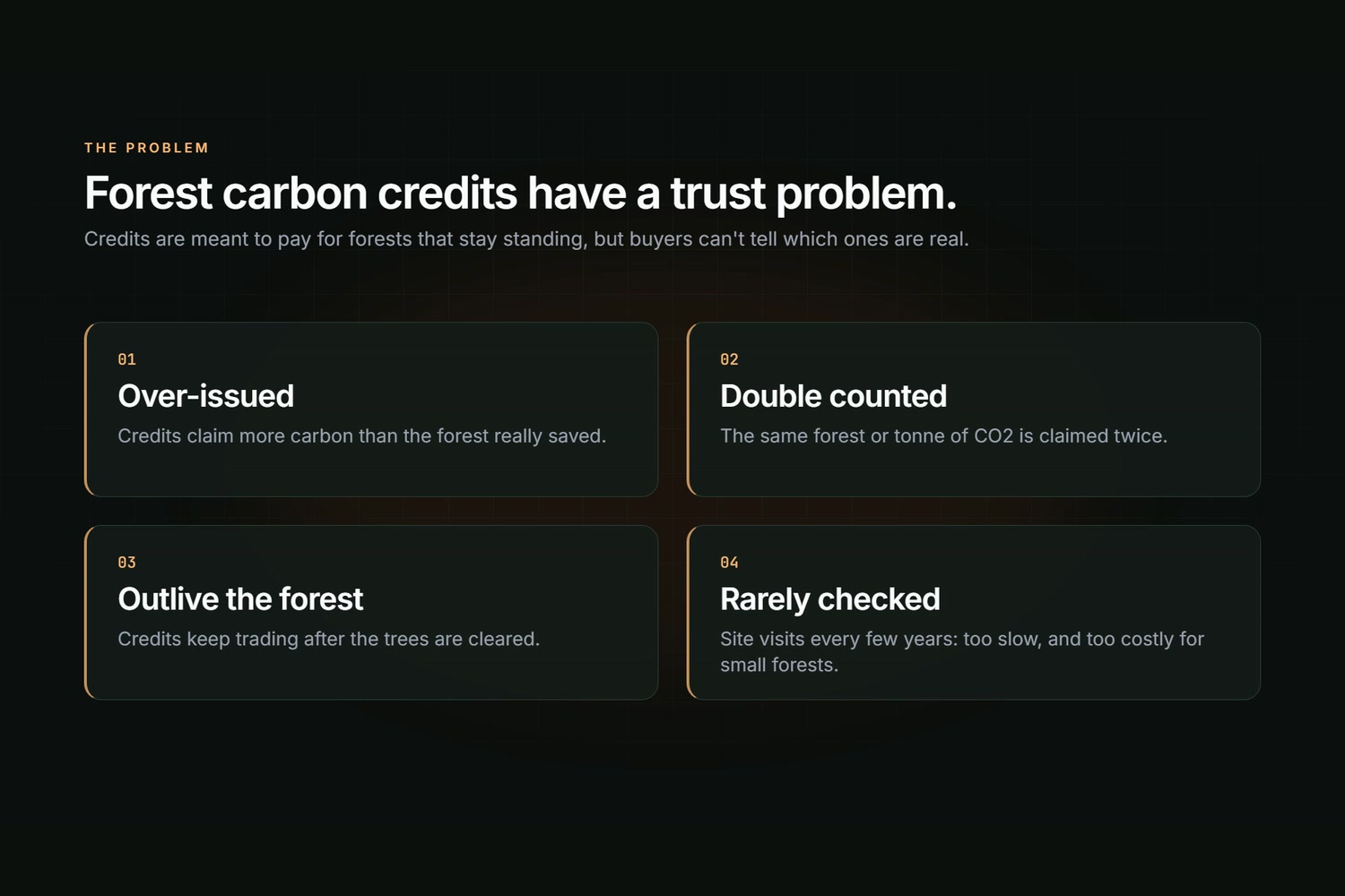
The problem: forest carbon credits people can't trust
-
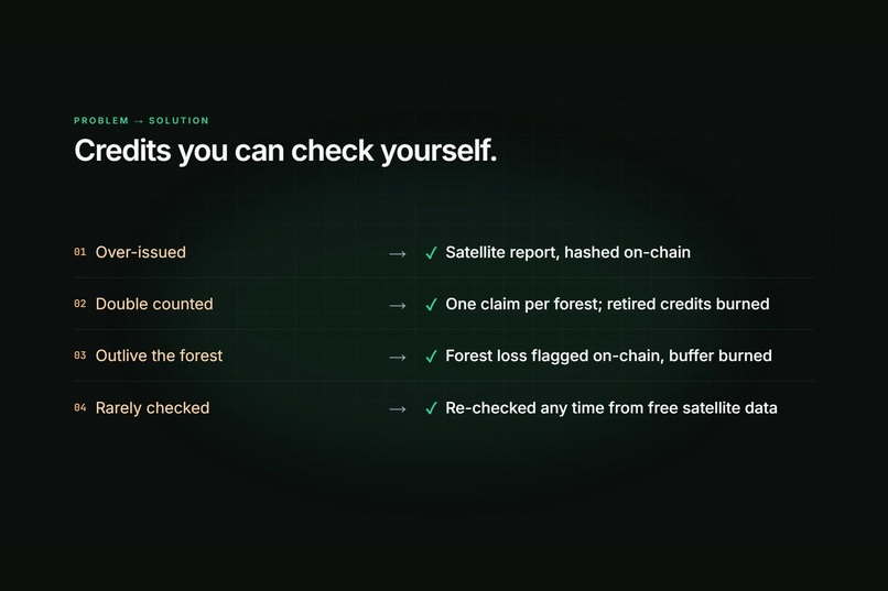
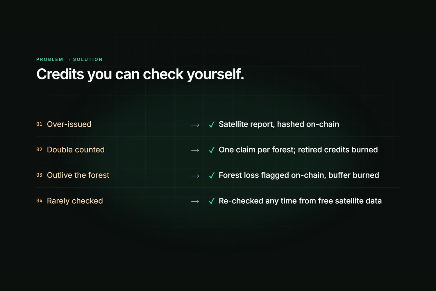
Each problem and its fix
-
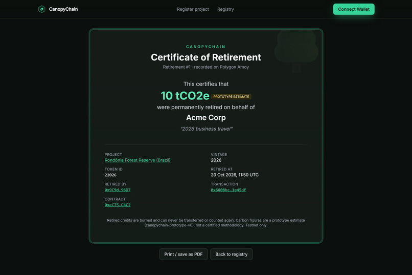
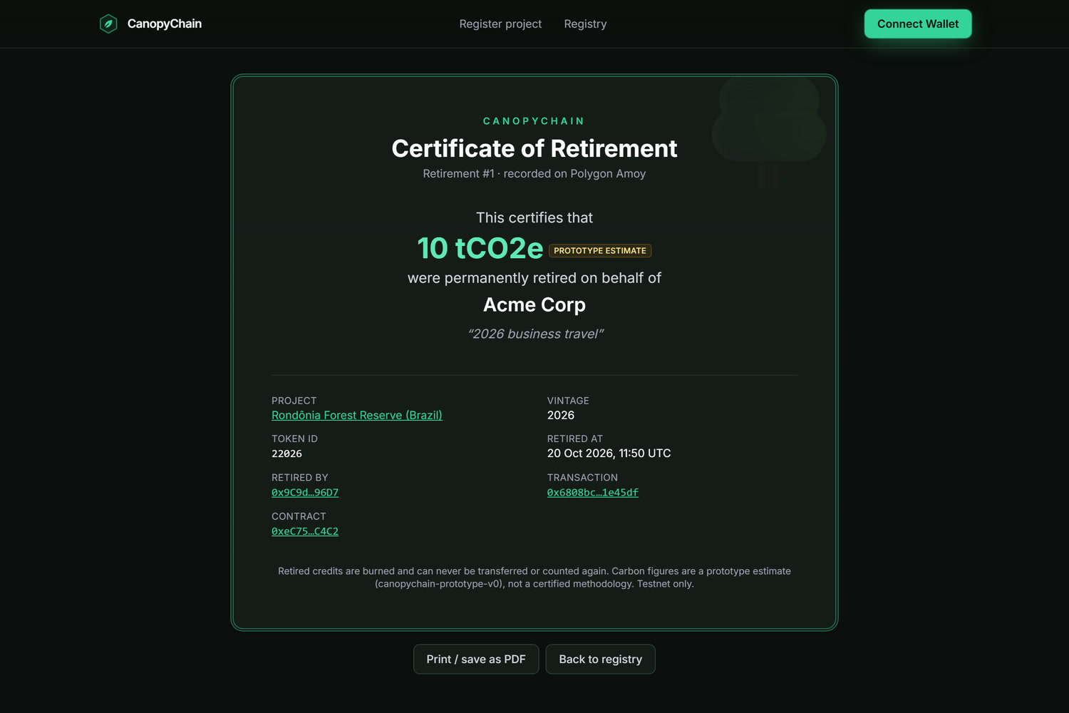
Retired credits are burned forever
-
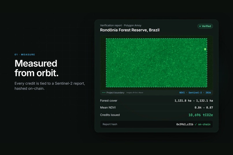
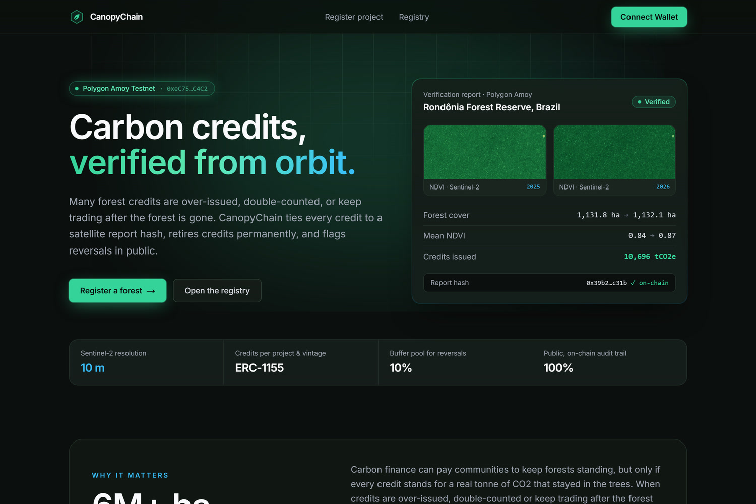
Satellite report with its hash stored on-chain
-
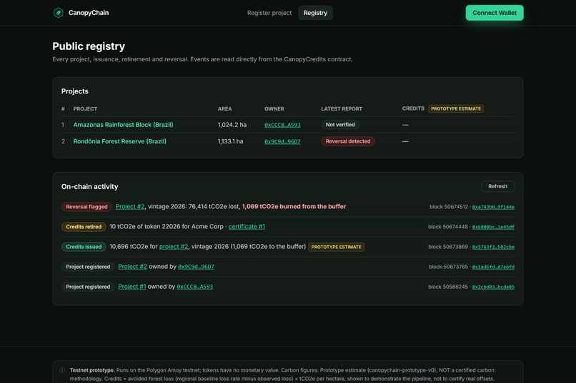
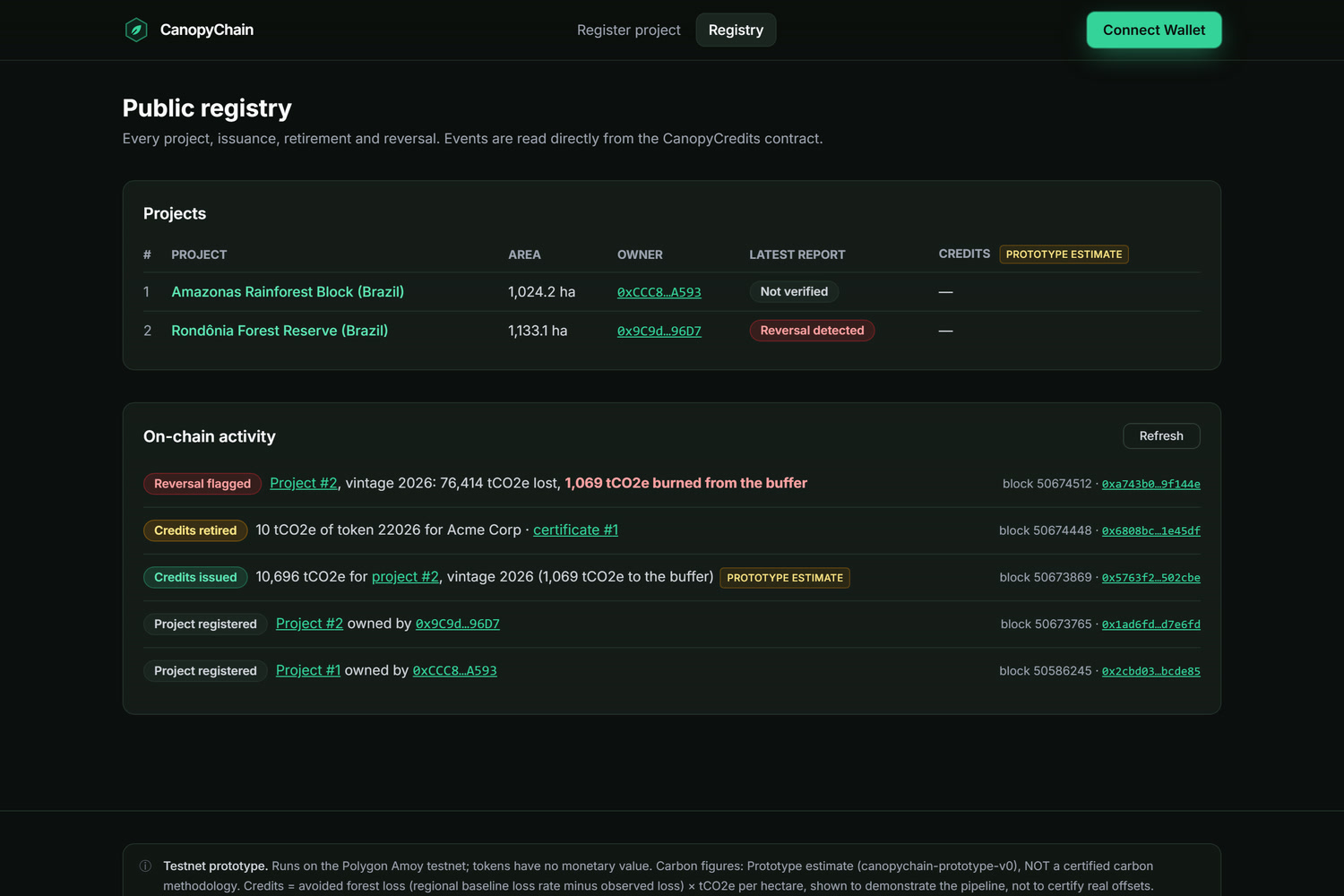
Every credit event, visible to anyone
-
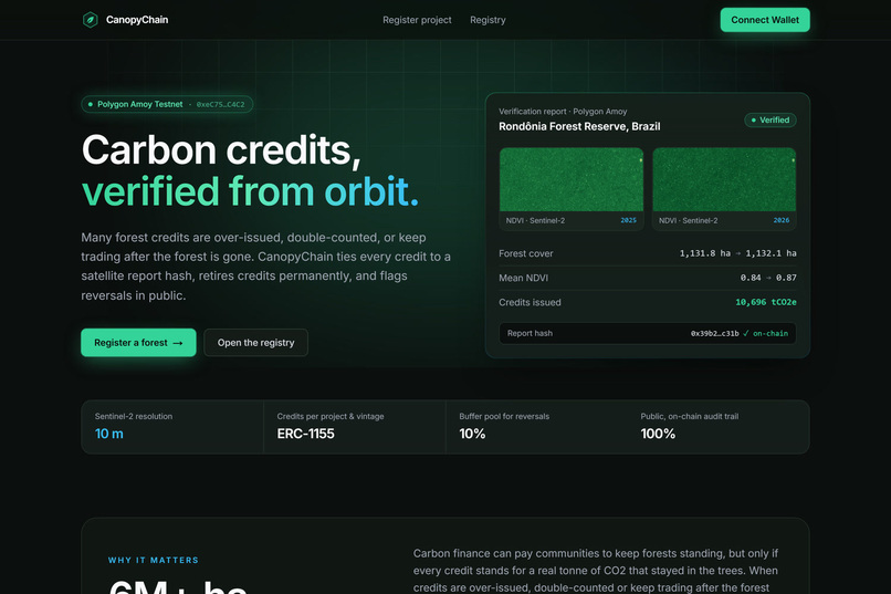
Carbon credits, verified from orbit
-
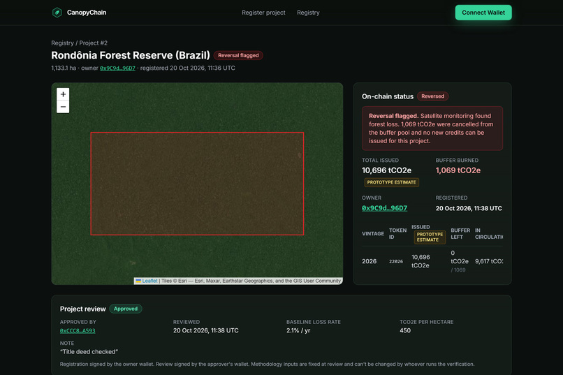
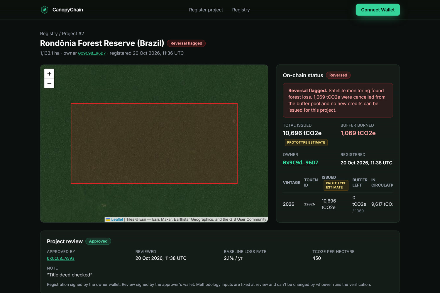
Forest loss flagged in public
-
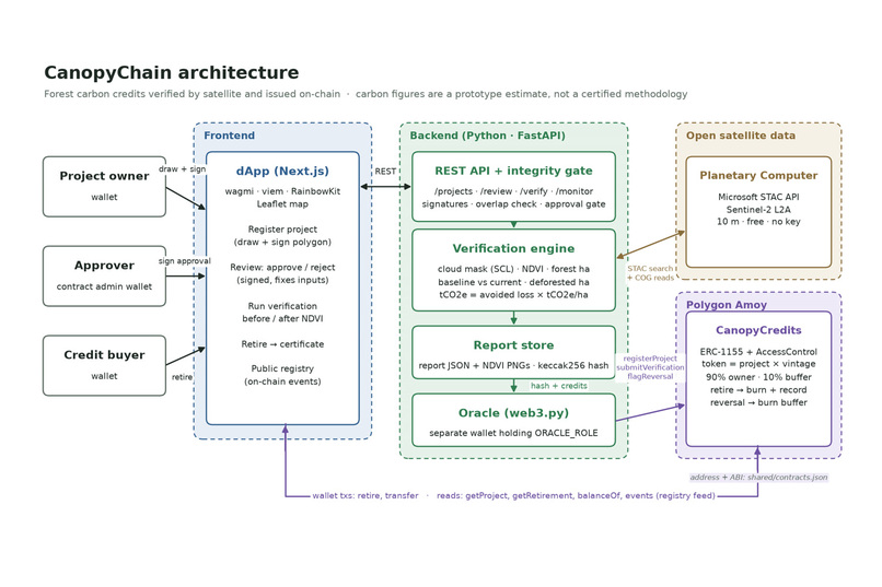
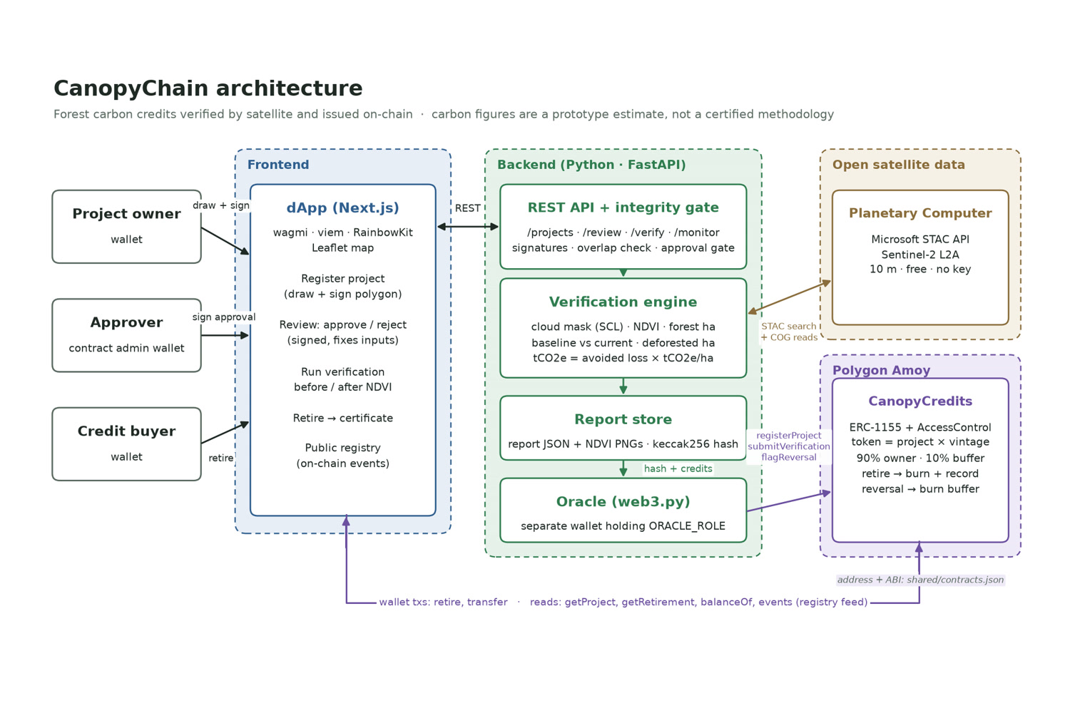
How CanopyChain fits together
-
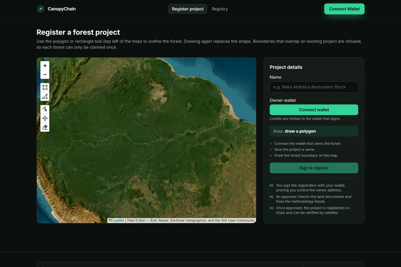
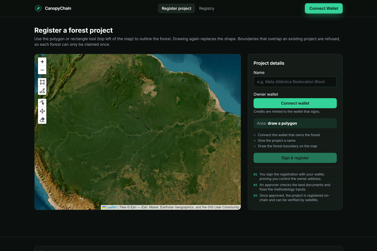
Draw your forest; overlapping claims are refused
Inspiration
Forest carbon credits are supposed to pay people to keep forests standing, but buyers can't tell which credits are real. Credits get over issued, double counted, and keep trading even after the forest is cut down. In 2024, over 6 million hectares of tropical forest was lost. Free satellite imagery covers every forest every few days, so we tied all the carbon credits to it.
What it does
- Register: Draw the forest boundary on a satellite map and sign with your wallet.
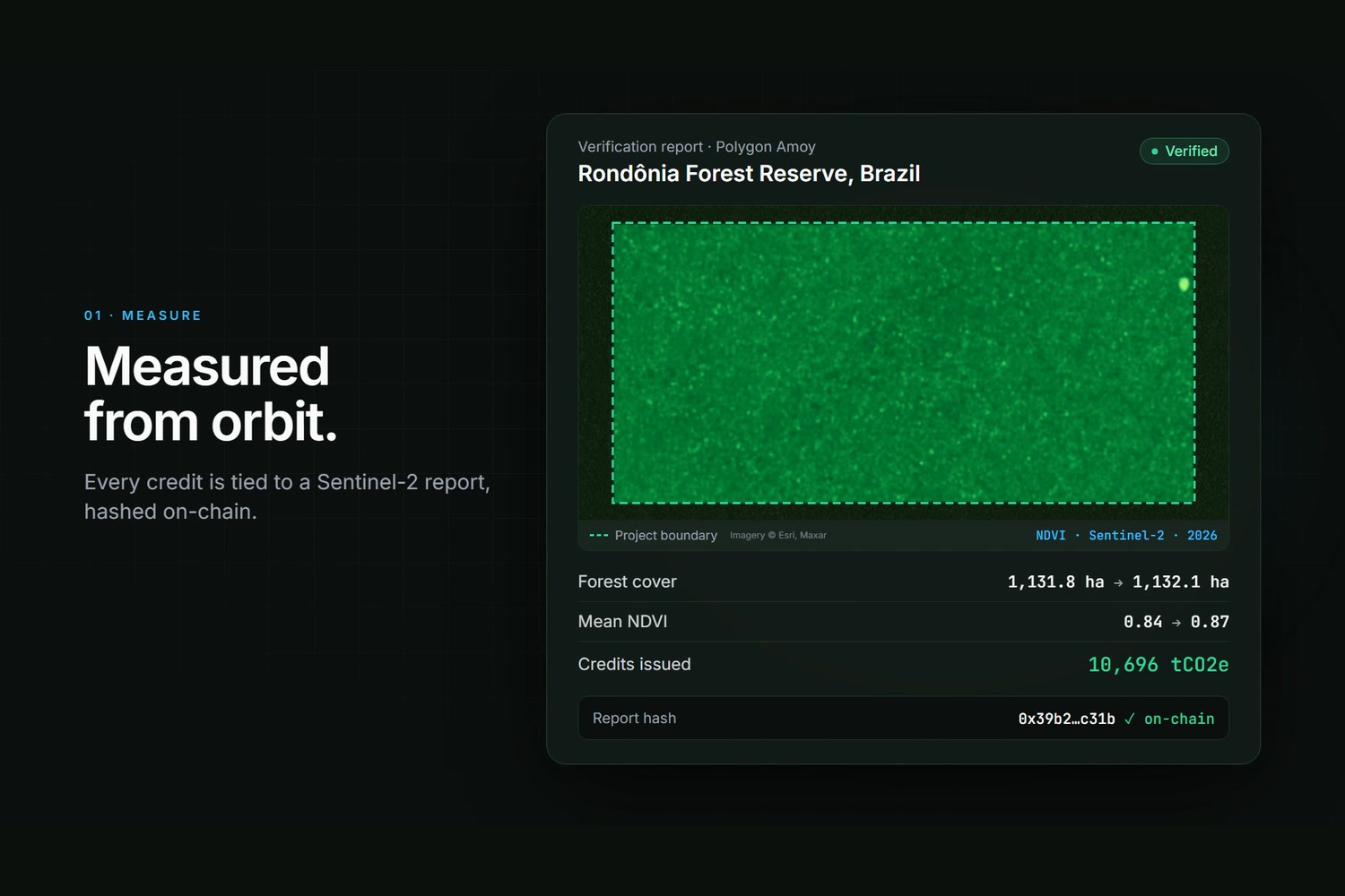
- Verify: Sentinel-2 imagery measures forest cover.
- Retire: Retiring credits burns them and writes a permanent on-chain certificate so they cant be counted twice.
- Monitor: If the forest is cut down, a reversal is created, buffer credits are burned.
How we built it
- Blockchain: A smart contract on the Polygon testnet creates, retires, and cancels the credits.
- Satellite checks: A Python server downloads free Sentinel-2 images of the forest and measures how much is still green.
- Website: Next.js web app where you can draw the forest on a map, connect your wallet and see every credit.
Challenges we ran into
- At first, anyone could claim any forest and create credits for it.
- The forest is so healthy that every pixel looks the same. We adjusted the color scale so rivers and clearings show up.
Accomplishments that we're proud of
A complete flow running on a real testnet with real satellite data.
What we learned
The hard part of carbon credits is the integrity: who can claim what, and how anyone can check it later.
What's next for CanopyChain
- Fairer credit amounts: Use past satellite data to judge how much forest is at risk of getting destroyed.
- See through clouds: Use radar satellite data which works when the sky is cloudy.
- Real world test: Test it with community forests and an official carbon-credit verifier.
Built With
- erc-1155
- fastapi
- hardhat
- leaflet.js
- microsoft-planetary-computer
- next.js
- numpy
- openzeppelin
- playwright
- polygon
- python
- rainbowkit
- rasterio
- react
- sentinel-2
- shapely
- solidity
- tailwindcss
- typescript
- vercel
- viem
- wagmi
- web3.py

Log in or sign up for Devpost to join the conversation.