-
-

1024x1024 icon
-
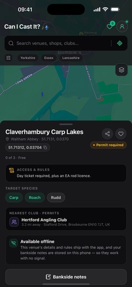
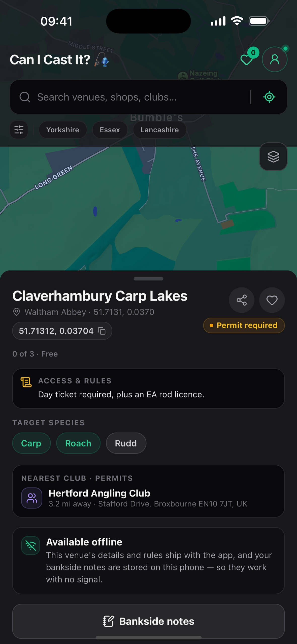
Venue Details
-
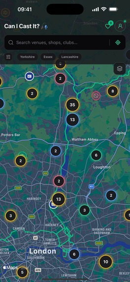
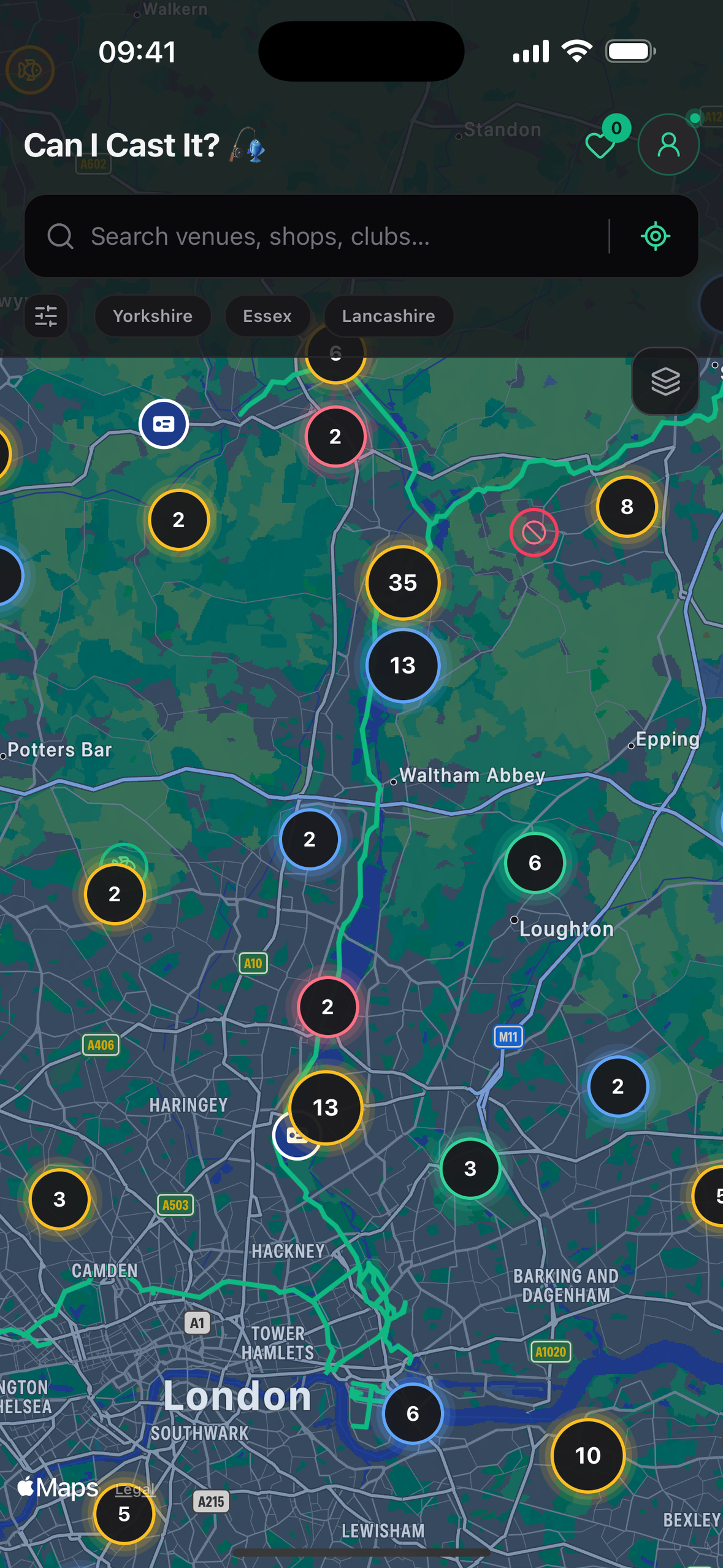
Map clustering

Inspiration
As an avid UK angler who loves exploring new lakes, rivers, and canals, I constantly hit the same frustrating wall: river access in the UK is completely fragmented.
On a single one-mile stretch of river, access rights can change four times. Half the bank might be leased by a private syndicate, the next bend controlled by a local club, another stretch completely off-limits, and a final pocket open on a £10 day ticket.
The traditional workaround is painful: anglers take screenshots of satellite views on Google Maps, rummage through niche Facebook groups asking "Does anyone know who controls this stretch?", and chase down obscure club websites or forum threads from 2011. Standing on a bank wondering, "Can I fish here, or will I get fined and kicked off?" ruins the experience. I built Can I Cast It to replace that guesswork with an interactive map that reveals waters, rules, and access permissions in seconds.
What it does
Can I Cast It is a location-aware directory and mapping tool designed specifically for UK anglers.
- Interactive Water Mapping: Pinpoints nearby rivers, canals, commercial fisheries, and lakes with clear ownership and access demarcations.
- Access & Cost Transparency: Identifies whether a stretch is free, requires a day ticket, demands an annual club book, or is strictly private.
- Community Resources: Maps local angling clubs, association waters, and nearby tackle shops so anglers can grab bait and permits without friction.
How we built it
- Design & Ideation: Prototyped UI layouts and component hierarchies in Claude before writing code. Used Gemini as an architectural "rubber duck" to stress-test data structures and user flow edge cases.
- Frontend & Cross-Platform Engine: Built with React Native to target both iOS and Android from a single codebase, utilizing a modern mobile component library for responsive map controls.
- Testing & Tooling: Leveraged Expo and EAS for build pipelines. Validated the app using Xcode simulators and physical iOS hardware running in Developer Mode, progressing to closed user testing via Apple TestFlight.
- Deployment: Hosted the companion web application on Railway.
Challenges we ran into
- Build Pipelines & Store Rejections: Setting up Expo Application Services (EAS), RevenueCat, and App Store Connect resulted in two initial Apple review rejections. Diagnosing the issue required tracking down missing environment variables that were defined locally but missing from EAS cloud build profiles.
- Cross-Platform Complexity: Choosing React Native for dual-platform deployment introduced hurdles like Google’s 14-day closed testing requirement. At times, sticking strictly to native Swift in Xcode felt like it would have been simpler, but cross-platform reach remained the priority.
- Siloed & Volatile Data: Aggregating UK fishing data was a massive hurdle. There is no central API for UK water rights. Sourcing required piecing together public canal records, Angling Trust archives, and club directories manually.
Accomplishments that we're proud of
- Cataloged 5,000+ Venues: Successfully mapped and categorized over 5,000 distinct UK fishing locations into a searchable structure.
- End-to-End Delivery: Took a frustrating real-world problem from a blank canvas to a working production deployment on Railway and an active Apple TestFlight build.
- Real Utility: Created a tool that eliminates the anxiety of trespass and fines for roaming anglers.
What we learned
- The Reality of UK Fishing Access: Out of 5,000+ venues mapped, only about 5% are truly free to fish. Between club dues, day ticket costs, and strict venue-specific rules, the financial barrier to entry for beginners and young anglers in the UK is substantial.
- Data Churn is Constant: Fishing rights change rapidly. Leases expire, syndicates form, and clubs lose stretches of water unexpectedly. Static data decays fast without an active maintenance strategy.
- Cloud Build Workflows: Gained hands-on mastery over Expo EAS configuration, certificate signing, and in-app purchase environment handling.
What's next for Can I cast it
- Crowdsourced Data Verification: Introducing a reporting and verification loop so local anglers can flag boundary changes, lost leases, or updated day-ticket prices directly in the app.
- Environmental & River Alerts: Integrating real-time river level data and drought-closure warnings to help protect fish stocks during vulnerable seasons.
- Full Public Release: Expanding beyond TestFlight to launch publicly on the Apple App Store and Google Play Store.


Log in or sign up for Devpost to join the conversation.