Inspiration
In large university campuses spanning hundreds of acres, stray canines often face medical emergencies, injuries, or create mobility bottlenecks across high-traffic pathways. Reporting these incidents to safety or animal welfare teams often gets lost in casual chat groups, leading to delayed medical care and unaddressed student safety concerns. We built this platform to centralize and speed up community-driven reporting.
What it does
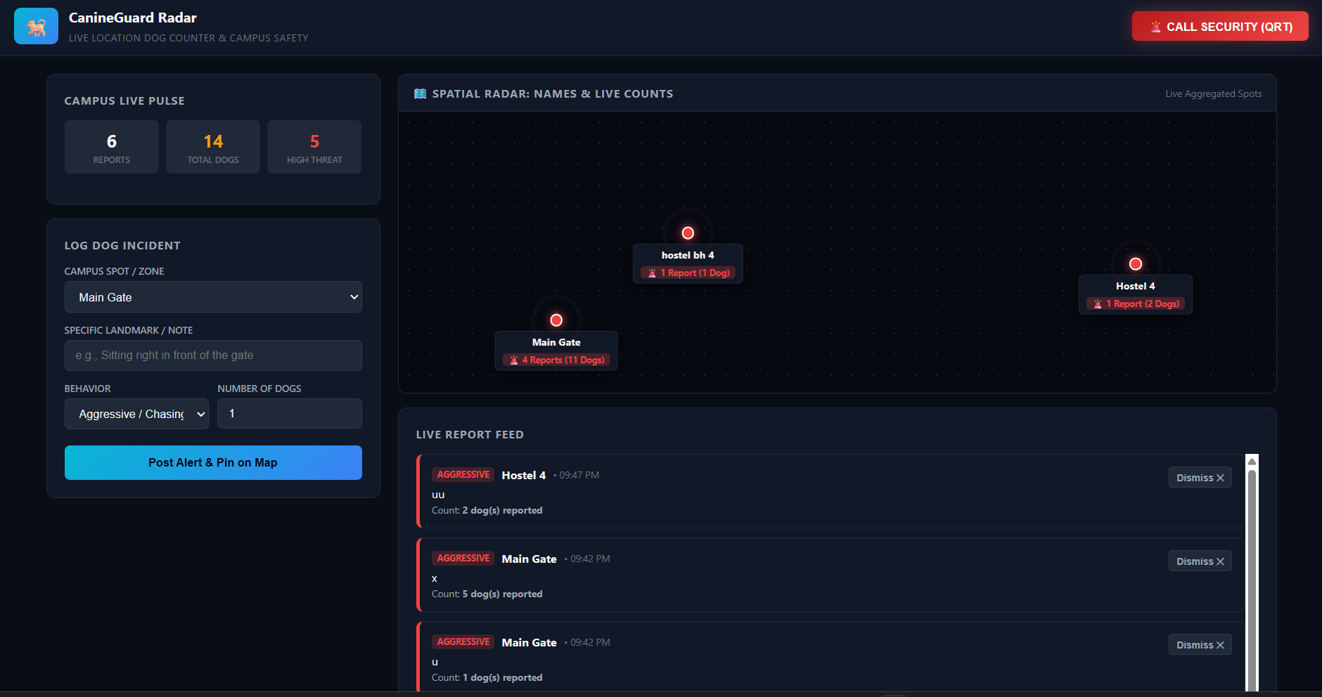
Instant Incident Logging: Allows students and security staff to submit geolocated reports with status categories (e.g., Injured Animal, Blocked Pathway, Aggressive Pack, Needs First Aid).
Live Campus Heatmap & Status Feed: Displays logged alerts in real-time with urgency tags, helping volunteer animal rescue groups and campus facilities prioritize responses.
Resource Directory: Quick one-tap contact access to campus emergency medical services, security control, and local animal rescue helplines.
How we built it
Frontend: Clean, semantic HTML5 for structural layouts and forms, styled with responsive modern CSS for effortless mobile and desktop viewing.
Logic: Vanilla JavaScript for local state management, report validation, category filtering, and instant submission rendering without heavy framework overhead.
Challenges we ran into
Designing a simple, high-contrast user interface that allows someone walking between classes to file an urgent report in under 30 seconds with minimal friction and no complicated logins.
Accomplishments that we're proud of
Zero-Friction Reporting Flow: Designed an intuitive interface that allows a student to log an incident, tag the issue category, and submit actionable details in under 30 seconds.
Lightweight & Fast Architecture: Built a completely responsive, dependency-free web tool using clean HTML, CSS, and vanilla JavaScript that runs smoothly even on patchy campus Wi-Fi.
Practical Campus Utility: Successfully turned a real daily campus issue—animal safety and path obstruction—into a practical digital solution that bridges students, campus security, and animal welfare responders.
What we learned
Building lightweight, accessible client-side tools that bridge community civic issues with actionable digital reporting.
What's next for CampusPaws
Integrating campus GPS map markers (OpenStreetMap / Leaflet) for pin-point pinpoint coordinates.
Direct SMS/WhatsApp automated triggers to campus rescue volunteers when an emergency injury status is logged.
Built With
- css3
- gemini-api
- html5
- javascript

Log in or sign up for Devpost to join the conversation.