-
-
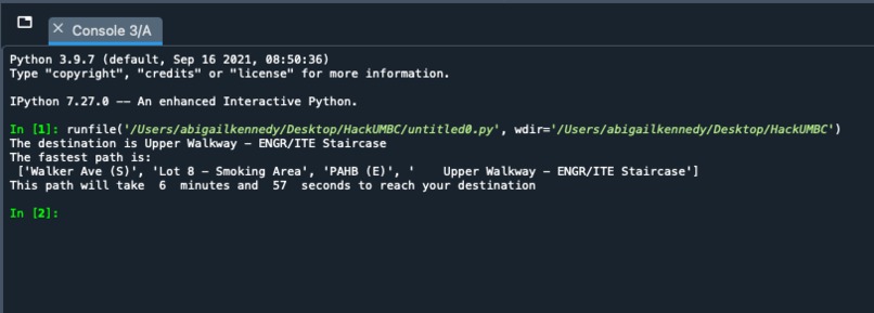
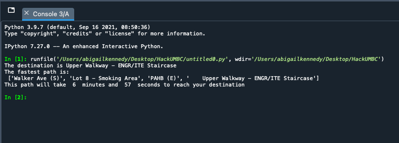
What the output would be for the Upper Walkway - ENGR/ITE without technical difficulties
-
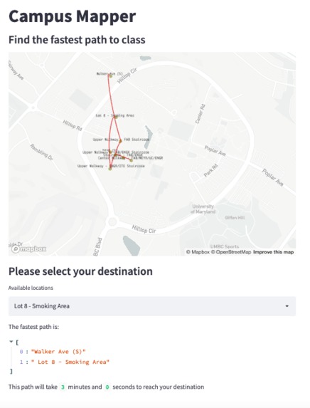
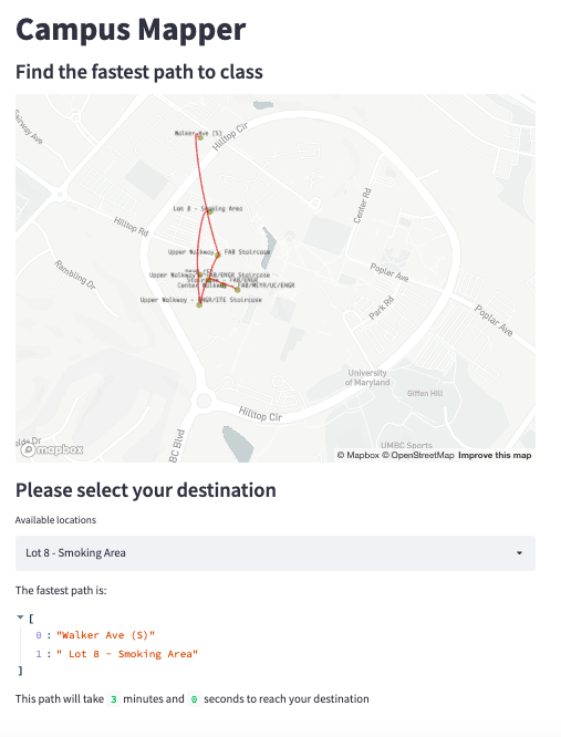
Campus Mapper as it appears in full
Inspiration
What inspired me to make this project was my friend asking me if I would be late to class. I told her "of course not, it's a six minute walk." Then I wanted to prove it.
What it does
This program takes location names, their latitude and longitude, and the time it takes to reach them from a previous point to construct a map of potential routes to academic buildings then calculate the fastest route
How we built it
This program started on Friday, Oct 29th as I walked around campus in the rain with Under Armour's MapMyWalk app running on my phone collecting data on how long it took for me to walk between various points on campus. That evening, after HackUMBC had started, I began by going through the documentation for Streamlit's Map and Pandas' DataFrame to construct a visual representation of my data. On the following day, I built up functions to take this data and construct nodes which could be represented as a tree through which to determine a., which paths were possible to take from one point to another, and b., the paths that yielded the fastest time. In the wee hours of Halloween, I tidied up the code, removed non-functioning implementation, and fixed an error with the array indexing until I was happy with my demonstration.
Challenges we ran into
The way by which the routes were originally meant to be calculated was a tree with DFS applied to it. However, I hit a wall with the node object attributes being read in as string values. Since I had committed to using the Streamlit framework, and thus Python, I decided to represent this tree as an array of nodes and to evaluate my pathways from there. Due to this setback, the csv file that was supposed to accompany this project was turned into a string so as to save time implementing loading and reading in the file.
Accomplishments that we're proud of
I am proud of myself for pushing myself outside my comfort zone of C++ and tackling API for the first time in my academic career. The rigorous documentation Streamlit provides for their library gave me a framework to build off of that led to an interface for what I had originally thought of as being only back-end code.
What we learned
I learned how to get back to the basics with arrays with the enhancements of my current knowledge that enabled me to overcome difficulties in coding practices between languages.
What's next for Campus Mapper
To add more data points! Due to the rain on Friday, data collection was far more limited than I'd hoped for and going forward I would like to have the entire UMBC campus mapped out. In addition, streamlining of all data inputs, including the addition of a csv file for data, and DataFrames to give the program a sleeker look.

Log in or sign up for Devpost to join the conversation.